Could an Active Atlantic be Heading Our Way??

Special Stories
29 Aug 2018 5:06 AM
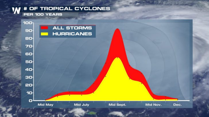 It has been a quiet hurricane season out in the Atlantic, but things could be changing over the next couple of weeks. From August to the end of October, tropical activity usually ramps up.
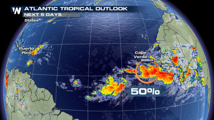 We are keeping our eye out on an area of low pressure over the next five days. The chances of it becoming our next named storm has increased in the past 24 hours. It is now up to a 50 percent chance and predicted to track northwest.
 If this storm continues to strengthen and becomes more organized, we could see Florence soon.
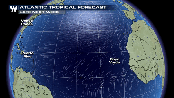 The GFS wind velocity model shows, late next week, another low pressure system forming just off the coast of Africa. Although it is still too early to say that the model is 100 percent correct, it is still a possible outcome. We could see Gordon form right behind the possible Florence.
For WeatherNation -Meteorologist Shelly Lindblade
The GFS wind velocity model shows, late next week, another low pressure system forming just off the coast of Africa. Although it is still too early to say that the model is 100 percent correct, it is still a possible outcome. We could see Gordon form right behind the possible Florence.
For WeatherNation -Meteorologist Shelly LindbladeAll Weather News
More
Severe Threat Marches East This Afternoon
UPPER MIDWEST - Through Monday, dangerous tor
28 Jul 2026 4:25 PM

Tropics: Fausto Heads towards Hawaii; Genevieve Cat 4 Hurricane
PacificTropical Storm Fausto continues to tra
28 Jul 2026 4:20 PM


Southeast Flood Risk Lingers Near Stalled Front
A stalled boundary over the Southeast will ke
25 Jul 2026 10:55 AM

Another Round of Storms Targets the Northeast
Tuesday brought severe weather again across p
23 Jul 2026 1:15 AM

Another Round of Severe Weather for the Upper Midwest and Great Lakes
The upper-level low train continues to keep t
21 Jul 2026 1:45 AM