Damaging Wind & Tornado Potential in the Northeast Friday
Special Stories
26 Mar 2021 8:00 AM
The storm system that brought numerous tornadoes to the Southeast on Thursday will bring severe storm potential to portions of the Northeast on Friday.
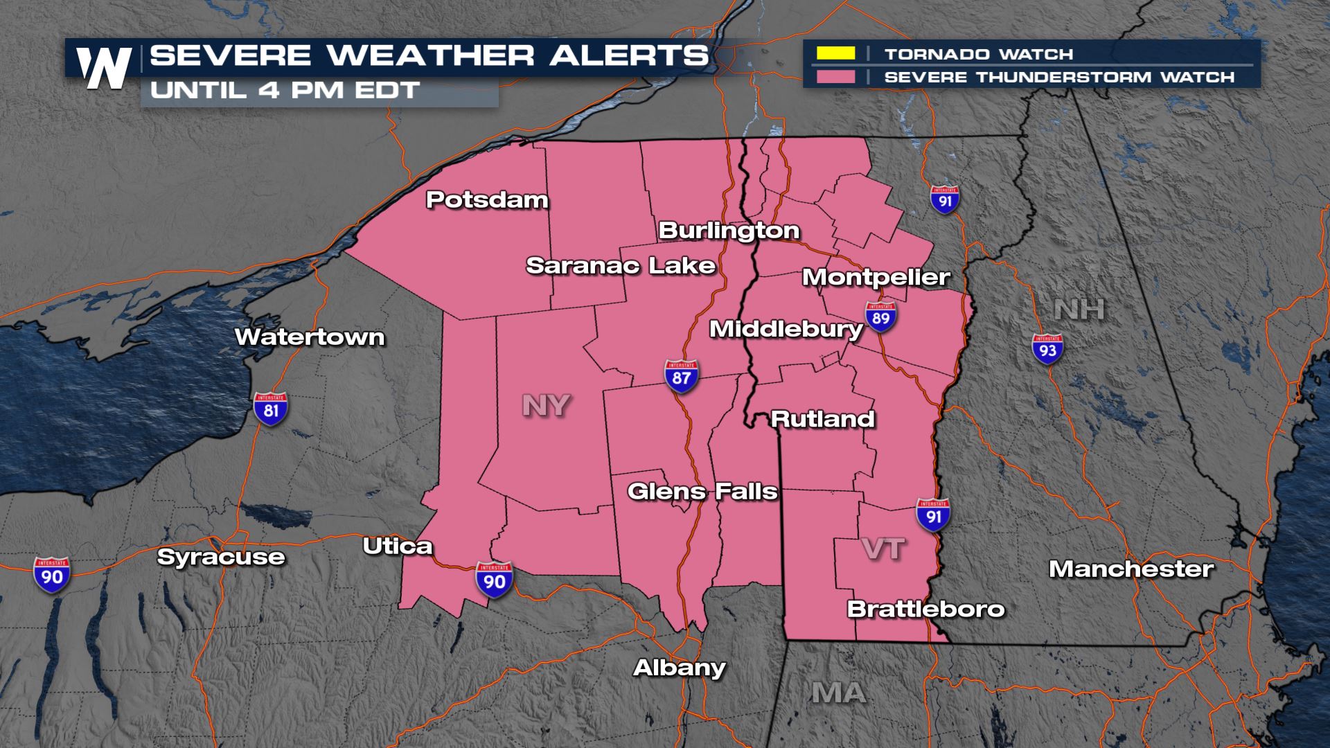 A severe thunderstorm watch is in effect through the afternoon for portions of New York and Vermont. Be sure to check our live stream or broadcast for the latest on this developing situation.
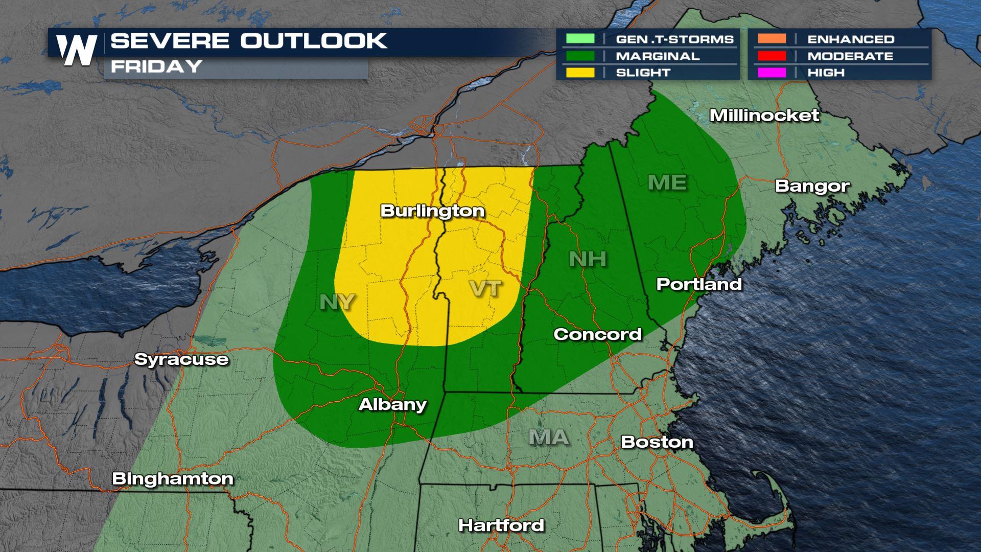
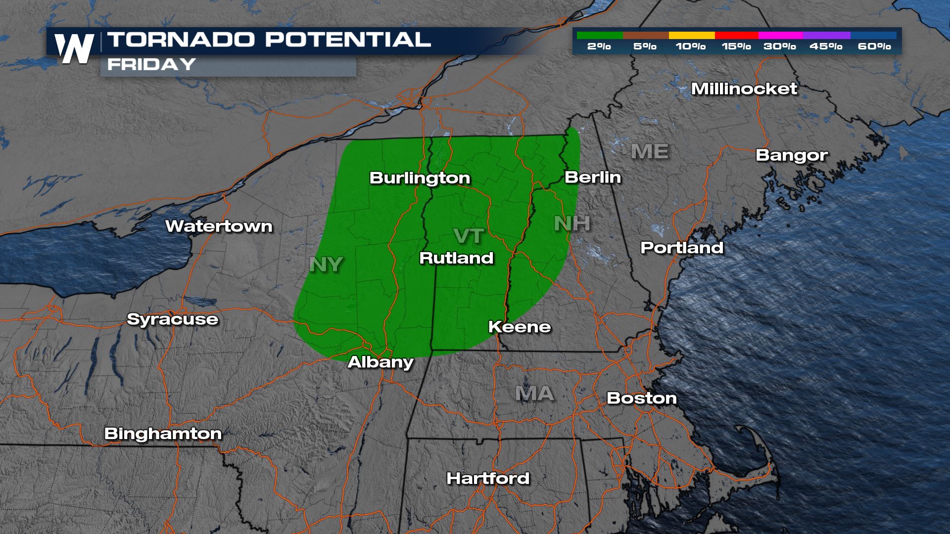
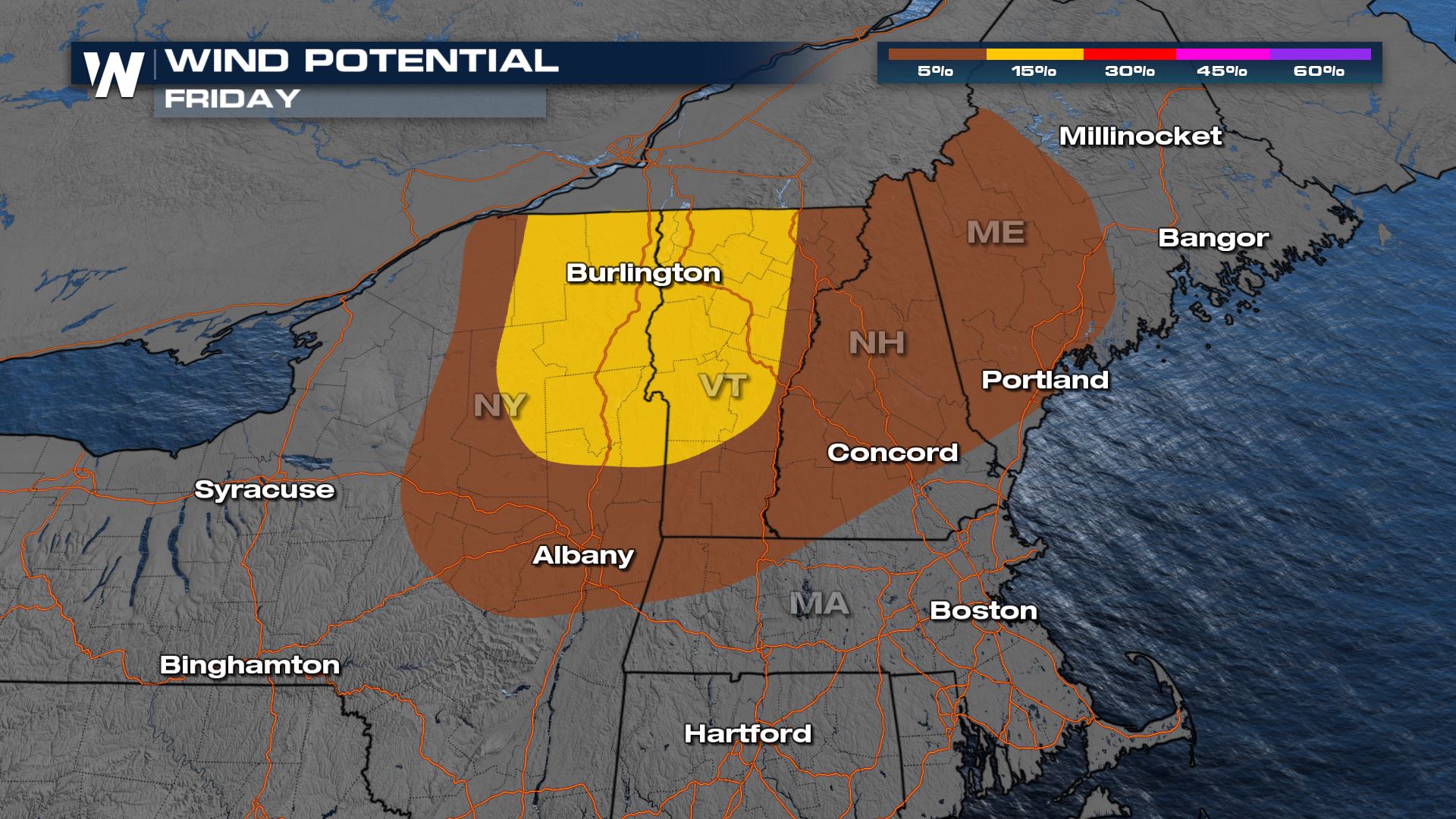 Damaging winds are the primary threat from stronger thunderstorms but an isolated tornado can't be ruled out.
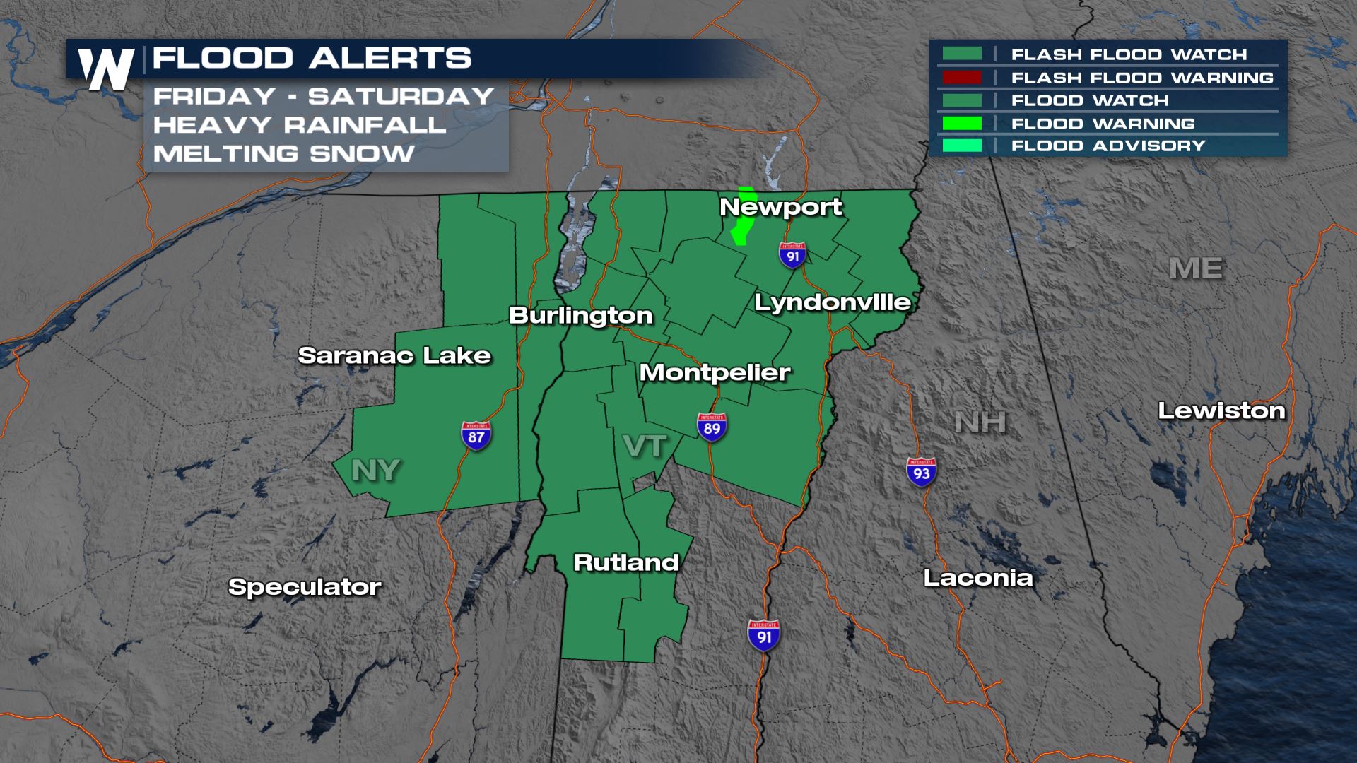 Flooding is the other concern as heavy downpours move over snowpack. Rapid melting could lead to flooding in creeks, streams, and drainage areas.
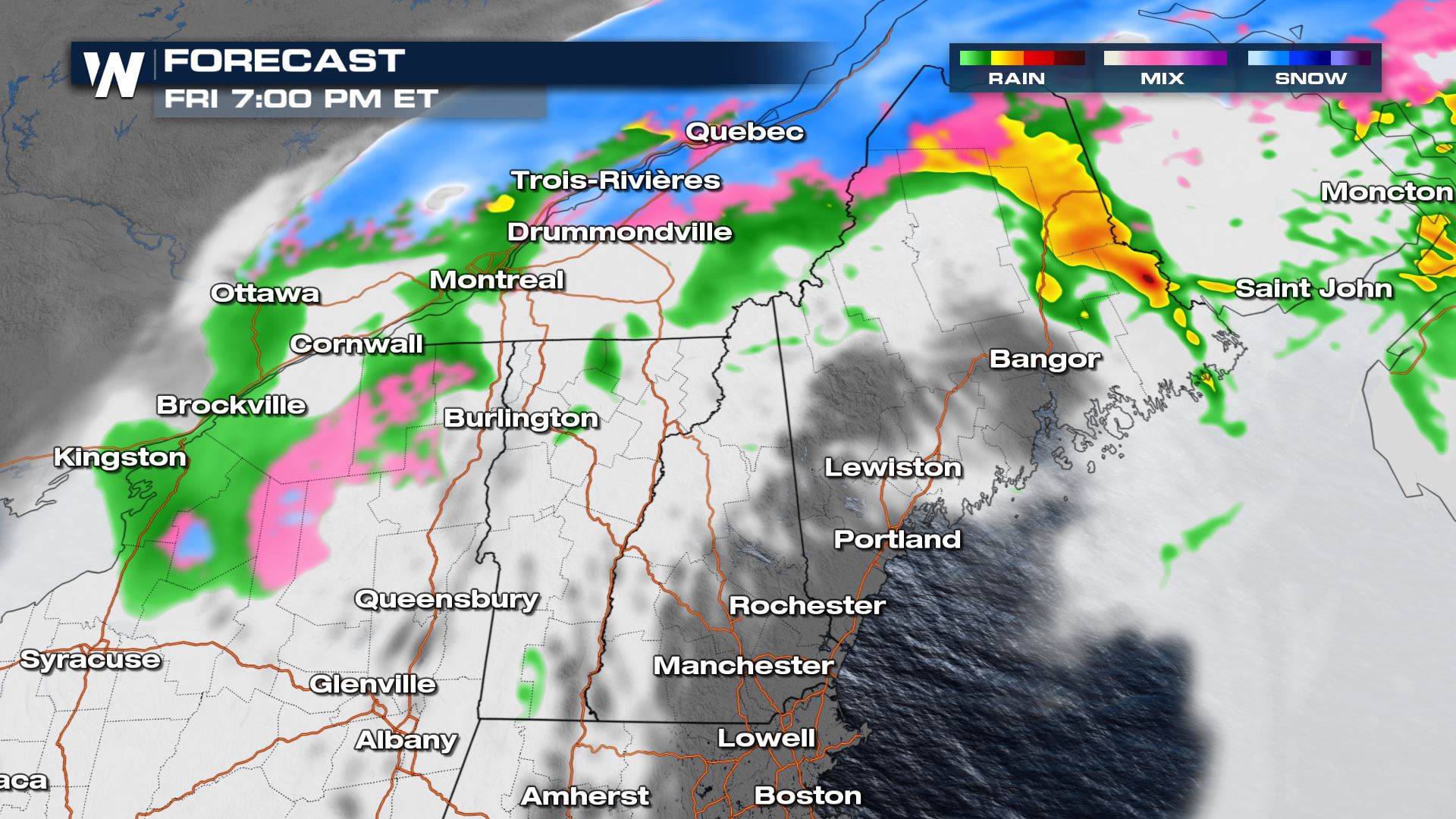
 Eventually as storms move east out of Maine, cold air wrapping around the backside of the low will bring a chance for a few more showers, with some snow or sleet mixing in, especially for higher elevation locations.
 Stay up to date with the latest warnings and advisories on our live streams and broadcasts, as well as on social media.
A severe thunderstorm watch is in effect through the afternoon for portions of New York and Vermont. Be sure to check our live stream or broadcast for the latest on this developing situation.
Damaging winds are the primary threat from stronger thunderstorms but an isolated tornado can't be ruled out.
Flooding is the other concern as heavy downpours move over snowpack. Rapid melting could lead to flooding in creeks, streams, and drainage areas.
Forecast
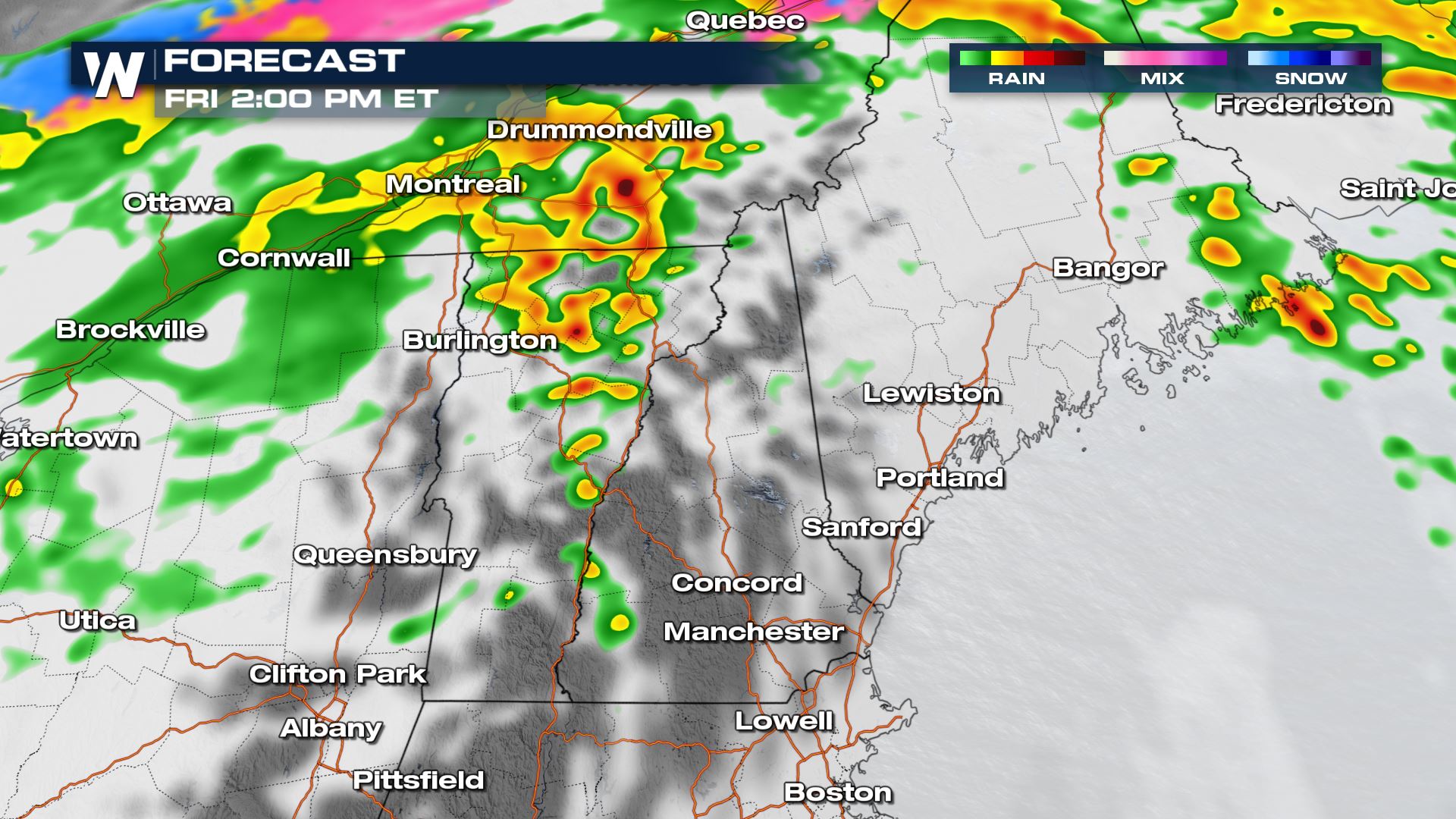
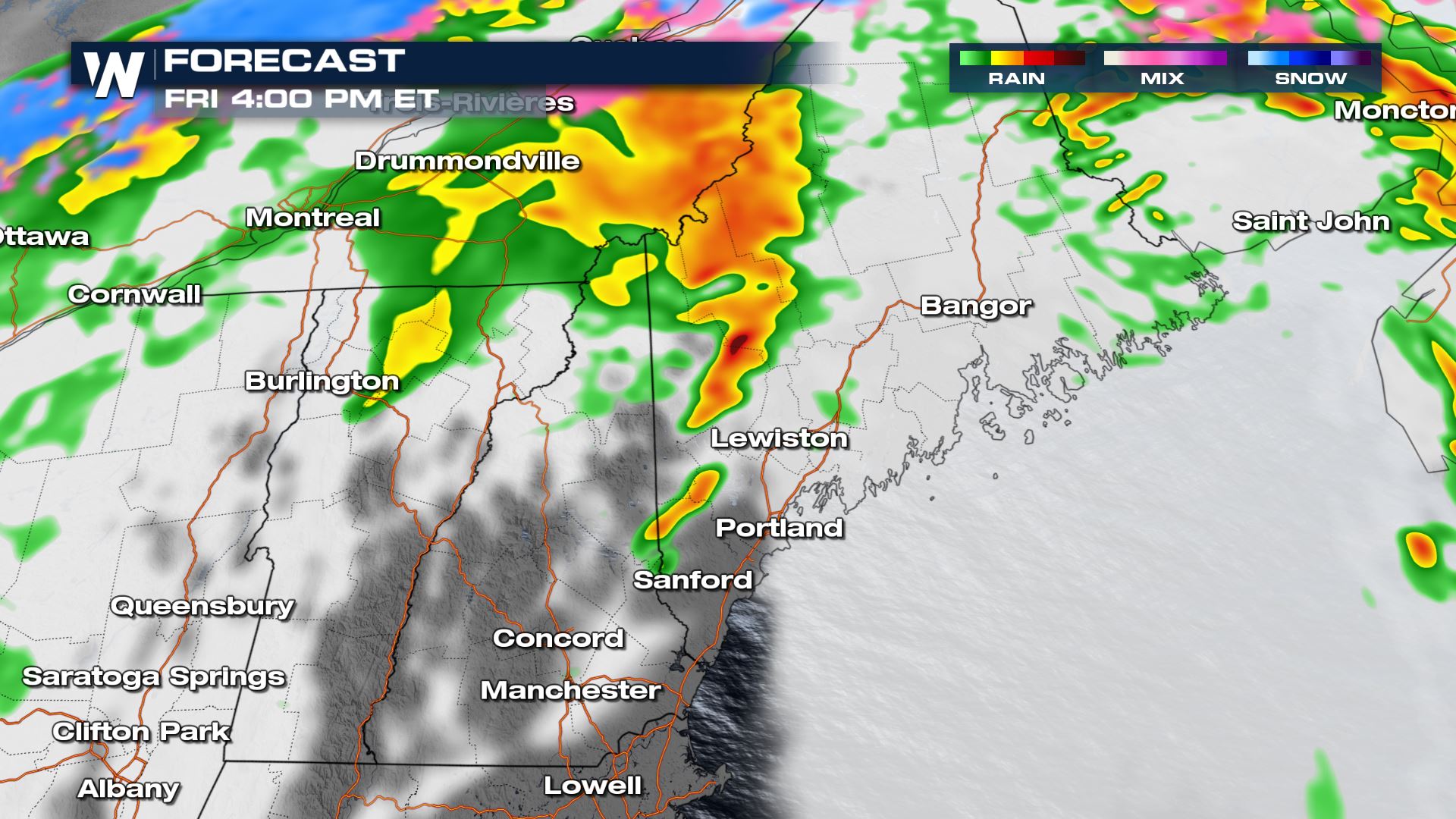
Lines of strong thunderstorms have already moved over the Great Lakes, but additional strong thunderstorms will move east with energy from the front through the afternoon.
Eventually as storms move east out of Maine, cold air wrapping around the backside of the low will bring a chance for a few more showers, with some snow or sleet mixing in, especially for higher elevation locations.
Stay up to date with the latest warnings and advisories on our live streams and broadcasts, as well as on social media.All Weather News
More
Wildfire Outbreak in the Pacific Northwest
SPOKANE, WA - On Saturday, August 1st, the Ol
2 Aug 2026 7:20 PM

More Storms for the East Through Monday
A low-pressure system that moved through the
2 Aug 2026 7:20 PM


After Reaching Category 5, Genevieve Weakens in the Pacific
PacificGenevieve formed on last Friday south
2 Aug 2026 6:25 PM

Flooding, Severe Storms Target the Midwest Again
After an active week of storms across the nor
1 Aug 2026 1:40 AM

Flooding Risk Increases as Heavy Rain Targets the Tri-State Area
Tuesday, heavy rainfall moved across the Nort
30 Jul 2026 12:25 AM

Severe Weather: Energy From the Midwest Now in the Southeast
UPPER MIDWEST - Through Monday, dangerous tor
29 Jul 2026 10:30 PM