Persistent Heat Dome to Keep Much of the Eastern U.S. Sweltering Through the Holiday Weekend

An expansive ridge of high pressure will continue to dominate the weather pattern across much of the eastern United States through the Fourth of July weekend, producing another round of dangerous heat and humidity for millions of people. The stagnant weather pattern has allowed temperatures to climb well above average for several days, with little overnight relief in many locations.
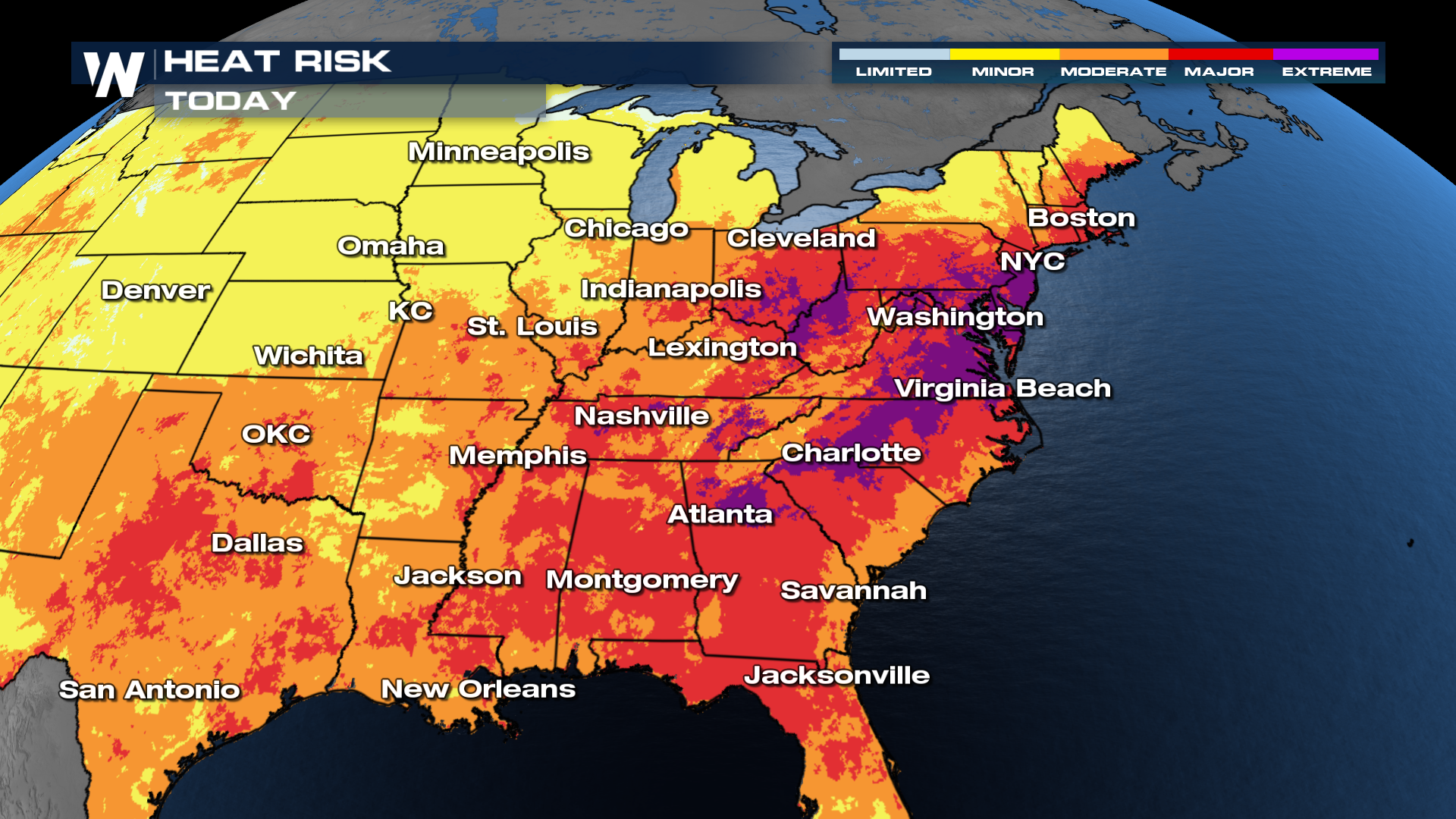
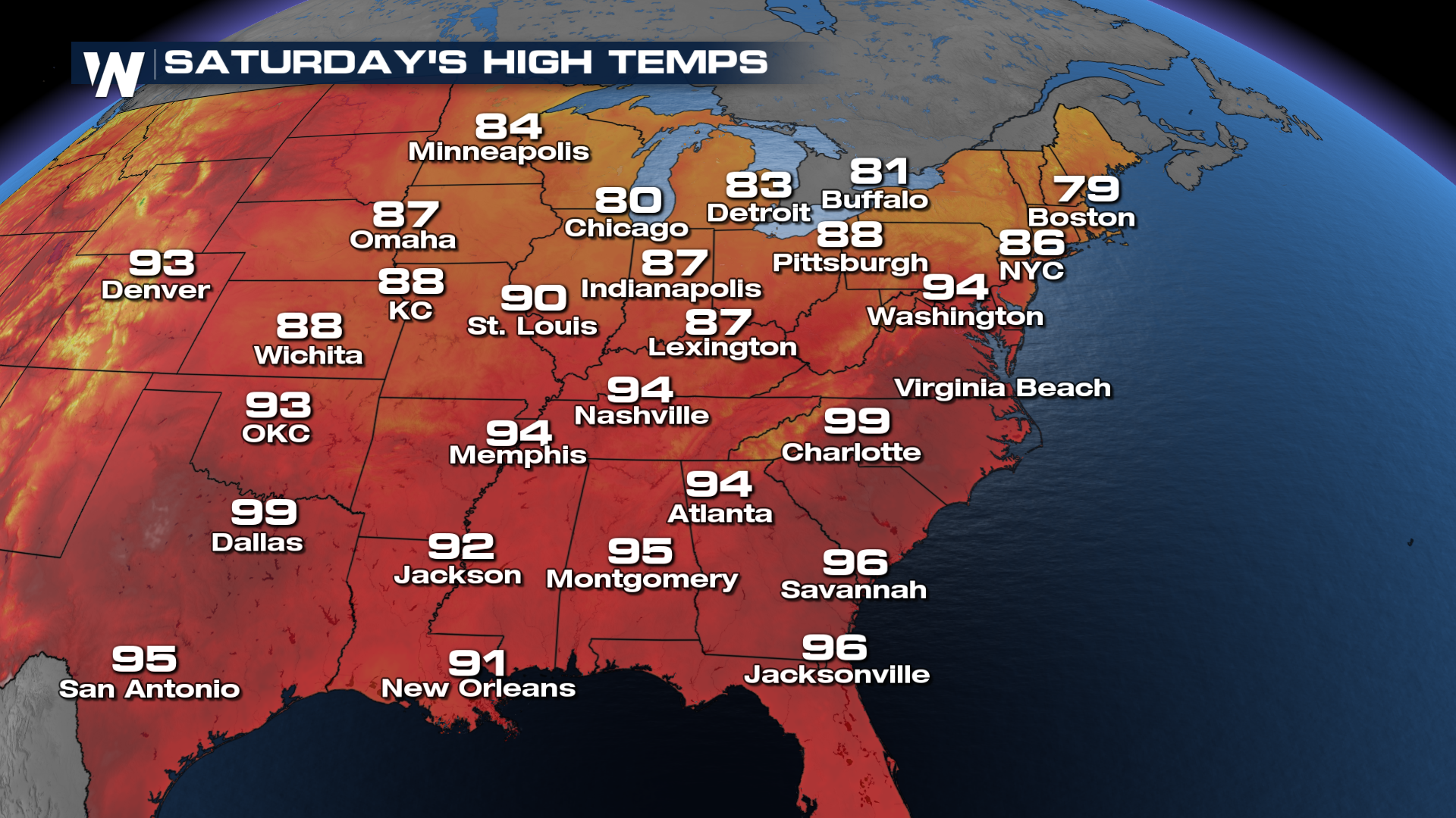
The heat is being driven by a strong upper-level ridge, often referred to as a heat dome. As air slowly sinks beneath the ridge, it compresses and warms, leading to widespread sunshine and hotter temperatures at the surface. With the ridge remaining firmly in place, daytime highs will climb into the 90s and lower 100s across portions of the Midwest, Ohio Valley, Mid-Atlantic and Northeast.
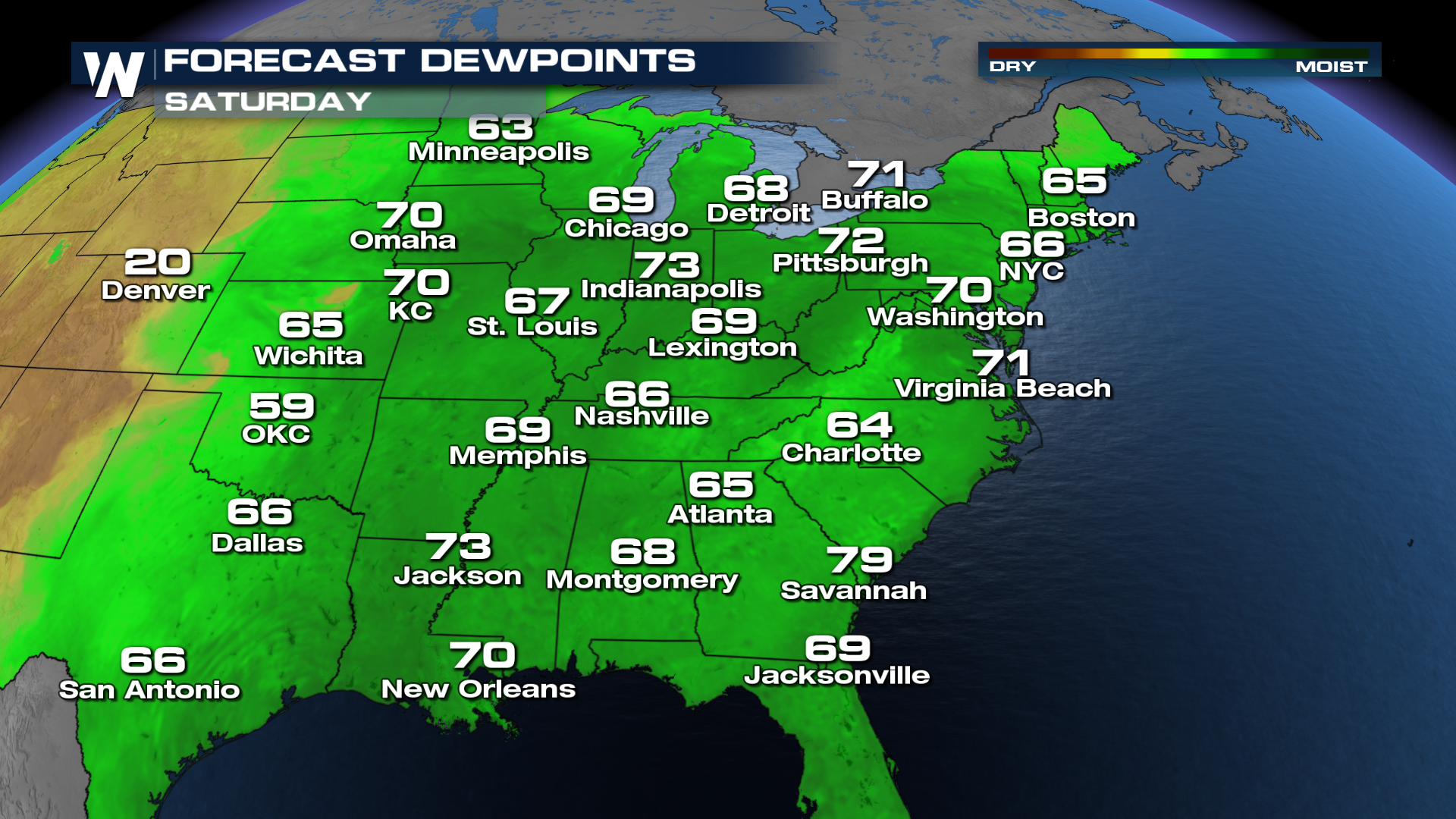
Humidity will make conditions even more dangerous. Dew points well into the 70s will push heat index values into the triple digits across many communities, making it feel significantly hotter than the actual air temperature. Warm overnight lows, with some locations struggling to fall below the upper 70s, will provide little opportunity for the body to recover from the daytime heat, increasing the risk of heat-related illnesses.
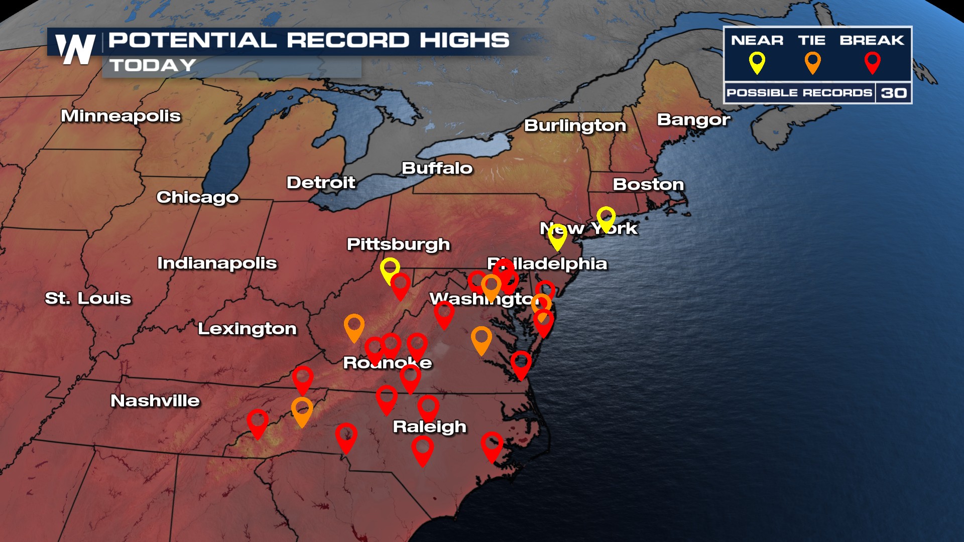
Several locations could challenge or break daily temperature records as the prolonged stretch of excessive heat continues. The combination of July sunshine, light winds, and persistent subsidence beneath the ridge will allow temperatures to rise quickly each afternoon.
We spoke with the National Weather Service in Philadelphia/Mt. Holly to get some perspective on just how unusual this heat is for the northeast.
Records could be going down when the official highs come in this afternoon. Cities like Roanoke and Raleigh have a good chance at breaking a record high for the 4th of July.
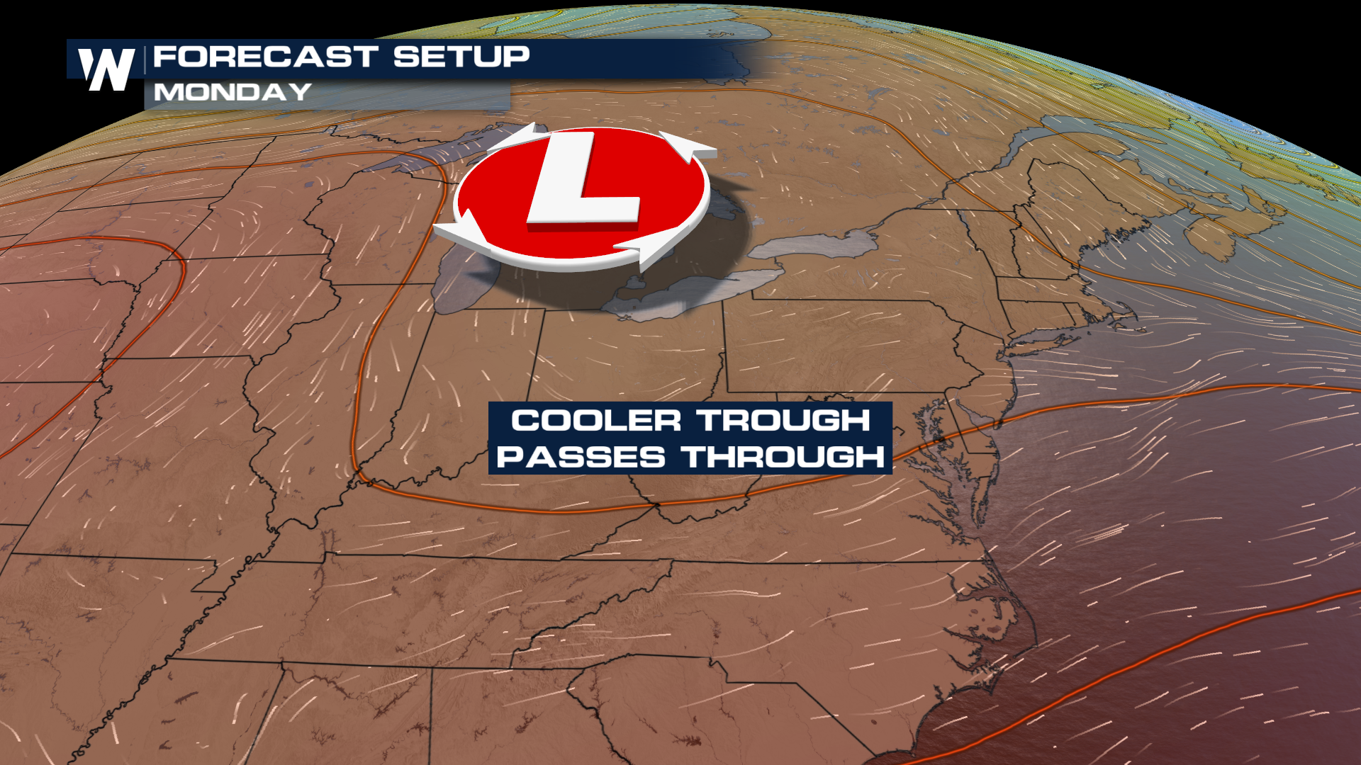
 A gradual pattern change is expected later this weekend as a cold front begins to press southward into the Northeast and Mid-Atlantic. The front will usher in slightly cooler and less humid air behind it, offering relief to some communities early next week. However, areas farther south are expected to remain under the influence of summer heat as the ridge weakens but does not disappear entirely.
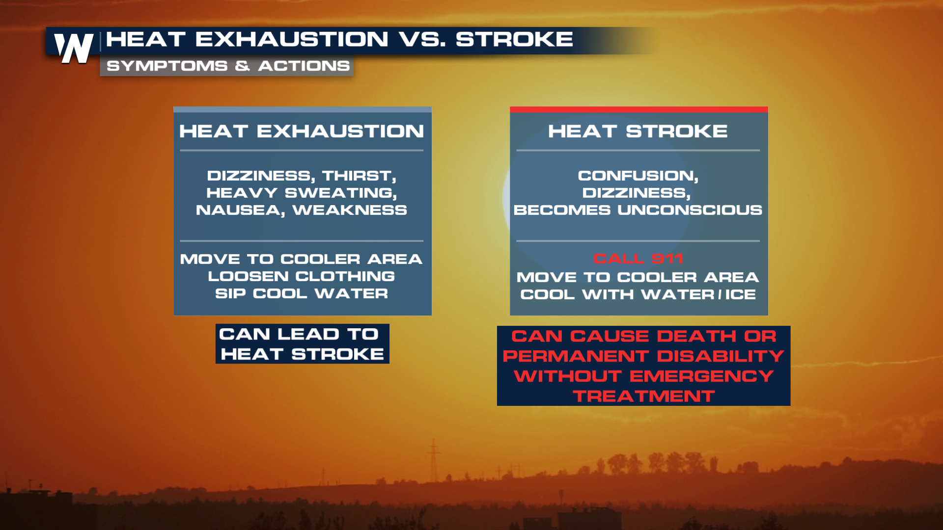
 With millions expected to spend time outdoors for Independence Day celebrations, meteorologists urge residents to take the heat seriously. Staying hydrated, taking frequent breaks in air-conditioned spaces and limiting strenuous outdoor activities during the hottest part of the day can help reduce the risk of heat exhaustion and heat stroke.
Heat waves become deadly when they are extended in duration, and complicated by overnight lows struggling to cool off enough. Be sure to mix in plenty of water this holiday weekend. Know the signs to look out for in friends and family.