Deep South Sizzled for the Holiday

Whoever was "Grill Master" on the Fourth of July Thursday certainly earned their burgers, hot dogs, and chicken wings because it was unbearably hot across the South and the Southeast. Max heat index values peaked above 110 degrees, even as high as 119 degrees in Arkadelphia, Arkansas! That king of heat can contribute to heat-related illness or even heat stroke very quickly!
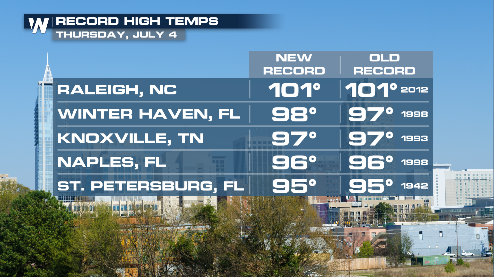 Actual high temperatures rose enough to tie or break records for the Fourth of July. It was the hottest 4th on record in cities such as Raleigh, Winter Haven, Knoxville, Naples, and St. Pete. Many Florida cities were entering the record books on Thursday, and more record highs may be established on Friday.
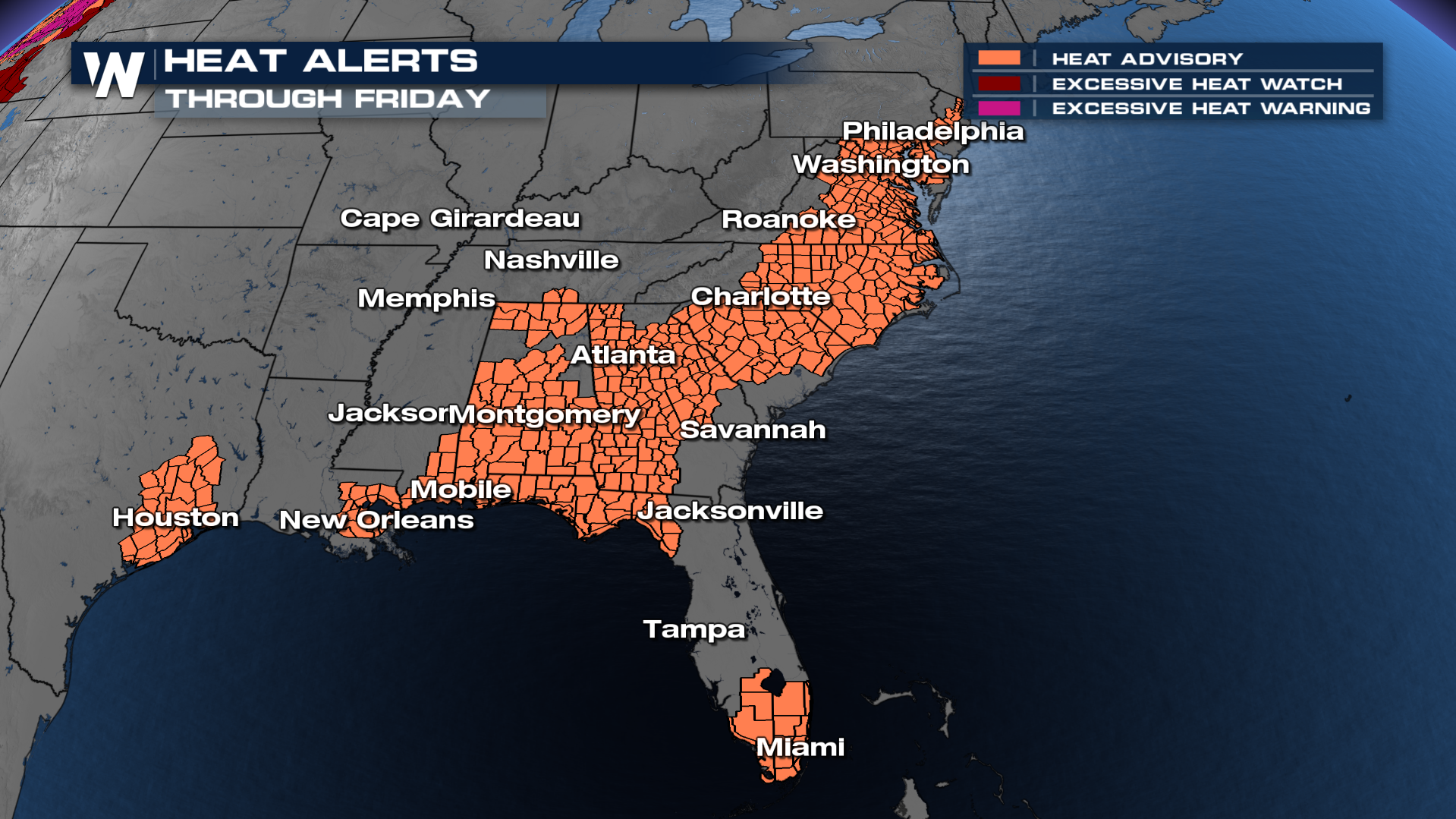 Heat alerts will remain in effect for parts of Texas, Louisiana, Mississippi, Tennessee, Alabama, Florida, Georgia, the Carolinas, Virginia, Maryland, Delaware, and New Jersey on Friday. These alerts may change, so we encourage you to stay up-to-date with the latest alerts from your local National Weather Service. The heat alerts are mainly heat advisories, meaning well above-average temperatures could contribute to heat illnesses.
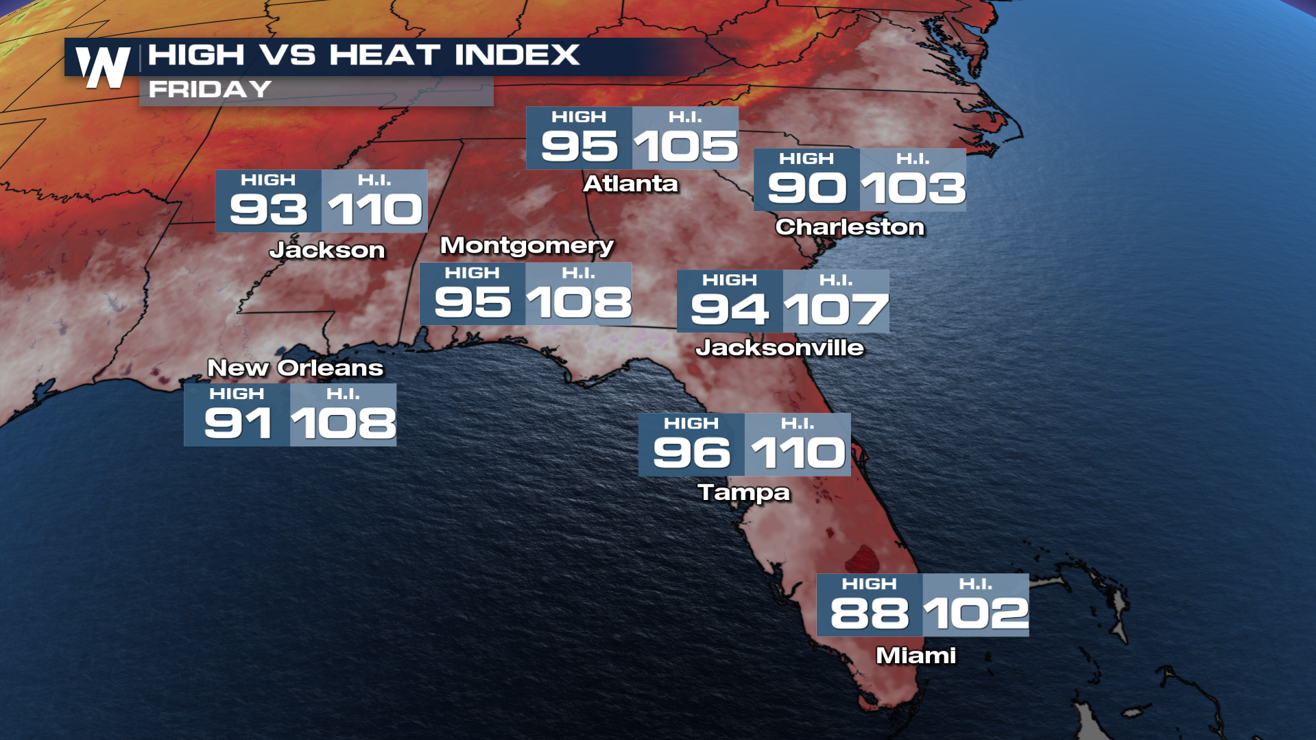 In the Southeast, high temperatures will reach to between 90 and 95 degrees, with feels-like temperatures reaching to 102 to 110 degrees, so about 10-15 degrees hotter than the actual air temperature. The feels-like temperature is what you want to plan for, by taking it easy and staying hydrated in this heat.
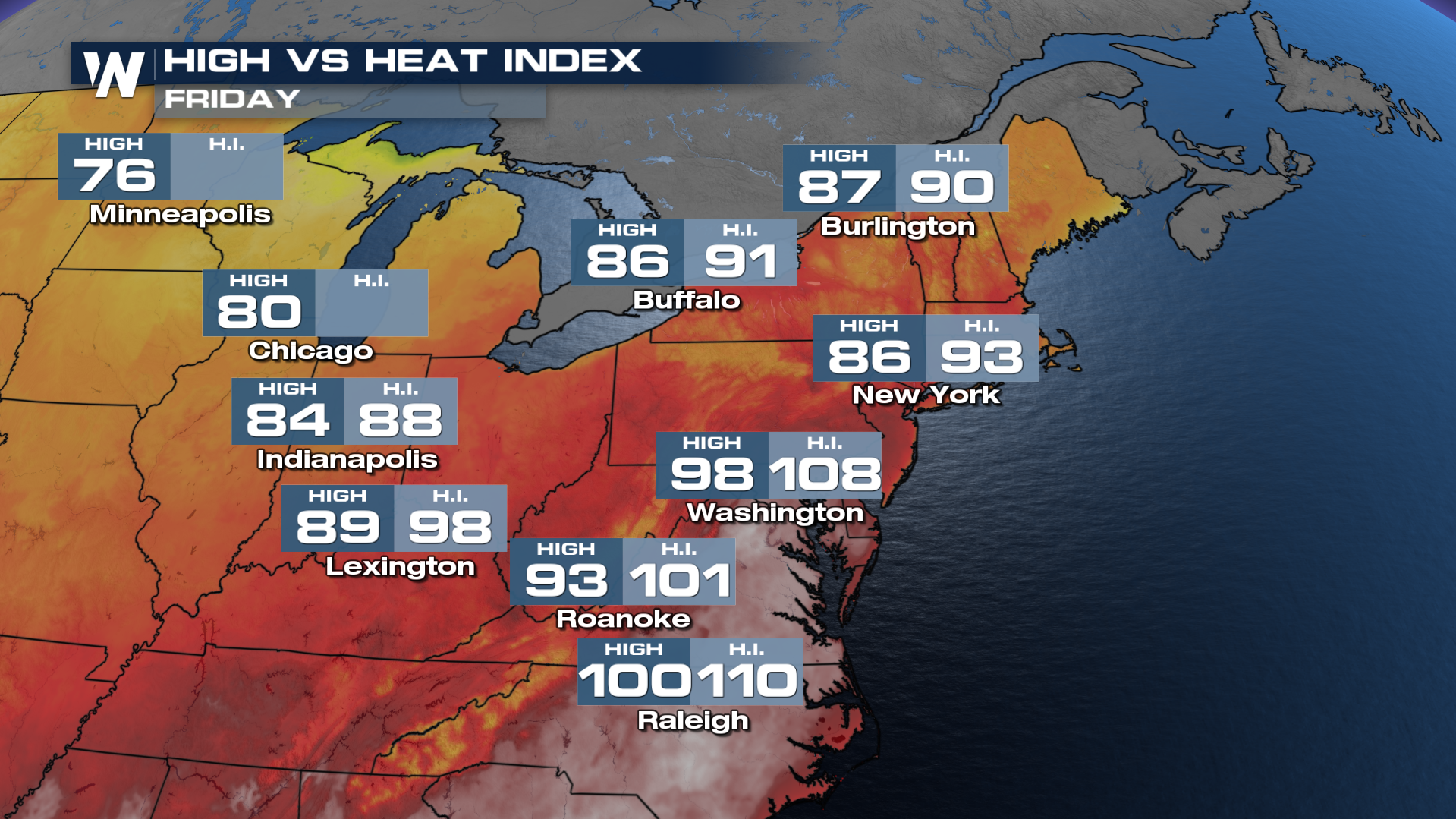 It will be warm, but not as hot, in the Northeast U.S. New England will be warm with highs in the 80's and feels-like temperatures in the 90's! Hotter weather will be felt across the mid-Atlantic with highs in the 90's and feels-like temperatures above 100 degrees for some cities.
Cooler weather will arrive at the East coast by this weekend with lower humidity levels and lower heat indices. Until then, stay safe in the heat!


