Defining the El Nino Southern Oscillation - ENSO
Special Stories
1 Oct 2021 12:00 PM
Have you ever wondered why one year we’re so hot, and the next cooler? Or record snow this winter… then bone dry the next?You can partly blame the "El Nino-Southern Oscillation" or "ENSO" for short. It is a shifting global pattern, pairing sea-surface and atmospheric temperatures in the Pacific Ocean.
Fluctuations in these temperatures impact large-scale air movements in the tropics… leading to predictable changes in U.S. weather patterns. ENSO can occur in three stages: El Nino, La Nina or ENSO Neutral. This pattern shifted back and forth every two to seven years.
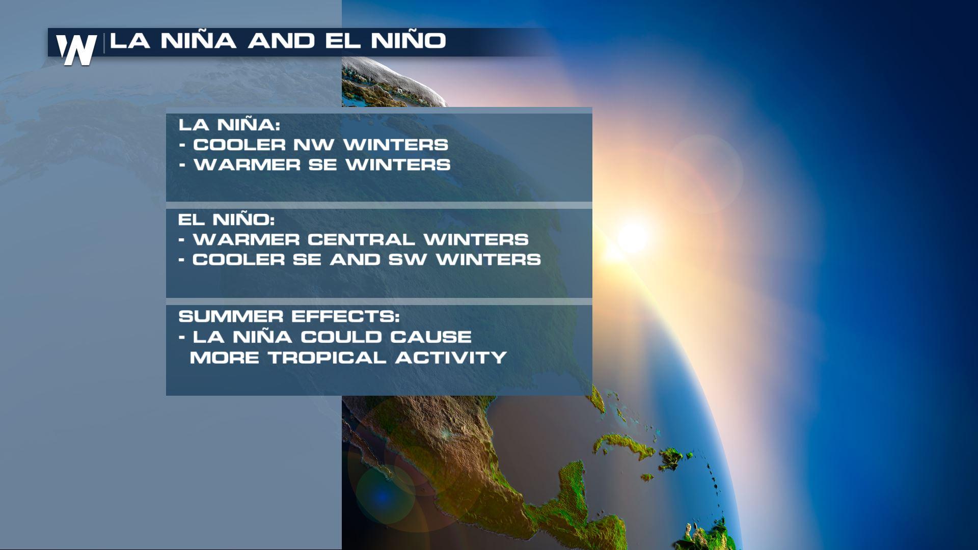
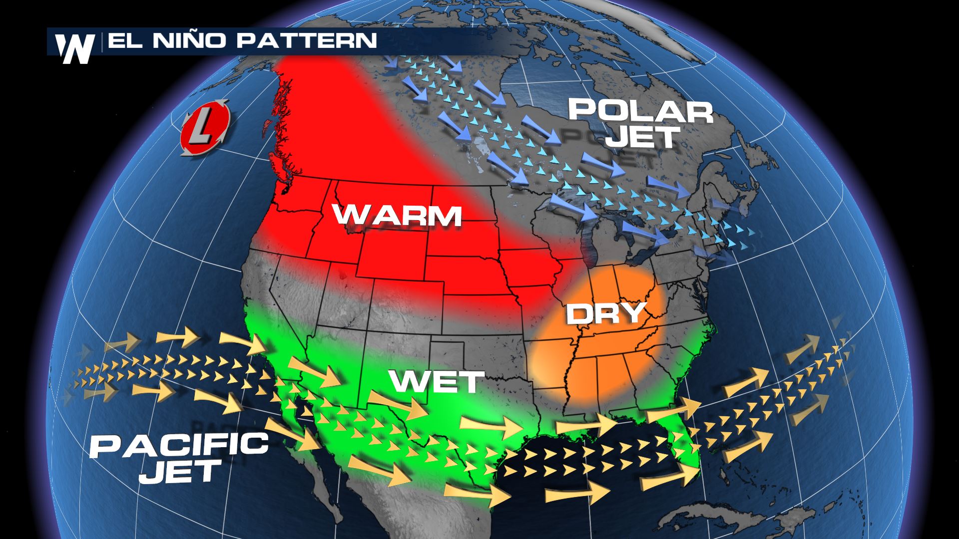
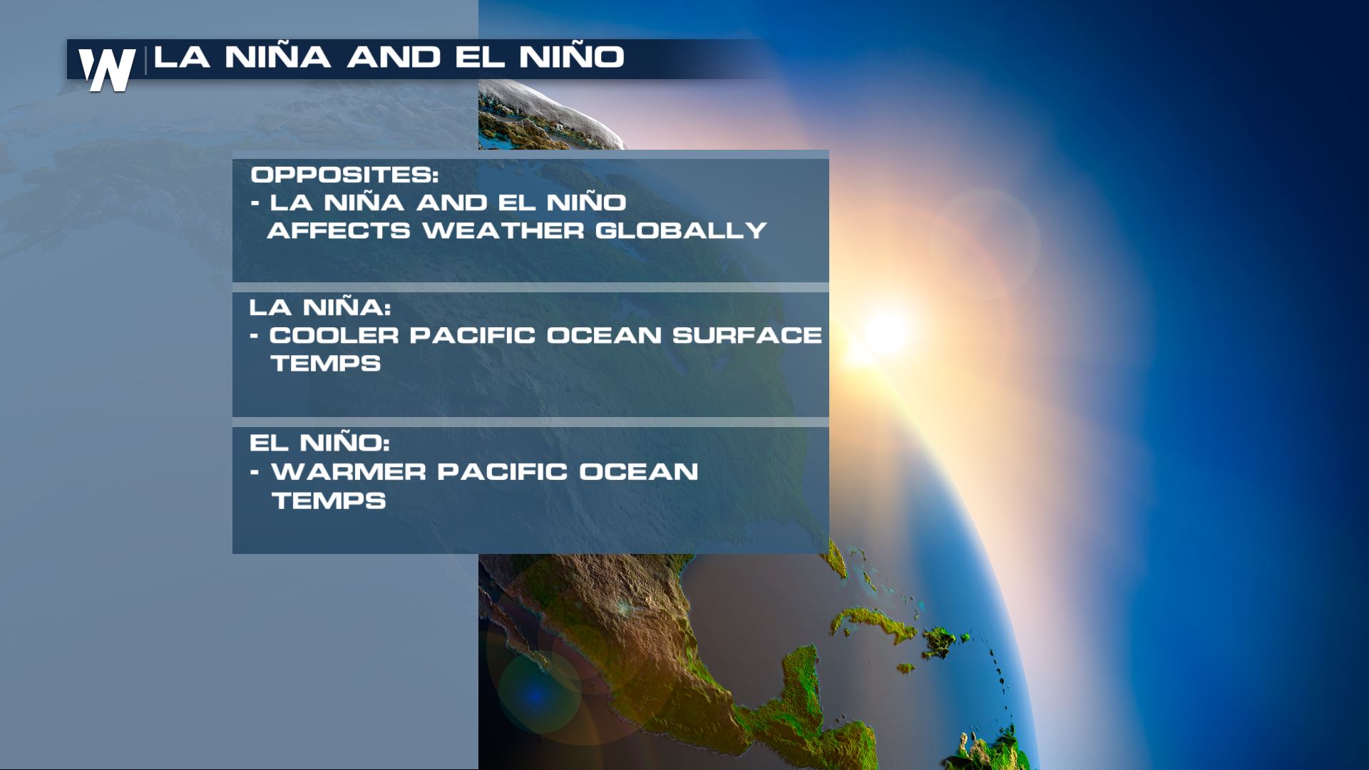 El Nino is characterized by *above* average sea surface temperatures in the Pacific. It is associated with wetter than average conditions along the Gulf of Mexico. In stronger El Nino years, there is a higher probability of heavy precipitation in the southwestern United States.
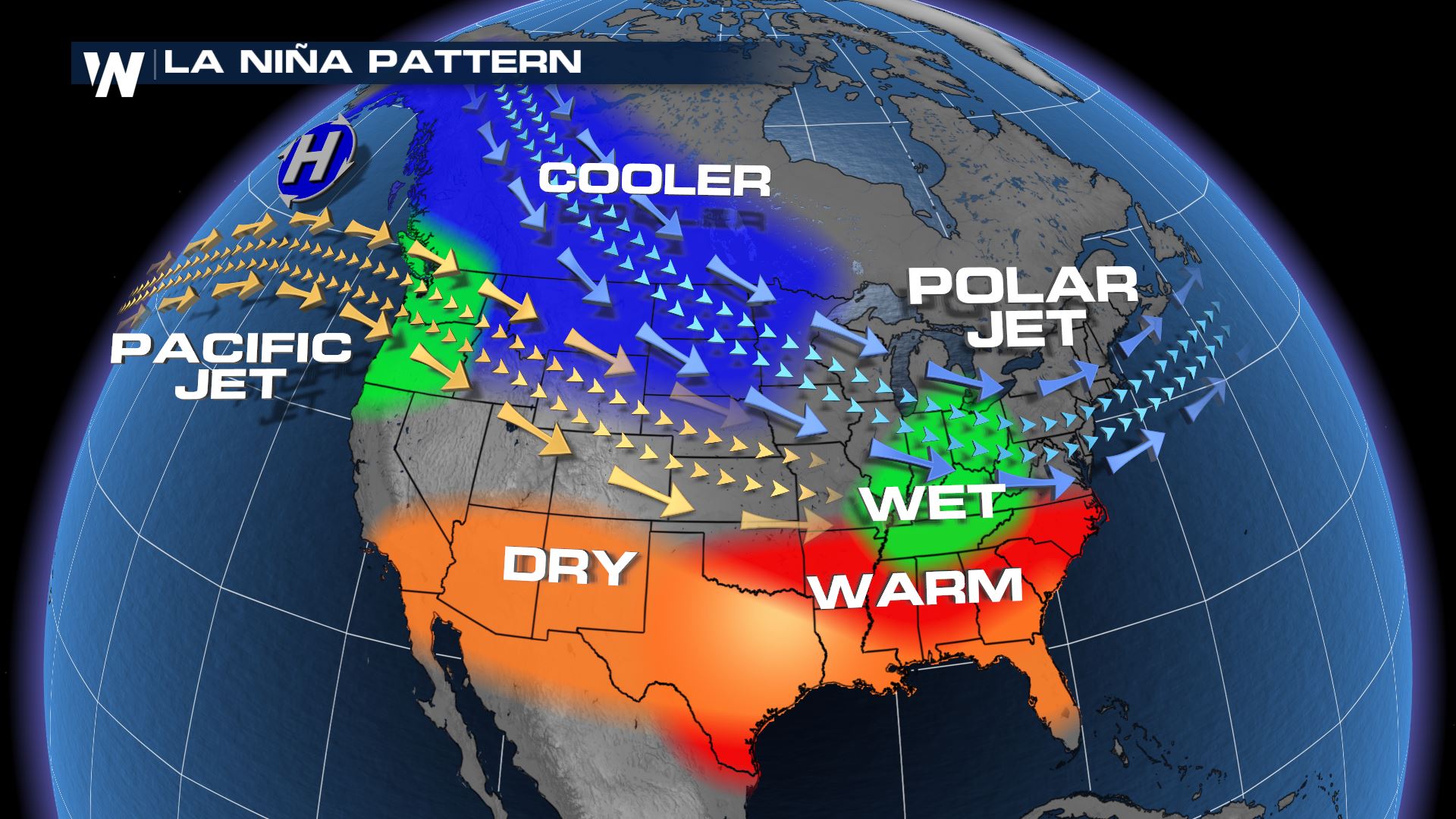
 La Nina is the opposite… characterized by *cooling* of the Pacific Ocean surface. La Nina phases tend to favor Atlantic Hurricane development. For example, the record setting 2020 season. In the lower-48, we tend to see cooler and wetter winters in the northern part of the country.
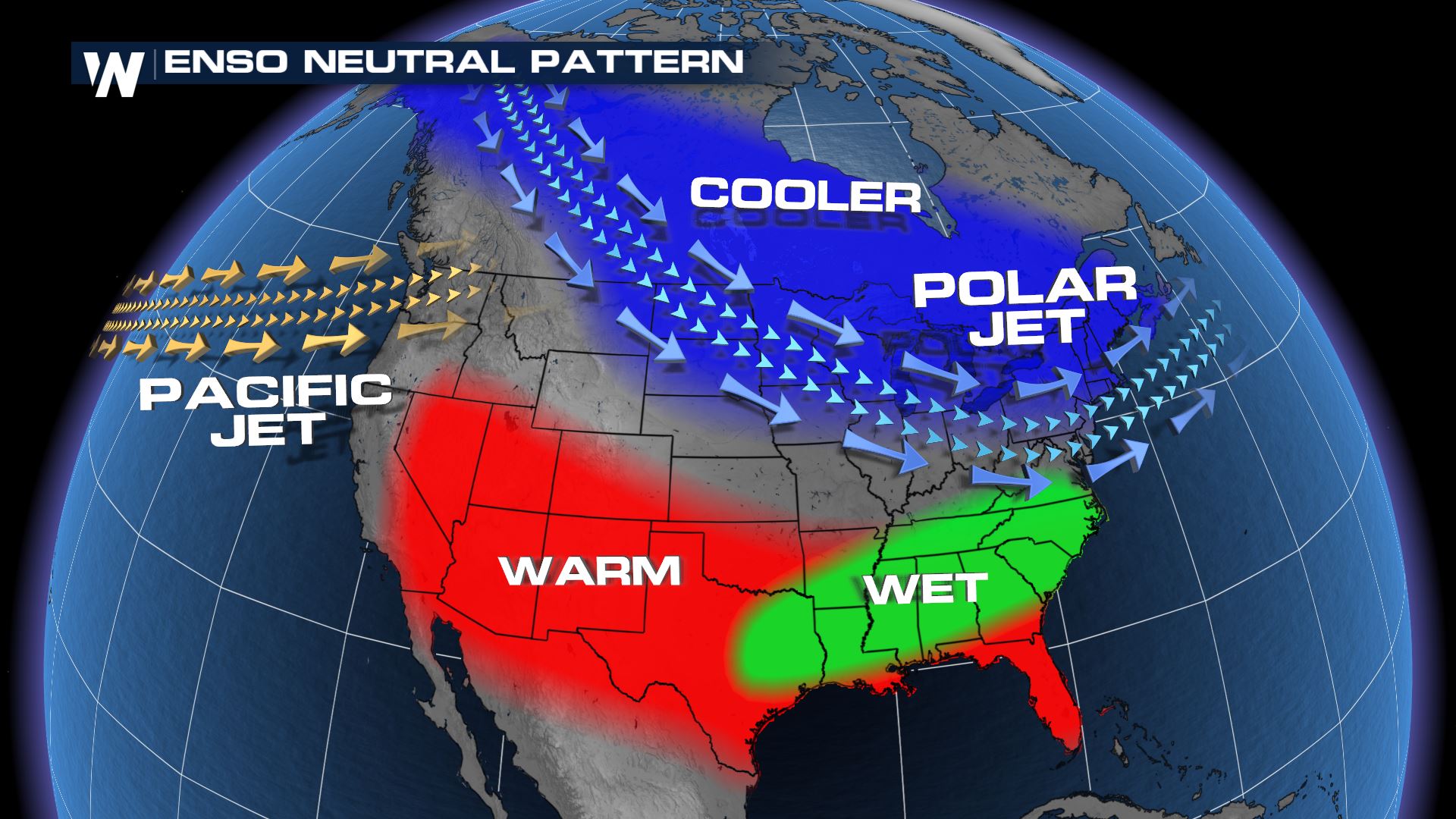
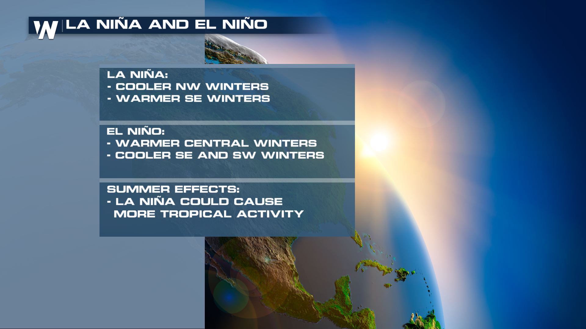 When ENSO is neutral, it means the sea surface temperatures are right around average or the atmospheric temperatures and ocean temperatures even themselves out.
 Stay with WeatherNation as we continue to bring you update on what phase of ENSO we are in and your top weather headlines.
El Nino is characterized by *above* average sea surface temperatures in the Pacific. It is associated with wetter than average conditions along the Gulf of Mexico. In stronger El Nino years, there is a higher probability of heavy precipitation in the southwestern United States.
La Nina is the opposite… characterized by *cooling* of the Pacific Ocean surface. La Nina phases tend to favor Atlantic Hurricane development. For example, the record setting 2020 season. In the lower-48, we tend to see cooler and wetter winters in the northern part of the country.
When ENSO is neutral, it means the sea surface temperatures are right around average or the atmospheric temperatures and ocean temperatures even themselves out.
Stay with WeatherNation as we continue to bring you update on what phase of ENSO we are in and your top weather headlines.All Weather News
More
Southeast Flood Risk Lingers Near Stalled Front
A stalled boundary over the Carolinas will ke
24 Jul 2026 12:35 PM

Tropics: Bertha Dissipates, Fausto Heads to Hawaii
BerthaBertha has dissipated after moving inla
24 Jul 2026 11:50 AM

Hot & Smoky w/ a Chance of Lightning
Conditions have been really dry out west. We'
24 Jul 2026 11:15 AM

Very Hot Temperatures For the Western and Central United States
Are you over the summer heat yet? Well, more
24 Jul 2026 9:20 AM

Severe Chances Return for the Midwest
The upcoming stretch of hot temperatures will
24 Jul 2026 1:57 AM

Another Round of Storms Targets the Northeast
Tuesday brought severe weather again across p
23 Jul 2026 1:15 AM

Another Round of Severe Weather for the Upper Midwest and Great Lakes
The upper-level low train continues to keep t
21 Jul 2026 1:45 AM