Drones That Hunt Hurricanes - NOAA Puts Some To The Test
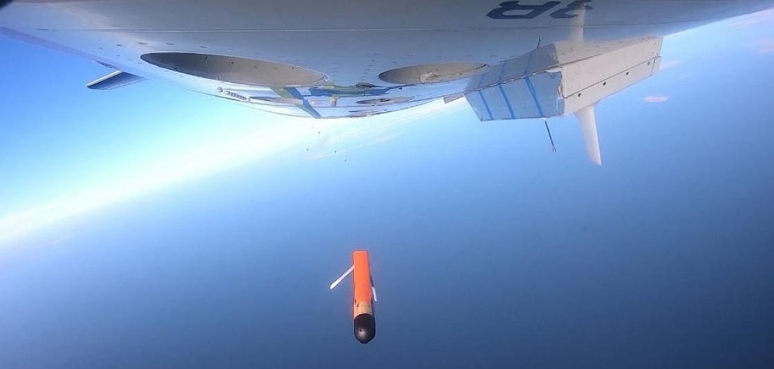
[View of the underside of the NOAA Hurricane Hunter plane as the Altius-600 uncrewed aircraft (research drone) is deployed high over a field during flight tests on January 15, 2021. Courtesy of Area-I via NOAA.]
[Written by NOAA] In clear skies over Maryland the week of January 11, NOAA scientists launched a new uncrewed small aircraft — a research drone — from a NOAA Hurricane Hunter plane to test its ability to gather weather data that could improve hurricane forecasts.
“We’re hopeful this new technology, once it can be successfully tested in a hurricane environment, will improve our understanding of the boundary layer and advance NOAA forecast models used in forecasts,” said Joseph Cione, lead meteorologist at NOAA’s Atlantic Oceanographic and Meteorological Laboratory Hurricane Research Division. “Ultimately, these new observations could help emergency managers make informed decisions on evacuations before tropical cyclones make landfall.”
For many years, NOAA Corps pilots have flown the agency’s two WP-3D Orion Hurricane Hunters into the eye of tropical storms to gather vital weather data. But they avoid the perilous lower eyewall in the boundary layer where the ocean meets the atmosphere. This violent area of high winds and towering ocean waves is of key interest to scientists, but it’s too dangerous for piloted aircraft.
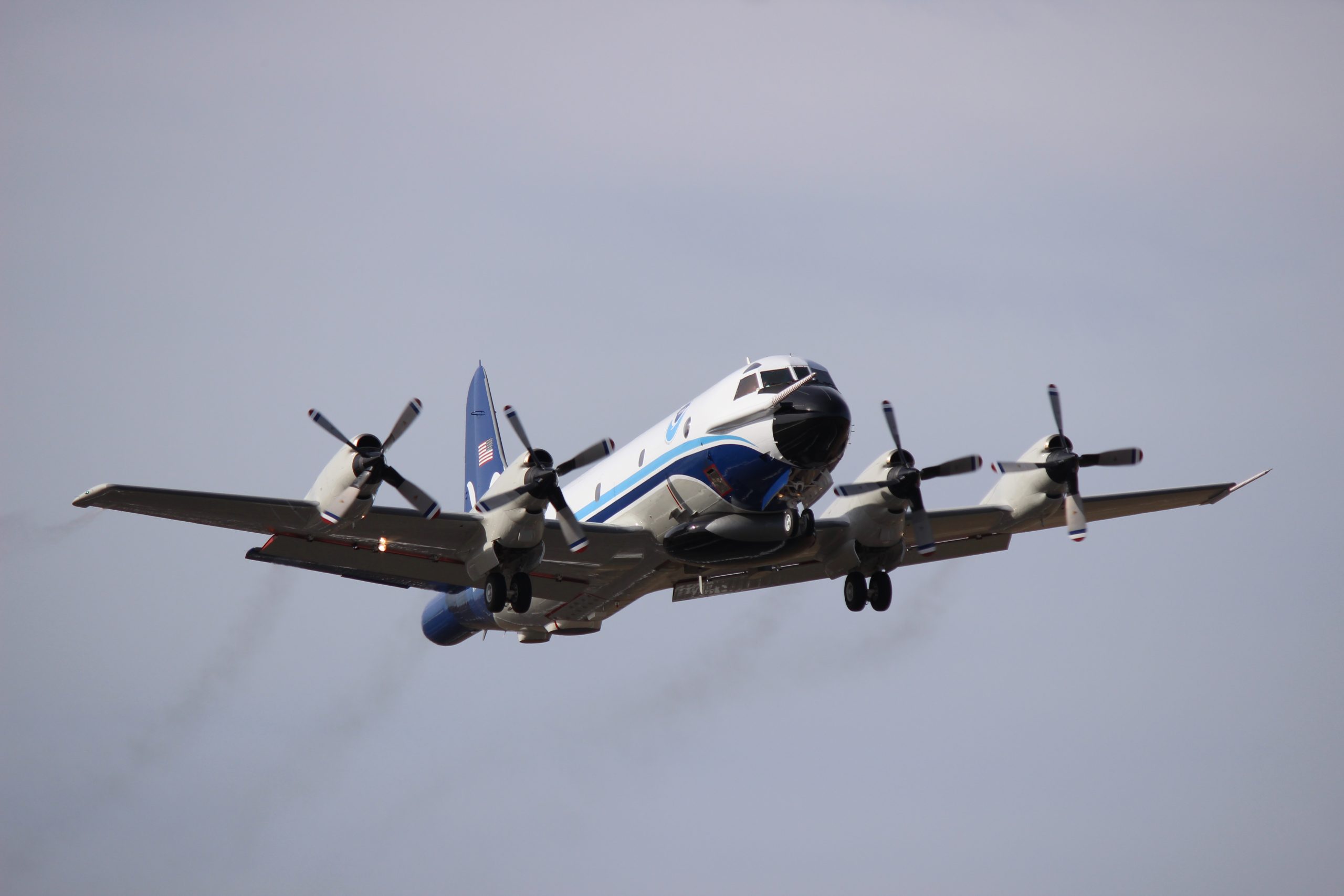
[The newly upgraded and repainted NOAA Lockheed WP-3D Orion N42RF, also known as "Kermit," taking off from Tampa, Florida, on Jan. 18, 2017.]
Instead, scientists aboard the Hurricane Hunters release sensors tethered to parachutes, known as dropsondes, which gather data as they drop from the sky all the way down to the ocean, recording wind speed and direction, temperature, moisture and pressure as they go.
Now it appears scientists might soon get a better view.
“Dropsondes give us 'snapshots' of weather conditions, while the continuous flow of data collected by uncrewed aircraft provide something closer to a movie,” said Cione, who conducted the drone test missions out of Patuxent River Naval Air Station. “Deploying the uncrewed aircraft from NOAA Hurricane Hunters will ultimately help us better detect changes in hurricane intensity and overall structure."
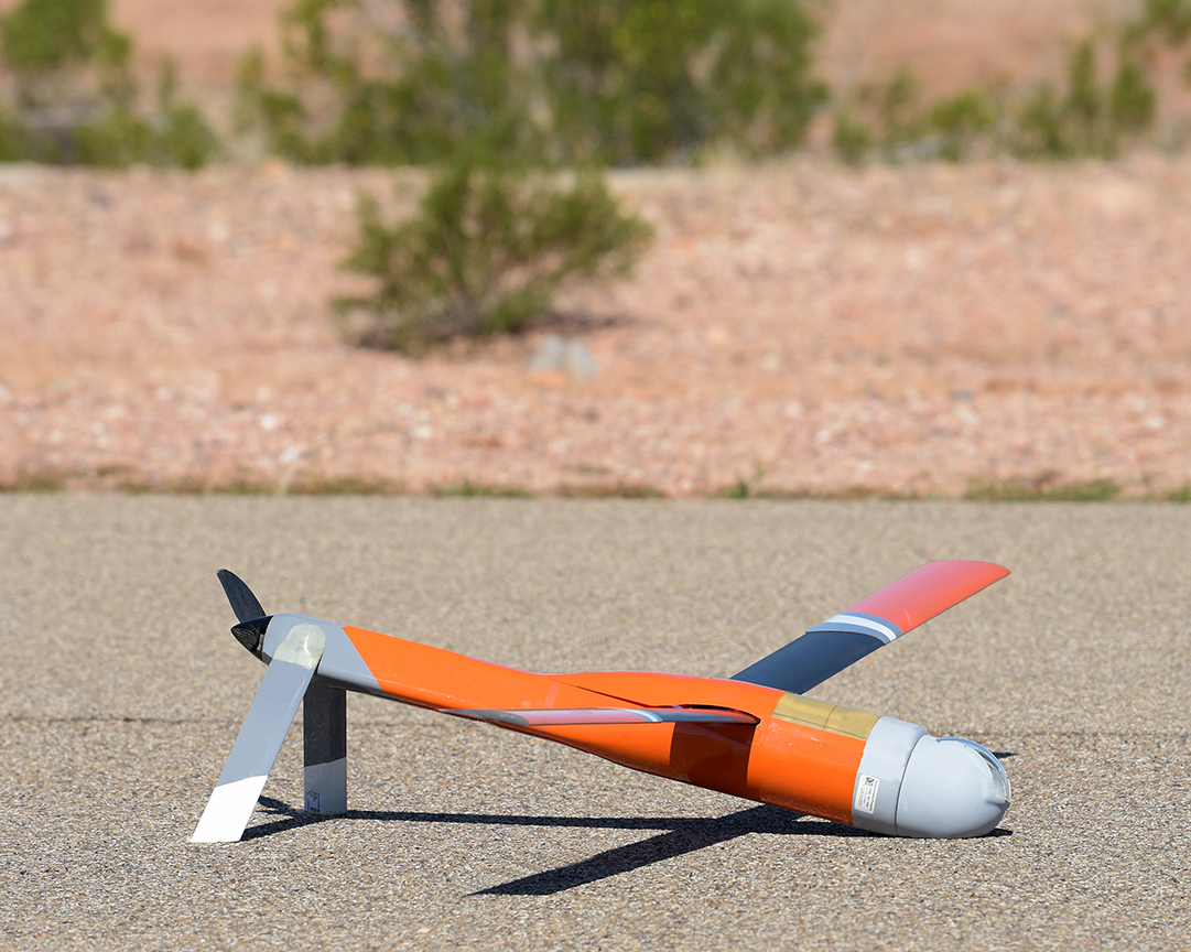
[An Altius uncrewed aircraft (research drone) at landing. This model is similar to those being tested by scientists aboard NOAA Hurricane Hunters. Courtesy of Area-I via NOAA.]
How do you safely test a drone? Carefully. And with a team of aviation experts
NOAA worked closely with Area-I, the Georgia-based aerospace company that created Altius-600, to adapt it for sampling weather data. The Altius-600 is the second generation of small uncrewed, remote-controlled aircraft that NOAA has used to collect hurricane data. The drone offers exciting, new data-gathering features such as the ability to fly up to four hours and distances up to 265 miles from its point of launch. Unfortunately, the new uncrewed aircraft systems, like dropsondes, cannot be recovered when deployed in storms.NOAA Corps test pilots and NOAA engineers also coordinated closely with the Naval Air Station Patuxent River’s Atlantic Test Range and the Navy’s unmanned aircraft test squadron UX-24 to successfully execute the test flights, which are required to certify the Altius for operational use in hurricane conditions.
About NOAA’s uncrewed aircraft research
The Altius-600 is the first of three small uncrewed aircraft systems NOAA is testing. The research supports NOAA’s Uncrewed Systems Strategy to expand the use of uncrewed systems. The development and testing of the uncrewed systems is also supported by NOAA’s Small Business Innovation Research Program.


