East Coast: Strong Storms Thursday
Special Stories
11 Jun 2020 8:00 AM
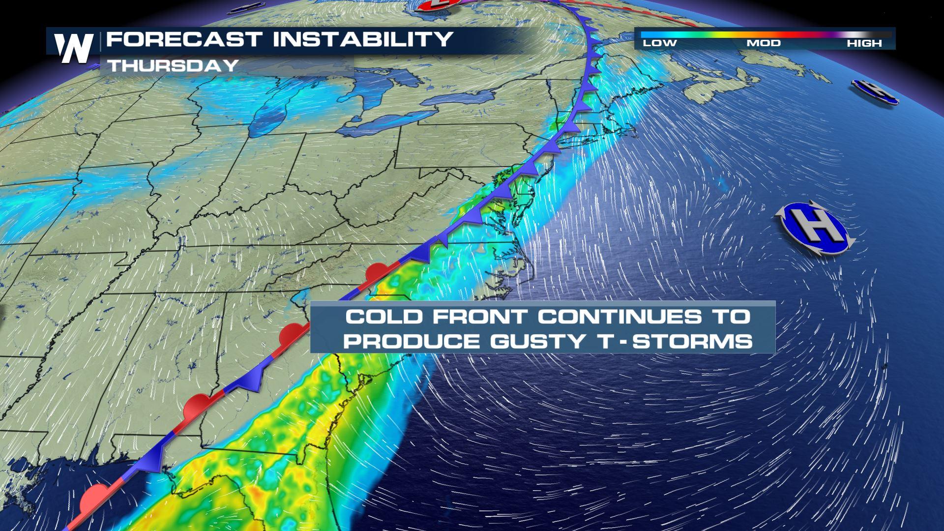
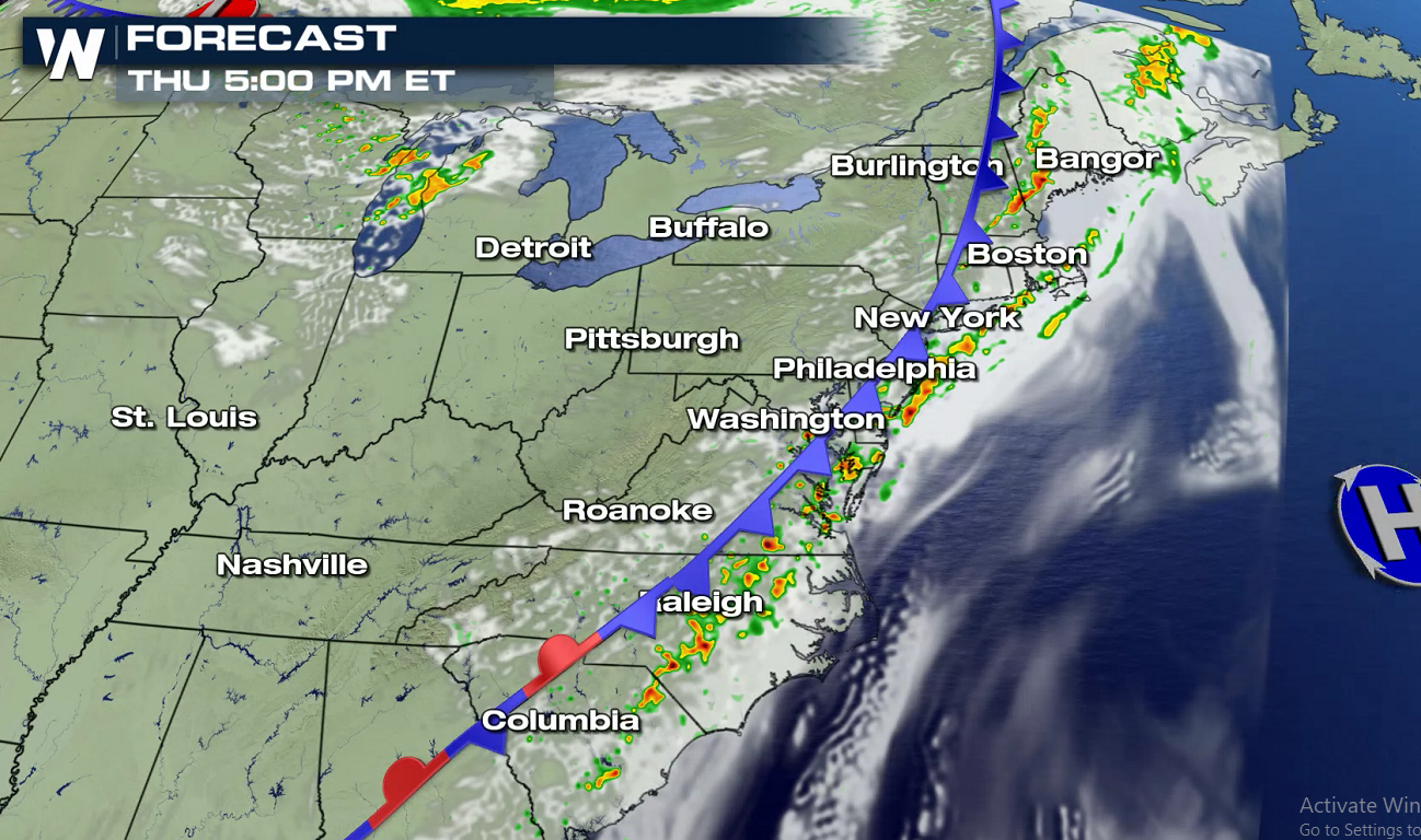
Scattered severe thunderstorms will be possible today (Thursday) along the Eastern Seaboard. Thunderstorms will fire up along a cold front pushing through the region. This same cold front sparked up severe weather on Wednesday in the Great Lakes, including numerous reports of damaging wind gusts.
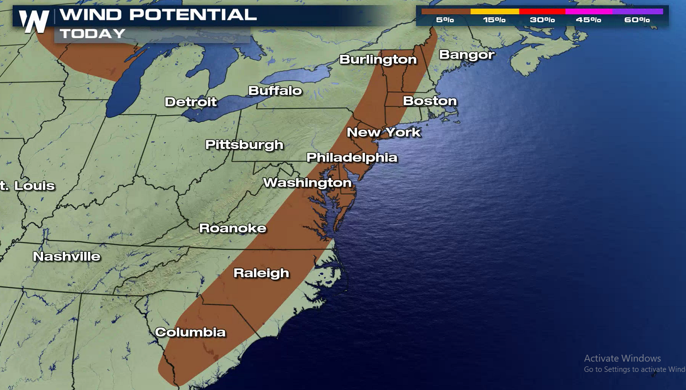
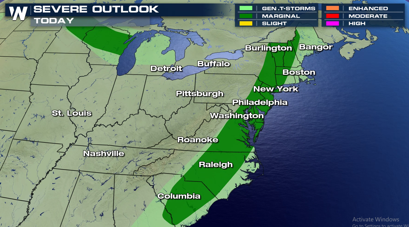 From New England to the Mid-Atlantic to the Southeast, there will be enough instability and atmospheric energy for thunderstorms to produce wind gusts over 60 mph. The risk for tornadoes and large hail remains low.
 Ongoing morning storms will push through the Appalachian Mountains. Additionally, daytime heating will allow for new thunderstorms to form along and ahead of the cold front.
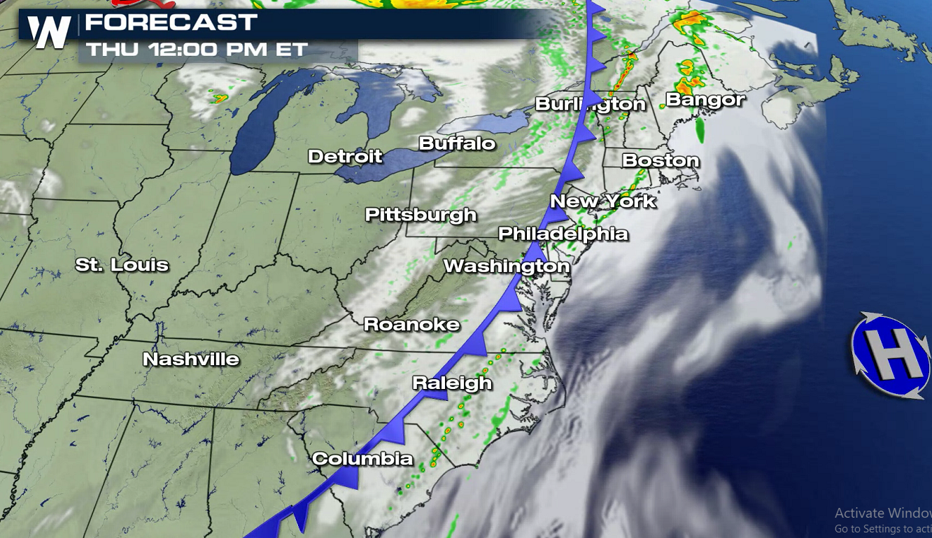
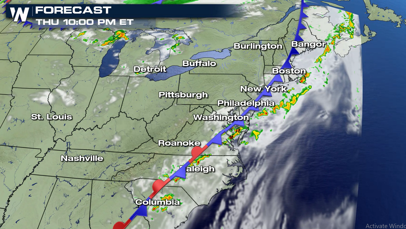
 By nighttime, the cold front will push east of the Interstate-95 corridor. Storms will linger a bit more in the Carolinas, however.
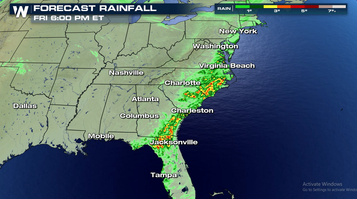
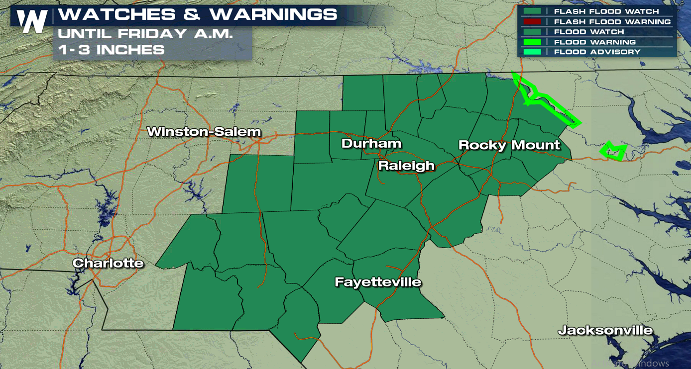
 As is often the case with summertime convection, heavy downpours will be a possibility. Some thunderstorms will include intense rainfall rates of 1 to 2 inches per hour. Flash Flood Watches have been issued in North Carolina.
 WeatherNation will keep you informed on the severe weather potential. Check back with us for updates on-air and online.
From New England to the Mid-Atlantic to the Southeast, there will be enough instability and atmospheric energy for thunderstorms to produce wind gusts over 60 mph. The risk for tornadoes and large hail remains low.
Ongoing morning storms will push through the Appalachian Mountains. Additionally, daytime heating will allow for new thunderstorms to form along and ahead of the cold front.
By nighttime, the cold front will push east of the Interstate-95 corridor. Storms will linger a bit more in the Carolinas, however.
As is often the case with summertime convection, heavy downpours will be a possibility. Some thunderstorms will include intense rainfall rates of 1 to 2 inches per hour. Flash Flood Watches have been issued in North Carolina.
WeatherNation will keep you informed on the severe weather potential. Check back with us for updates on-air and online.All Weather News
More
After Reaching Category 5, Genevieve Weakens in the Pacific
PacificGenevieve formed on last Friday south
2 Aug 2026 1:25 PM

More Storms for the East Sunday and Monday
A low-pressure system crashing through the Mi
2 Aug 2026 1:25 PM


Wildfire Outbreak in the Pacific Northwest
Conditions have been incredibly dry out west.
2 Aug 2026 12:20 PM

Flooding, Severe Storms Target the Midwest Again
After an active week of storms across the nor
1 Aug 2026 1:40 AM

Flooding Risk Increases as Heavy Rain Targets the Tri-State Area
Tuesday, heavy rainfall moved across the Nort
30 Jul 2026 12:25 AM

Severe Weather: Energy From the Midwest Now in the Southeast
UPPER MIDWEST - Through Monday, dangerous tor
29 Jul 2026 10:30 PM