Eastern U.S. Heavy Rain Potential Monday
Top Stories
7 Oct 2019 4:08 AM
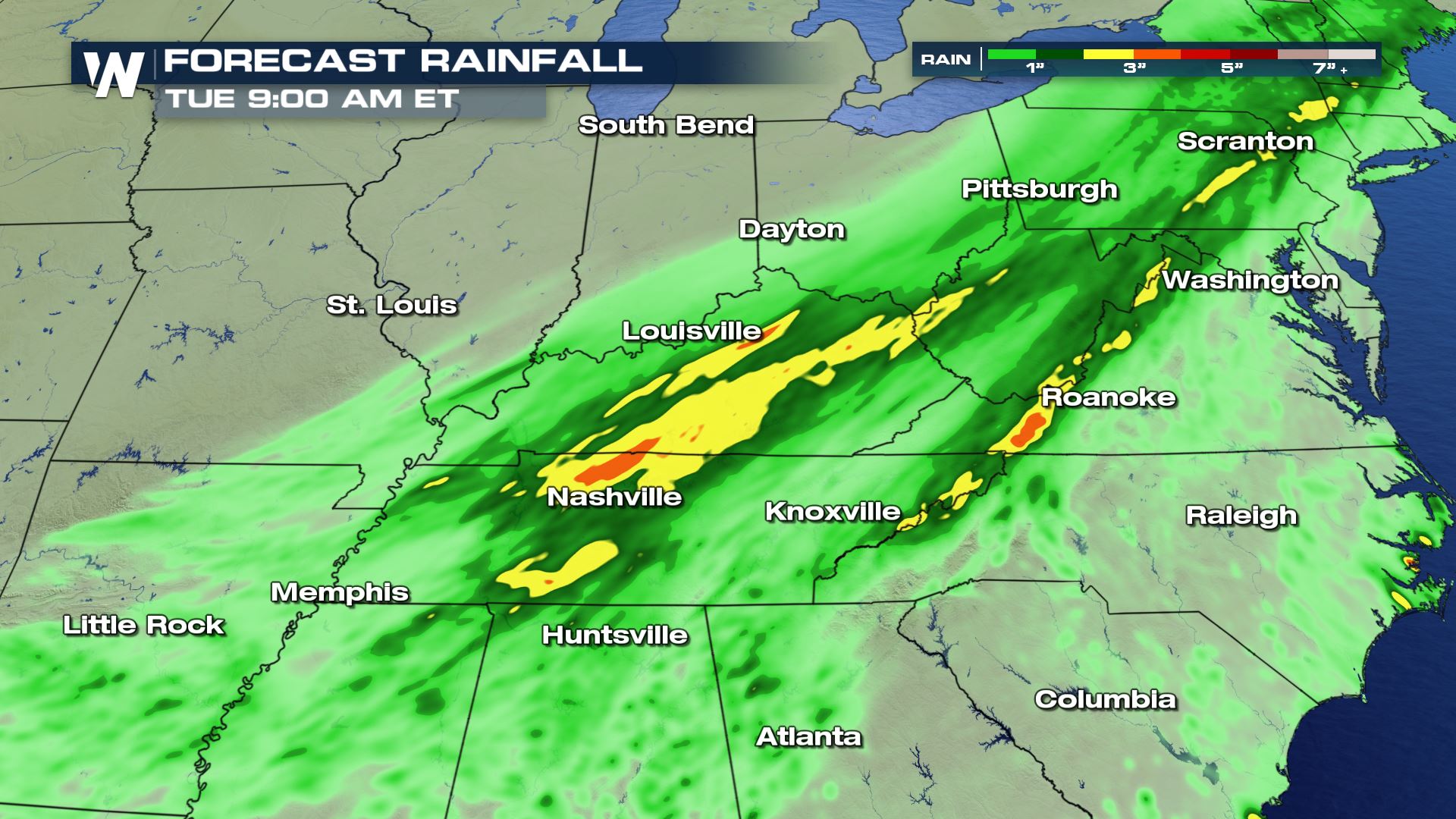
A significant cold front is helping to produce heavy scattered showers and storms for the Eastern United States today. Areas in the Tennessee Valley and Eastern Florida could all see several inches of rain by Tuesday morning. Here is the latest heavy rain forecast.
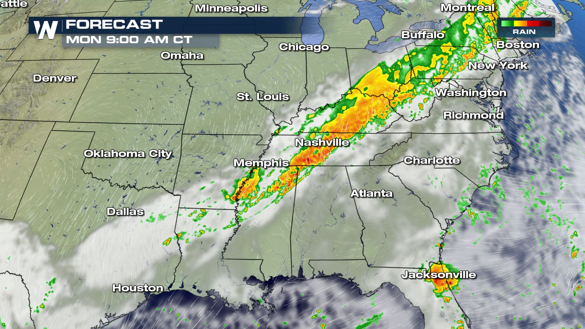
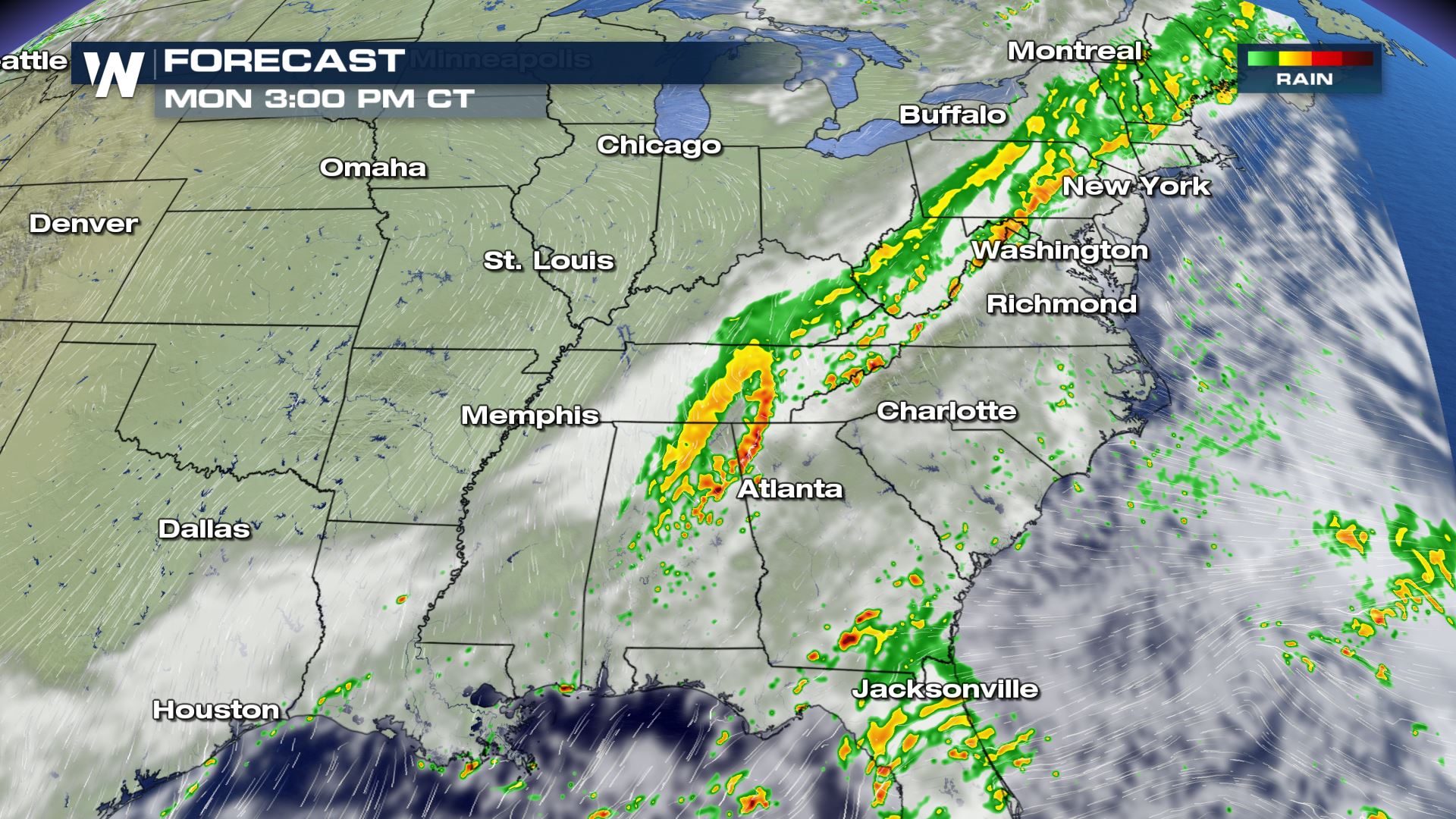
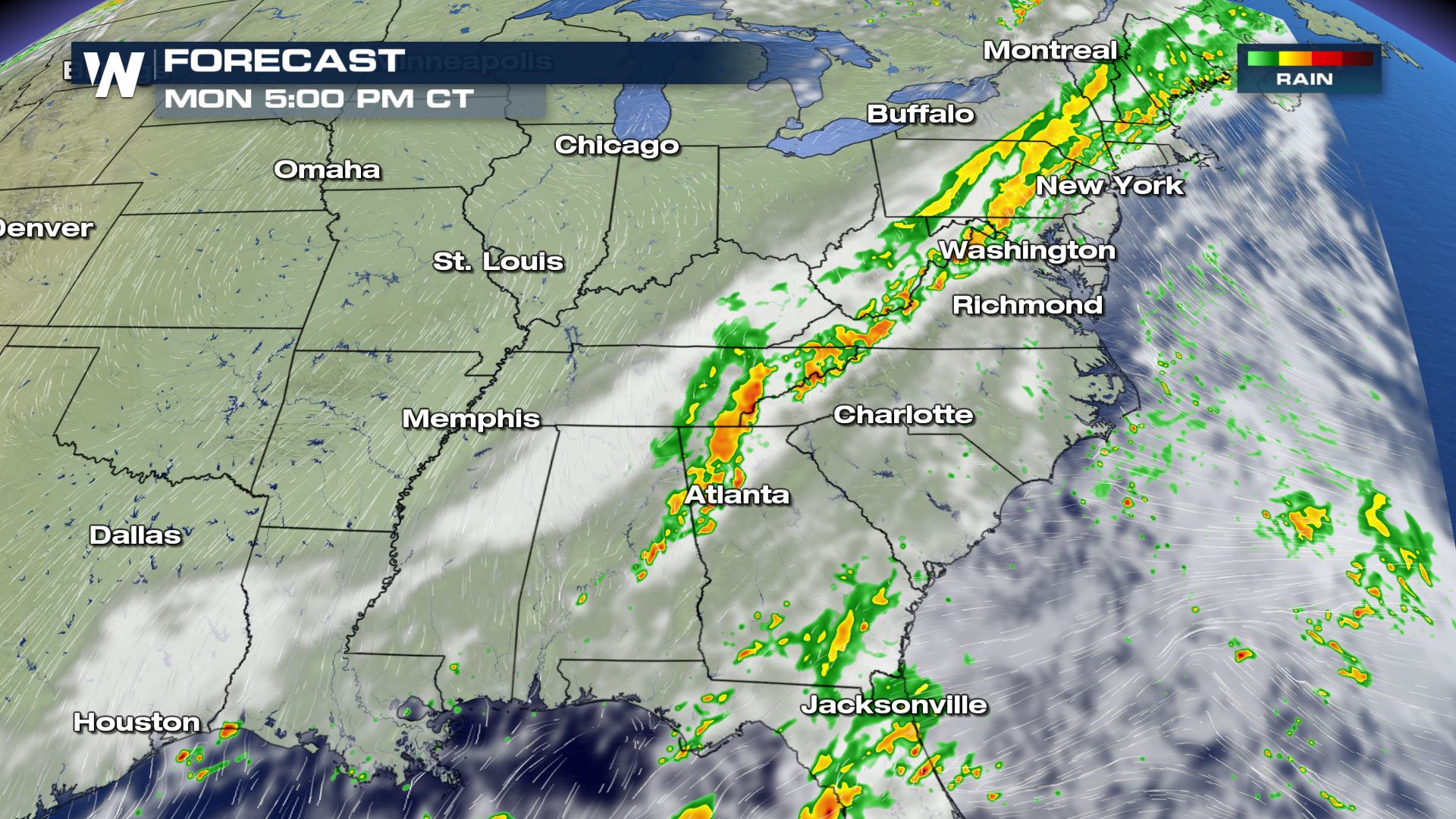 Showers and storms will be moving along the cold front all morning and all afternoon. Training storms will be the set-up, meaning heavy rain will be falling over a lot of the same areas. This will lead to a risk of flash flooding. Be safe!

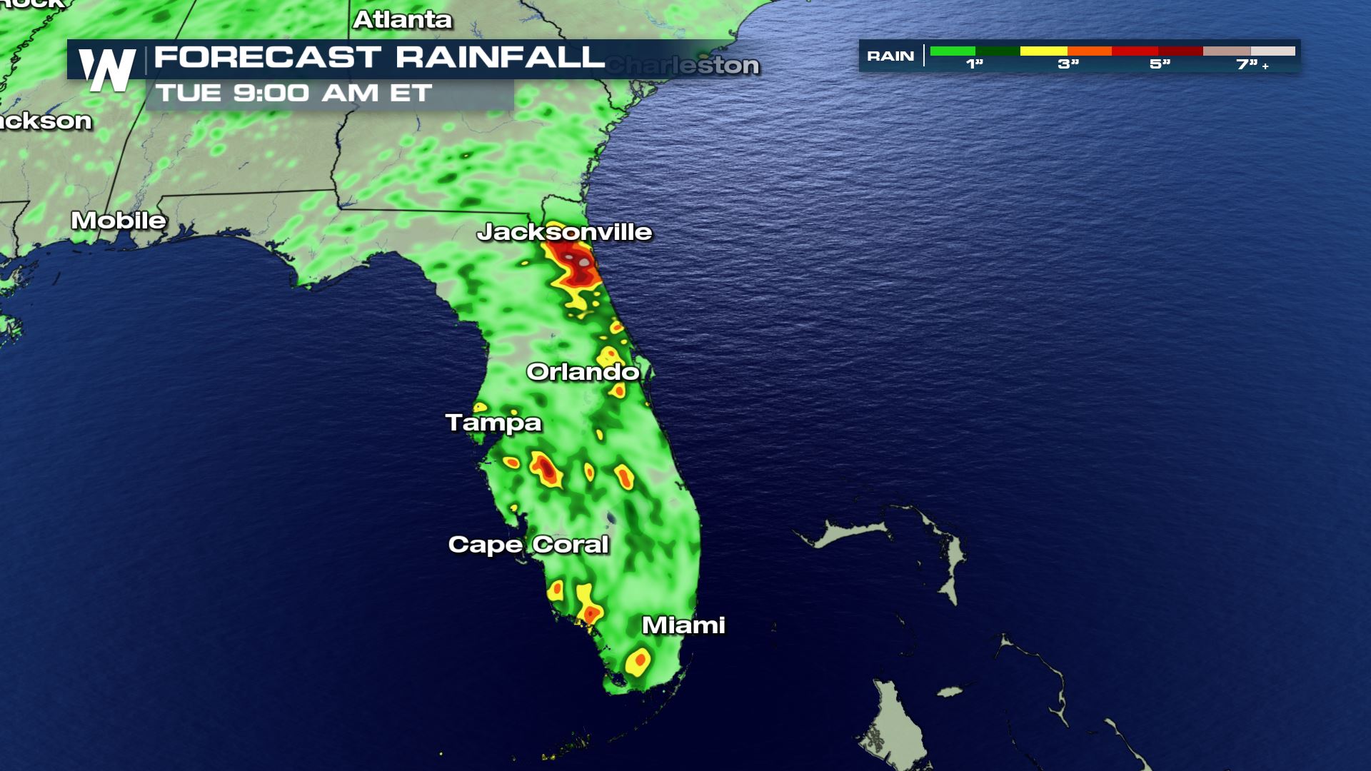 The heavy rain risk will be mostly isolated for areas in the Mid-Atlantic and Northeast, but more widespread heavy rain is likely for the Sunshine State of Florida. Check out that rainfall forecast for Jacksonville, Florida...could exceed 5 inches in that area through Tuesday morning.
More updates on the heavy rain are coming up on all day on WeatherNation.
The heavy rain risk will be mostly isolated for areas in the Mid-Atlantic and Northeast, but more widespread heavy rain is likely for the Sunshine State of Florida. Check out that rainfall forecast for Jacksonville, Florida...could exceed 5 inches in that area through Tuesday morning.
More updates on the heavy rain are coming up on all day on WeatherNation.
Forecast
Showers and storms will be moving along the cold front all morning and all afternoon. Training storms will be the set-up, meaning heavy rain will be falling over a lot of the same areas. This will lead to a risk of flash flooding. Be safe!
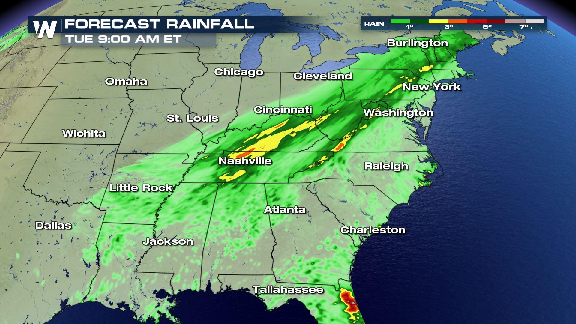
Rainfall Potential
The heavy rain risk will be mostly isolated for areas in the Mid-Atlantic and Northeast, but more widespread heavy rain is likely for the Sunshine State of Florida. Check out that rainfall forecast for Jacksonville, Florida...could exceed 5 inches in that area through Tuesday morning.
More updates on the heavy rain are coming up on all day on WeatherNation.All Weather News
More


More Storms for the East Sunday and Monday
A low-pressure system crashing through the Mi
2 Aug 2026 2:20 AM

After Reaching Category 5, Genevieve Weakens in the Pacific
PacificGenevieve formed on last Friday south
2 Aug 2026 1:30 AM

Flooding, Severe Storms Target the Midwest Again
After an active week of storms across the nor
1 Aug 2026 1:40 AM

Flooding Risk Increases as Heavy Rain Targets the Tri-State Area
Tuesday, heavy rainfall moved across the Nort
30 Jul 2026 12:25 AM

Severe Weather: Energy From the Midwest Now in the Southeast
UPPER MIDWEST - Through Monday, dangerous tor
29 Jul 2026 10:30 PM