El Niño Over, La Niña On Track For Fall

El Niño is over. The powerful El Niño/Southern Oscillation (or ENSO) phase that impacted US Weather conditions through the winter and spring has now transitioned. On Thursday June 13, NOAA's Climate Prediction Center reported that we have now entered into ENSO Neutral conditions.
The El Niño-Southern Oscillation (ENSO) is an oscillating climate pattern involving changes in the temperature of waters in the central and eastern tropical Pacific Ocean. Sea surface temperatures (SSTs) over a large swath of the tropical Pacific Ocean can warm or cool anywhere from 1°C to 3°C from normal. El Niño marks above-average sea surface temperatures, while La Niña marks below-average water temperatures. ENSO Neutral means that SSTs are near normal., meaning we are neither in an El Niño or La Niña phase.
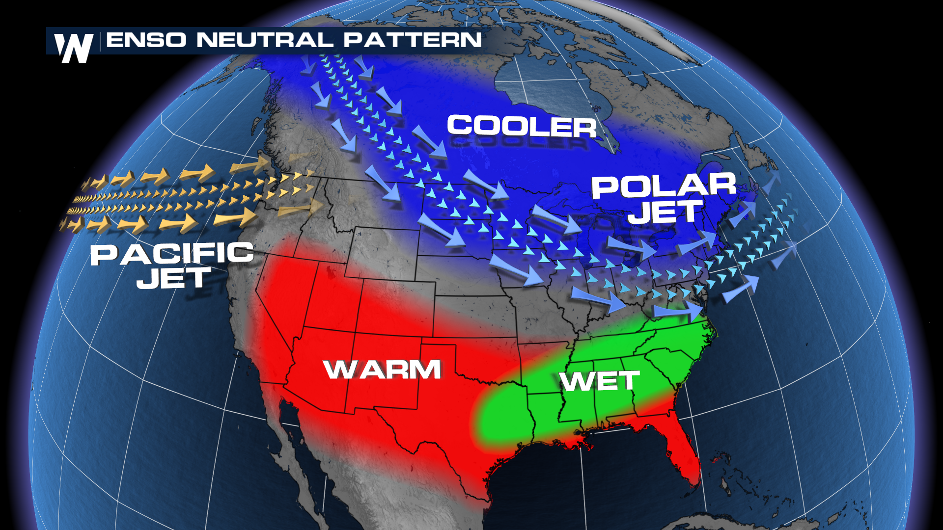
ENSO Neutral conditions tend to bring the Polar Jet stream farther south, bringing in cooler air for the northern tier of the country. The southern half of the country generally sees warmer than average temperatures, with a wetter pattern in the southeast. This is most amplified during the fall months, but some influences can be felt into the summer too.
 The forecast for ENSO conditions could have major implications going into the heart of hurricane season. NOAA anticipates the development of La Niña conditions this summer, citing "the persistent below-average subsurface ocean temperatures and changes in the tropical atmospheric circulation."
RELATED ARTICLE: NOAA Predicts Above Average 2024 Atlantic Hurricane Season
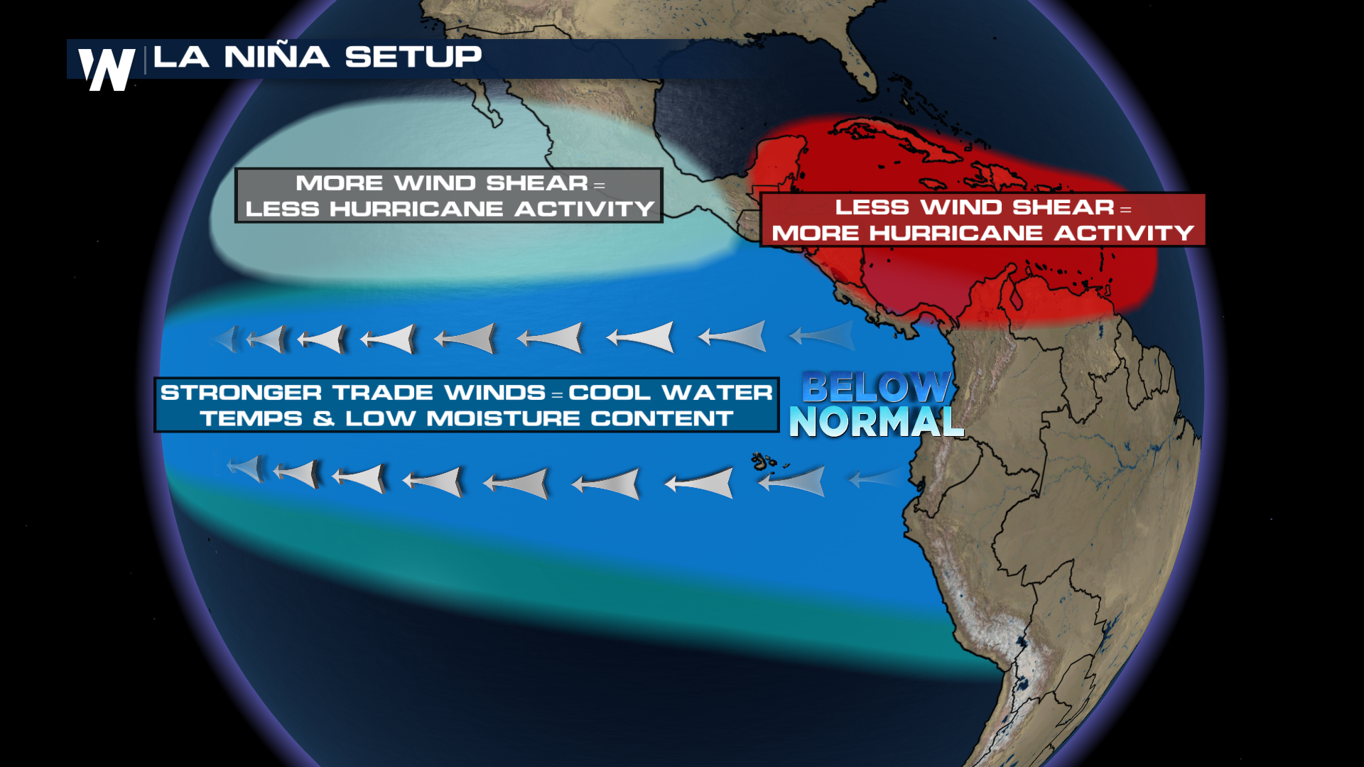
Before 2023, La Niña conditions contributed to three years of overly active hurricane seasons; starting with the record breaking 2020 Atlantic season. La Niña conditions lead to less wind shear in the Atlantic, allowing tropical systems to develop and strengthen. Into the heart of hurricane season, La Niña is forecast to be in full swing.
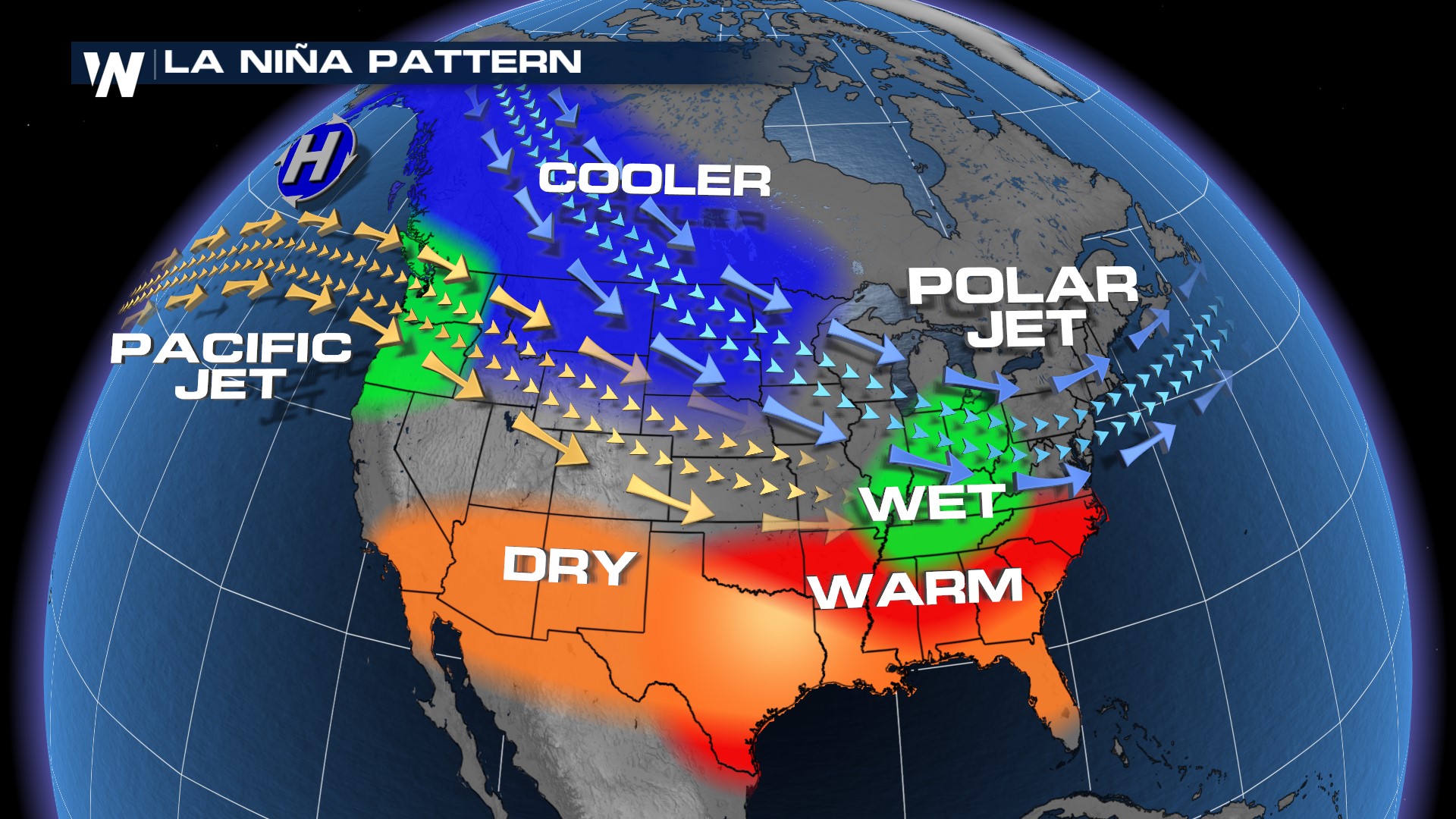
 It will likely continue into the Northern Hemisphere winter of 2024-25. Signals/impacts from ENSO are usually more prominent during winter with cooler than average conditions in the northern tier of the country while it is warmer and drier for the southern part of the continental U.S.. A wetter pattern is more likely for the PNW and Midwest.