Excessive Rainfall Remains in the Forecast
Special Stories
12 Apr 2019 11:23 AM
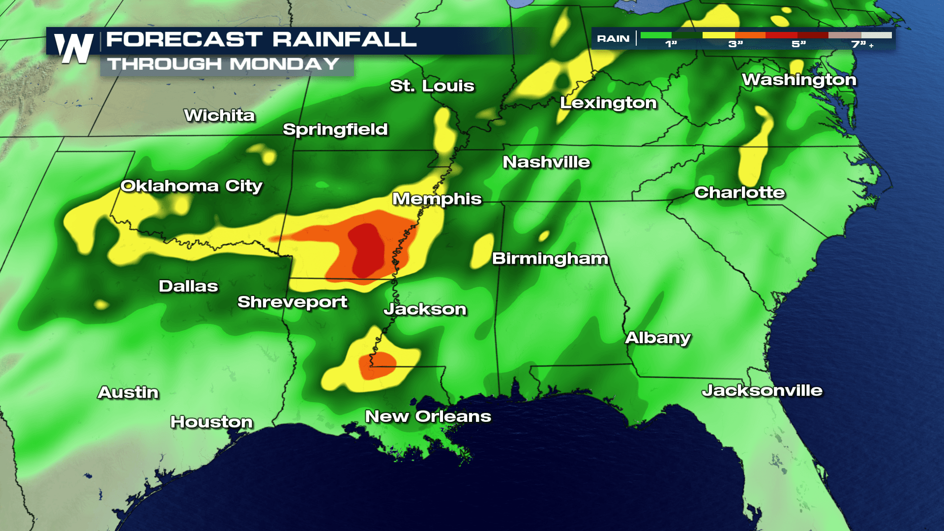
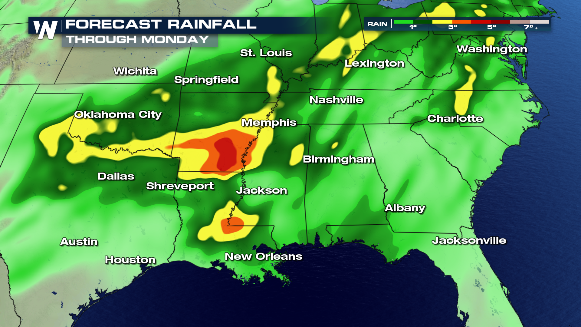
Another strong wave of energy will drop moderate to heavy rain for areas in the south into the upcoming weekend, as a steady surge of moisture will stream in from the Gulf of Mexico and interact with a stationary frontal boundary. Rain is expected to fall from east Texas to southern Oklahoma and into Arkansas, Mississippi and Louisiana.
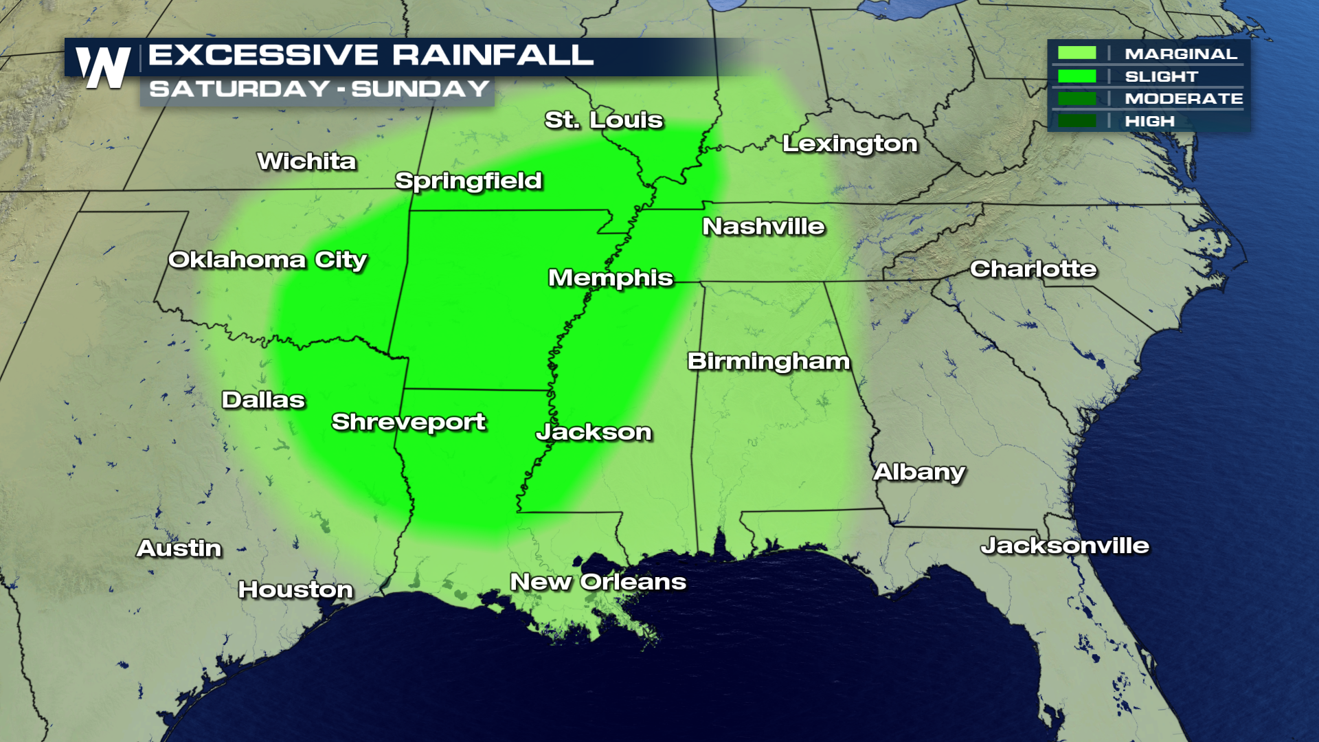 Areas that will likely see the heaviest rainfall will be in southern Arkansas and into central and eastern Louisiana. Rain totals may exceed 4-5" by early Monday morning in the areas shaded in orange and red. Flooding may also be a concern, especially around low lying areas and near the Mississippi River.
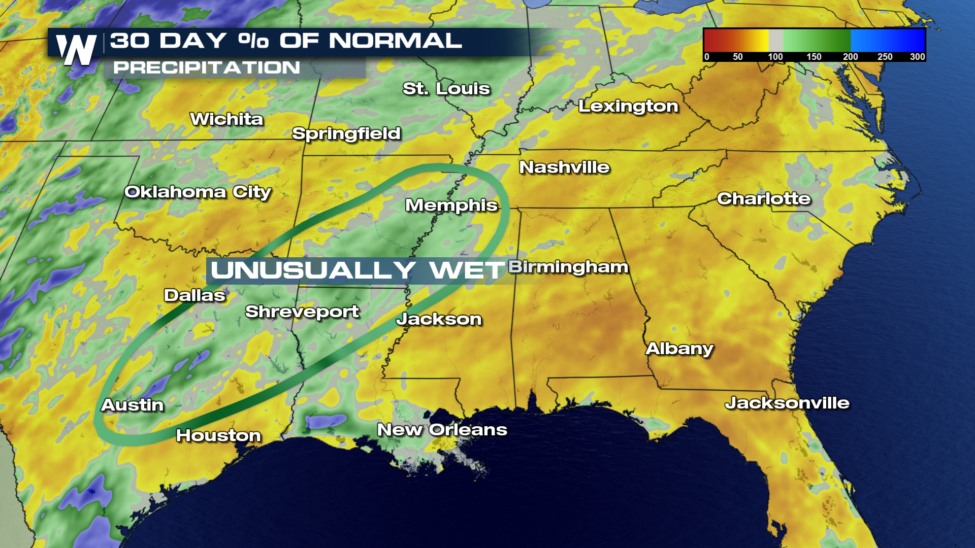
 Some areas are already 150-200% above average for precipitation over the last 30 days, so any rainfall that is produced will likely generate flooding concerns due to the saturated soils that are currently in place.
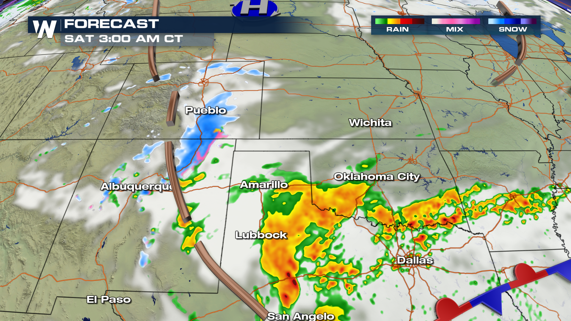
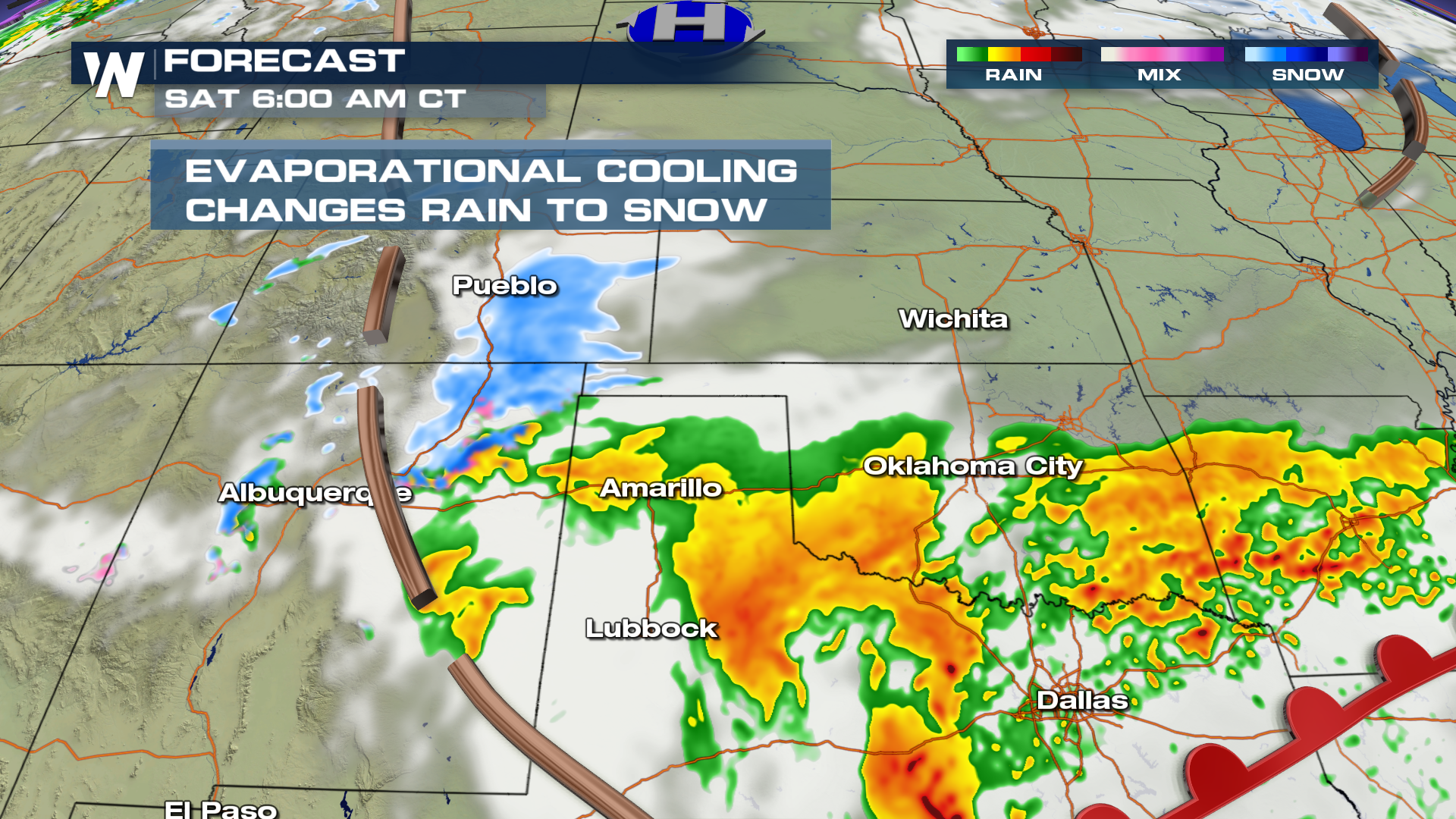
 Here is the expected timing of showers to develop by early Saturday morning.
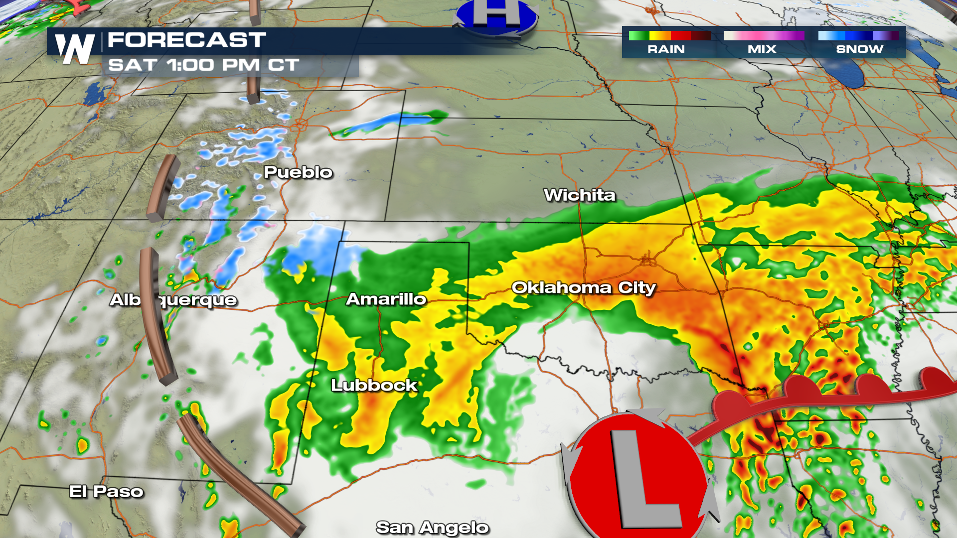
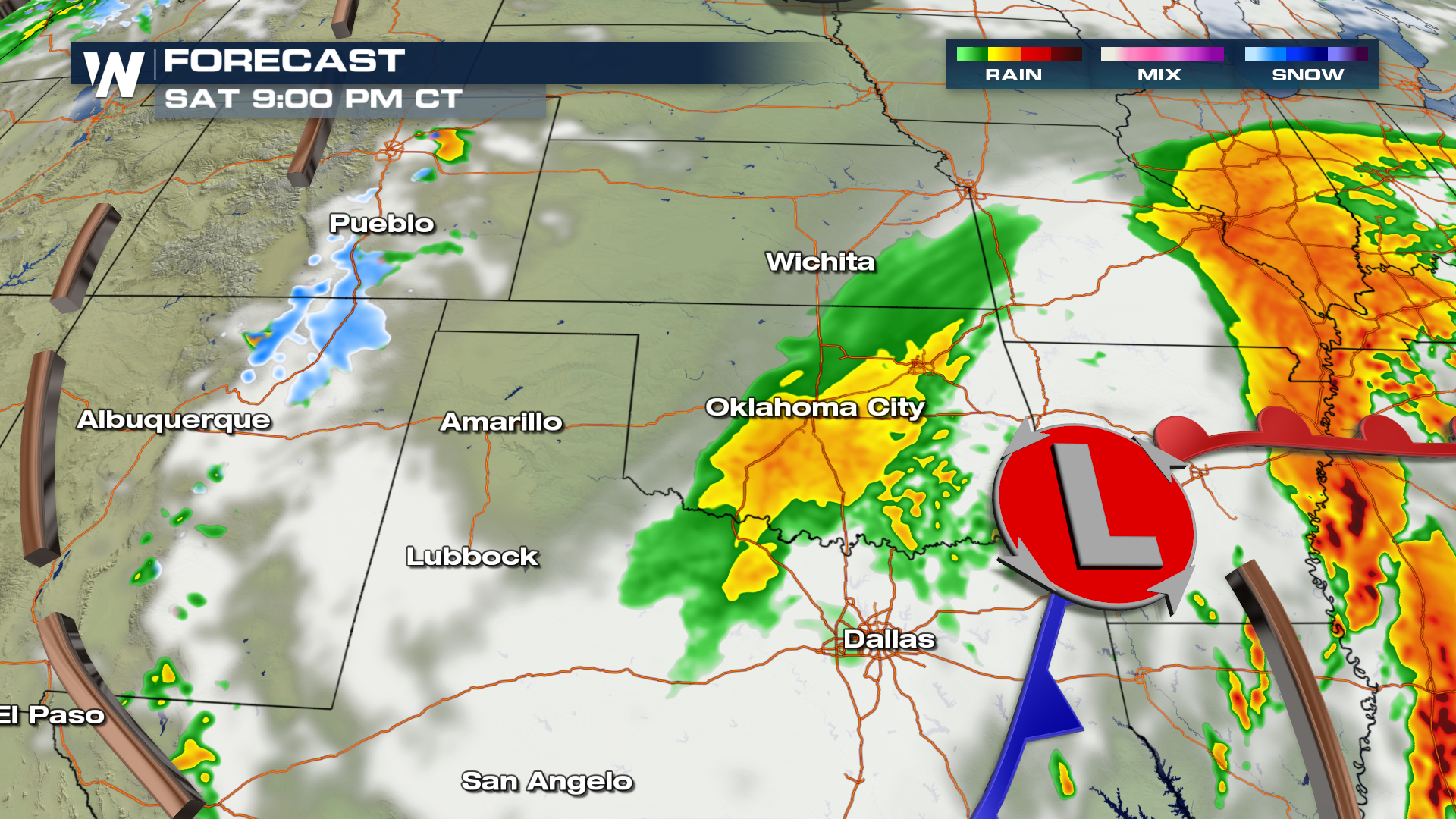
 By 6 AM, storms become more widespread in coverage with the chance for isolated pockets of severe weather, too.
 For WeatherNation, I'm Meteorologist Greg Rule
Areas that will likely see the heaviest rainfall will be in southern Arkansas and into central and eastern Louisiana. Rain totals may exceed 4-5" by early Monday morning in the areas shaded in orange and red. Flooding may also be a concern, especially around low lying areas and near the Mississippi River.
Some areas are already 150-200% above average for precipitation over the last 30 days, so any rainfall that is produced will likely generate flooding concerns due to the saturated soils that are currently in place.
Here is the expected timing of showers to develop by early Saturday morning.
By 6 AM, storms become more widespread in coverage with the chance for isolated pockets of severe weather, too.
For WeatherNation, I'm Meteorologist Greg RuleAll Weather News
More
Wildfire Outbreak in the Pacific Northwest
SPOKANE, WA - On Saturday, August 1st, the Ol
3 Aug 2026 1:55 AM

More Storms for the East Through Monday
A low-pressure system that moved through the
3 Aug 2026 1:50 AM


After Reaching Category 5, Genevieve Weakens in the Pacific
PacificGenevieve formed last Friday south of
3 Aug 2026 12:30 AM

Flooding, Severe Storms Target the Midwest Again
After an active week of storms across the nor
1 Aug 2026 1:40 AM

Flooding Risk Increases as Heavy Rain Targets the Tri-State Area
Tuesday, heavy rainfall moved across the Nort
30 Jul 2026 12:25 AM

Severe Weather: Energy From the Midwest Now in the Southeast
UPPER MIDWEST - Through Monday, dangerous tor
29 Jul 2026 10:30 PM