Feast Your Eyes on Brand New GOES-17 Imagery
Special Stories
29 Aug 2018 8:21 AM
Listen up, weather nerds! The amount of state-of-the-art satellite imagery available for consumption has DOUBLED! The era of GOES-17 is here.
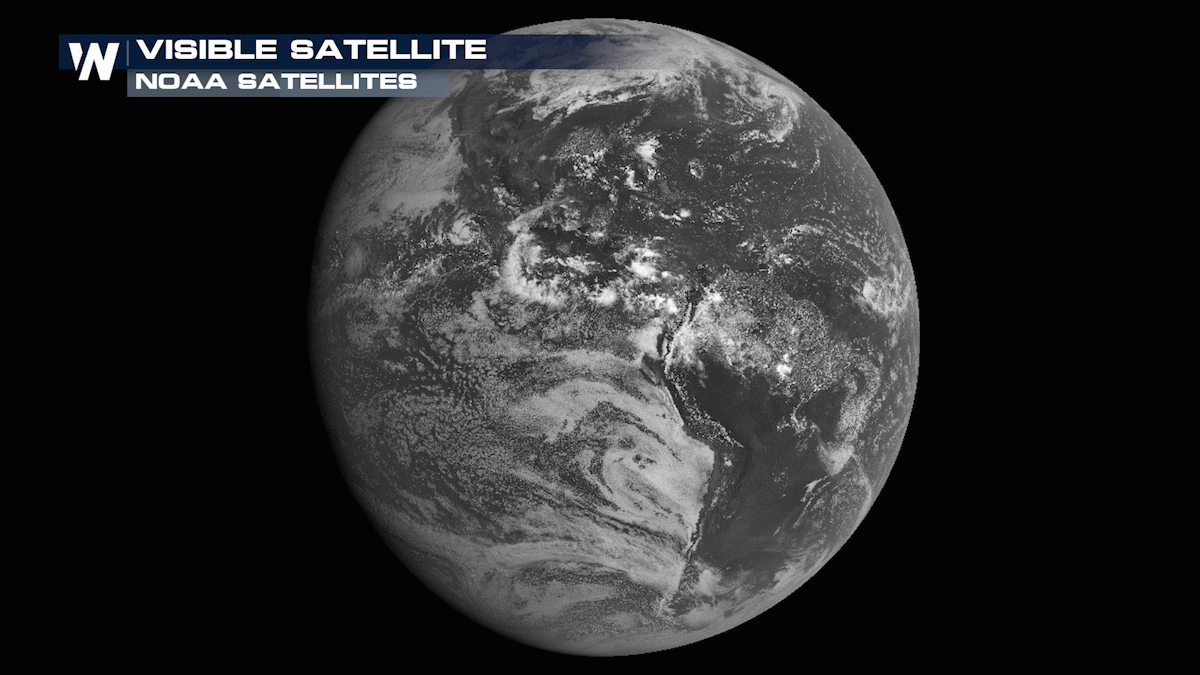
Yesterday, Kevin Micke, a web developer for the Cooperative Institute for Research in the Atmosphere (CIRA), tweeted that the first images of GOES-17 were up. Almost immediately, meteorologists and weather weenies alike were geeking out (me included):
https://twitter.com/weatherdak/status/1034499746449084417
https://twitter.com/CIMSS_Satellite/status/1034605280003325952
https://twitter.com/GOESguy/status/1034500755347202049
While the new data is freaking amazing, GOES-17 has faced some set backs due to hardware malfunctions. Dan Lindsey, a research meteorologist at CIRA, brought us a few updates at the recent National Weather Association Annual Meeting.
According to Lindsey, GOES-17's heat loop pipes, are not functioning properly which will require engineers to get a little creative to maximize GOES-17's data output. The satellite will rotate during each equinox to cut down on the solar load experienced on the satellite's Advanced Baseline Imager instrument.
https://twitter.com/nwas/status/1034204291416944640
Without this rotation, the ABI instrument would be too warm for an extended period of time, causing increased outages in several data products. Longer wavelength products including infrared imagery is expected to be most affected. To compensate for potential data losses, the current GOES-West (GOES-15) will run in tandem with GOES-17.
Don't worry too much, two more satellites (GOES-T and GOES-U) are planned for orbit that will provide identically beautiful and high resolution imagery. Naturally, scientists are learning from GOES-17's pitfall in hopes to avoid any further data losses on future satellites.
 For now, go get your fix of satellite imagery over on CIRA's Slider. Trust me, you won't regret it.
(Note: GOES-17 data is preliminary, non-operational, and insanely beautiful)
Written by: Dakota Smith.
For now, go get your fix of satellite imagery over on CIRA's Slider. Trust me, you won't regret it.
(Note: GOES-17 data is preliminary, non-operational, and insanely beautiful)
Written by: Dakota Smith.
For now, go get your fix of satellite imagery over on CIRA's Slider. Trust me, you won't regret it.
(Note: GOES-17 data is preliminary, non-operational, and insanely beautiful)
Written by: Dakota Smith.All Weather News
More

More Storms for the East Through Monday
A low-pressure system that moved through the
3 Aug 2026 12:20 PM


After Reaching Category 5, Genevieve Weakens in the Pacific
PacificGenevieve formed last Friday south of
3 Aug 2026 12:30 AM

Flooding, Severe Storms Target the Midwest Again
After an active week of storms across the nor
1 Aug 2026 1:40 AM

Flooding Risk Increases as Heavy Rain Targets the Tri-State Area
Tuesday, heavy rainfall moved across the Nort
30 Jul 2026 12:25 AM