FINAL REPORT: NHC Details Hurricane Florence
Special Stories
5 May 2019 3:52 AM
https://twitter.com/NHC_Atlantic/status/1124405559187394561
The National Hurricane Center has issued its complete evaluation of Hurricane Florence in their final Tropical Cyclone Report of 2018's Atlantic Season. Florence peaked at category 4 strength, before making landfall in North Carolina as a category 1 hurricane. However, Florence's true power was evident in the freshwater flooding and storm surge impacts across the southeast. This single storm was responsible for 22 direct deaths and 24 billion dollars in damage.
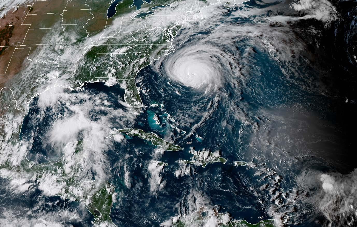
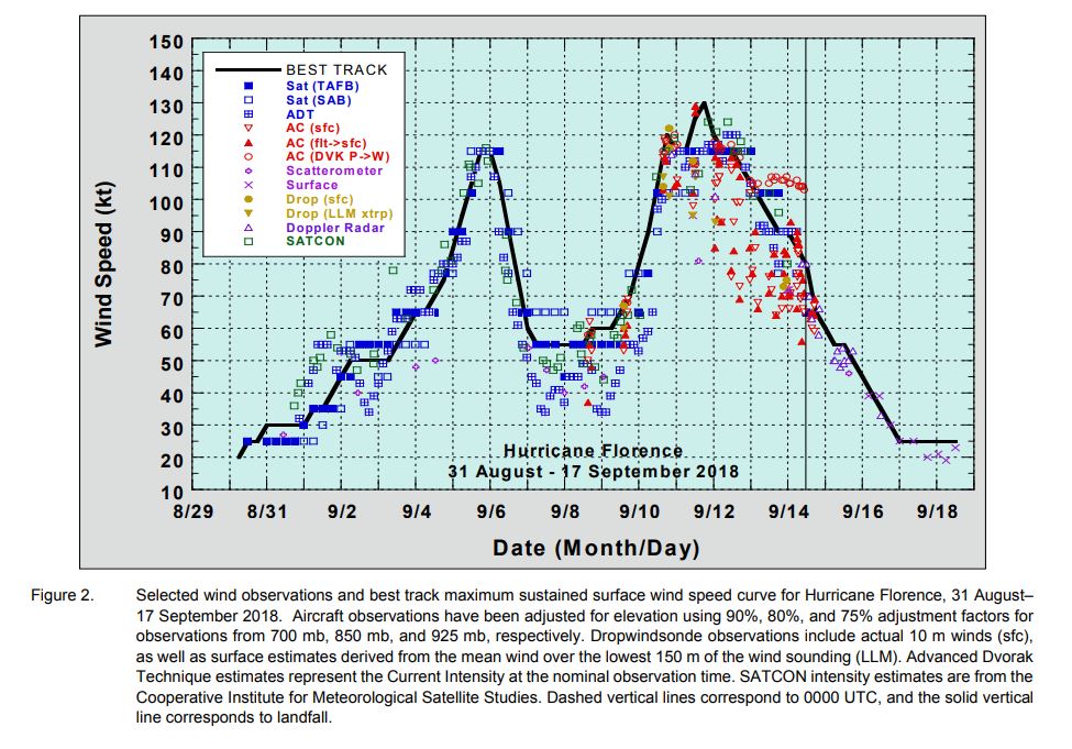
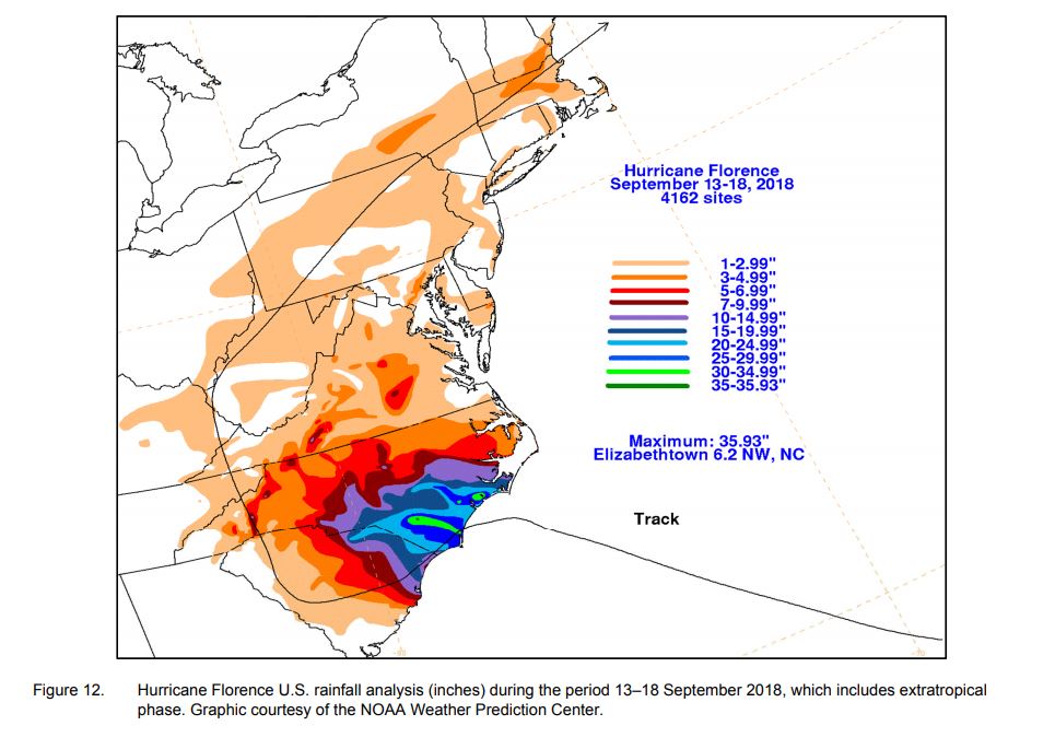
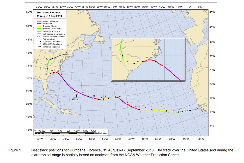 NHC tracked Florence from its beginnings as a tropical wave off of the African coast. The cyclone systematically charged across the Atlantic into early September 2018. Florence went through several cycles of rapid intensification and weakening. Despite reaching peak intensity 725 n mi east-southeast of Cape Fear, NC, cooler sea surface temperatures caused by upwelling allowed it to weaken as it approached land. Florence made landfall as a 80-kt hurricane near Wrightsville Beach, NC on September 14, 2018. The slow forward speed kept heavy rain training over the same areas of the southeastern US. Flooding continued for days after landfall.
 Minimum Central Pressure: 937 millibars
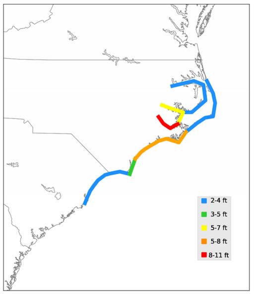
Maximum Storm Surge Inundation Heights: 8 to 11 ft above ground level
Minimum Central Pressure: 937 millibars
Maximum Storm Surge Inundation Heights: 8 to 11 ft above ground level
 Tornadoes: 44 across 3 states
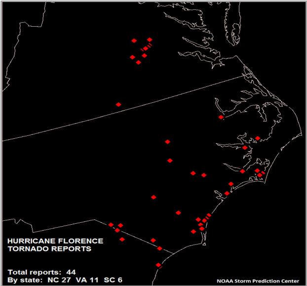 Deaths: 22 direct (15 in NC, 4 in SC, 3 in VA), 30 indirect
Rainfall:
Deaths: 22 direct (15 in NC, 4 in SC, 3 in VA), 30 indirect
Rainfall:
 Impacts outlined in an excerpt form the report:
NHC tracked Florence from its beginnings as a tropical wave off of the African coast. The cyclone systematically charged across the Atlantic into early September 2018. Florence went through several cycles of rapid intensification and weakening. Despite reaching peak intensity 725 n mi east-southeast of Cape Fear, NC, cooler sea surface temperatures caused by upwelling allowed it to weaken as it approached land. Florence made landfall as a 80-kt hurricane near Wrightsville Beach, NC on September 14, 2018. The slow forward speed kept heavy rain training over the same areas of the southeastern US. Flooding continued for days after landfall.
Top Stats:
Wind Speed: 150 mph
Minimum Central Pressure: 937 millibars
Maximum Storm Surge Inundation Heights: 8 to 11 ft above ground level
Tornadoes: 44 across 3 states
Deaths: 22 direct (15 in NC, 4 in SC, 3 in VA), 30 indirect
Rainfall:
Impacts outlined in an excerpt form the report:
"The NOAA National Centers for Environmental Information (NCEI) estimates that wind and water damage caused by Florence totaled approximately $24 billion. This makes Florence the ninth-most-destructive hurricane to affect the United States. Approximately 1.1 million customers lost power due to Florence’s effects, with 1 million customers having lost power in North Carolina and 100,000 customers experiencing power loss in South Carolina."
All Weather News
More
More Storms for the East Through Monday
The threat for flooding rain continues across
3 Aug 2026 6:00 PM


After Reaching Category 5, Genevieve Weakens in the Pacific
PacificGenevieve formed last Friday south of
3 Aug 2026 12:30 AM

Flooding, Severe Storms Target the Midwest Again
After an active week of storms across the nor
1 Aug 2026 1:40 AM

Flooding Risk Increases as Heavy Rain Targets the Tri-State Area
Tuesday, heavy rainfall moved across the Nort
30 Jul 2026 12:25 AM