Fire Risk for Florida

Special Stories
9 Mar 2018 10:43 AM
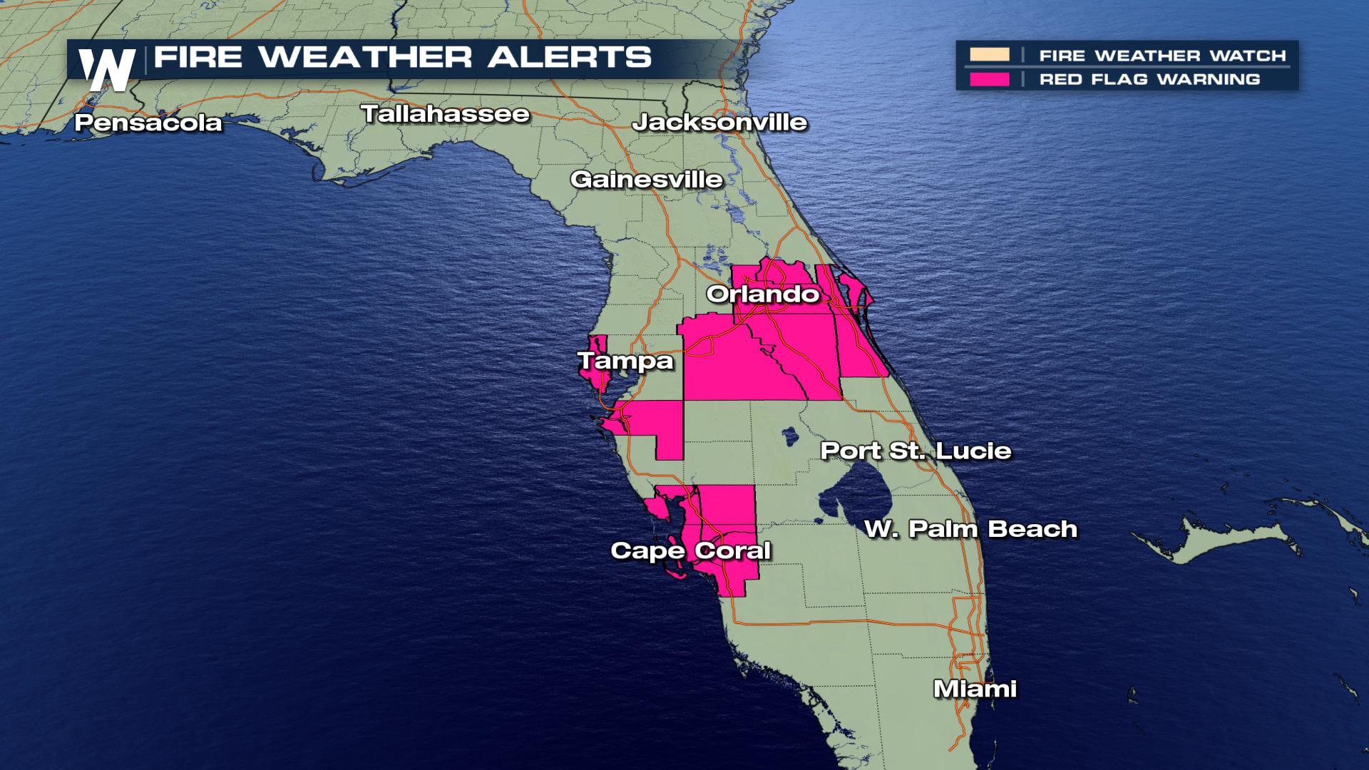
Red Flag Warning are in effect through 7 PM eastern for central sections of Florida. This means that critical fire weather conditions are either occurring now or will shortly. A combination of
low relative humidity, dry vegetation and high temperatures can contribute to extreme fire behavior.
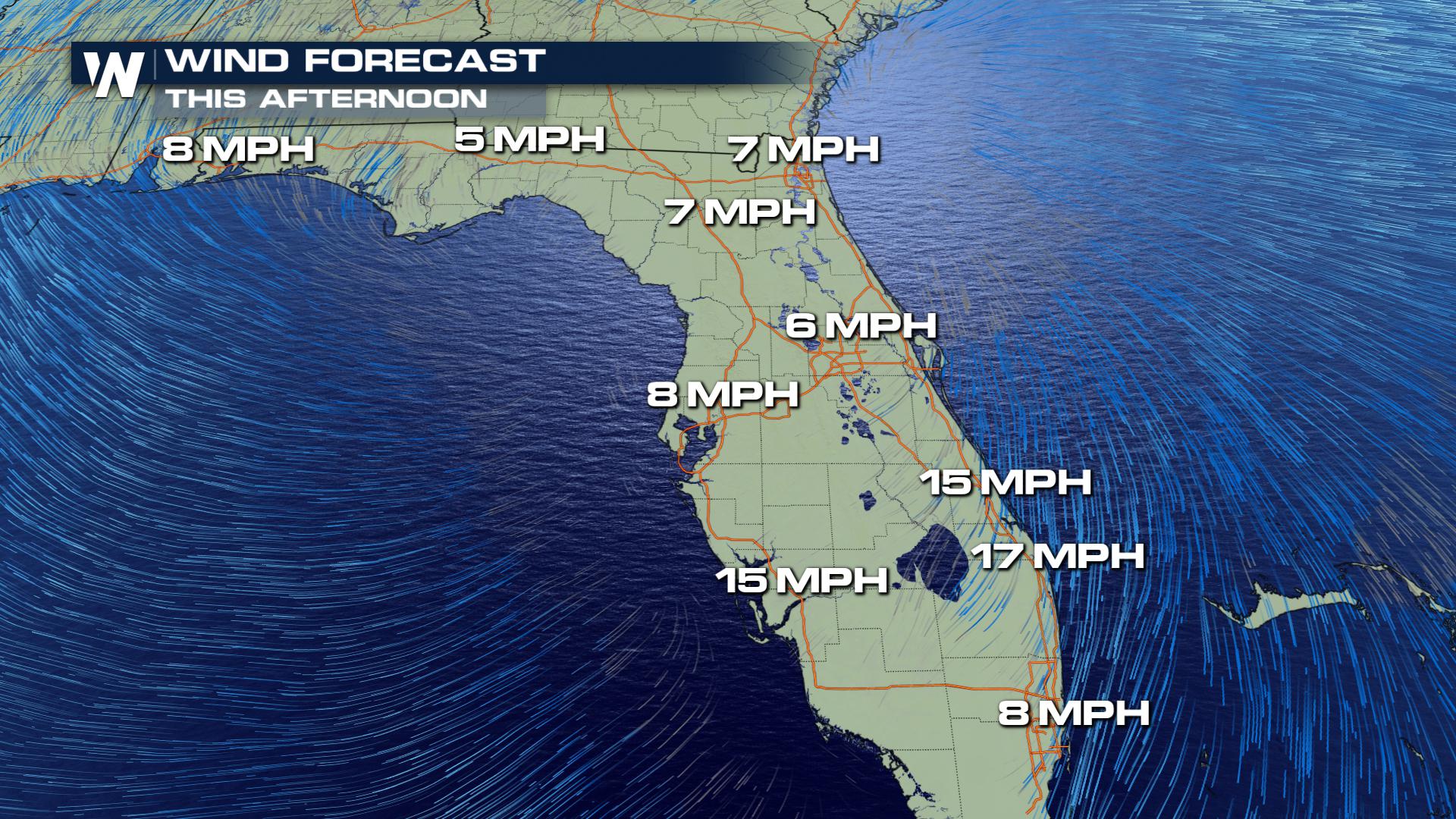
 After a breezy morning Friday, lighter wind moves in for the afternoon, but humidity drops significantly, leading to the fire threat. Humidity is forecast to dip down to upper 10s and 20s during the afternoon, meaning the air will be very dry.
 Areas that will be affected include Orange, Seminole, and Osceola counties as well as areas west of Interstate 95 in Brevard County.
According to the National Weather Service, any fires that develop will likely spread rapidly and that outdoor burning is not recommended.
For WeatherNation, I am Meteorologist Marcus Walter.
Areas that will be affected include Orange, Seminole, and Osceola counties as well as areas west of Interstate 95 in Brevard County.
According to the National Weather Service, any fires that develop will likely spread rapidly and that outdoor burning is not recommended.
For WeatherNation, I am Meteorologist Marcus Walter.
After a breezy morning Friday, lighter wind moves in for the afternoon, but humidity drops significantly, leading to the fire threat. Humidity is forecast to dip down to upper 10s and 20s during the afternoon, meaning the air will be very dry.
Areas that will be affected include Orange, Seminole, and Osceola counties as well as areas west of Interstate 95 in Brevard County.
According to the National Weather Service, any fires that develop will likely spread rapidly and that outdoor burning is not recommended.
For WeatherNation, I am Meteorologist Marcus Walter.All Weather News
More
East Gears Up for Stormy, Wet Weekend
A low pressure system crashing through the Mi
1 Aug 2026 11:35 AM

Flooding, Severe Storms Target the Midwest Again
After an active week of storms across the nor
1 Aug 2026 1:40 AM


After Reaching Category 5, Genevieve Weakens in the Pacific
PacificFausto is now a post-tropical cyclone.
31 Jul 2026 1:30 AM

Flooding Risk Increases as Heavy Rain Targets the Tri-State Area
Tuesday, heavy rainfall moved across the Nort
30 Jul 2026 12:25 AM

Severe Weather: Energy From the Midwest Now in the Southeast
UPPER MIDWEST - Through Monday, dangerous tor
29 Jul 2026 10:30 PM