Windy with Fire Weather Concerns in the Southwest
Special Stories
4 Mar 2021 5:30 AM
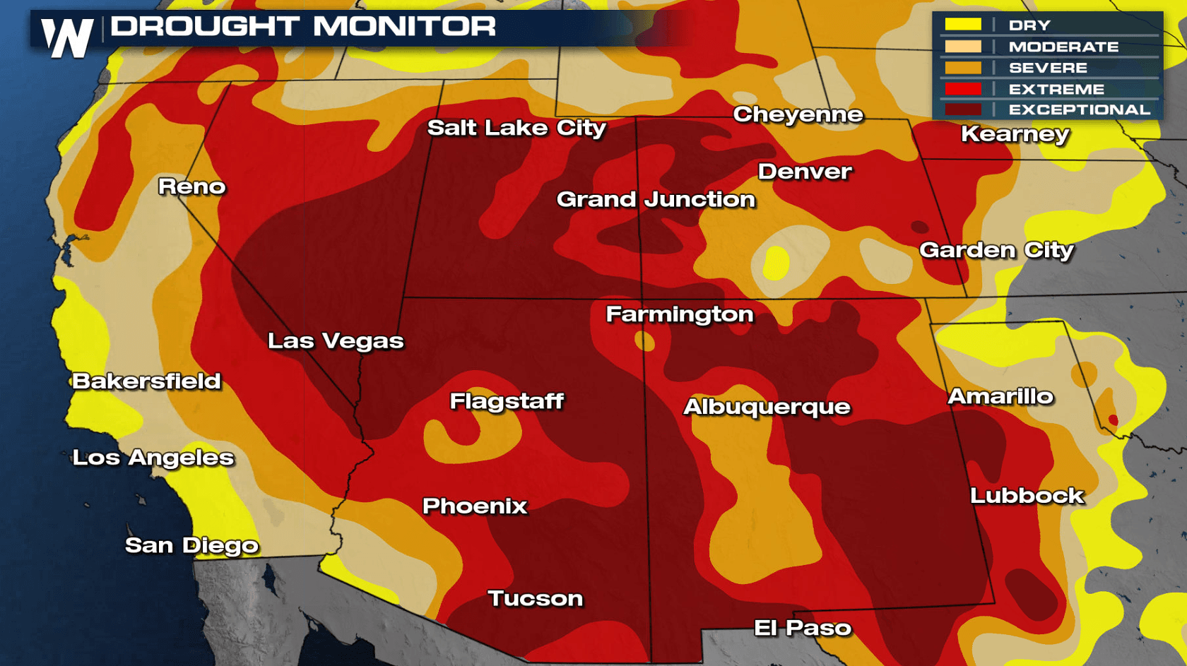
It has been very dry in the Southwest with drought conditions found all across the region. Some areas are experiencing an extreme to exceptional drought. Much needed precipitation is on-the-way for the region, but strong winds and low humidity ahead of the system will lead to fire weather concerns.
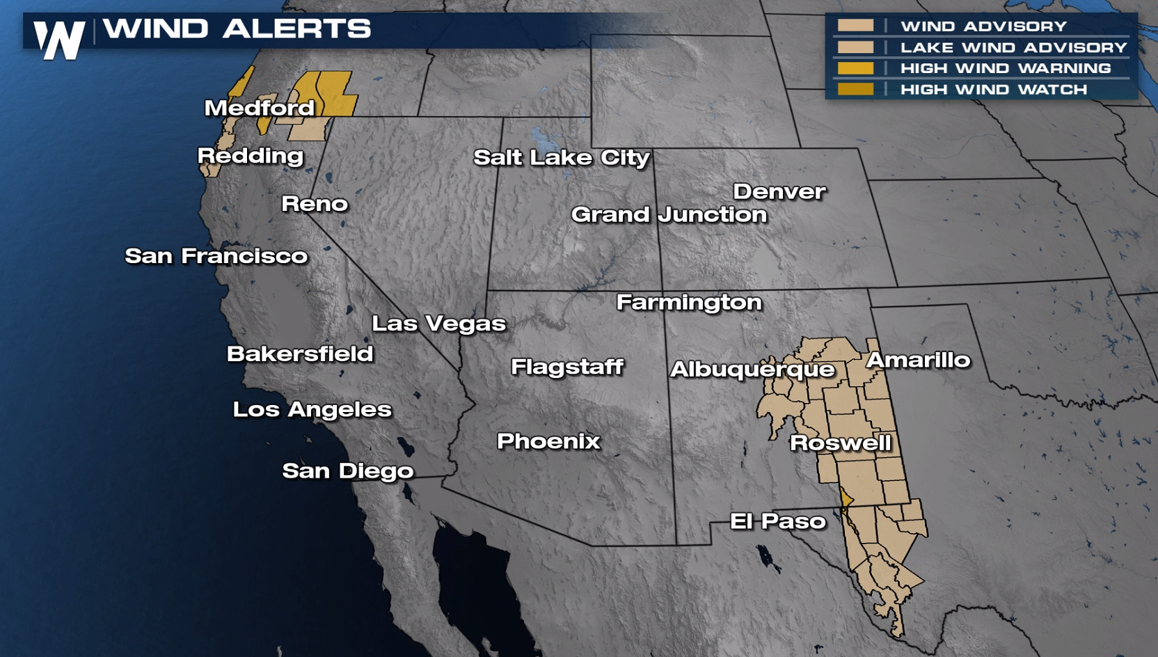 Wind alerts are in effect for southern Oregon and northern California for gusts as high as 70 mph. Alerts have also been issued in western Texas and eastern New Mexico. Gusts may reach 55 to 75 mph, especially in the Guadalupe and Delaware Mountains.
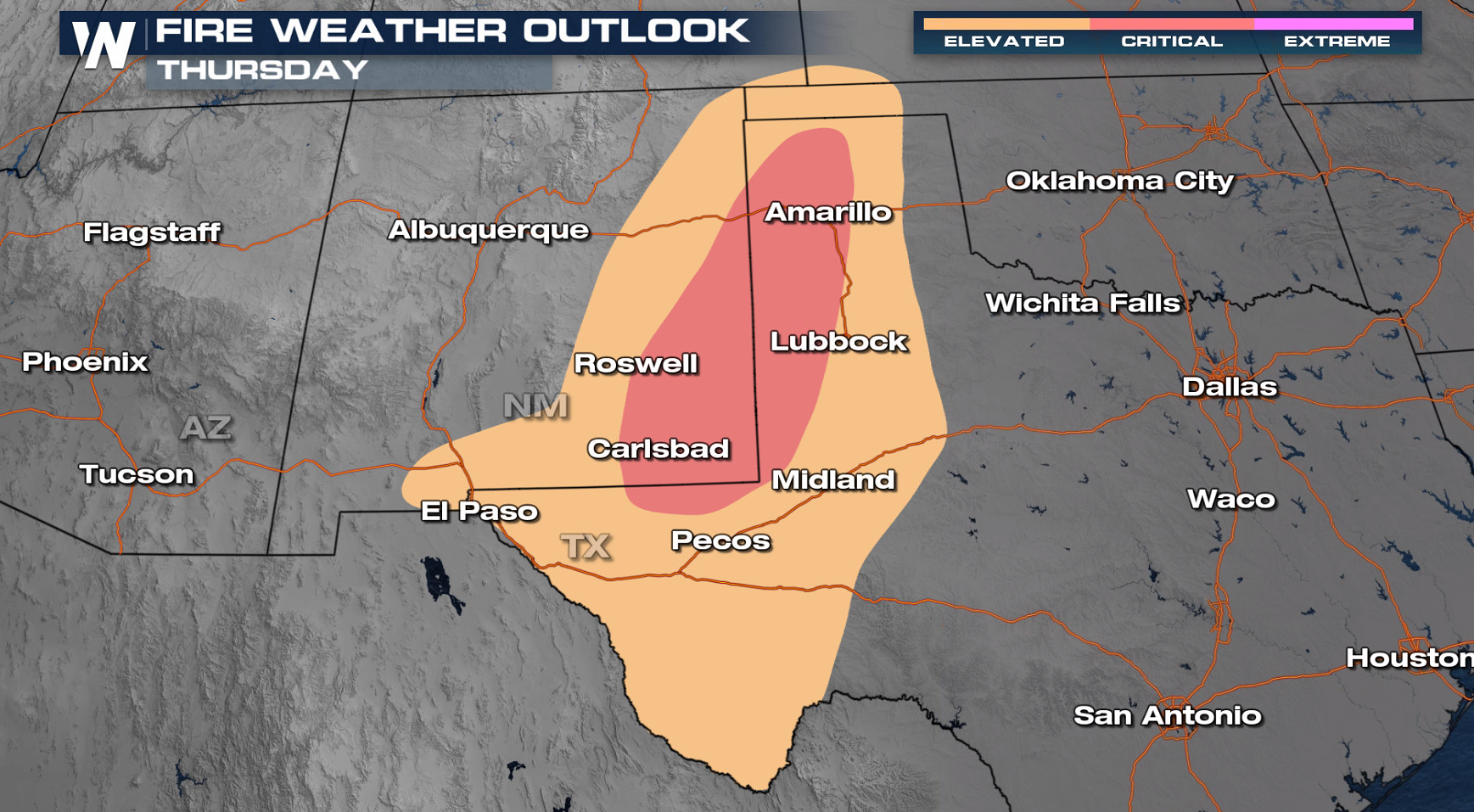
 The fire danger has increased to critical for eastern New Mexico and the Texas Panhandle today (Thursday).
 We will be tracking the chance for rain and the fire weather forecast on WeatherNation so check us out for free on Roku, AppleTV, Amazon Fire and PlutoTV on Channel 217.
Wind Alerts
Wind alerts are in effect for southern Oregon and northern California for gusts as high as 70 mph. Alerts have also been issued in western Texas and eastern New Mexico. Gusts may reach 55 to 75 mph, especially in the Guadalupe and Delaware Mountains.
Fire Weather Concern
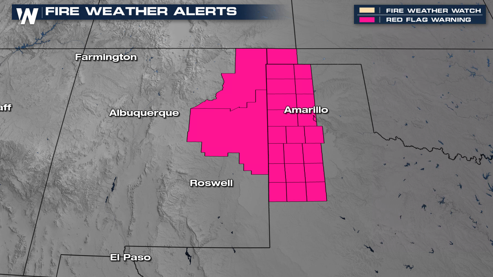
With strong winds in the forecast and low relative humidity, Red Flag Warnings are in place for northeastern New Mexico and the western parts of the Texas Panhandle. Relative humidity may drop as low as 10% and with breezy conditions.
The fire danger has increased to critical for eastern New Mexico and the Texas Panhandle today (Thursday).
We will be tracking the chance for rain and the fire weather forecast on WeatherNation so check us out for free on Roku, AppleTV, Amazon Fire and PlutoTV on Channel 217.All Weather News
More
Fronts Continue To Spark Severe Weather Across the Plains
A cold front that brought record lows to the
18 Jul 2025 10:40 PM

Extreme Heat Impacts for the East Coast & South
Extreme heat continues to impact several area
18 Jul 2025 10:05 PM

Flooding Threat Remains Elevated in the East
A cold front pushing through the Eastern Seab
18 Jul 2025 9:10 PM

EF-2 Firenado from the Deer Creek Fire in Utah
A fire tornado was spotted near La Sal, Utah
18 Jul 2025 7:30 AM

Tropical System Brings Flood Risk to the Central Gulf
Time has run out for notable tropical develop
18 Jul 2025 3:05 AM

Heavy Rain, Flooding Threat Returns to Florida
Keep the rain boots handy in Florida - heavy
13 Jul 2025 12:50 PM

Severe Storm Risk Pushes into the Great Lakes, Ohio Valley
Friday was another busy day with severe weath
12 Jul 2025 8:00 PM