NOAA GOES-17 Shares First Light Imagery from Geostationary Lightning Mapper
Special Stories
21 May 2018 9:44 AM
https://www.youtube.com/watch?v=QFTrwqhEaKE
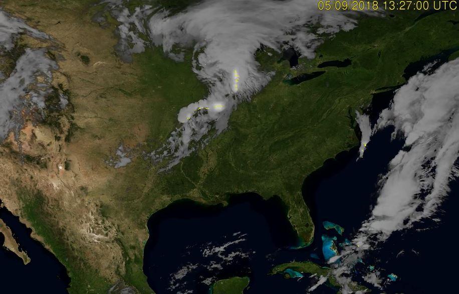
(NOAA) -- NOAA GOES-17 satellite has transmitted its first Geostationary Lightning Mapper (GLM) data. This GLM data in this animation shows storms quickly intensifying and forming into an impressive line across the U.S. Plains on May 9, 2018.
The Geostationary Lightning Mapper onboard GOES-17, like the one on board NOAA GOES East, is transmitting data never previously available to forecasters. The mapper observes lightning in the Western Hemisphere, giving forecasters an indication of when a storm is forming, intensifying and becoming more dangerous. Rapid increases of lightning are a signal that a storm may strengthen quickly and could produce severe weather.
During heavy rain, GLM data can show when thunderstorms are stalled or if they are gathering strength. When combined with radar and other satellite data, GLM data will help forecasters anticipate severe weather and issue flood and flash flood warnings sooner.
Also, in large long-lived storm systems, lightning may travel hundreds of miles before striking the ground. GLM can show forecasters areas far from the main line of storms where the risk of lightning strikes to ground presents a public safety hazard. In dry areas, especially in the western United States, information from the instrument will help forecasters, and ultimately firefighters, identify areas prone to wildfires sparked by lightning.
Data from GLM will serve an essential role in helping to keep American lives and property safe when GOES-17 is positioned in its operational GOES West position, where it will cover a vast swath of the data-sparse Pacific Ocean and monitor high-risk wildfire-prone areas in the Western U.S.
All Weather News
More
East Gears Up for Stormy, Wet Weekend
A low pressure system crashing through the Mi
1 Aug 2026 11:35 PM


Flooding, Severe Storms Target the Midwest Again
After an active week of storms across the nor
1 Aug 2026 1:40 AM

After Reaching Category 5, Genevieve Weakens in the Pacific
PacificFausto is now a post-tropical cyclone.
31 Jul 2026 1:30 AM

Flooding Risk Increases as Heavy Rain Targets the Tri-State Area
Tuesday, heavy rainfall moved across the Nort
30 Jul 2026 12:25 AM

Severe Weather: Energy From the Midwest Now in the Southeast
UPPER MIDWEST - Through Monday, dangerous tor
29 Jul 2026 10:30 PM