First Nor'easter of the Season - What to Expect
Special Stories
25 Oct 2018 8:55 AM
https://youtu.be/gvXyF7JIFvo
The first nor'easter of the season will take aim on the eastern U.S. this weekend...but it may not bring what you think.
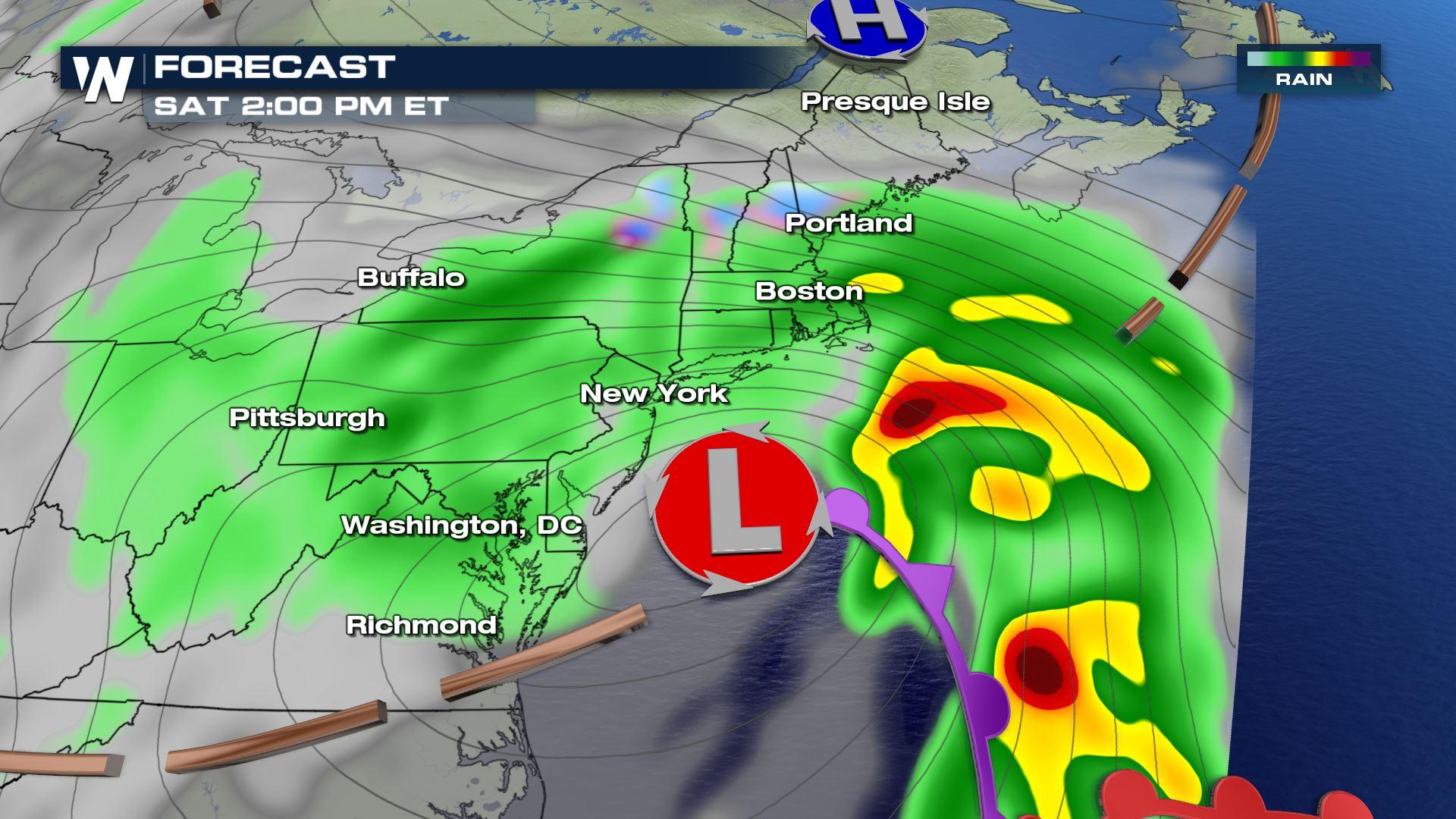
Most think heavy, blowing snow when the term 'nor'easter' is in the forecast. BUT, did you know, the term only refers to the wind direction that comes with the storm? The term nor'easter is meant to describe an area of low pressure that forms just along the northeast coastline, often causing winds to come in from the northeast for those areas affected. The position of this Low pressure often does cause intense rain, snow, or mixed precipitation, along with blustery northeast winds.
This time around, we can expect mostly rain, some just a hint of wintry weather for some parts of interior New England.
https://twitter.com/WeatherNation/status/1055469914654306304
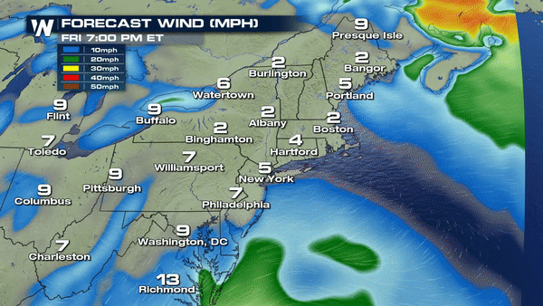
For coastal communities, heavy rain and coastal flooding will be a concern with this storm. Some areas may pick up 1-3" of rain from New Jersey to Maine. At the coast, winds will gust over 30 mph, even stronger for some areas right along the coastline where would could gust over 40 mph. This will cause wind to drive into the coastline and create minor flooding. The moon phase, near full, will also create higher than normal water levels, adding to the effects of coastal flooding.
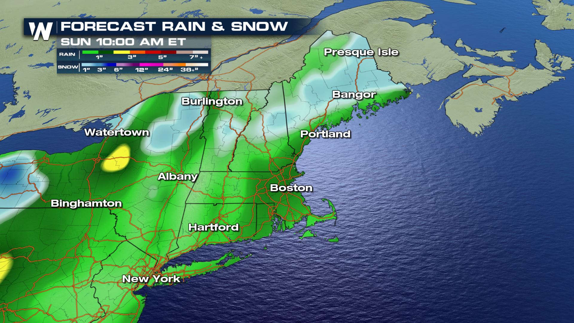
Snow amounts will likely be small by New England standards, with generally 1-3" of snow expected for the higher terrain of New York, Vermont, and New Hampshire, as well as northern Maine. Some locally higher amounts up to 6-8" will fall at the highest peaks of New Hampshire, near Mount Washington, which sits at over 6000' elevation and will be cold enough to support all snow.
 Stay with WeatherNation as we follow the first nor'easter of the season up the coast this weekend.
Stay with WeatherNation as we follow the first nor'easter of the season up the coast this weekend.
All Weather News
More
Wildfire Outbreak in the Pacific Northwest
Conditions have been incredibly dry out west.
2 Aug 2026 1:30 PM

After Reaching Category 5, Genevieve Weakens in the Pacific
PacificGenevieve formed on last Friday south
2 Aug 2026 1:25 PM

More Storms for the East Sunday and Monday
A low-pressure system crashing through the Mi
2 Aug 2026 1:25 PM


Flooding, Severe Storms Target the Midwest Again
After an active week of storms across the nor
1 Aug 2026 1:40 AM

Flooding Risk Increases as Heavy Rain Targets the Tri-State Area
Tuesday, heavy rainfall moved across the Nort
30 Jul 2026 12:25 AM

Severe Weather: Energy From the Midwest Now in the Southeast
UPPER MIDWEST - Through Monday, dangerous tor
29 Jul 2026 10:30 PM