Flooding and Severe Weather Threat in the Southeast
Special Stories
4 Jan 2019 7:21 AM
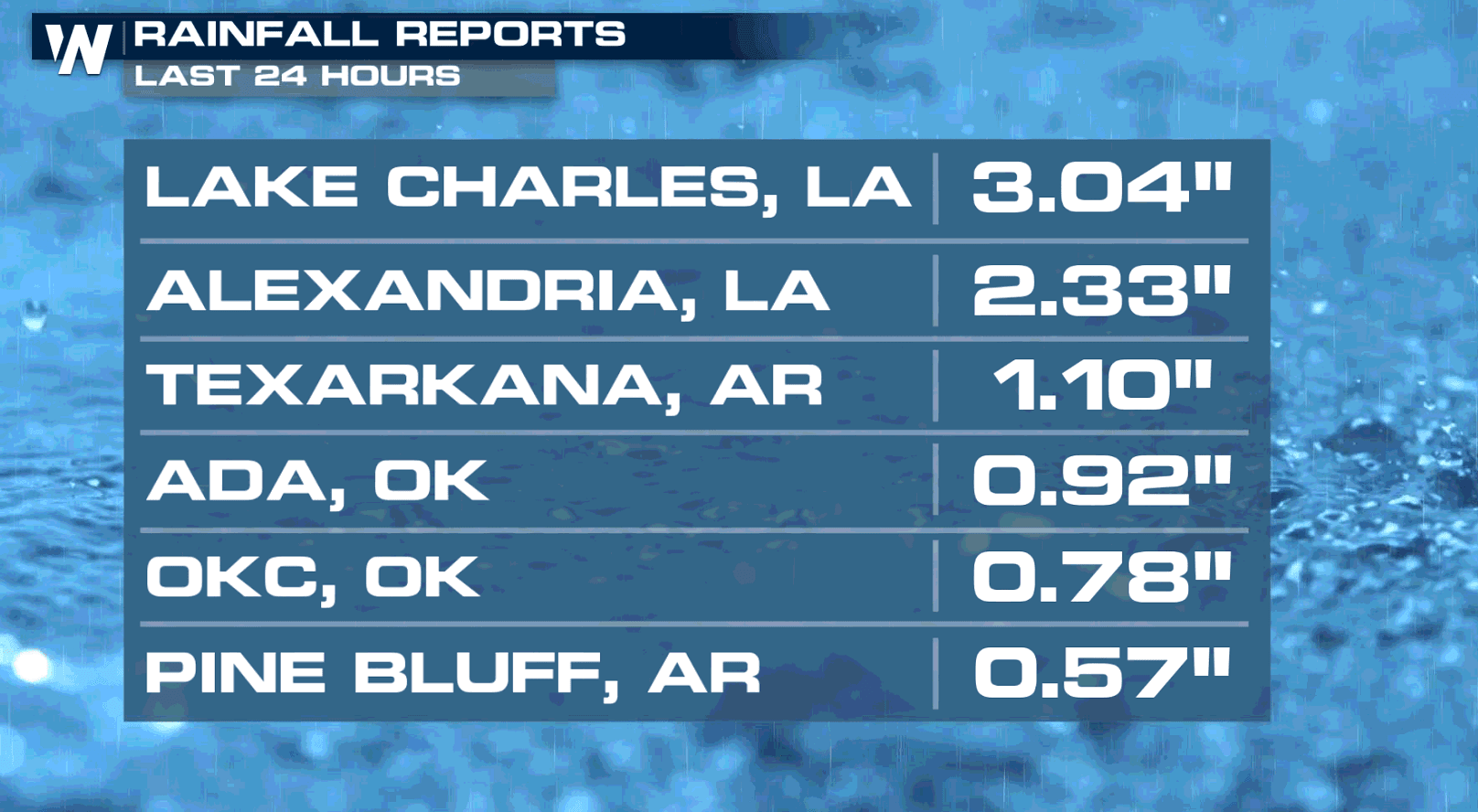
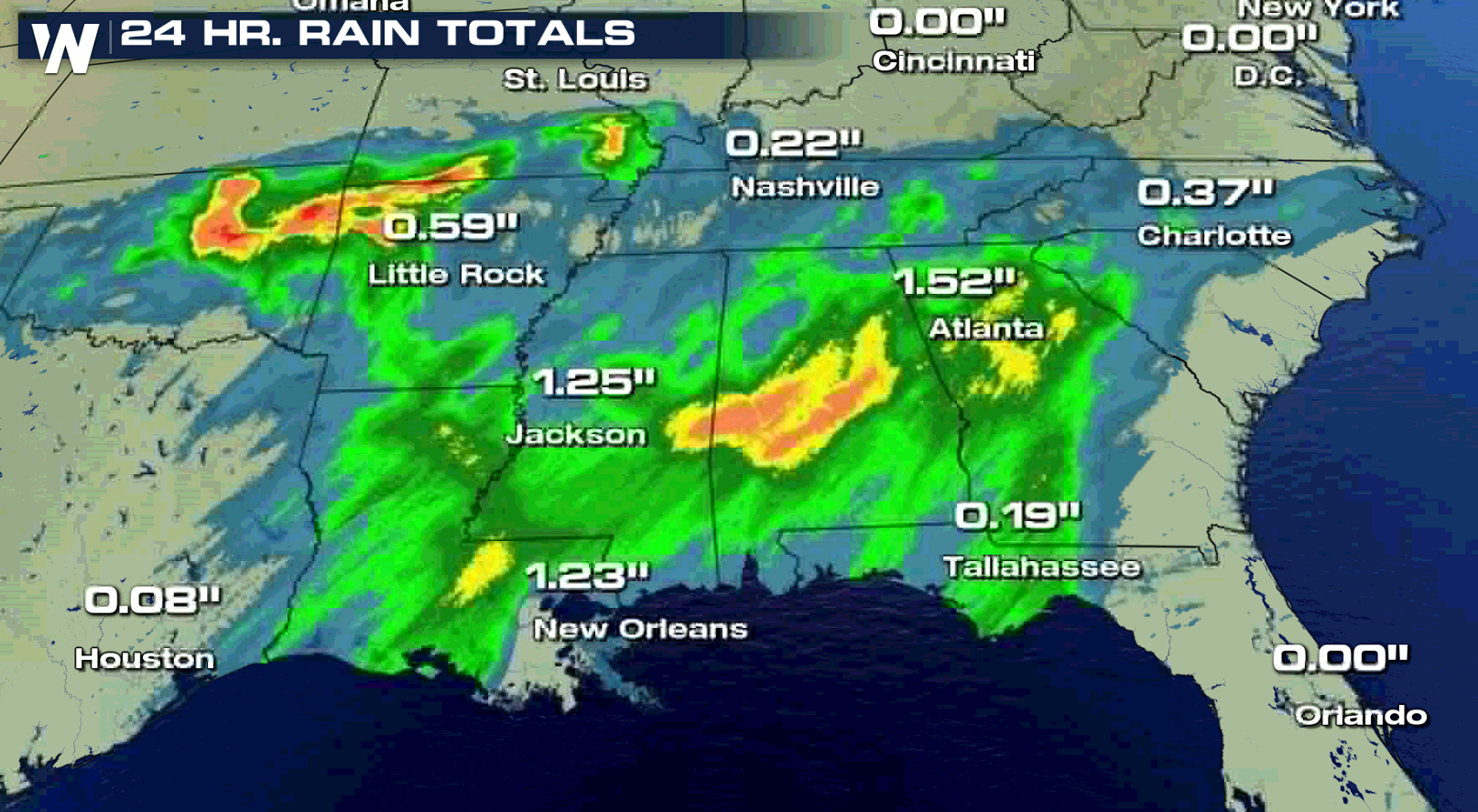
A slow moving storm system has been producing heavy rain across the South and into the Southeast. Some areas have seen more than 3" of rain and more is ahead today (Friday).
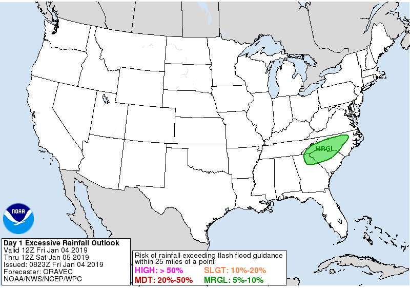
 Flash Flood Watches remain in effect in a small area of North Carolina, Georgia and South Carolina. There is a marginal risk for excessive rainfall across the area, with the potential for up to 3" of rain by Saturday morning. A Flash Flood Watch means there is a potential for flash flooding within the next 12-36 hours. Flash flooding is associated with quickly-rising water and can occur in just moments. If you hear of a flash flood warning, that means that water is about to rise quickly (within minutes) or has already been observed.
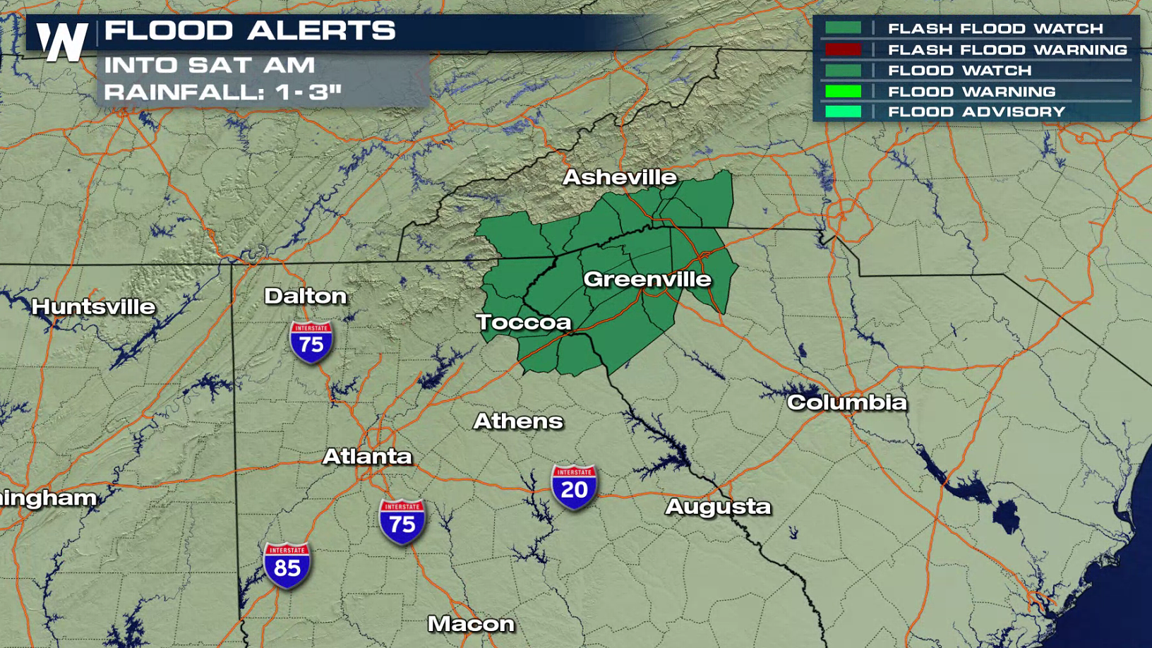
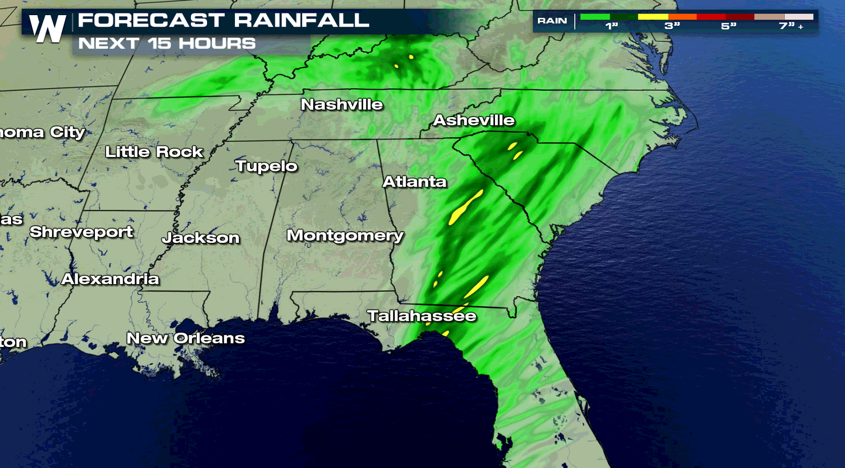 The flood alerts stem from the warmer side of a winter storm rolling across the Deep South. Ahead of the storm lies a warm front that will act as the initiator of downpours. The whole system will continue to move very slowly to the east.
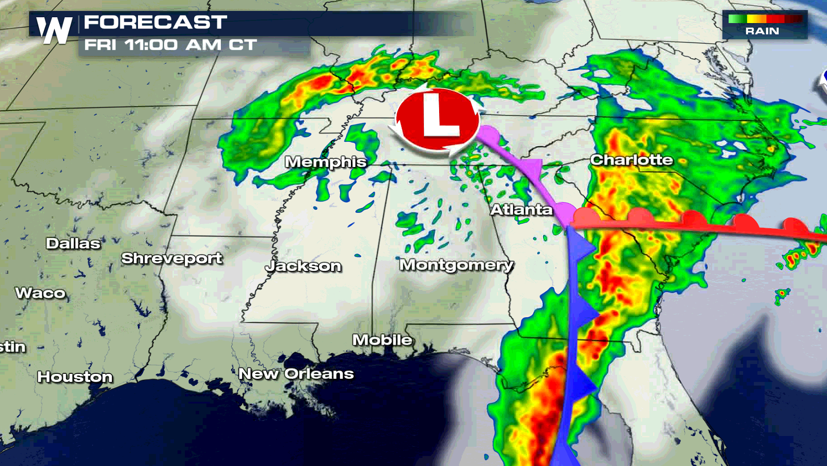
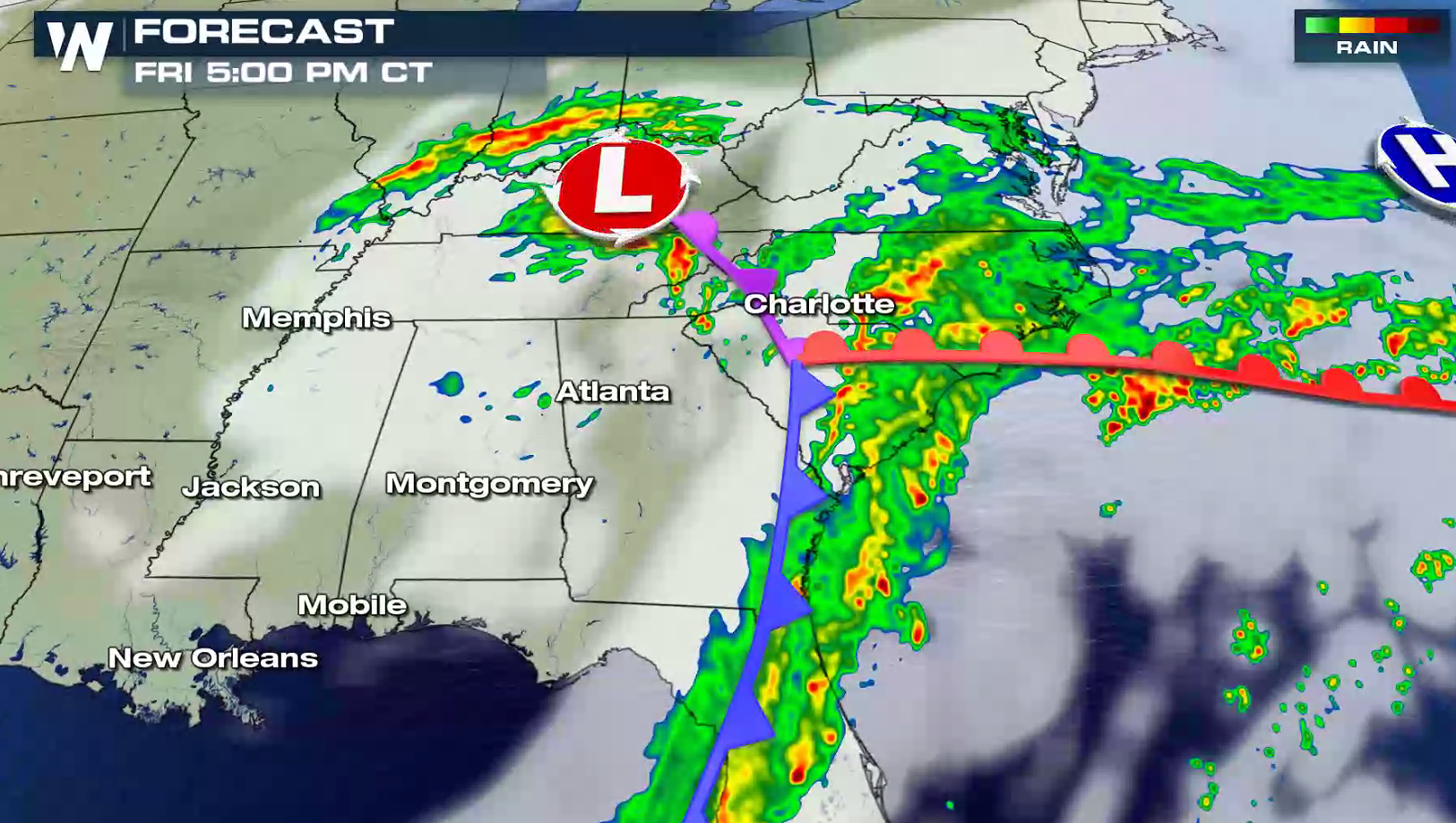
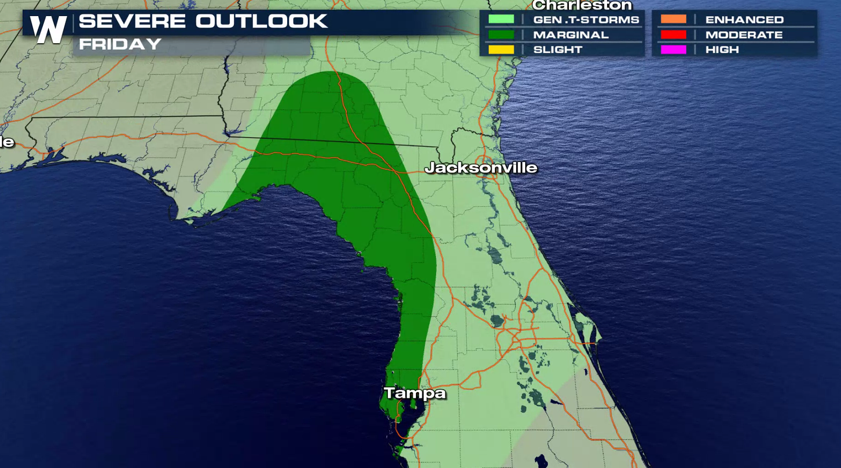
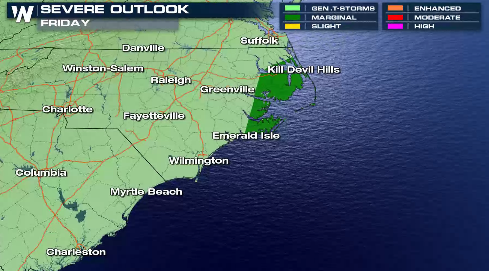
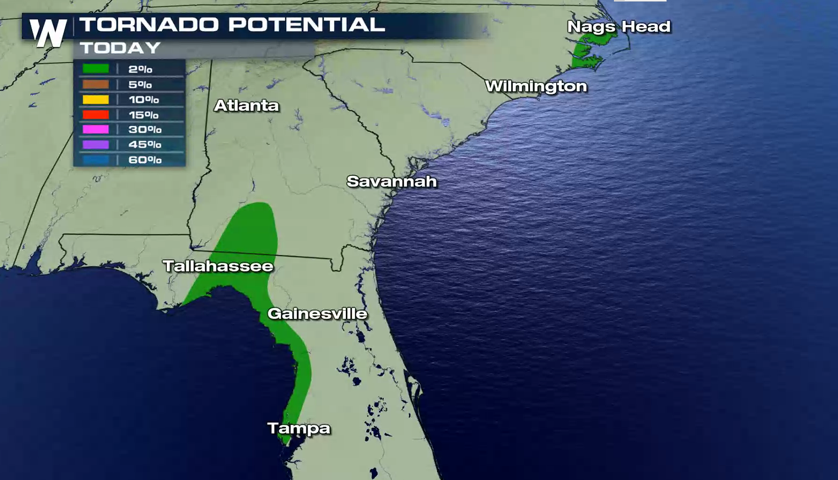
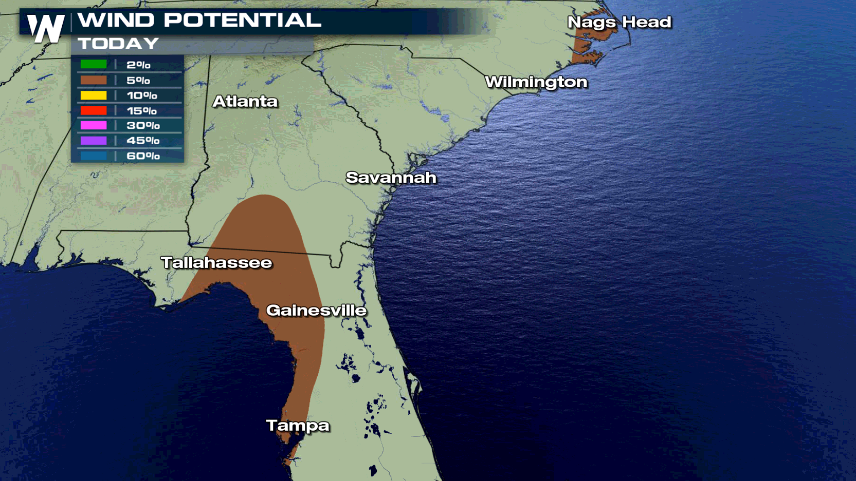
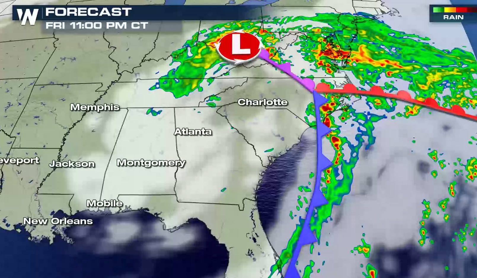 Along with the threat for heavy rain is isolated severe storms. There is a marginal severe weather risk near the Big Bend in Florida and the Outer Banks of North Carolina. Isolated tornadoes and strong wind gusts are the biggest concern.
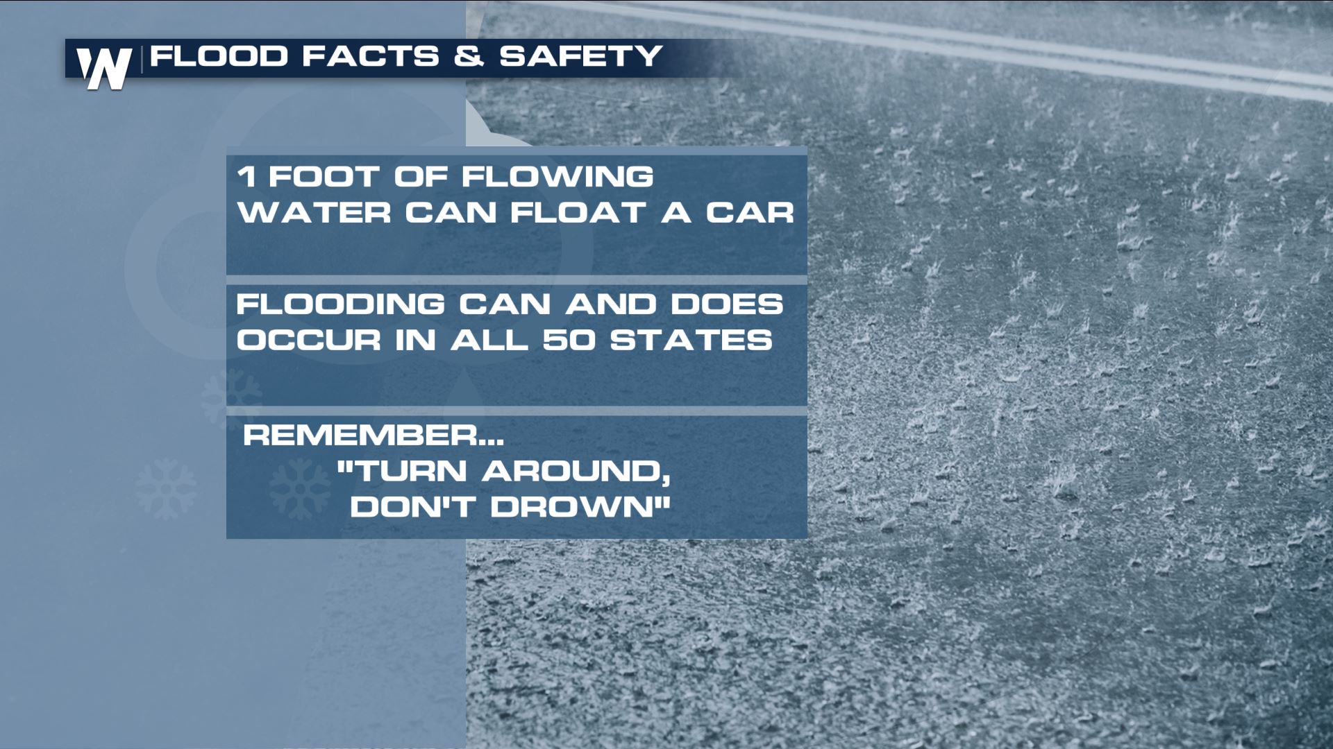
 Remember the following tidbits on flooding if you encounter it!
 Continue to stay with WeatherNation as we follow this weather system across the southern United States. We'll bring you updates here as well as on our over-the-air platforms!
For WeatherNation, Meteorologist Steve Glazier
Continue to stay with WeatherNation as we follow this weather system across the southern United States. We'll bring you updates here as well as on our over-the-air platforms!
For WeatherNation, Meteorologist Steve Glazier
Flash Flood Watches remain in effect in a small area of North Carolina, Georgia and South Carolina. There is a marginal risk for excessive rainfall across the area, with the potential for up to 3" of rain by Saturday morning. A Flash Flood Watch means there is a potential for flash flooding within the next 12-36 hours. Flash flooding is associated with quickly-rising water and can occur in just moments. If you hear of a flash flood warning, that means that water is about to rise quickly (within minutes) or has already been observed.
The flood alerts stem from the warmer side of a winter storm rolling across the Deep South. Ahead of the storm lies a warm front that will act as the initiator of downpours. The whole system will continue to move very slowly to the east.
Along with the threat for heavy rain is isolated severe storms. There is a marginal severe weather risk near the Big Bend in Florida and the Outer Banks of North Carolina. Isolated tornadoes and strong wind gusts are the biggest concern.
Remember the following tidbits on flooding if you encounter it!
Continue to stay with WeatherNation as we follow this weather system across the southern United States. We'll bring you updates here as well as on our over-the-air platforms!
For WeatherNation, Meteorologist Steve GlazierAll Weather News
More

More Storms for the East Through Monday
A low-pressure system that moved through the
3 Aug 2026 12:20 PM


After Reaching Category 5, Genevieve Weakens in the Pacific
PacificGenevieve formed last Friday south of
3 Aug 2026 12:30 AM

Flooding, Severe Storms Target the Midwest Again
After an active week of storms across the nor
1 Aug 2026 1:40 AM

Flooding Risk Increases as Heavy Rain Targets the Tri-State Area
Tuesday, heavy rainfall moved across the Nort
30 Jul 2026 12:25 AM