Flash Flood Watches for the Upper Midwest into Thursday
Special Stories
19 Sep 2018 12:52 PM
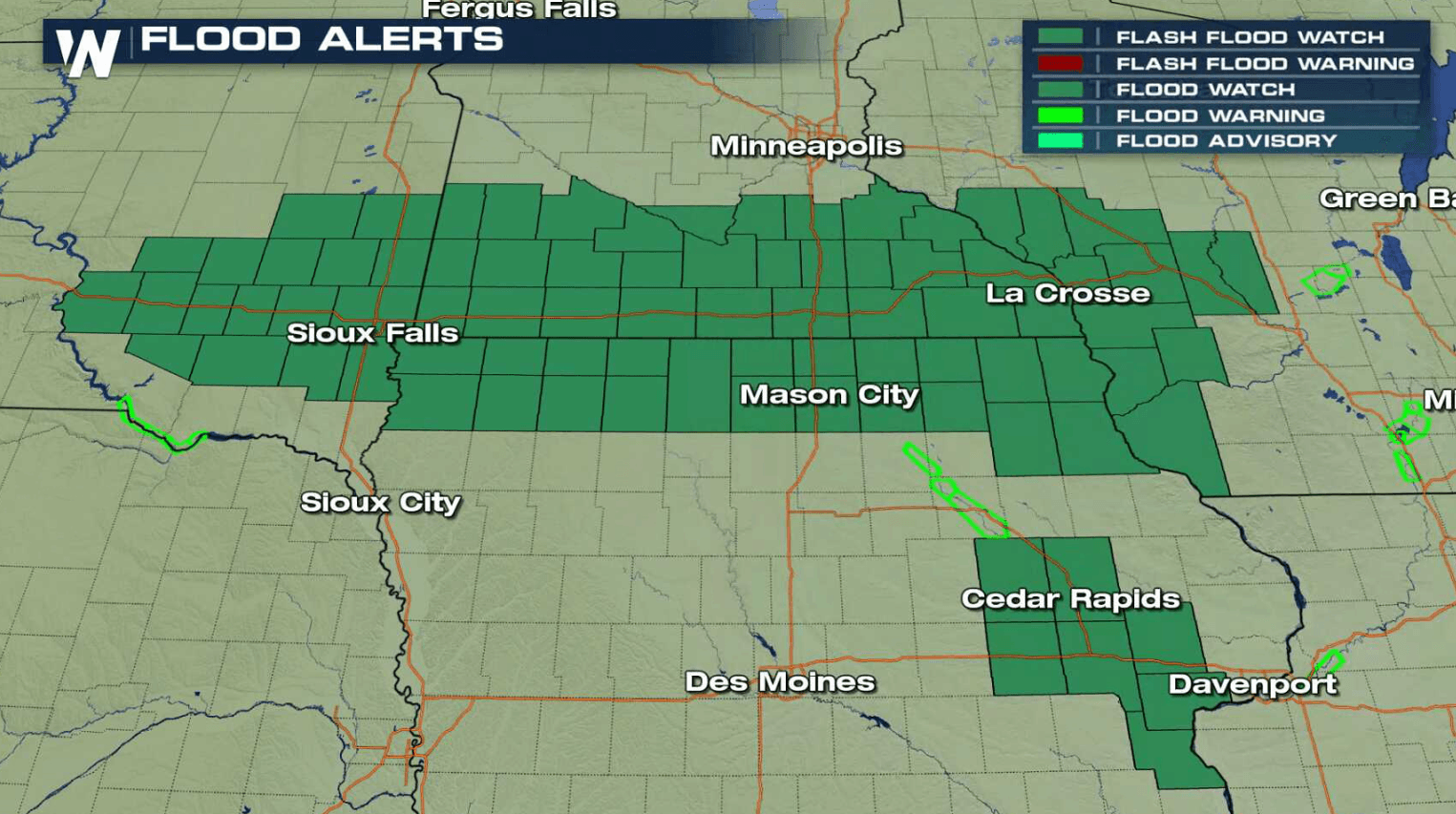
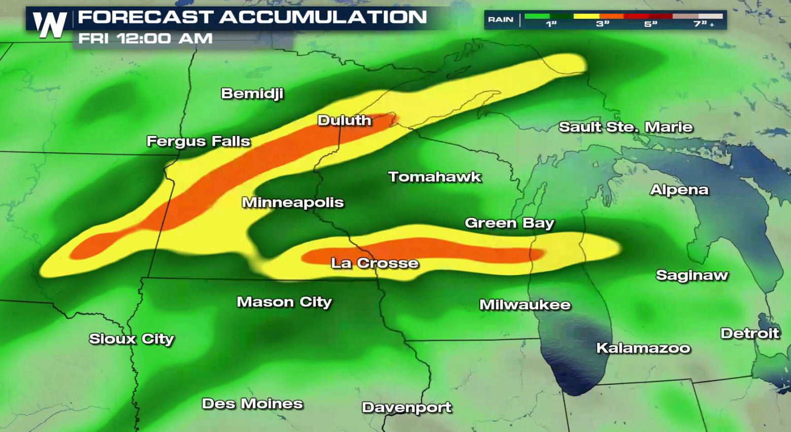
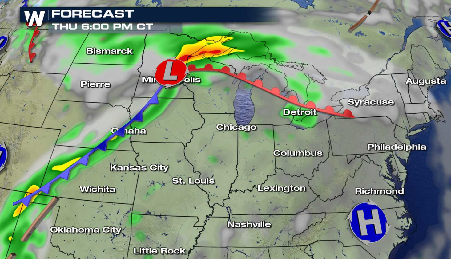
Strong thunderstorms will bring the threat for flooding rains today (Wednesday) into Thursday across the Upper Midwest. Flash Flood Watches include portions of South Dakota, Minnesota, Iowa, and Wisconsin. 3" to 6" rainfall totals are possible by Friday morning.
 https://twitter.com/NWSTwinCities/status/1042443422123085824
https://twitter.com/NWSSiouxFalls/status/1042486996093022209
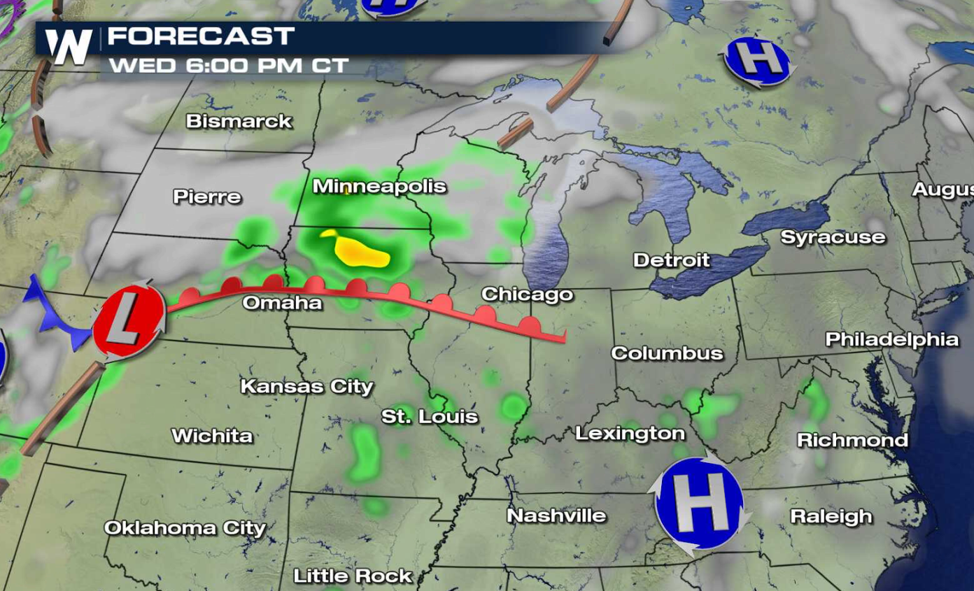
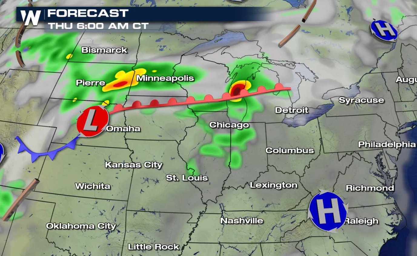
Several waves of storms are likely to push through the region. The first couple of rounds of rain will be associated with a warm front tonight into Thursday morning. Another line of thunderstorms will move through the area along a cold front Thursday night. Severe thunderstorms will be possible, along with the threat of flooding rains.
https://twitter.com/NWSTwinCities/status/1042443422123085824
https://twitter.com/NWSSiouxFalls/status/1042486996093022209
Several waves of storms are likely to push through the region. The first couple of rounds of rain will be associated with a warm front tonight into Thursday morning. Another line of thunderstorms will move through the area along a cold front Thursday night. Severe thunderstorms will be possible, along with the threat of flooding rains.
 For WeatherNation: Meteorologist Mace Michaels
https://twitter.com/NWSTwinCities/status/1042443422123085824
https://twitter.com/NWSSiouxFalls/status/1042486996093022209
Several waves of storms are likely to push through the region. The first couple of rounds of rain will be associated with a warm front tonight into Thursday morning. Another line of thunderstorms will move through the area along a cold front Thursday night. Severe thunderstorms will be possible, along with the threat of flooding rains.
For WeatherNation: Meteorologist Mace MichaelsAll Weather News
More
East Gears Up for Stormy, Wet Weekend
A low pressure system crashing through the Mi
1 Aug 2026 6:15 PM


Flooding, Severe Storms Target the Midwest Again
After an active week of storms across the nor
1 Aug 2026 1:40 AM

After Reaching Category 5, Genevieve Weakens in the Pacific
PacificFausto is now a post-tropical cyclone.
31 Jul 2026 1:30 AM

Flooding Risk Increases as Heavy Rain Targets the Tri-State Area
Tuesday, heavy rainfall moved across the Nort
30 Jul 2026 12:25 AM

Severe Weather: Energy From the Midwest Now in the Southeast
UPPER MIDWEST - Through Monday, dangerous tor
29 Jul 2026 10:30 PM