Flood Concerns from the Appalachians to the Tennessee Valley

Special Stories
9 Feb 2018 9:13 AM
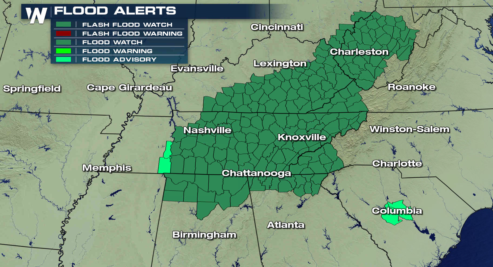
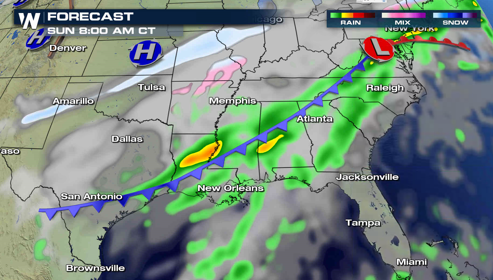
The work week is ending with dry weather and sunshine from the Appalachians into the Tennessee Valley, but that will change this weekend. A slow moving cold front will bring thunderstorms with heavy rainfall. Flash Flood Watches extend from West Virginia to Alabama. Rainfall totals may reach 3" to 6" by early next week.
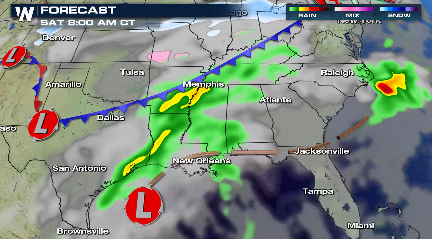
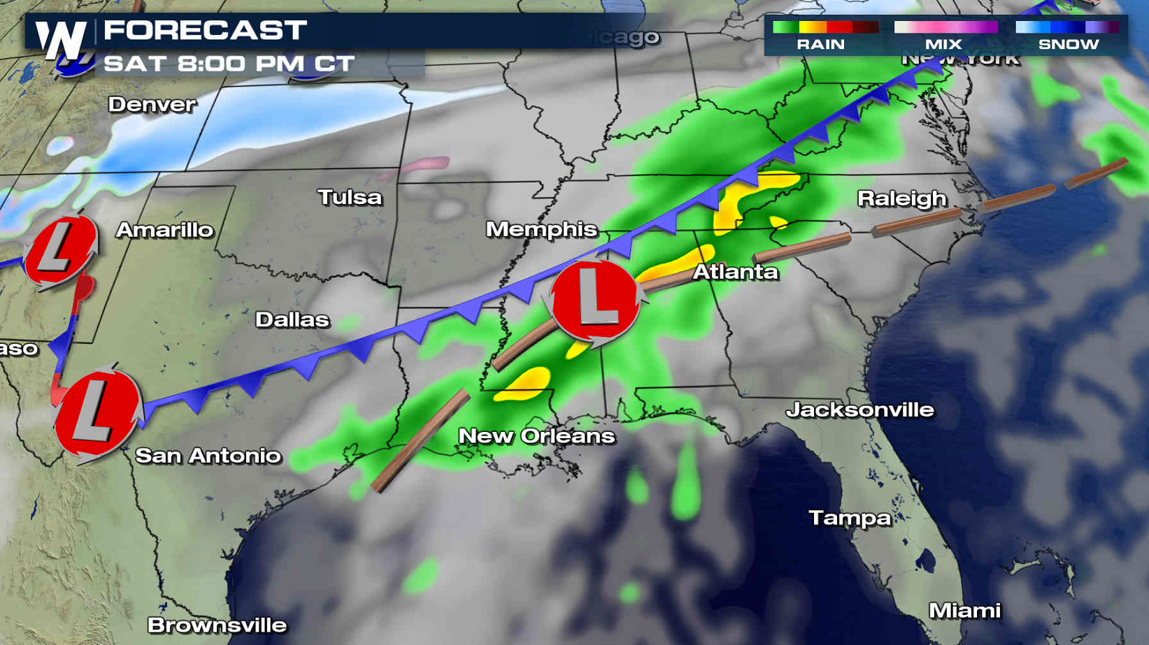
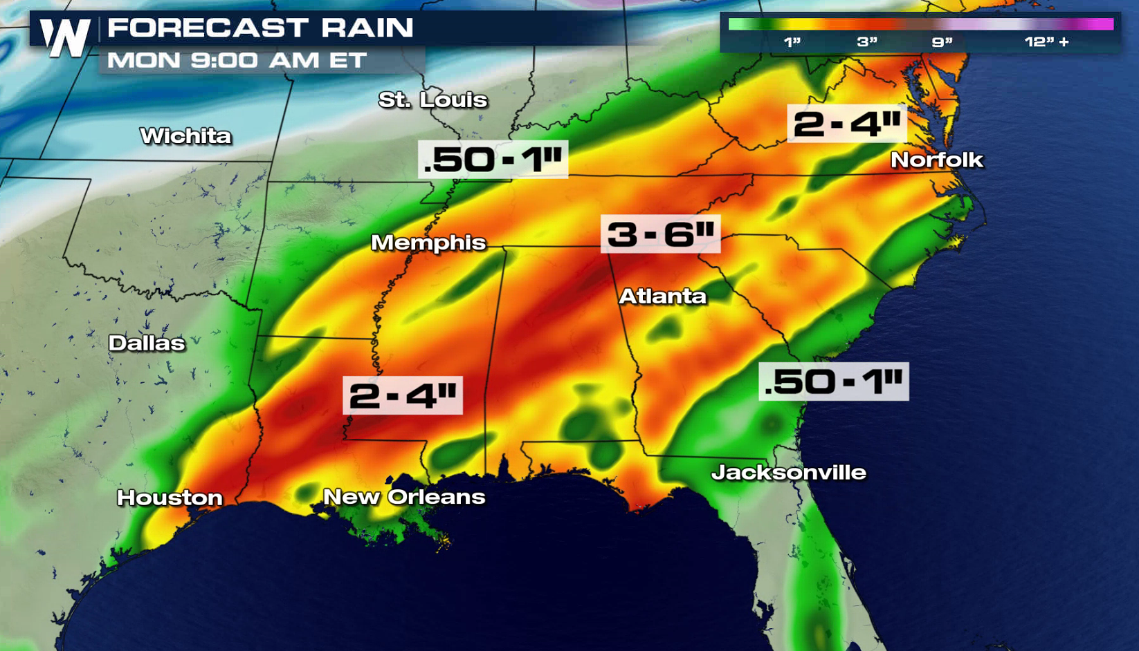 A cold front slowing pushing through the Ohio Valley now will move eastward Saturday into the Tennessee Valley. A rich feed of moisture flowing into the Southeast from the Gulf of Mexico will increase humidity, leading to heavy rainfall and potential flooding. The system will push into the Southeast and Great Smoky mountains Sunday.
Storms with heavy rain could lead to instances of flash flooding, while long duration excessive rainfall combined with ground that has already been saturated from recent rains, may lead to more prolonged flooding along streams, creeks, and in low lying areas. In addition, rises to near bankfull or into flood are expected on portions of the Kentucky and Cumberland River basins.
A cold front slowing pushing through the Ohio Valley now will move eastward Saturday into the Tennessee Valley. A rich feed of moisture flowing into the Southeast from the Gulf of Mexico will increase humidity, leading to heavy rainfall and potential flooding. The system will push into the Southeast and Great Smoky mountains Sunday.
Storms with heavy rain could lead to instances of flash flooding, while long duration excessive rainfall combined with ground that has already been saturated from recent rains, may lead to more prolonged flooding along streams, creeks, and in low lying areas. In addition, rises to near bankfull or into flood are expected on portions of the Kentucky and Cumberland River basins.
 For WeatherNation: Meteorologist Mace Michaels
A cold front slowing pushing through the Ohio Valley now will move eastward Saturday into the Tennessee Valley. A rich feed of moisture flowing into the Southeast from the Gulf of Mexico will increase humidity, leading to heavy rainfall and potential flooding. The system will push into the Southeast and Great Smoky mountains Sunday.
Storms with heavy rain could lead to instances of flash flooding, while long duration excessive rainfall combined with ground that has already been saturated from recent rains, may lead to more prolonged flooding along streams, creeks, and in low lying areas. In addition, rises to near bankfull or into flood are expected on portions of the Kentucky and Cumberland River basins.
For WeatherNation: Meteorologist Mace MichaelsAll Weather News
More

More Storms for the East Through Monday
A low-pressure system that moved through the
3 Aug 2026 12:20 PM


After Reaching Category 5, Genevieve Weakens in the Pacific
PacificGenevieve formed last Friday south of
3 Aug 2026 12:30 AM

Flooding, Severe Storms Target the Midwest Again
After an active week of storms across the nor
1 Aug 2026 1:40 AM

Flooding Risk Increases as Heavy Rain Targets the Tri-State Area
Tuesday, heavy rainfall moved across the Nort
30 Jul 2026 12:25 AM