Flood Potential in the Midsection of the Nation
Special Stories
27 Mar 2018 9:07 AM
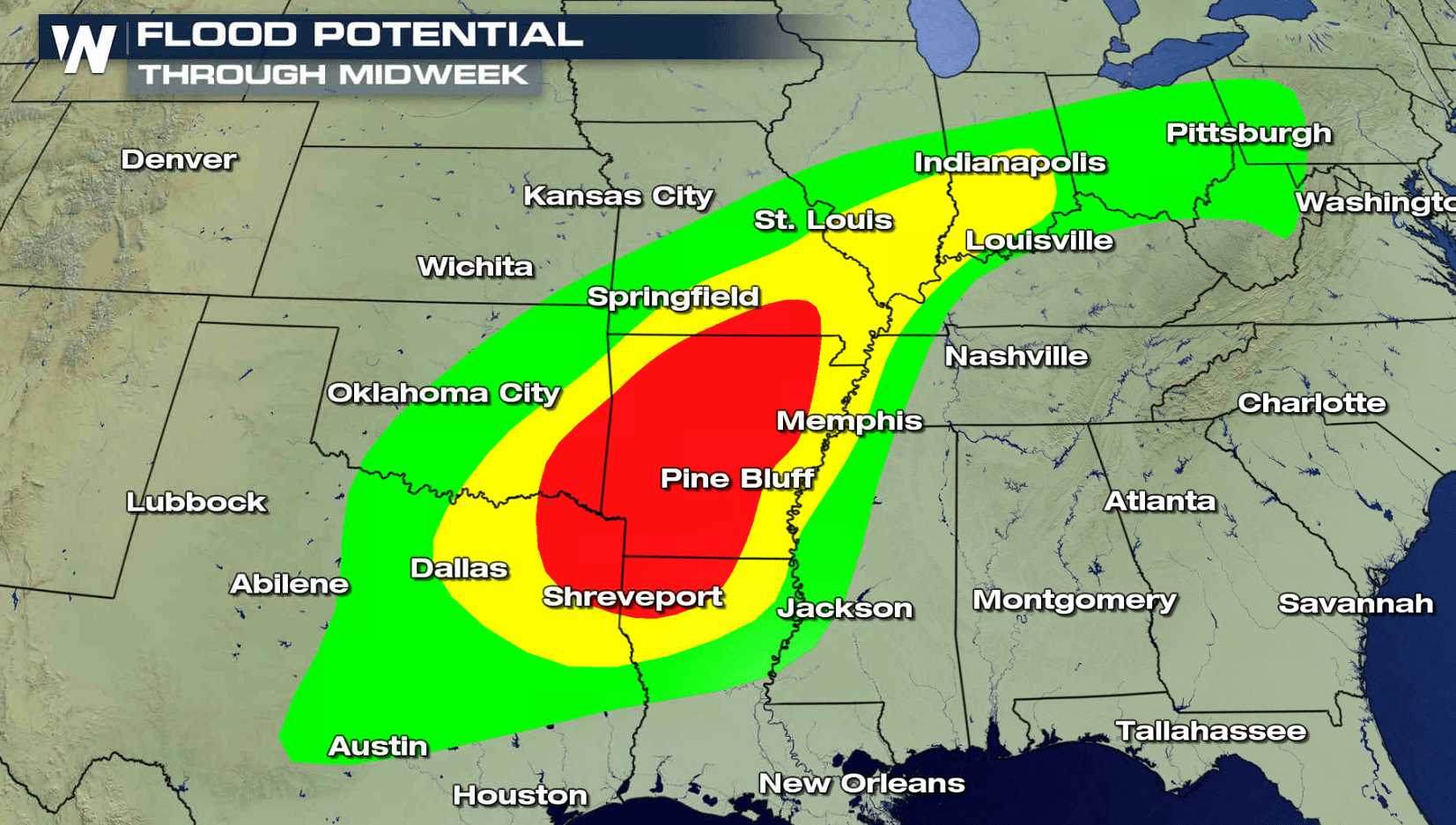
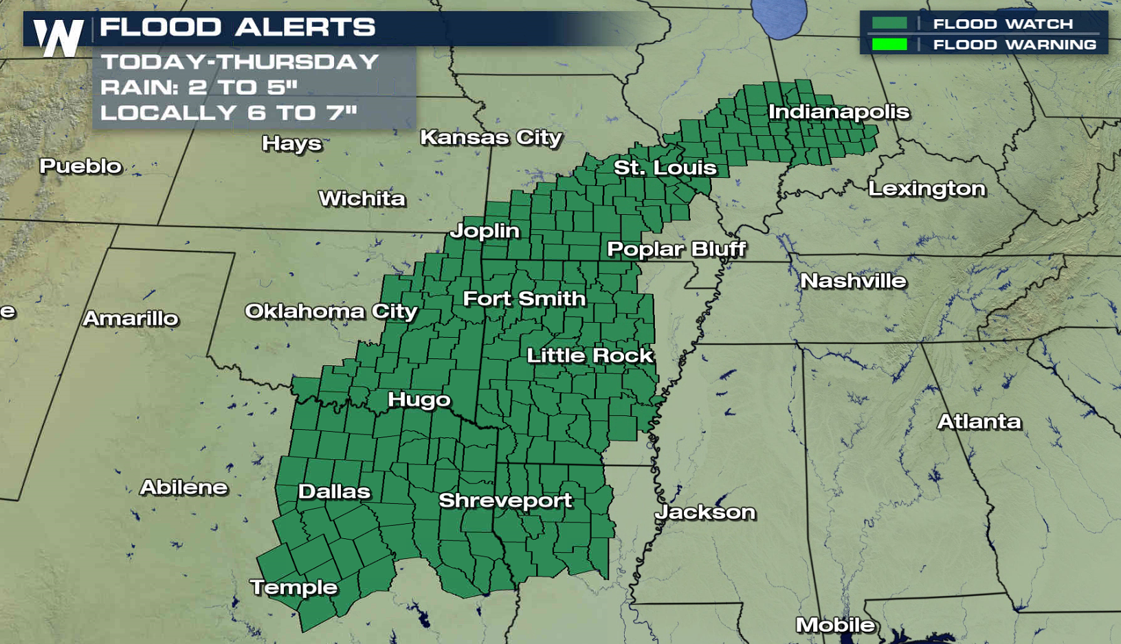
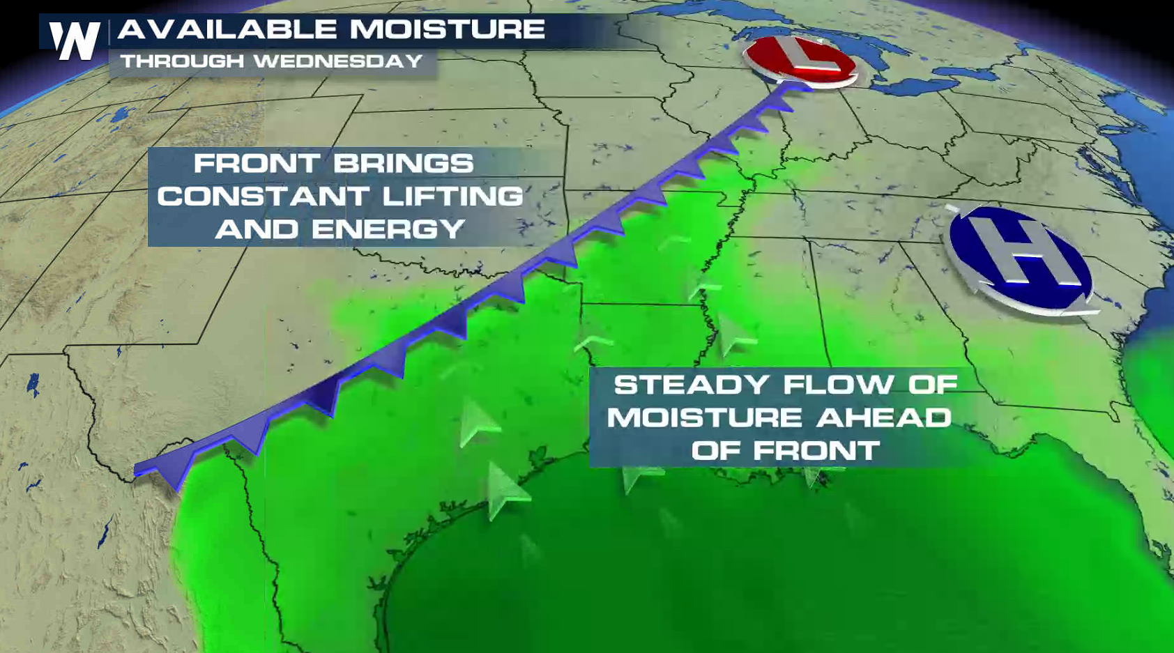
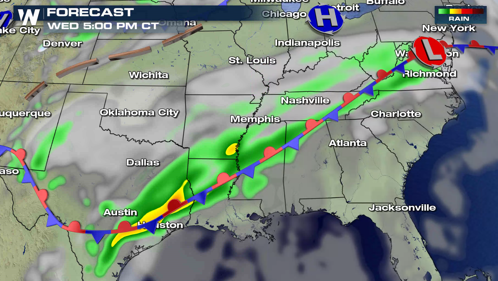
The flooding threat continues from the Plains into the Ohio and Mississippi Valleys over the next few days. Flood Watches remain in effect from Indiana to Texas. Some areas may see up to 7" of rain through Thursday as a rich feed of humidity continues to flow into the region from the Gulf of Mexico. A slow moving front will be the focus for storms, providing energy to sustain their growth and production.
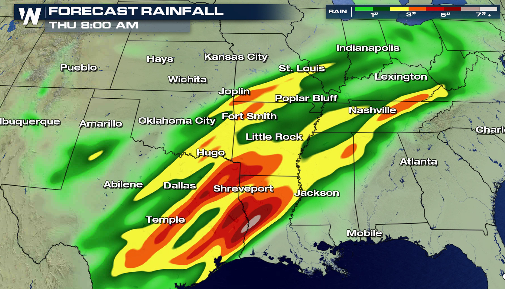
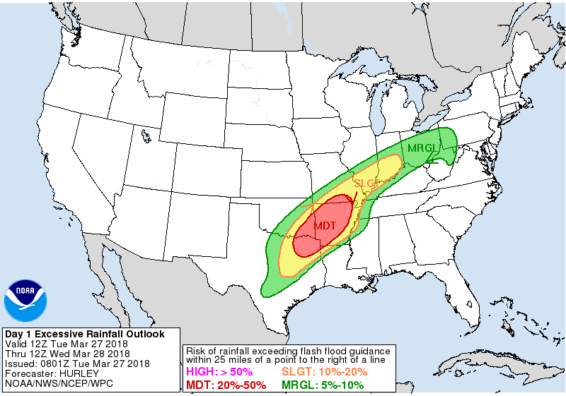
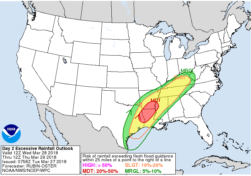
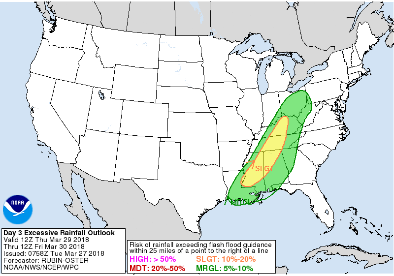
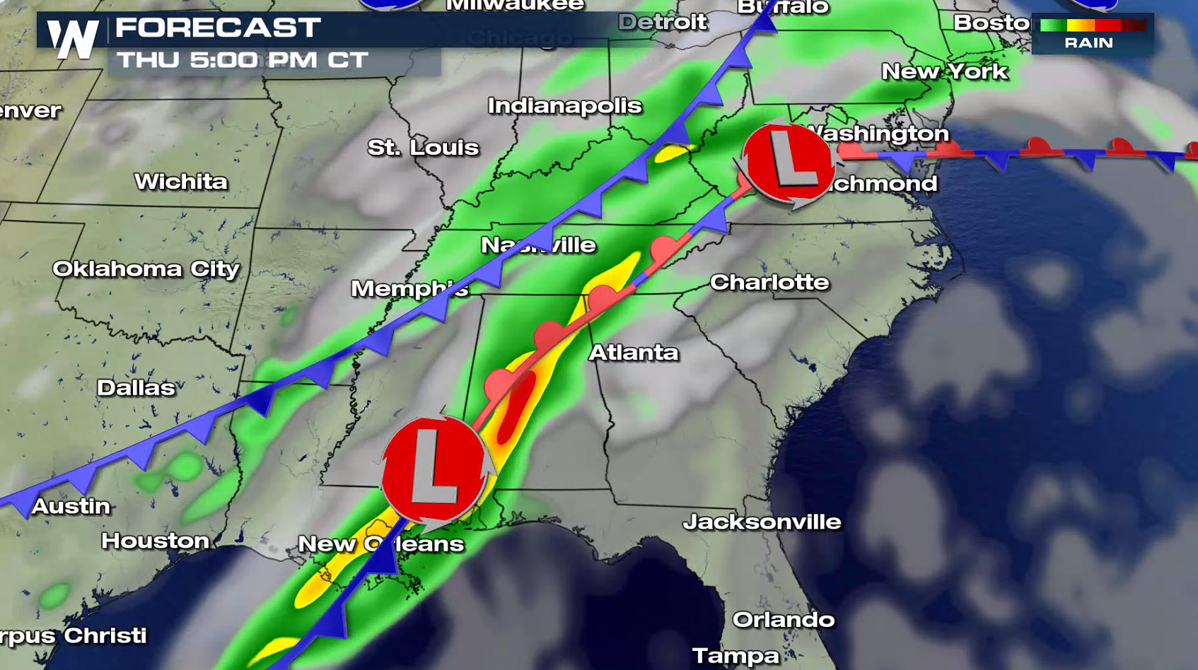
 The excessive rainfall forecasts from NOAA's Weather Prediction Center shows a moderate potential for flooding today from southern Missouri to the Arklatex. That area shifts slighly to the south and east Wednesday to include parts of Louisiana and Mississippi. A slight risk for flooding extend from the Ohio Valley to the Tennessee and Mississippi Valleys today through Thursday.
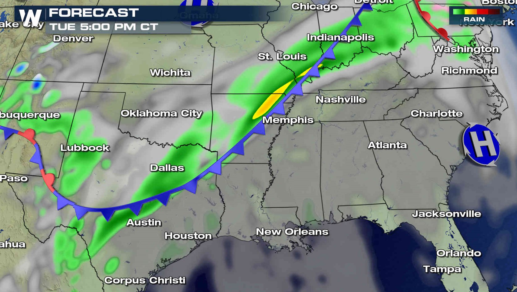
 A cold front stretches from the Great Lakes into the southern Plains. Showers and thunderstorms will continue to fire along the front. As storm develop and travel over the same areas, the ground may become over saturated which could produce flooding. The front will slowly slide to the southeast through Thursday.
 For WeatherNation: Meteorologist Mace Michaels
The excessive rainfall forecasts from NOAA's Weather Prediction Center shows a moderate potential for flooding today from southern Missouri to the Arklatex. That area shifts slighly to the south and east Wednesday to include parts of Louisiana and Mississippi. A slight risk for flooding extend from the Ohio Valley to the Tennessee and Mississippi Valleys today through Thursday.
A cold front stretches from the Great Lakes into the southern Plains. Showers and thunderstorms will continue to fire along the front. As storm develop and travel over the same areas, the ground may become over saturated which could produce flooding. The front will slowly slide to the southeast through Thursday.
For WeatherNation: Meteorologist Mace MichaelsAll Weather News
More
More Storms for the East Through Monday
The threat for flooding rain continues across
3 Aug 2026 6:00 PM


After Reaching Category 5, Genevieve Weakens in the Pacific
PacificGenevieve formed last Friday south of
3 Aug 2026 12:30 AM

Flooding, Severe Storms Target the Midwest Again
After an active week of storms across the nor
1 Aug 2026 1:40 AM

Flooding Risk Increases as Heavy Rain Targets the Tri-State Area
Tuesday, heavy rainfall moved across the Nort
30 Jul 2026 12:25 AM