Flood Potential near the Potomac River
Special Stories
27 Jul 2018 10:13 AM
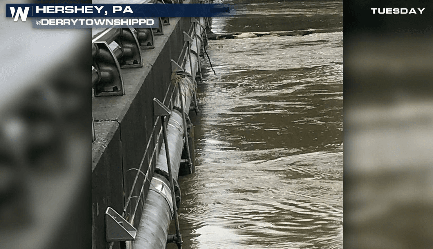
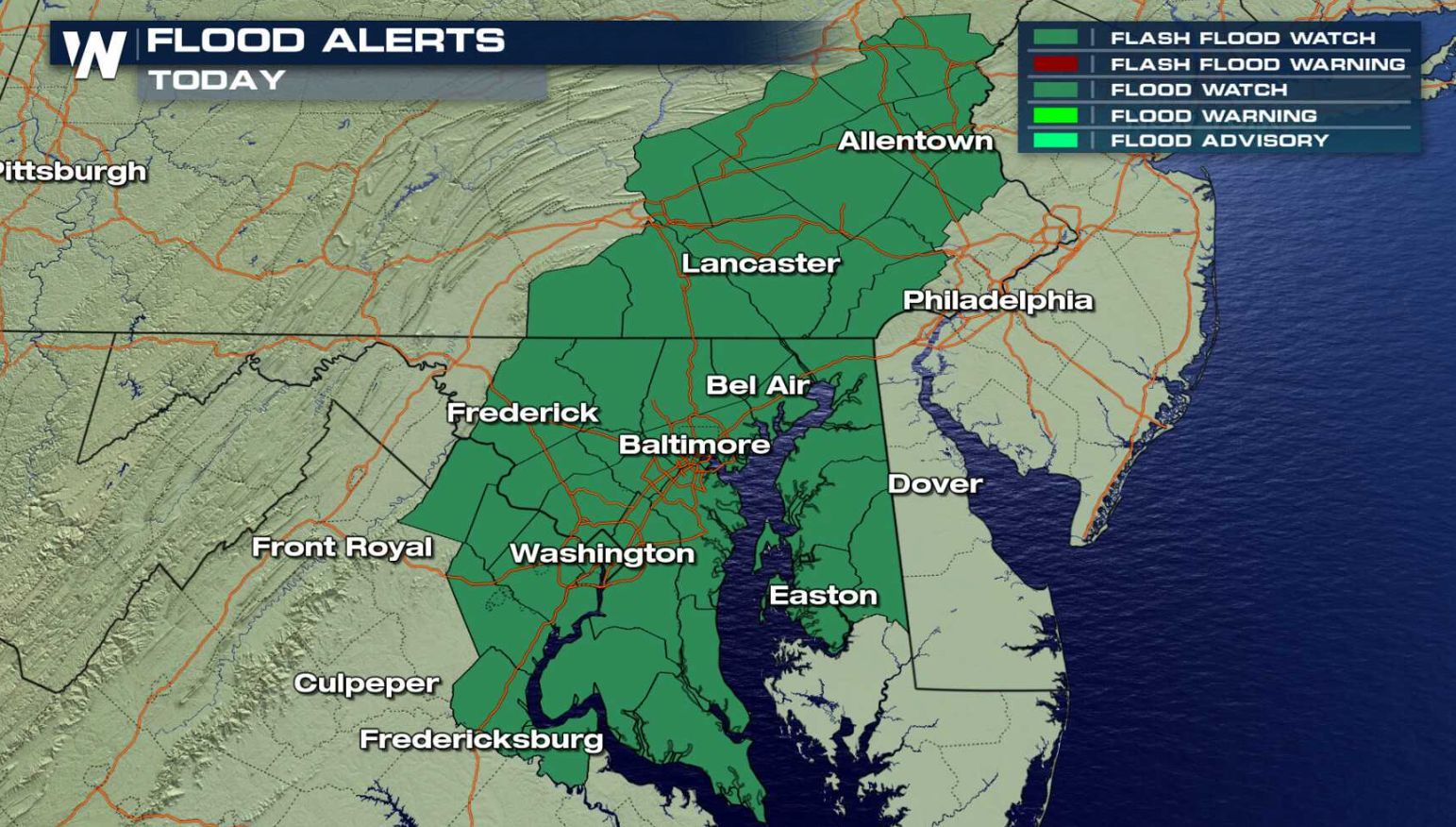
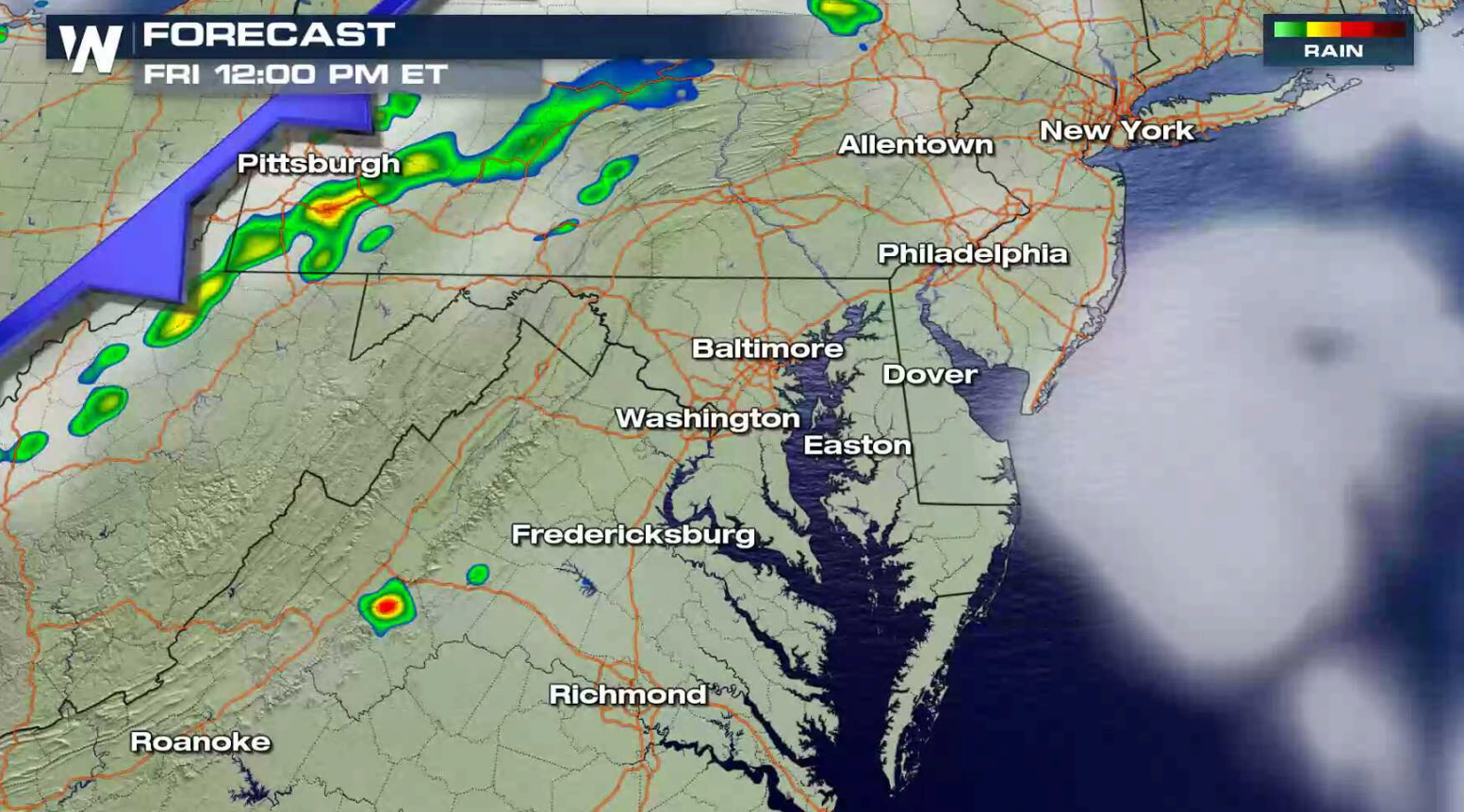
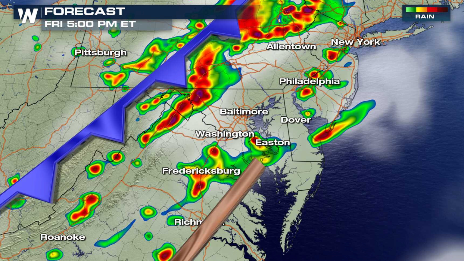
A storm system pushing out of the Ohio Valley and into the Eastern Seaboard will produce numerous showers and thunderstorms today (Friday). Heavy rain is a concern, as soils are already over-saturated from rainfall earlier this week. Flash Flood Watches have been issued through eastern Pennsylvania southward along the Potomac River to north of Richmond, including Baltimore and Washington, D.C.
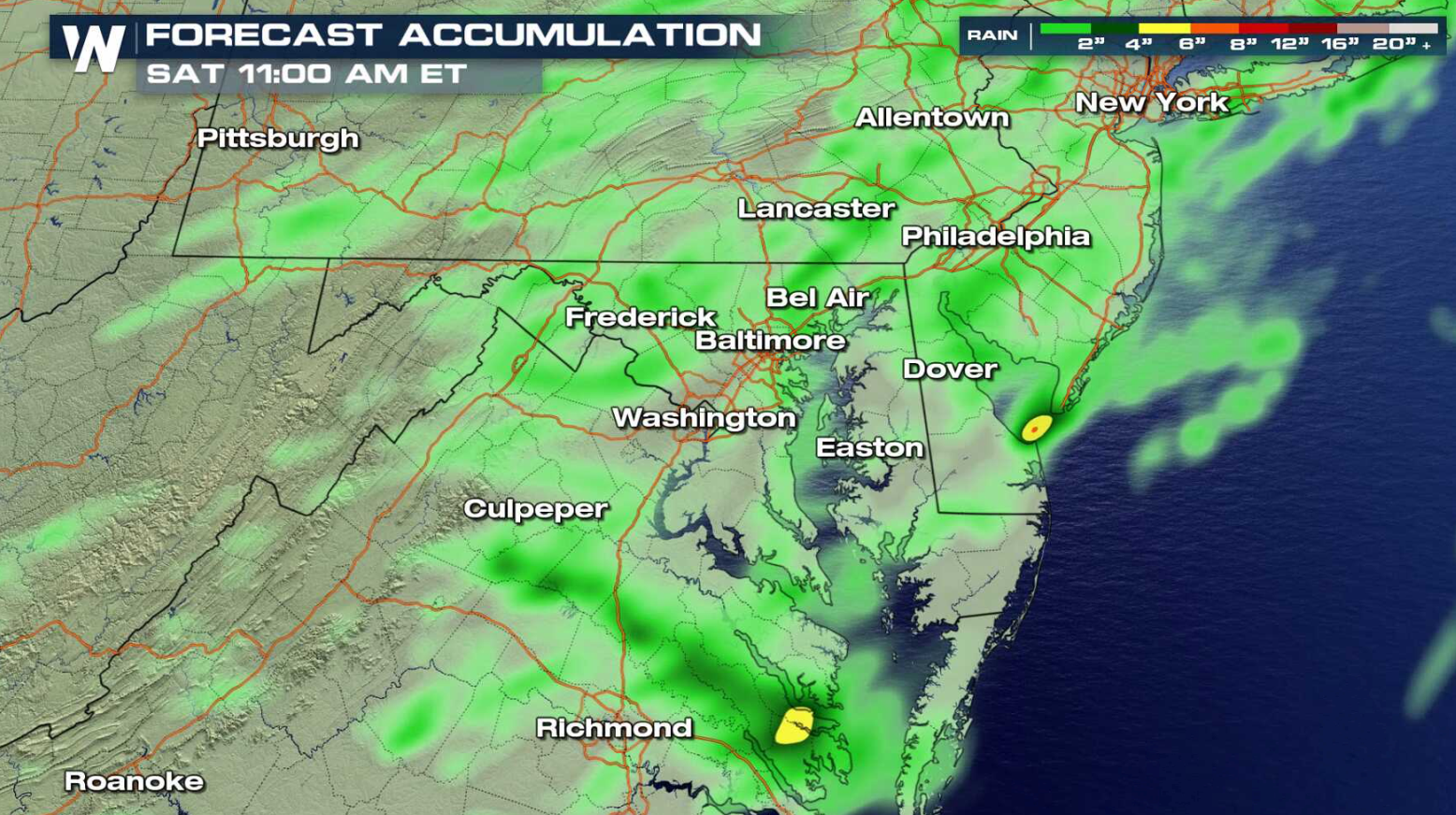 Rainfall amounts are not expected to be as heavy as earlier in the week, but any additional rain will
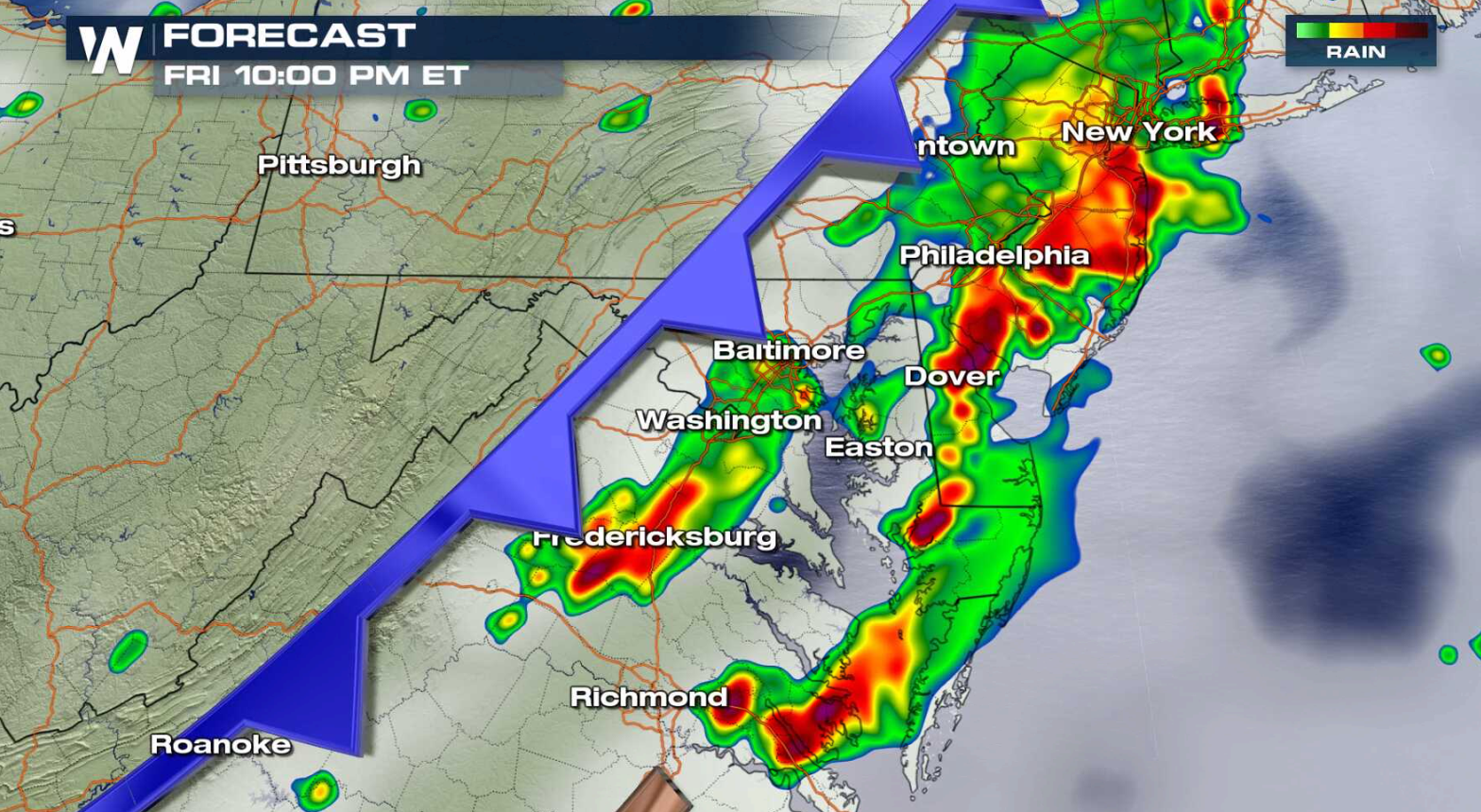
quickly become runoff and could lead to flash flooding. The cold front will move into the region later this afternoon and evening, bringing the highest rain threat. The system will shift into the Atlantic Ocean into Saturday morning, ending the flooding risk.
Rainfall amounts are not expected to be as heavy as earlier in the week, but any additional rain will
quickly become runoff and could lead to flash flooding. The cold front will move into the region later this afternoon and evening, bringing the highest rain threat. The system will shift into the Atlantic Ocean into Saturday morning, ending the flooding risk.
 For WeatherNation: Meteorologist Mace Michaels
Rainfall amounts are not expected to be as heavy as earlier in the week, but any additional rain will
quickly become runoff and could lead to flash flooding. The cold front will move into the region later this afternoon and evening, bringing the highest rain threat. The system will shift into the Atlantic Ocean into Saturday morning, ending the flooding risk.
For WeatherNation: Meteorologist Mace MichaelsAll Weather News
More
Fronts Continue To Spark Severe Weather Across the Plains
A cold front that brought record lows to the
18 Jul 2025 10:40 PM

Extreme Heat Impacts for the East Coast & South
Extreme heat continues to impact several area
18 Jul 2025 10:05 PM

Flooding Threat Remains Elevated in the East
A cold front pushing through the Eastern Seab
18 Jul 2025 9:10 PM

EF-2 Firenado from the Deer Creek Fire in Utah
A fire tornado was spotted near La Sal, Utah
18 Jul 2025 7:30 AM

Tropical System Brings Flood Risk to the Central Gulf
Time has run out for notable tropical develop
18 Jul 2025 3:05 AM

Heavy Rain, Flooding Threat Returns to Florida
Keep the rain boots handy in Florida - heavy
13 Jul 2025 12:50 PM

Severe Storm Risk Pushes into the Great Lakes, Ohio Valley
Friday was another busy day with severe weath
12 Jul 2025 8:00 PM