Flash Flooding Ongoing in Texas and Louisiana

Rounds of heavy rain have been creating scattered flooding issues in Louisiana, Texas, and Mississippi over the last few days, thanks to a stalled frontal system. Some locations in Texas and Louisiana have been upgraded to a moderate risk of flash flooding (level 3 of 4) by the Weather Prediction Center(below) on Thursday!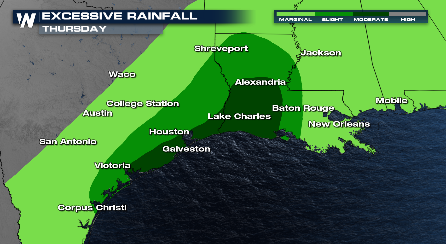
Many places in the South Central U.S. have already piled up over 6-7" of rain within a day. Remember to never drive through flooded waters!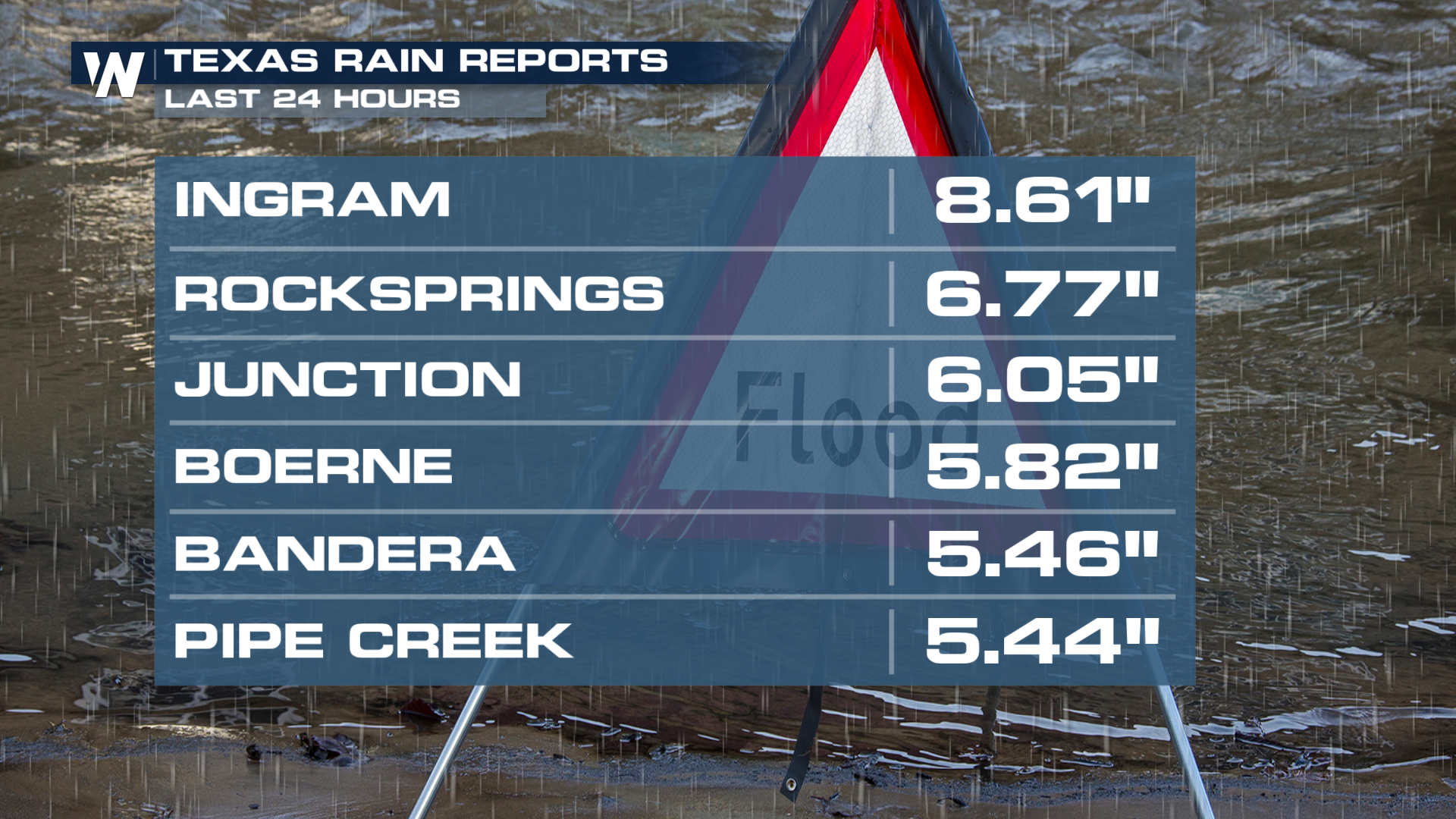 The low-pressure system that's relatively stagnant, increases rain chances across the states of Texas, Louisiana, and the Lower Mississippi Valley. Increased Gulf flow will bring heavy downpours to the Gulf Coast as this front dissipates.
Thunderstorm activity is expected to peak each afternoon and evening through Thursday. A few strong storms are possible, but flooding looks to be the bigger impact. Rainfall totals over the week ahead are likely to top 3-6 inches for a large portion of Texas and Louisiana, mostly south of I-20. Isolated totals over 8 inches are possible where multiple rounds of thunderstorms form.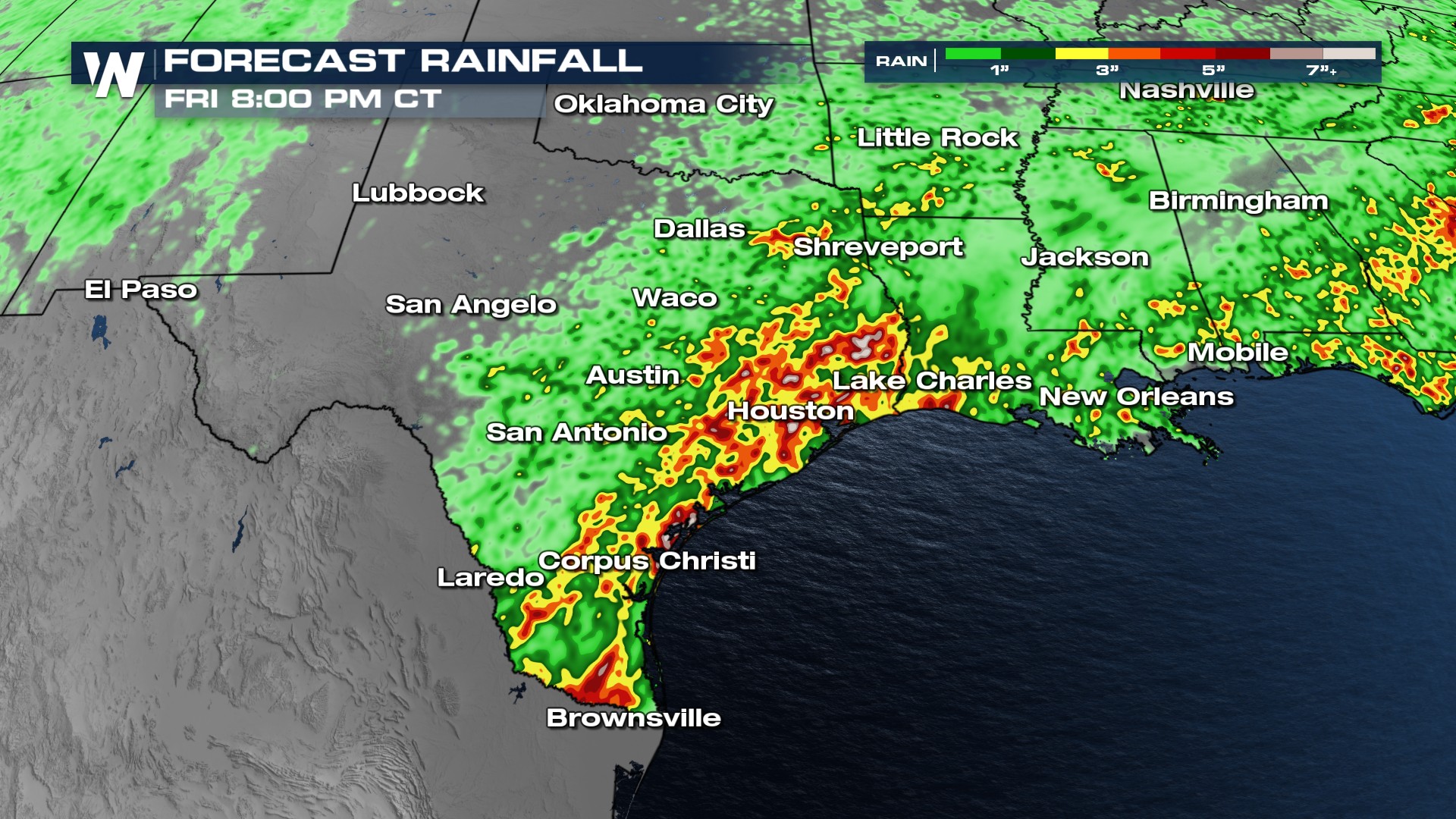
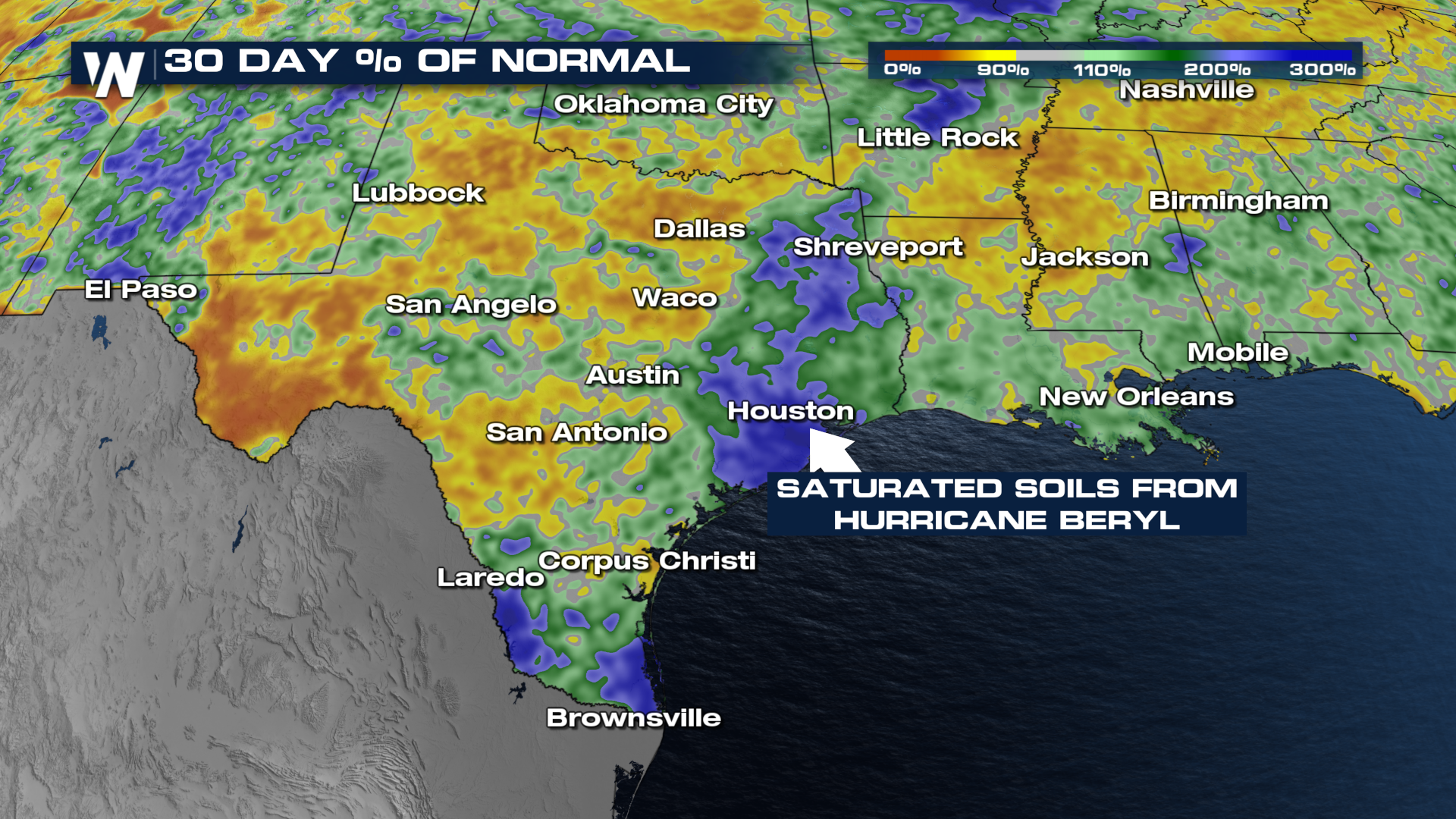
The Weather Prediction Center (WPC) has outlined portions of the South with the potential for flash flooding through the start of the weekend. The soils are saturated after Hurricane Beryl dropped heavy rain in eastern Texas. From Galveston, to Houston, and up through Shreveport, flooding will be at a heightened threat since the ground can't act like a sponge as well as it normally does.