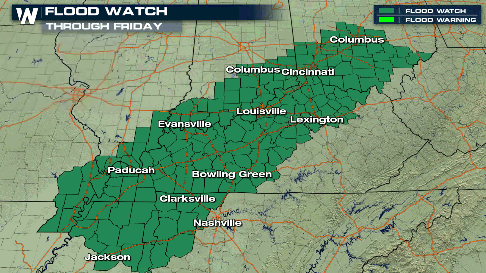
Flood Watches in the Ohio Valley
Special Stories
30 Oct 2018 4:56 PM
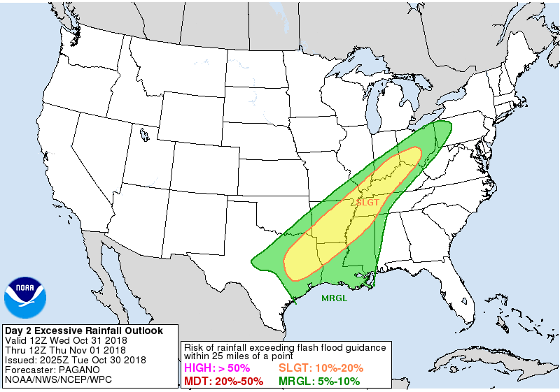
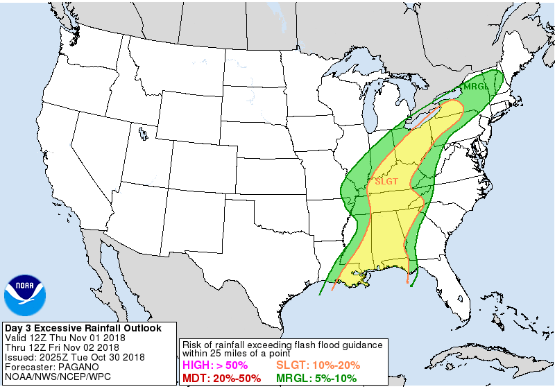
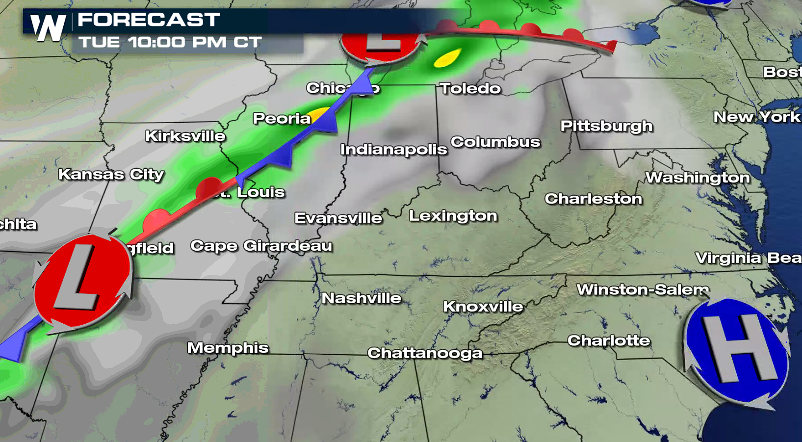
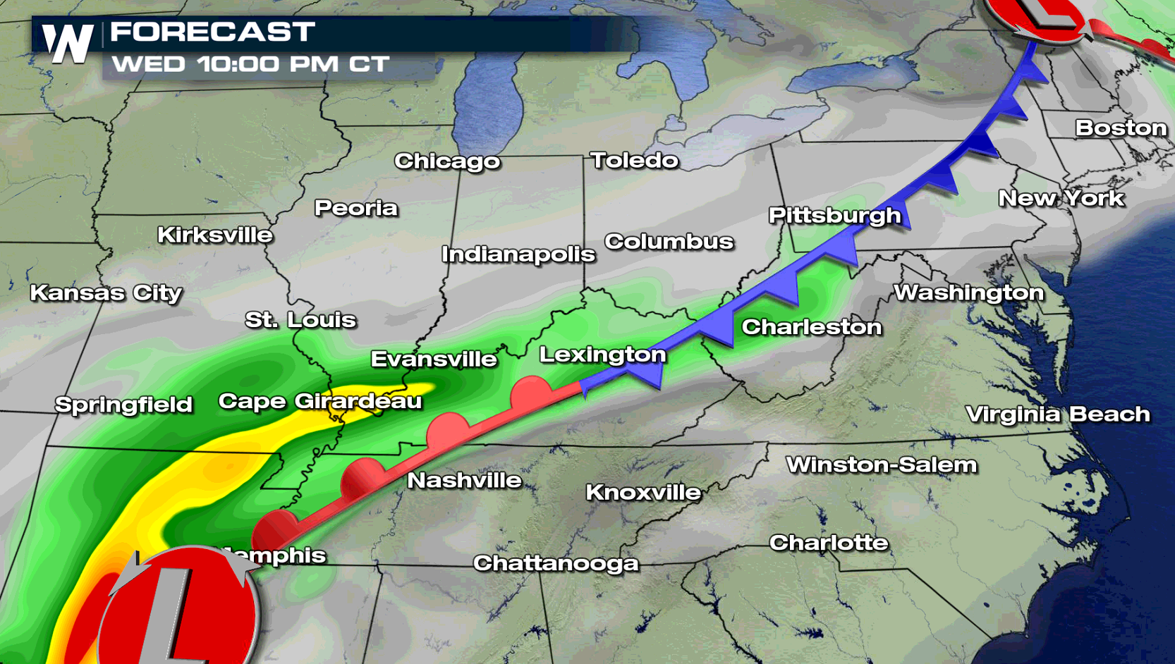
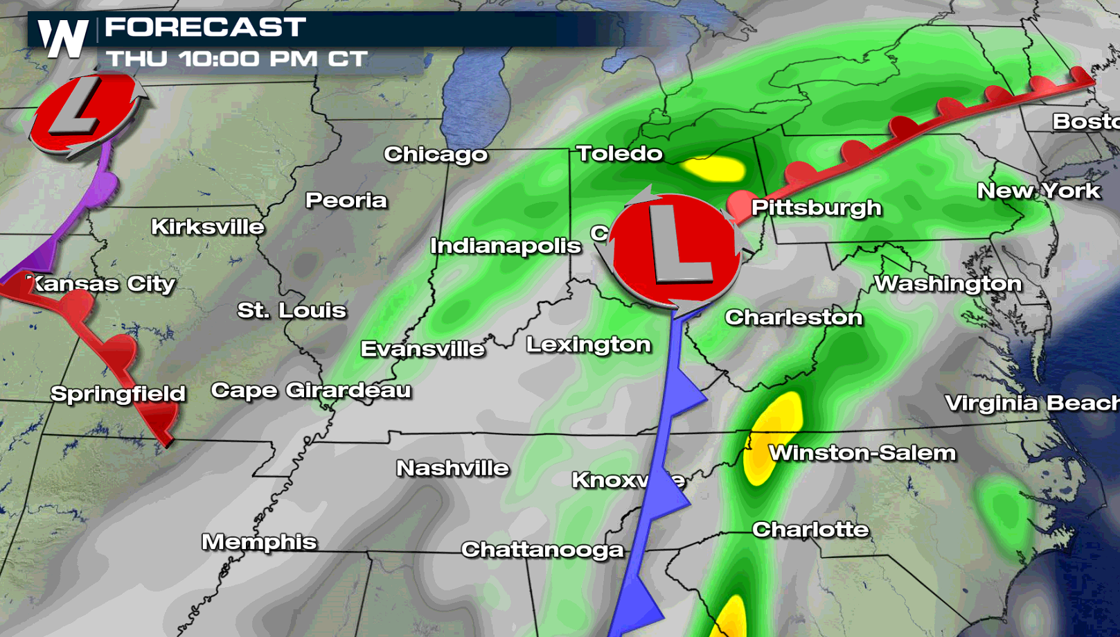
A slow moving storm system will bring several rounds of showers and thunderstorms to portions of the Ohio Valley Wednesday into Friday. Flood Watches extend from central Ohio to northeastern Arkansas. The multiple rounds of rainfall will be heavy at times, producing totals of 2" to 4". Flood-prone and low-lying areas will be susceptible to flooding. Rises on area creeks, streams, and rivers are expected. Falling leaves may also clog drainage systems and impede the normal course of water runoff.
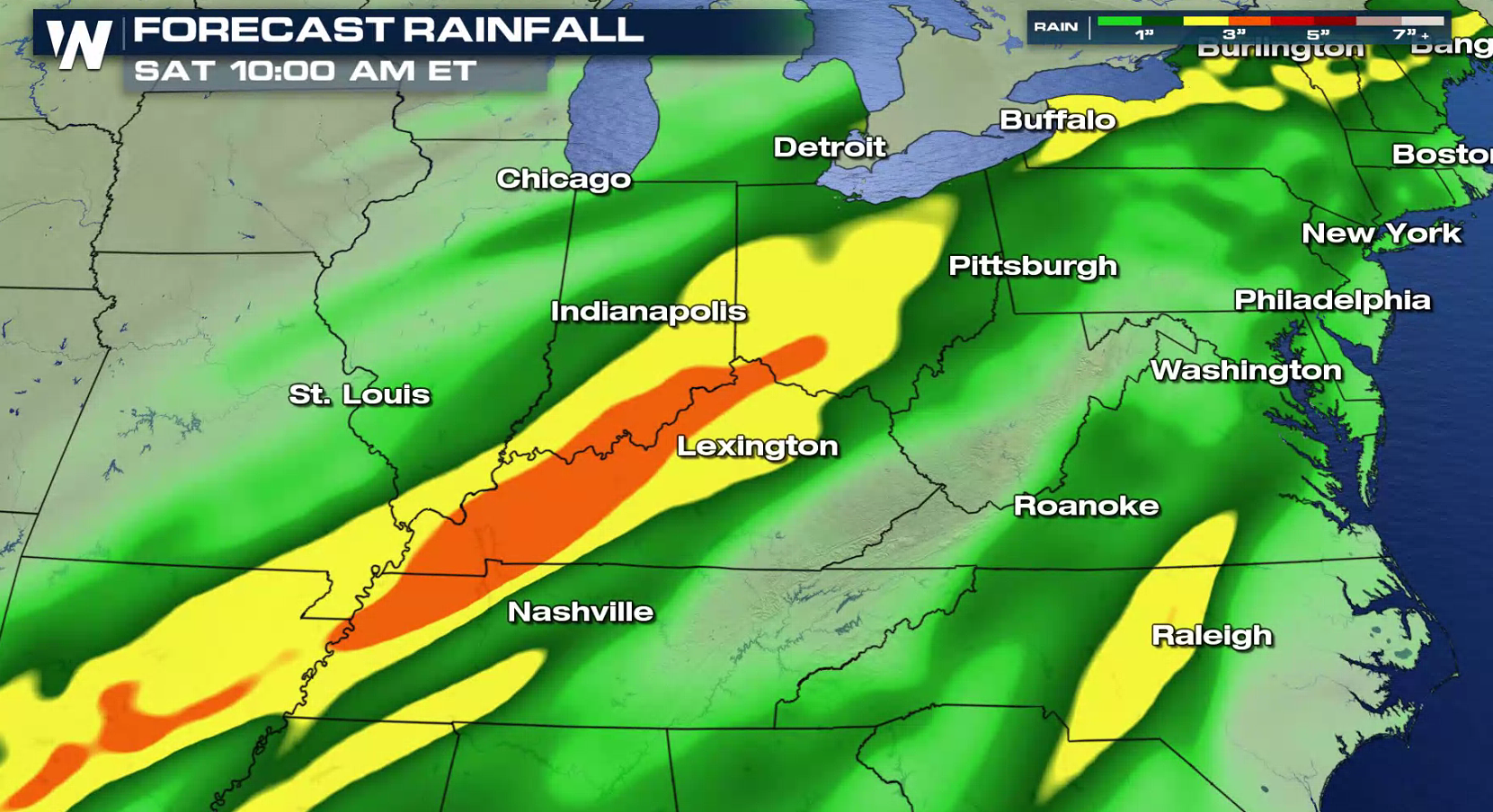
 A cold front will sink slowly to the south and east from the Great Lakes to central Plains. Humidity will push northward from the Gulf of Mexico as dew points climb. The front will temporarily stall over the region Wednesday night into Thursday, bringing widespread waves of heavy rain. The system will lift away by Friday evening and the showers will come to an end.
A cold front will sink slowly to the south and east from the Great Lakes to central Plains. Humidity will push northward from the Gulf of Mexico as dew points climb. The front will temporarily stall over the region Wednesday night into Thursday, bringing widespread waves of heavy rain. The system will lift away by Friday evening and the showers will come to an end.
All Weather News
More

Flooding, Severe Storms Target the Midwest Again
After an active week of storms across the nor
1 Aug 2026 1:40 AM


After Reaching Category 5, Genevieve Weakens in the Pacific
PacificFausto is now a post-tropical cyclone.
31 Jul 2026 1:30 AM

Flooding Risk Increases as Heavy Rain Targets the Tri-State Area
Tuesday, heavy rainfall moved across the Nort
30 Jul 2026 12:25 AM

Severe Weather: Energy From the Midwest Now in the Southeast
UPPER MIDWEST - Through Monday, dangerous tor
29 Jul 2026 10:30 PM