Flooding Still A Major Concern Across the South

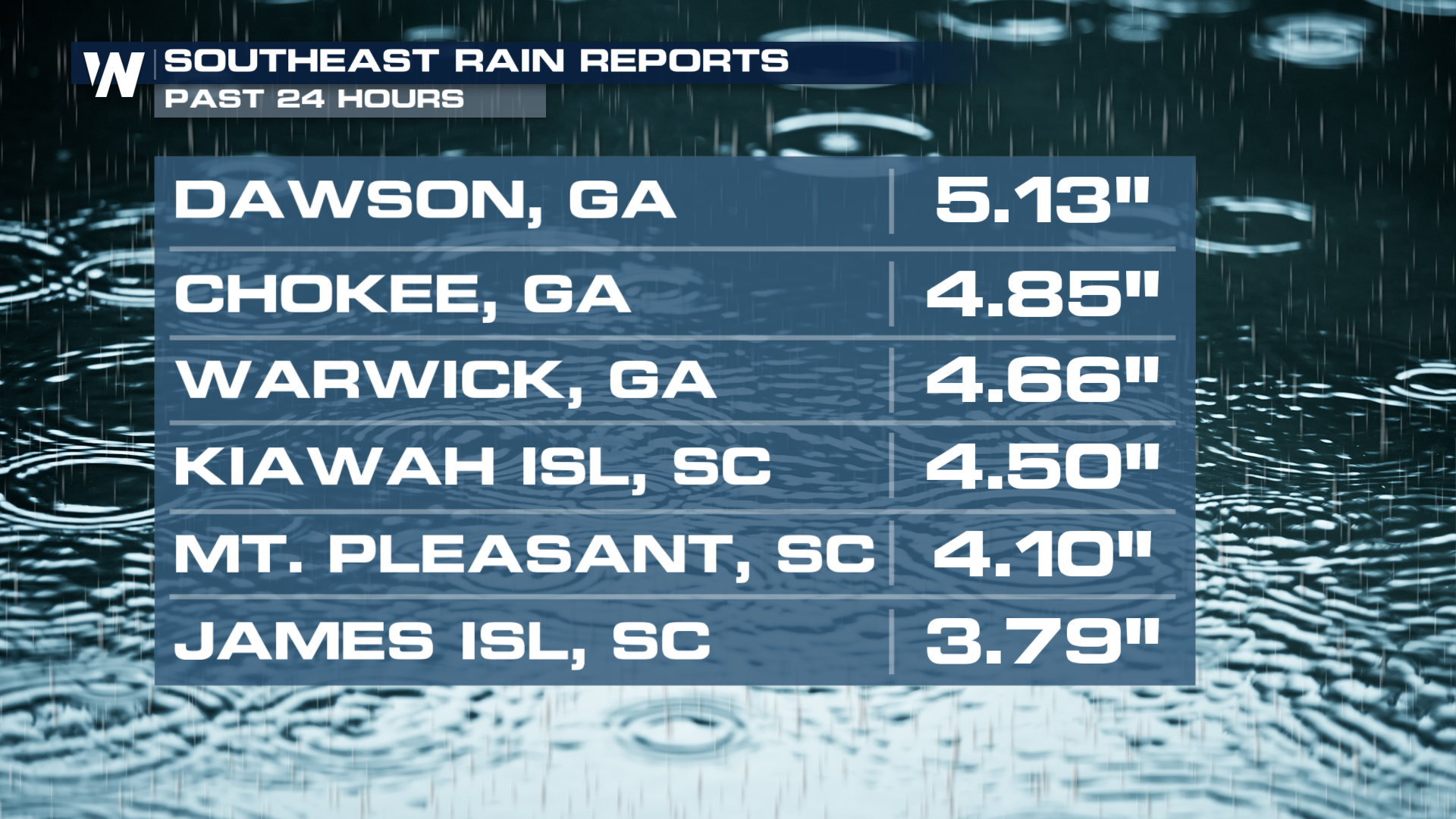
Widespread torrential downpours accompanied strong and isolated severe storms still pose a threat across the South. These storms will be working across Alabama, Florida, Georgia, and the Carolinas through the evening. The same system already produced rain totals of 3-5" in less than 6 hours, and led to areas of widespread street flooding south of Jackson, Mississippi.
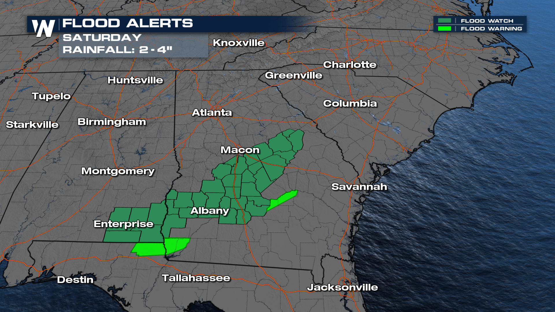
 Parts of the Panhandle of Florida, Southern Georgia, and the Carolinas are at a level 2 out of 4 threat (slight) for flooding through Saturday morning. A quick 2-4" of rainfall will be likely, causing flooding in urban and low-lying areas. A Flood Watch is in effect through Saturday evening to account for this threat.
 If a Flash Flood Warning is issued for your area, please check your location and seek higher ground if necessary. Do not drive through flood waters.
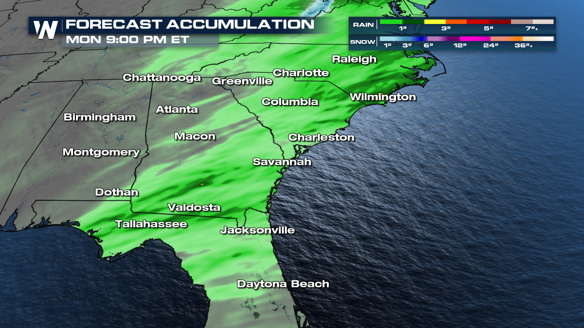 The heaviest rain will continue to shift towards the Carolinas. Saturday afternoon and evening will feature another round of heavy downpours and potential severe storms from the I-95 corridor toward the coast as the cold front moves in to very warm and humid air.
Make sure to tune into Weather Nation for the lastest information.


