Flooding Concerns Continue for the Mid-Atlantic
Special Stories
2 Jun 2018 4:43 PM
The Mid-Atlantic region has certainly gotten plenty of rain recently. The soil is saturated, and many streams and creeks are already running high. Now, more rain is falling this weekend, and flooding could be widespread.
The National Weather Service in DC/Baltimore posted on its Twitter page what to expect. Repeated rounds of heavy rain through the weekend. Widespread rainfall of one to three inches. And possible rapid rises of water.
https://twitter.com/NWS_BaltWash/status/1002837571947331585
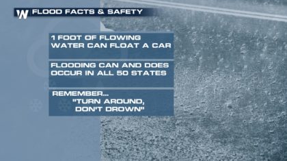
The National Weather Service near Richmond, Virginia also posted on Twitter. They warn of isolated totals of four inches with torrential downpours. They also highlight the possibility of flash flooding, and the need to be prepared to move to higher ground immediately if that happens. And they stress... never drive into areas where water covers the road. This is very important for two reasons. You don't know the depth of the water, and you don't know the condition of the road. In some cases, the road may not be there!
https://twitter.com/NWSWakefieldVA/status/1002851447715913728
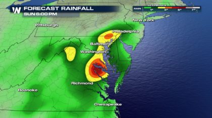
Rainfall totals are expected to be the highest between Philadelphia and Richmond. One to three inches of rain are expected. However, there could be spots that receive four or five inches of rain by Sunday afternoon.
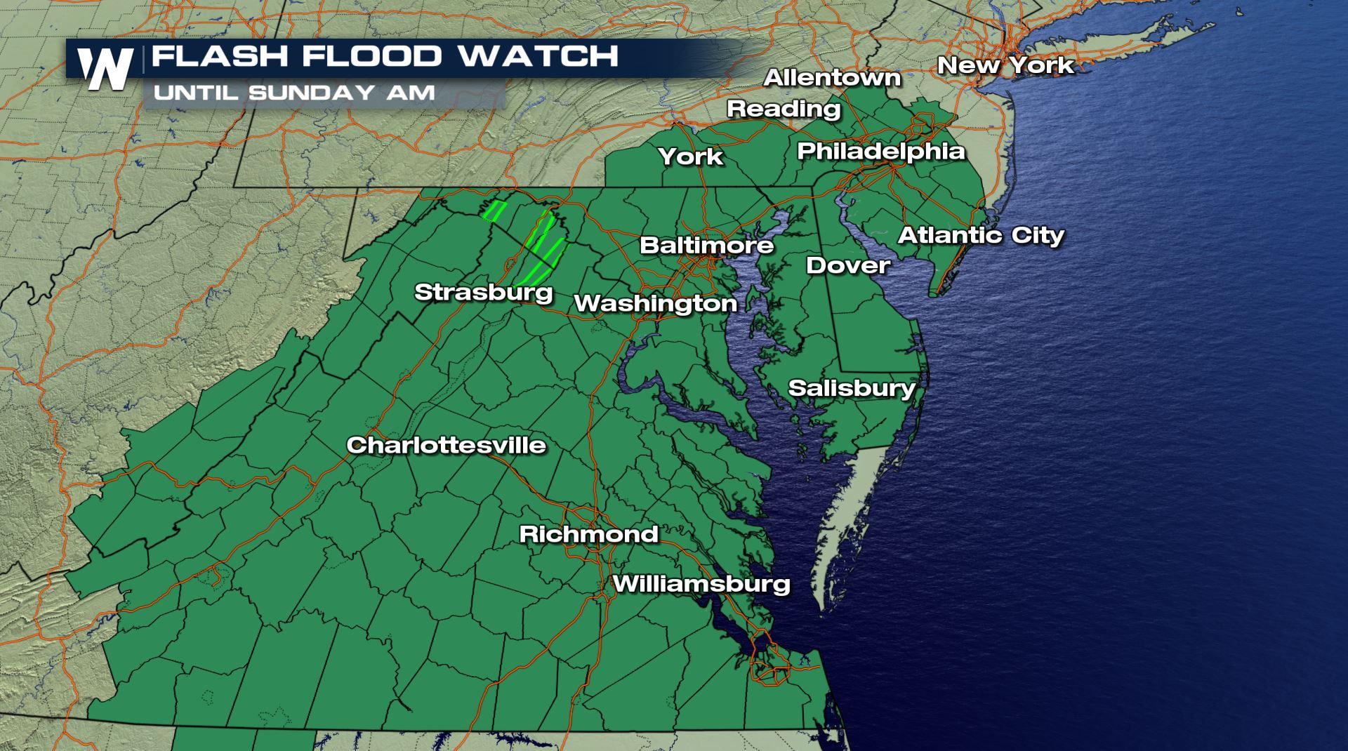
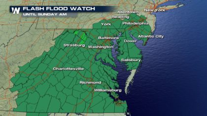
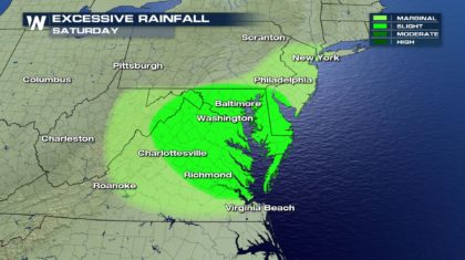 Flash Flood Watches are now in effect for the entire region. Eastern Virginia, southern New Jersey, Delaware, Maryland, and southeastern Pennsylvania are all included in this watch area. Washington D.C. is also included.
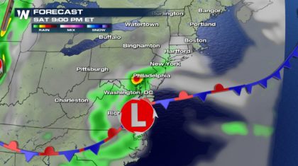
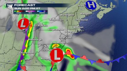
 Why so much rain? The answer is simple. There's a stalled out front with an area of low pressure parked right over eastern Virginia. The low is dragging in moisture from the Atlantic Ocean, creating a conveyor belt of rain over the mid-Atlantic region for the entire weekend. Notice in next two illustrations how the low hardly moves between 9pm Saturday night and 2pm Sunday afternoon. Rain will continue to fall over the same areas during this time. As the rain totals rise, flooding concerns will increase.
 The most important thing to keep in mind is flood safety. Always have a plan in place should flooding occur. Have a safe place to go if flooding begins in your home or neighborhood. And NEVER drive across flooded roads. As the National Weather Service warns, "Turn Around, Don't Drown".
 For WeatherNation: Meteorologist Matt Monroe
Flash Flood Watches are now in effect for the entire region. Eastern Virginia, southern New Jersey, Delaware, Maryland, and southeastern Pennsylvania are all included in this watch area. Washington D.C. is also included.
Why so much rain? The answer is simple. There's a stalled out front with an area of low pressure parked right over eastern Virginia. The low is dragging in moisture from the Atlantic Ocean, creating a conveyor belt of rain over the mid-Atlantic region for the entire weekend. Notice in next two illustrations how the low hardly moves between 9pm Saturday night and 2pm Sunday afternoon. Rain will continue to fall over the same areas during this time. As the rain totals rise, flooding concerns will increase.
The most important thing to keep in mind is flood safety. Always have a plan in place should flooding occur. Have a safe place to go if flooding begins in your home or neighborhood. And NEVER drive across flooded roads. As the National Weather Service warns, "Turn Around, Don't Drown".
For WeatherNation: Meteorologist Matt MonroeAll Weather News
More
Wildfire Outbreak in the Pacific Northwest
SPOKANE, WA - On Saturday, August 1st, the Ol
3 Aug 2026 1:55 AM

More Storms for the East Through Monday
A low-pressure system that moved through the
3 Aug 2026 1:50 AM


After Reaching Category 5, Genevieve Weakens in the Pacific
PacificGenevieve formed last Friday south of
3 Aug 2026 12:30 AM

Flooding, Severe Storms Target the Midwest Again
After an active week of storms across the nor
1 Aug 2026 1:40 AM

Flooding Risk Increases as Heavy Rain Targets the Tri-State Area
Tuesday, heavy rainfall moved across the Nort
30 Jul 2026 12:25 AM

Severe Weather: Energy From the Midwest Now in the Southeast
UPPER MIDWEST - Through Monday, dangerous tor
29 Jul 2026 10:30 PM