First Tropical System in the Atlantic Could Form Mid-June

Atlantic hurricane season is just around the corner, so the question is, when and where we will see the first system of the season?
Signs are pointing to areas around Central America during the 2nd or 3rd week of June, as increasing lift moves into the region along with westerly winds.
The Climate Prediction Center is highlighting this region (top of page) with low confidence of a tropical system forming in the western Caribbean or southwestern Gulf, also known as the Bay of Campeche. This doesn't indicate a system is expected, so be sure to stay up to date with the 7-Day forecast from the National Hurricane Center.
Better chances for formation around Mid-June are expected in the Eastern Pacific, which already has one name crossed off the list.
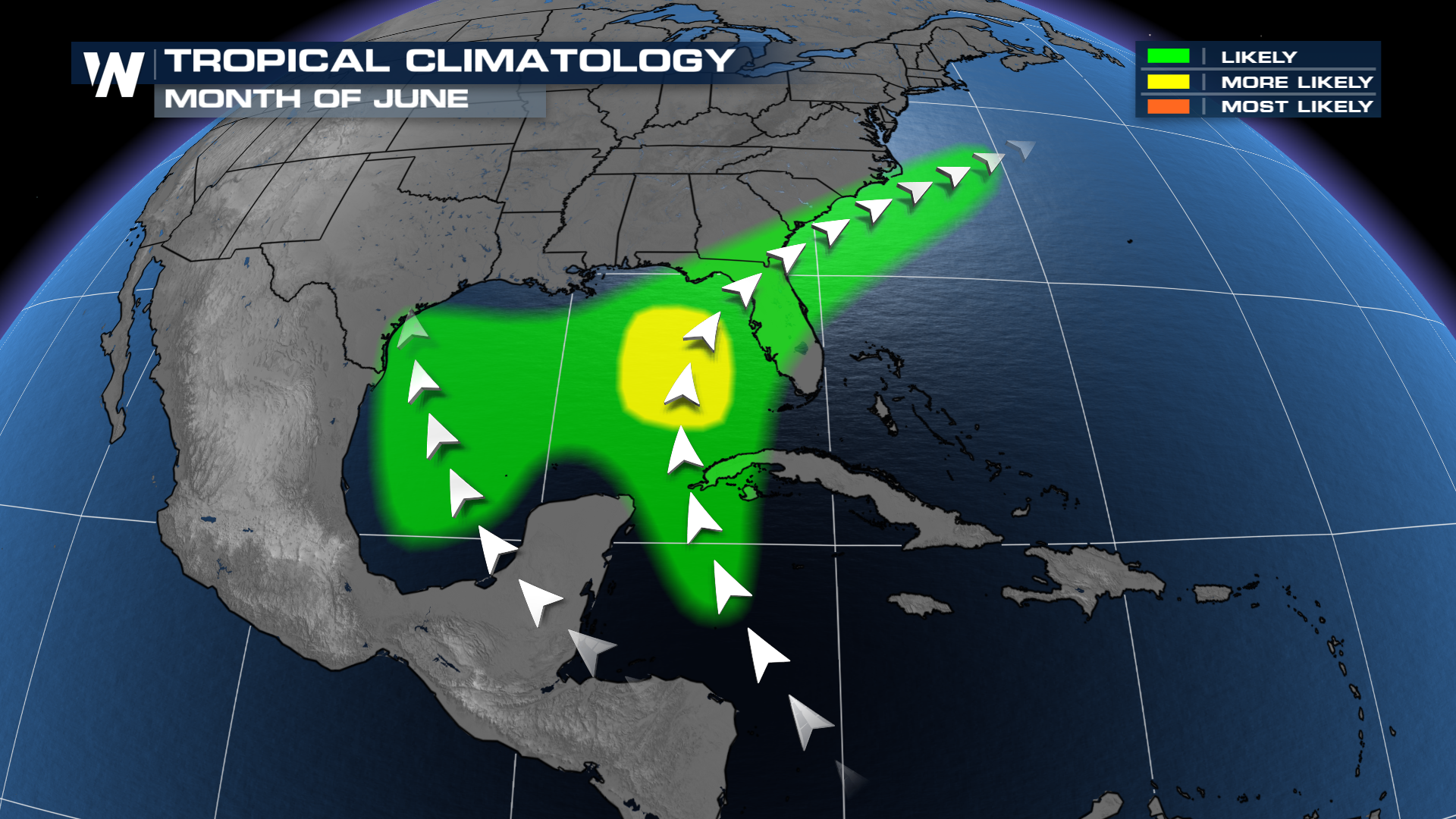 A system in the Gulf or western Atlantic is not unusual in the month of June, which typically has warmer water early in the season compared to the MDR in the Atlantic (between the Caribbean and west Africa).
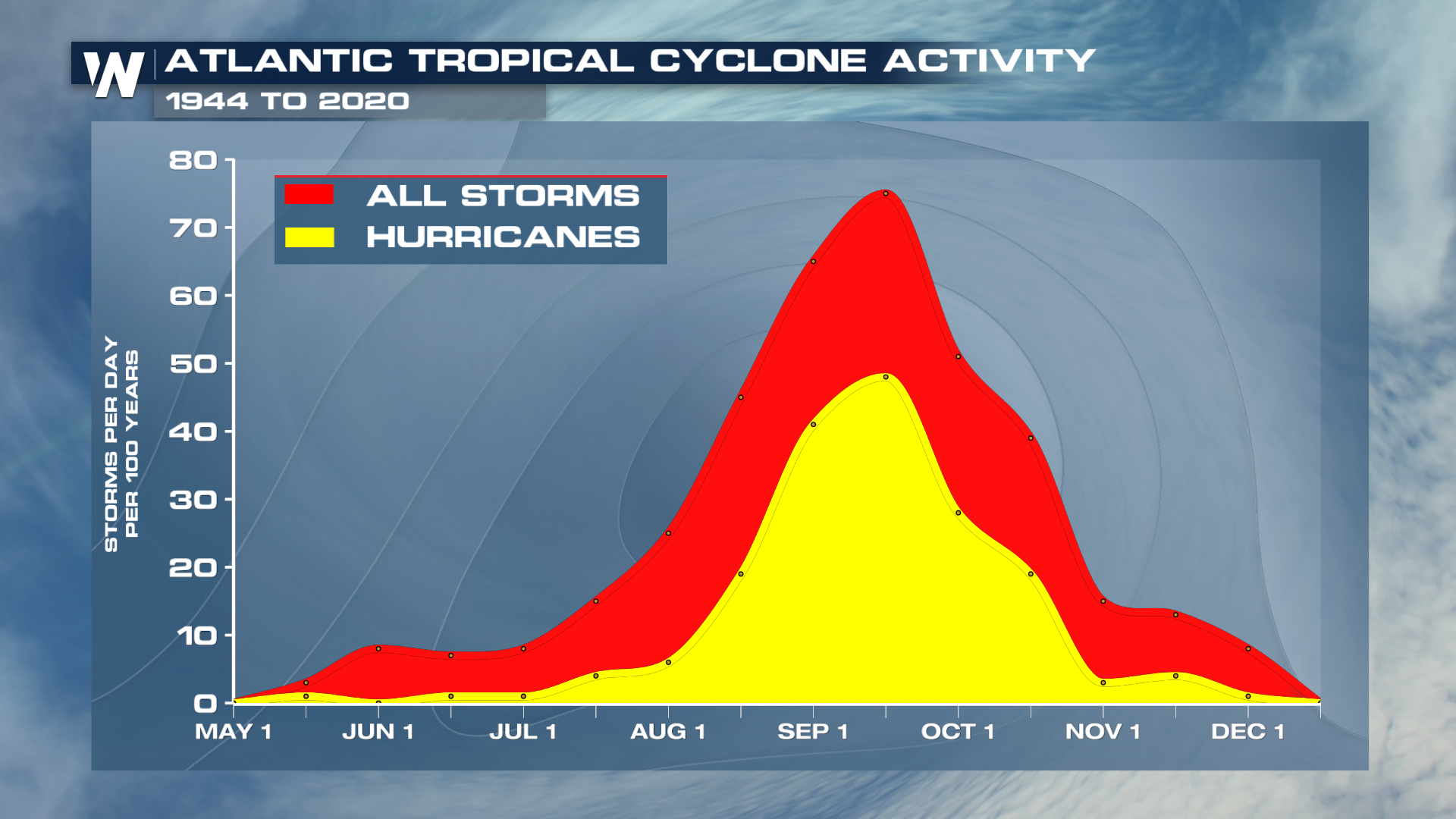
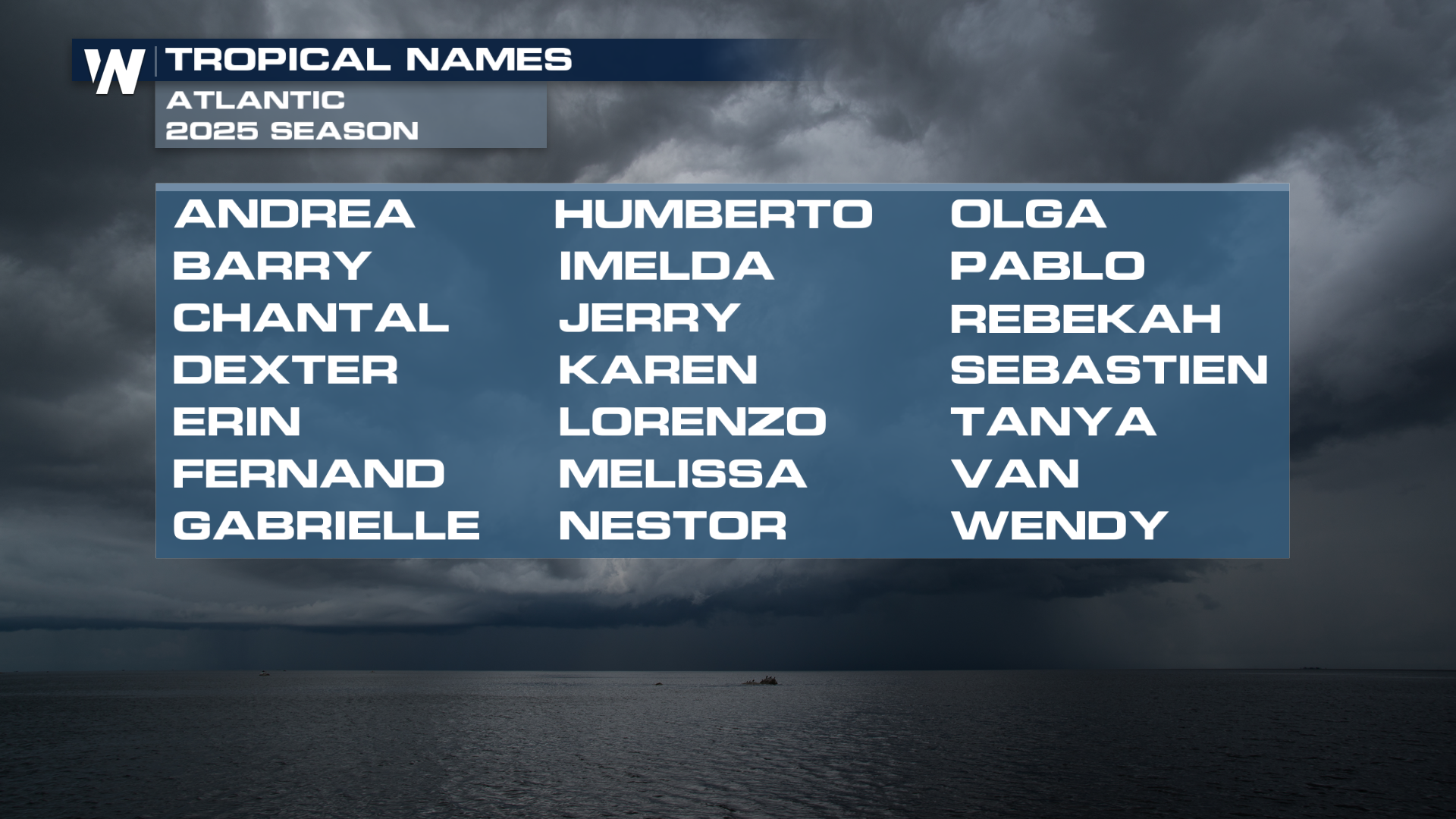
The early season will more often see more tropical storms than hurricanes, but hurricanes can form and impact the United States, so it's always best to be prepared. Andrea is the first name on the list in the Atlantic in 2025.
NOAA and Colorado State are expected an above average season in the Atlantic Basin. Click here to read more.


