Florida System Heads for Southeast Coast

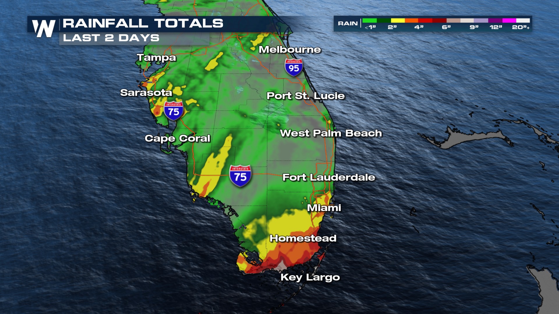
FLORIDA - Over the past couple of days, heavy rain has saturated the parched soils of South Florida. Key Largo recorded an impressive 8.32 inches of rainfall over just 48 hours.
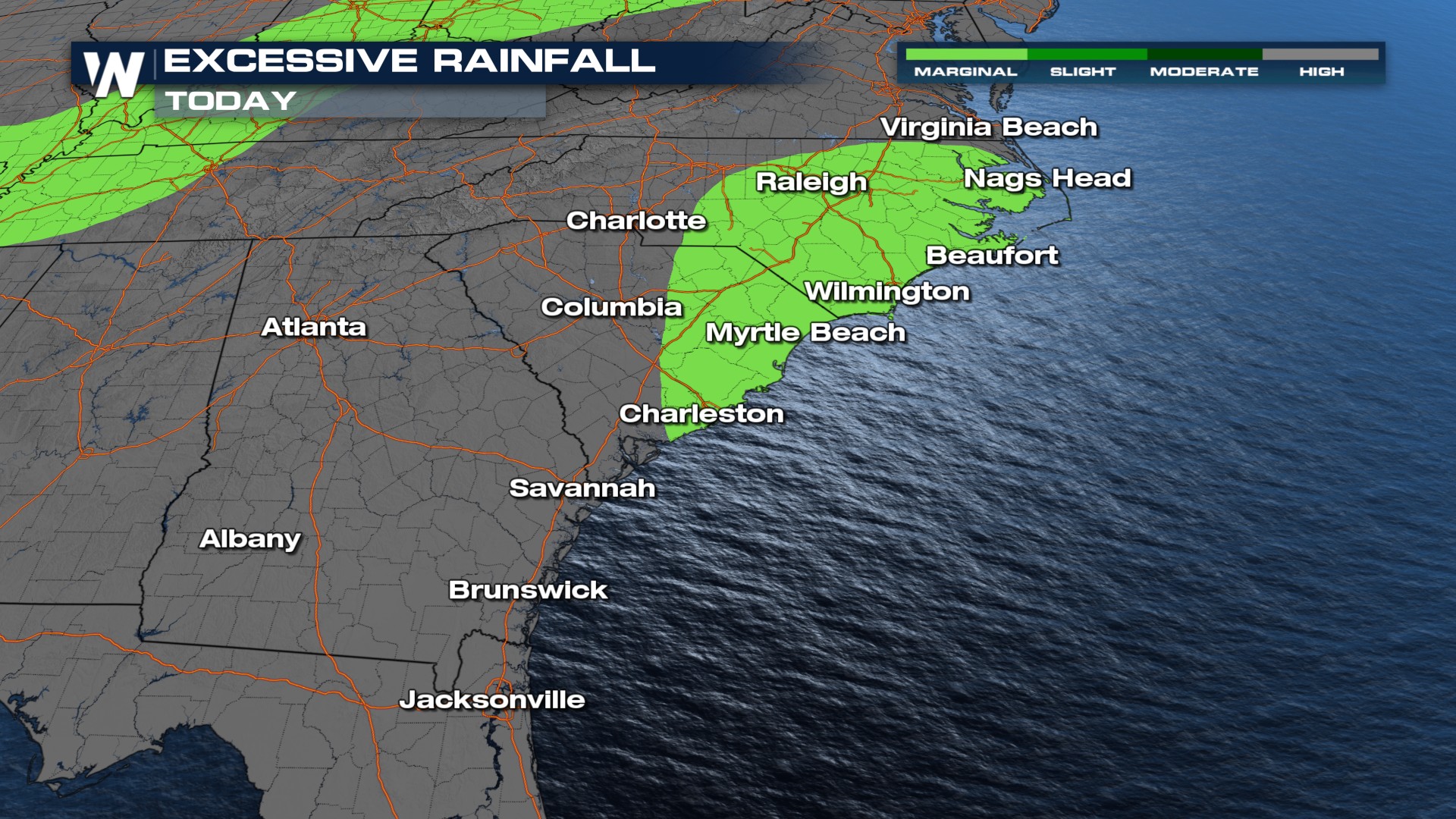
The system responsible, along with an upper-level low (top of page), is shifting from Florida into Georgia and the Carolinas on Thursday. This will draw tropical moisture northward, increasing the risk for flash flooding. The Weather Prediction Center has issued a SLIGHT (Level 2 of 4) for flash flooding on Thursday across portions of eastern North Carolina, with localized rainfall totals potentially exceeding 5 inches.
Rain Timing
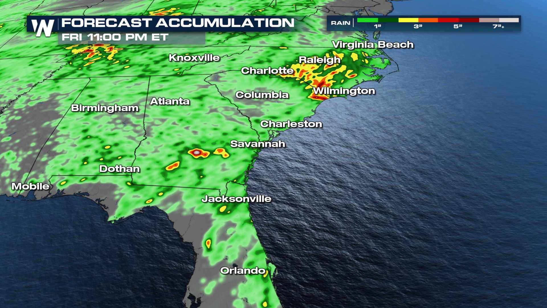
Thunderstorm activity is winding down overnight. However, on Thursday, more scattered storms are likely near the upper low across Georgia and the Carolinas, and some coastal heavy rain is likely. A cold front arriving later this week and into the weekend will bring yet another round of rain.
Rainfall Totals
Localized totals of up to 5 inches are possible from now through the end of the week.
 For more on how your weekend weather may be impacted, be sure to join us at :10 past the hour for your eastern regional forecast.


