Flooding Concerns in the Upper Midwest
Special Stories
10 Oct 2018 8:04 AM
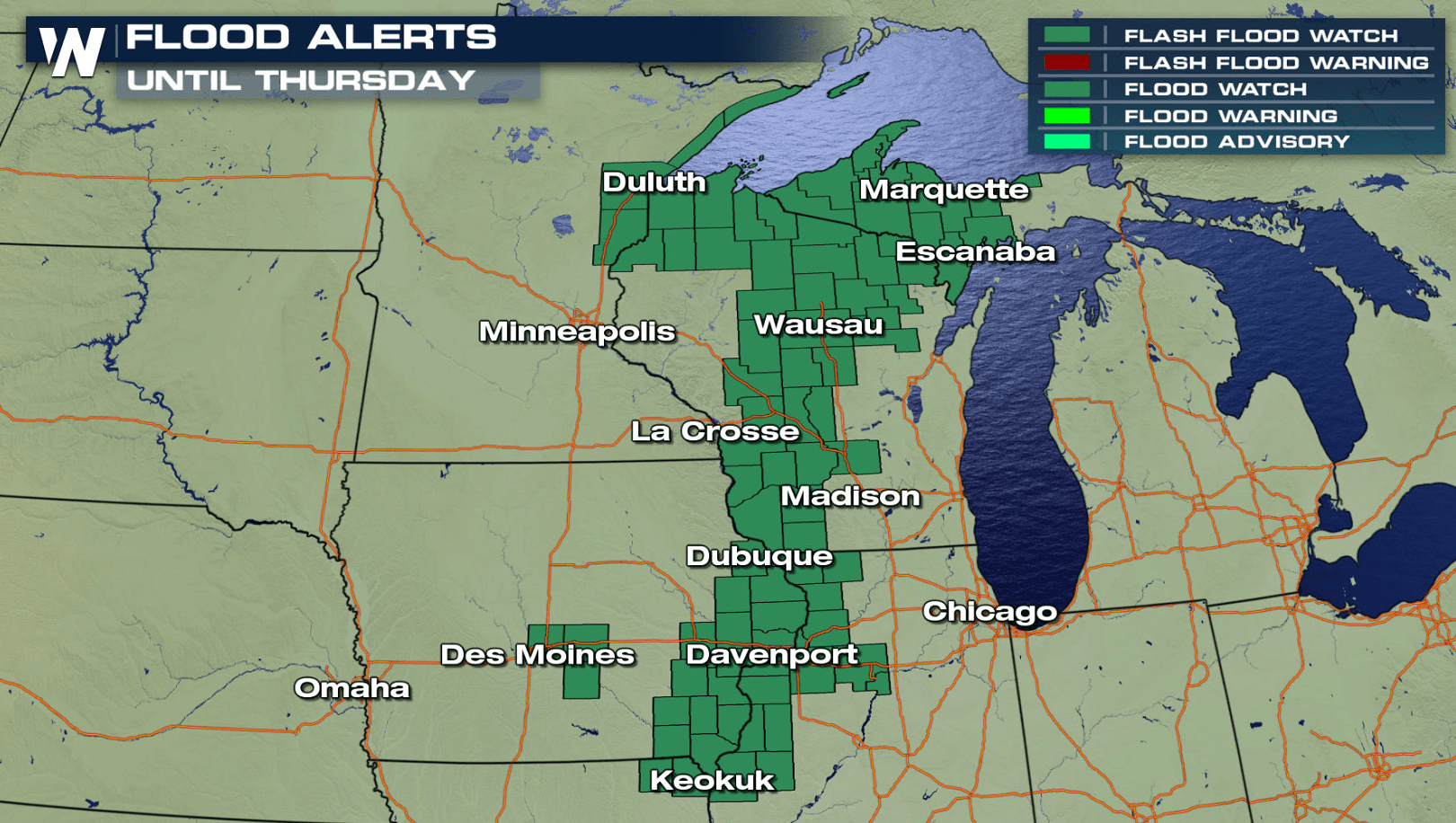
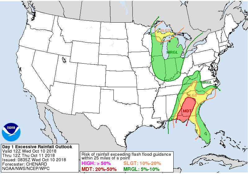
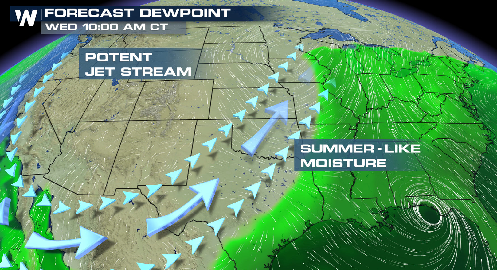
A slow moving cold front continues to produce numerous showers and thunderstorms in the Upper Midwest and western Great Lakes. A rich feed of humidity has been funneling northward along the front, fueling the heavy rainfall. Flood Watches remain in effect from the Upper Peninsula of Michigan to northeastern Missouri.
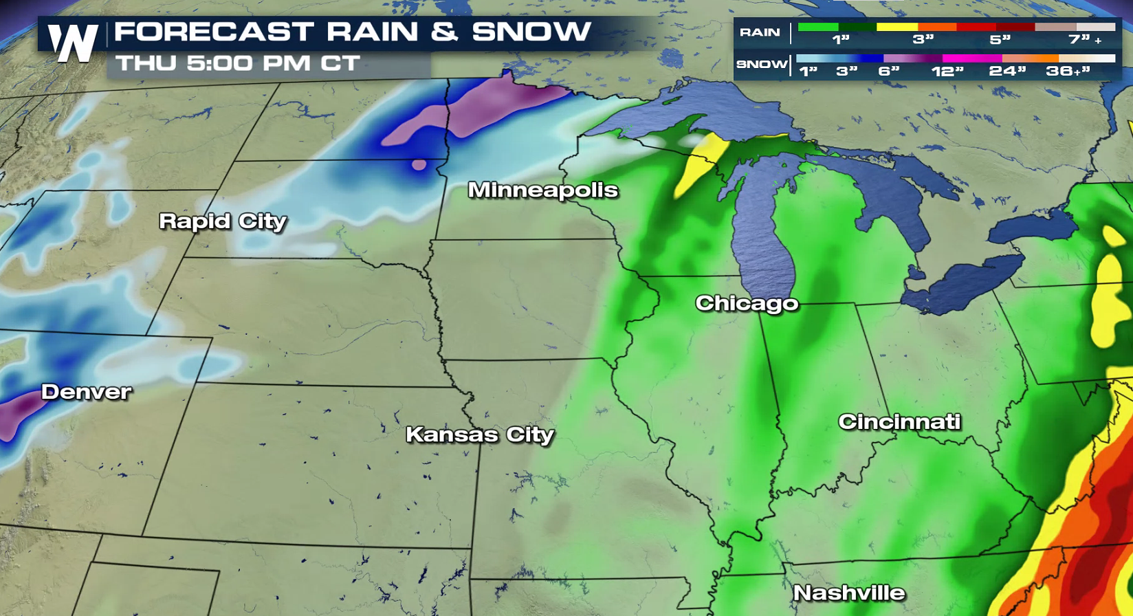 An additional 1" to 2" of rain is possible through Thursday. Due to the already saturated ground from the rain that has occurred over the last week, rivers and streams will be susceptible to quick rises. There may be flooding in low-lying and poor drainage areas, including downstream of dams and other hydrological projects.
 For WeatherNation: Meteorologist Mace Michaels
An additional 1" to 2" of rain is possible through Thursday. Due to the already saturated ground from the rain that has occurred over the last week, rivers and streams will be susceptible to quick rises. There may be flooding in low-lying and poor drainage areas, including downstream of dams and other hydrological projects.
For WeatherNation: Meteorologist Mace MichaelsAll Weather News
More
Fronts Continue To Spark Severe Weather Across the Plains
A cold front that brought record lows to the
18 Jul 2025 10:40 PM

Extreme Heat Impacts for the East Coast & South
Extreme heat continues to impact several area
18 Jul 2025 10:05 PM

Flooding Threat Remains Elevated in the East
A cold front pushing through the Eastern Seab
18 Jul 2025 9:10 PM

EF-2 Firenado from the Deer Creek Fire in Utah
A fire tornado was spotted near La Sal, Utah
18 Jul 2025 7:30 AM

Tropical System Brings Flood Risk to the Central Gulf
Time has run out for notable tropical develop
18 Jul 2025 3:05 AM

Heavy Rain, Flooding Threat Returns to Florida
Keep the rain boots handy in Florida - heavy
13 Jul 2025 12:50 PM

Severe Storm Risk Pushes into the Great Lakes, Ohio Valley
Friday was another busy day with severe weath
12 Jul 2025 8:00 PM