More Flooding Possible in the South
Special Stories
26 Feb 2018 4:17 PM
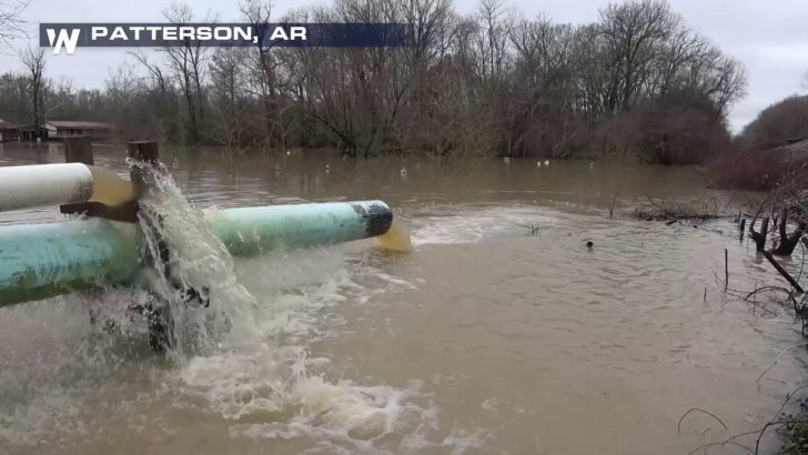
Heavy rain and severe thunderstorms will once again bring the threat of flooding to the southern United States. Even areas as far north as the Ohio Valley will deal with this threat during the middle of the week. Unfortunately, many of these locations are still reeling from last week's historic rain and flooding.
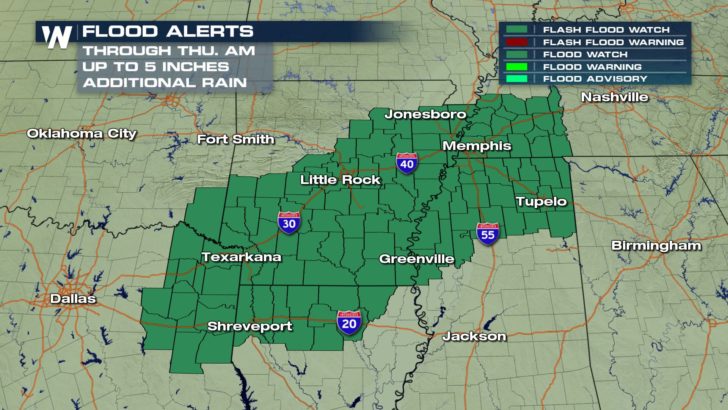
 Flood and Flash Flood Watches were posted by the National Weather Service Monday afternoon from the Ark-La-Tex region into West Tennessee. These watches will likely be expanded, so be sure to give WeatherNation a follow on Twitter for the latest information.
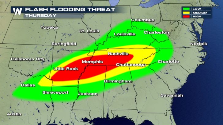
 The risk for flash flooding in this area is fairly high, considering the ground is already saturated and river levels are running high.
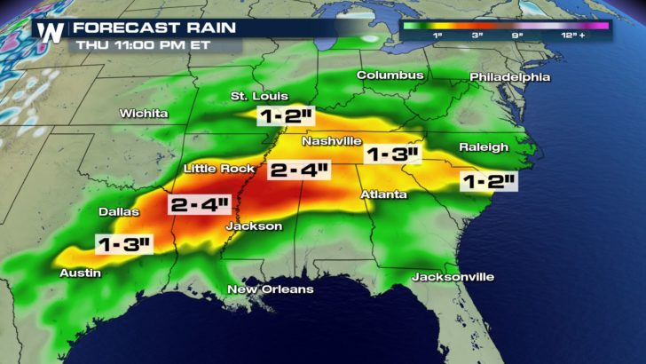
 Rainfall rates will be the highest in thunderstorms. Several cities like Shreveport, Little Rock, and Memphis could potentially pick up 2 to 4 inches of rain. Isolated pockets of 5 inches will be possible between Tuesday and Thursday.
 The end of February and beginning of March is shaping up to be quite stormy and soggy throughout the South.
-Meteorologist Joe Astolfi
 Flood and Flash Flood Watches were posted by the National Weather Service Monday afternoon from the Ark-La-Tex region into West Tennessee. These watches will likely be expanded, so be sure to give WeatherNation a follow on Twitter for the latest information.
 The risk for flash flooding in this area is fairly high, considering the ground is already saturated and river levels are running high.
 Rainfall rates will be the highest in thunderstorms. Several cities like Shreveport, Little Rock, and Memphis could potentially pick up 2 to 4 inches of rain. Isolated pockets of 5 inches will be possible between Tuesday and Thursday.
 The end of February and beginning of March is shaping up to be quite stormy and soggy throughout the South.
-Meteorologist Joe Astolfi
The end of February and beginning of March is shaping up to be quite stormy and soggy throughout the South.
-Meteorologist Joe AstolfiAll Weather News
More