Flooding Potential Along the Ohio River
Special Stories
16 Aug 2018 8:43 AM
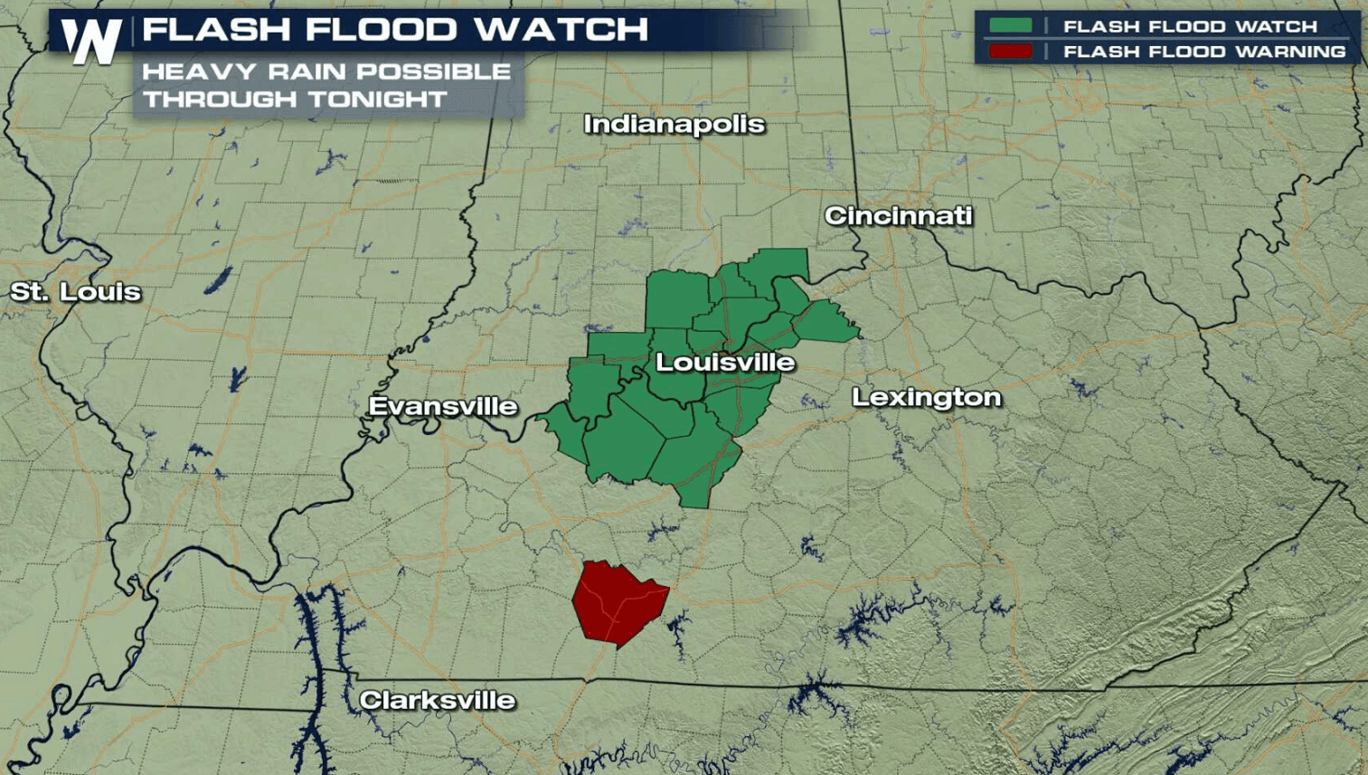
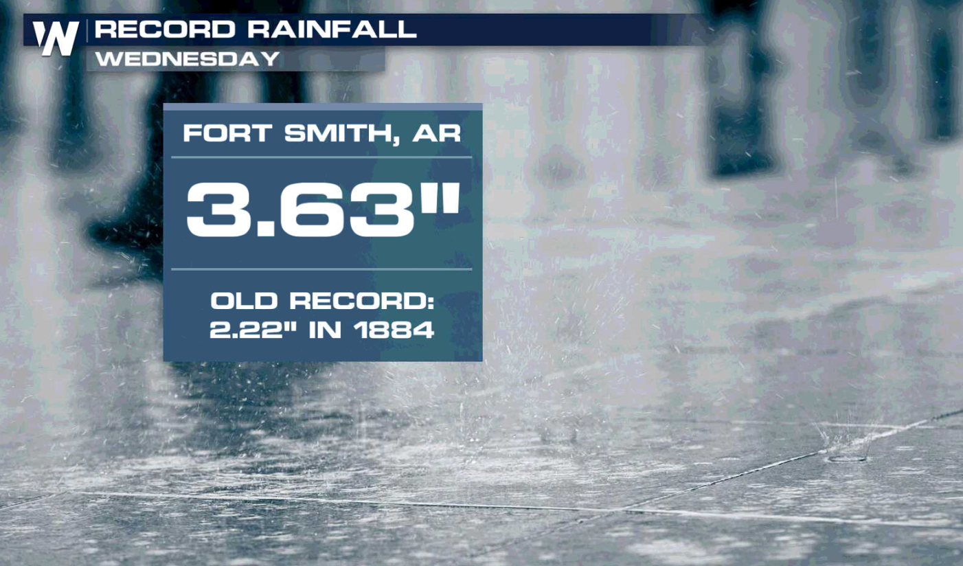
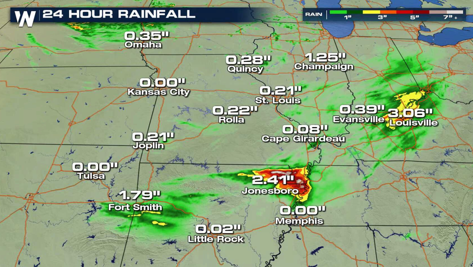
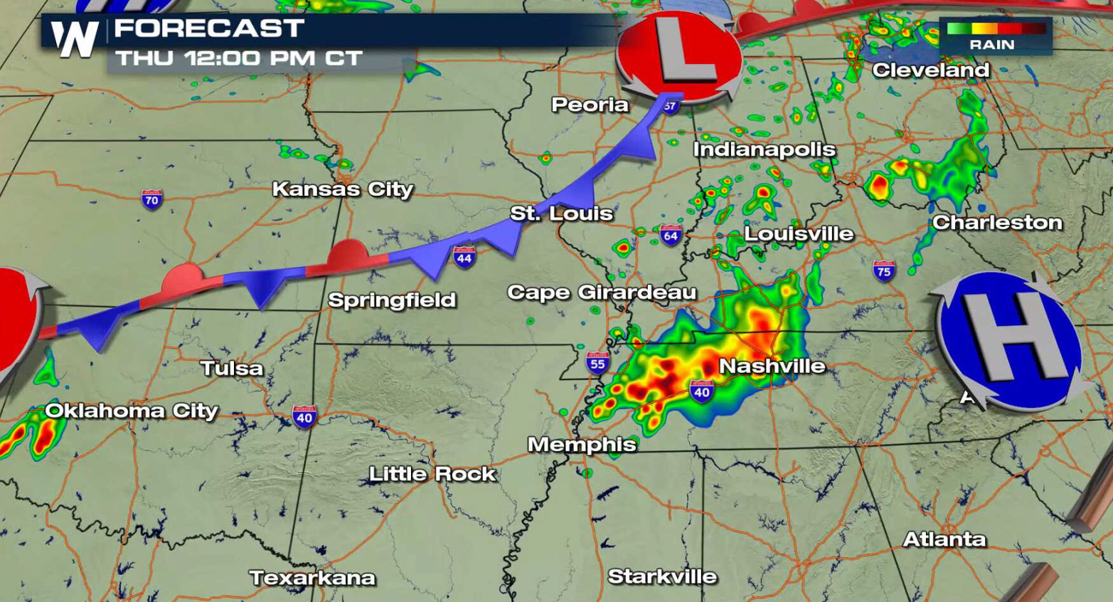
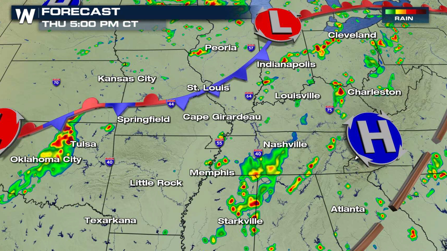
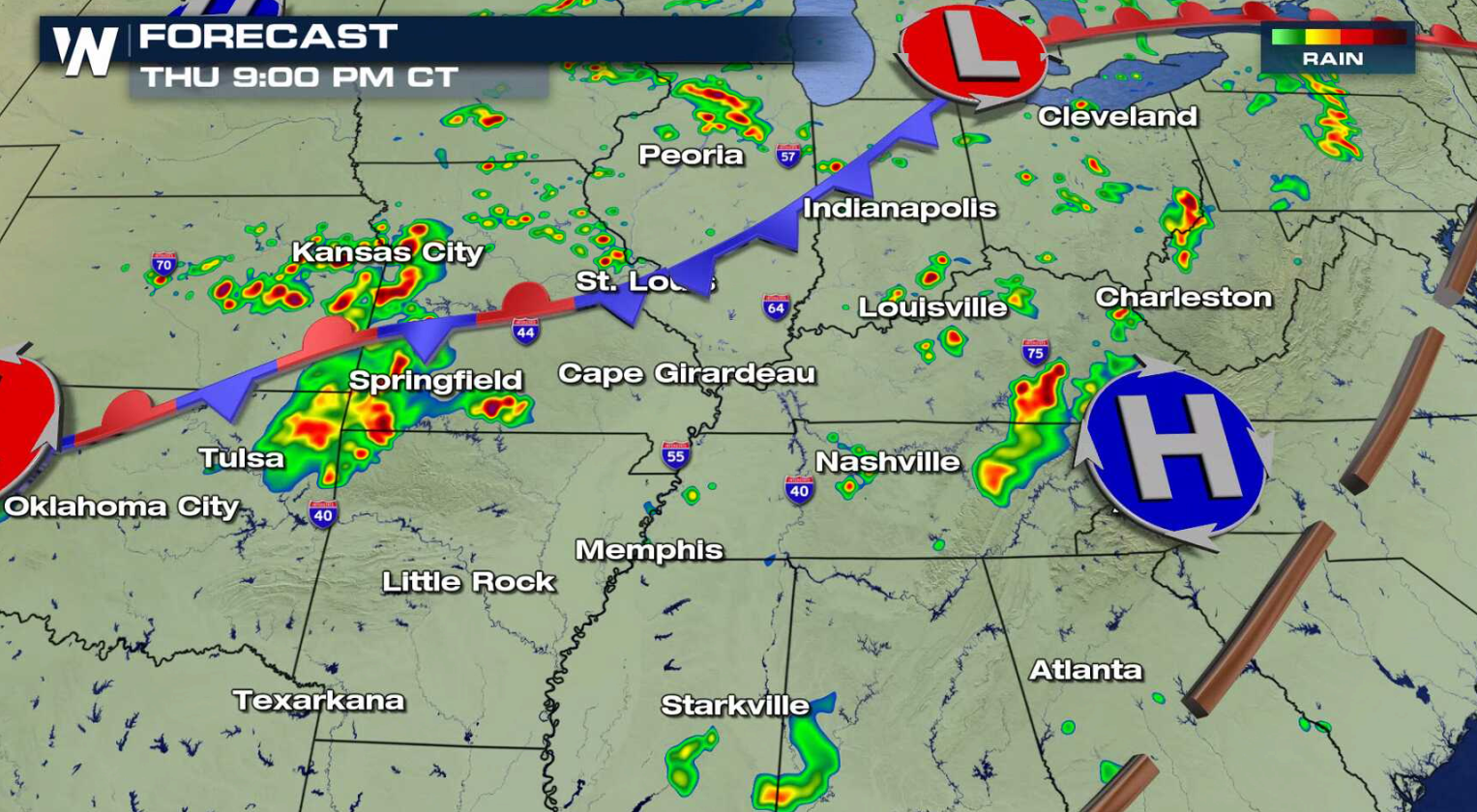
Numerous showers and thunderstorms fell from the Plains into the Ohio Valley on Wednesday, producing more than 3" of rain in some areas with flooding. More thunderstorms are ahead today (Thursday) with a risk for flooding in Indiana and Kentucky along the Ohio River. Flash Flood Watches have been issued into this afternoon, centered near Louisville.
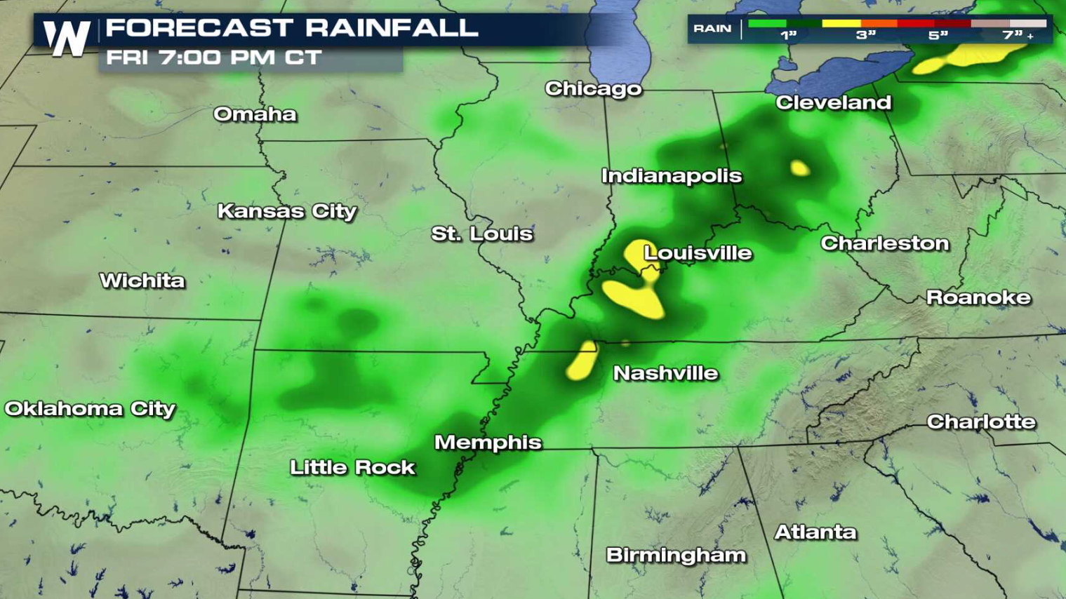 A front is dropping slowly south from the Great Lakes to the Plains. High humidity ahead of the system will provide significant moisture for thunderstorms to produce heavy rainfall. Coverage will be scattered and not widespread, but amounts could reach higher than 3" in the heaviest storms. This could lead to flooding, especially in areas where soils are over-saturated.
 For WeatherNation: Meteorologist Mace Michaels
A front is dropping slowly south from the Great Lakes to the Plains. High humidity ahead of the system will provide significant moisture for thunderstorms to produce heavy rainfall. Coverage will be scattered and not widespread, but amounts could reach higher than 3" in the heaviest storms. This could lead to flooding, especially in areas where soils are over-saturated.
For WeatherNation: Meteorologist Mace MichaelsAll Weather News
More
Wildfire Outbreak in the Pacific Northwest
SPOKANE, WA - On Saturday, August 1st, the Ol
3 Aug 2026 1:55 AM

More Storms for the East Through Monday
A low-pressure system that moved through the
3 Aug 2026 1:50 AM


After Reaching Category 5, Genevieve Weakens in the Pacific
PacificGenevieve formed last Friday south of
3 Aug 2026 12:30 AM

Flooding, Severe Storms Target the Midwest Again
After an active week of storms across the nor
1 Aug 2026 1:40 AM

Flooding Risk Increases as Heavy Rain Targets the Tri-State Area
Tuesday, heavy rainfall moved across the Nort
30 Jul 2026 12:25 AM

Severe Weather: Energy From the Midwest Now in the Southeast
UPPER MIDWEST - Through Monday, dangerous tor
29 Jul 2026 10:30 PM