Flooding Potential for California Today and Tomorrow

Top Stories
21 Mar 2018 4:37 AM
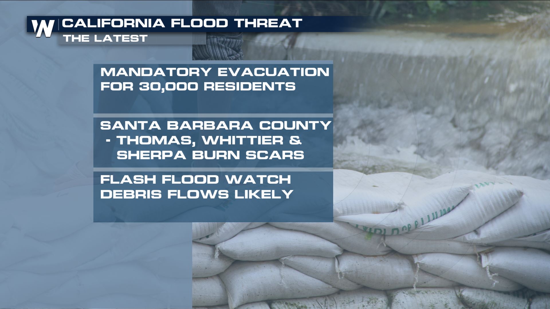
A system moving into the Western U.S. will bring the potential for heavy mountain snow and heavy rain in the lower elevations. Areas that are dealing with the burn scars from the wildfires last year will have to really be on alert for flash flooding and debris flow.
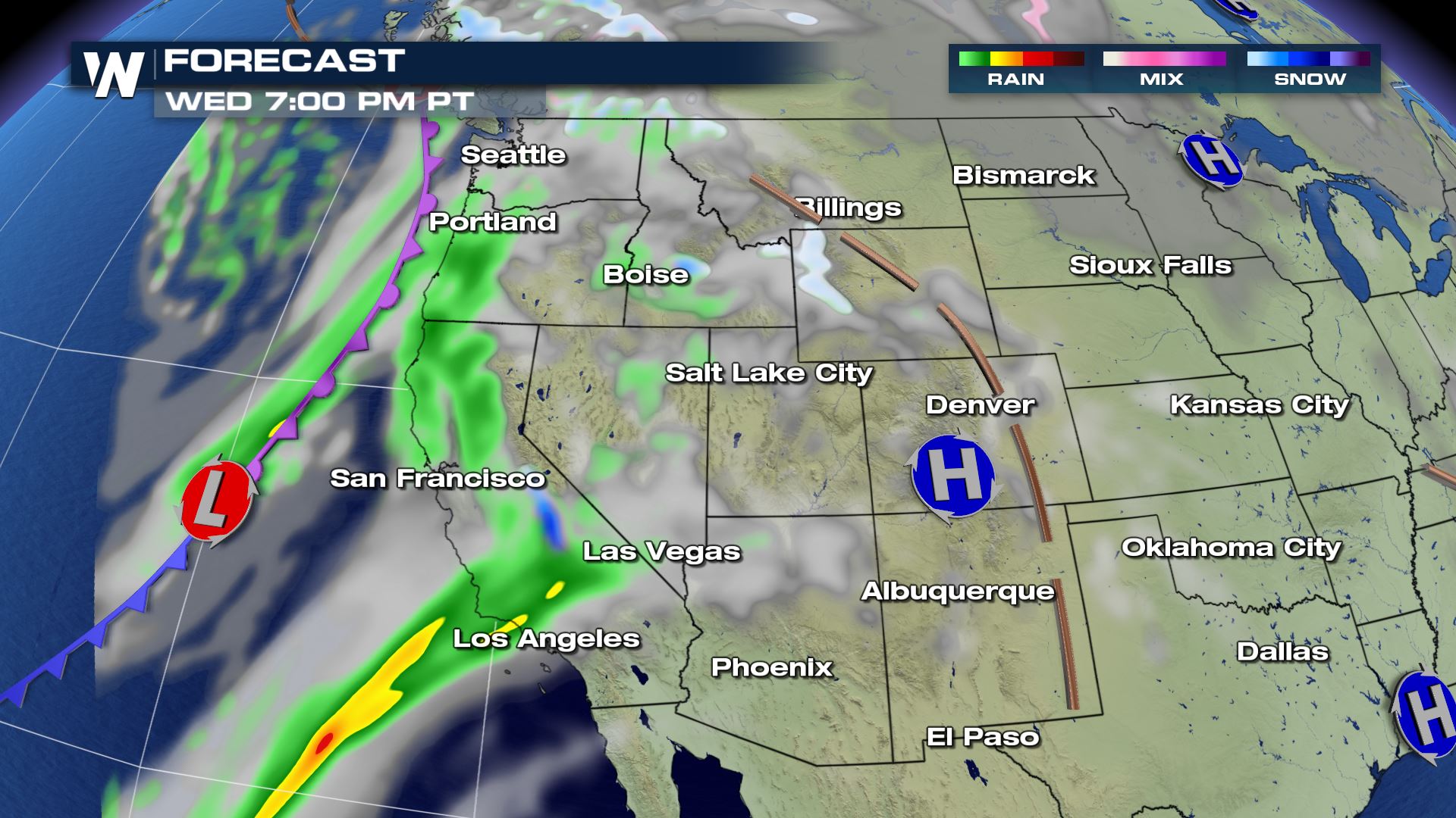
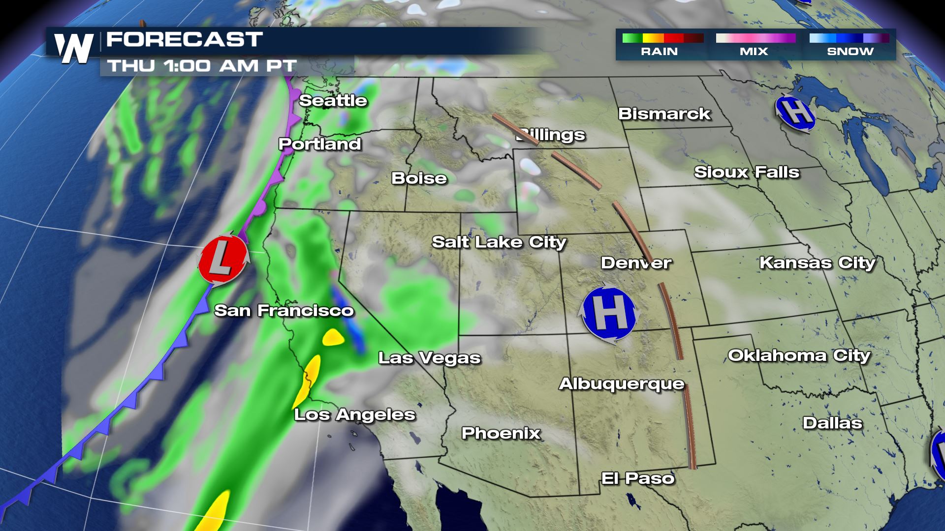
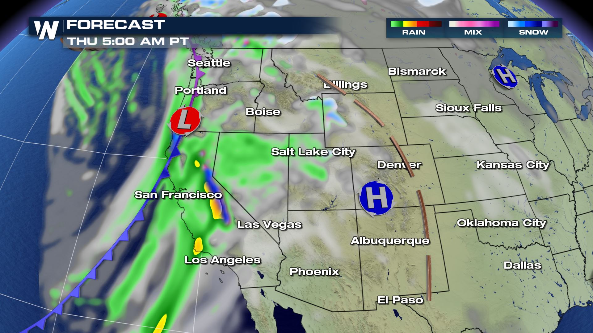
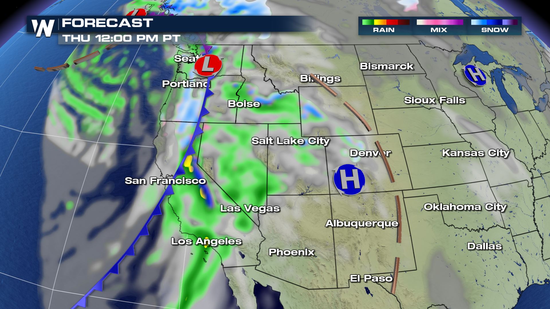 A cold front pushing into California will have plenty of Pacific Moisture to work with and this will help generate heavy precipitation for parts of California and Nevada. Heavy rainfall in addition to snow melt will create excess runoff and bring a threat of flash flooding, mudslides, rock slides and debris flows, particularly in the vicinity of the Detwiler and Pier fire burn scars.
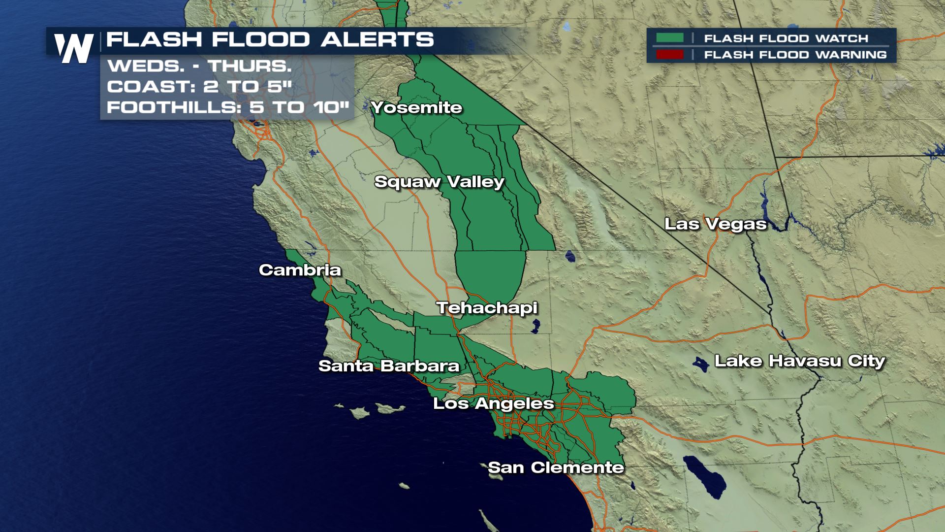 Several inches of rainfall will be possible today and tomorrow and this means some flash flood alerts for parts of California. Some roads may become impassable or become completely washed out. Anyone in these areas should be on alert for rising waters on area streams.
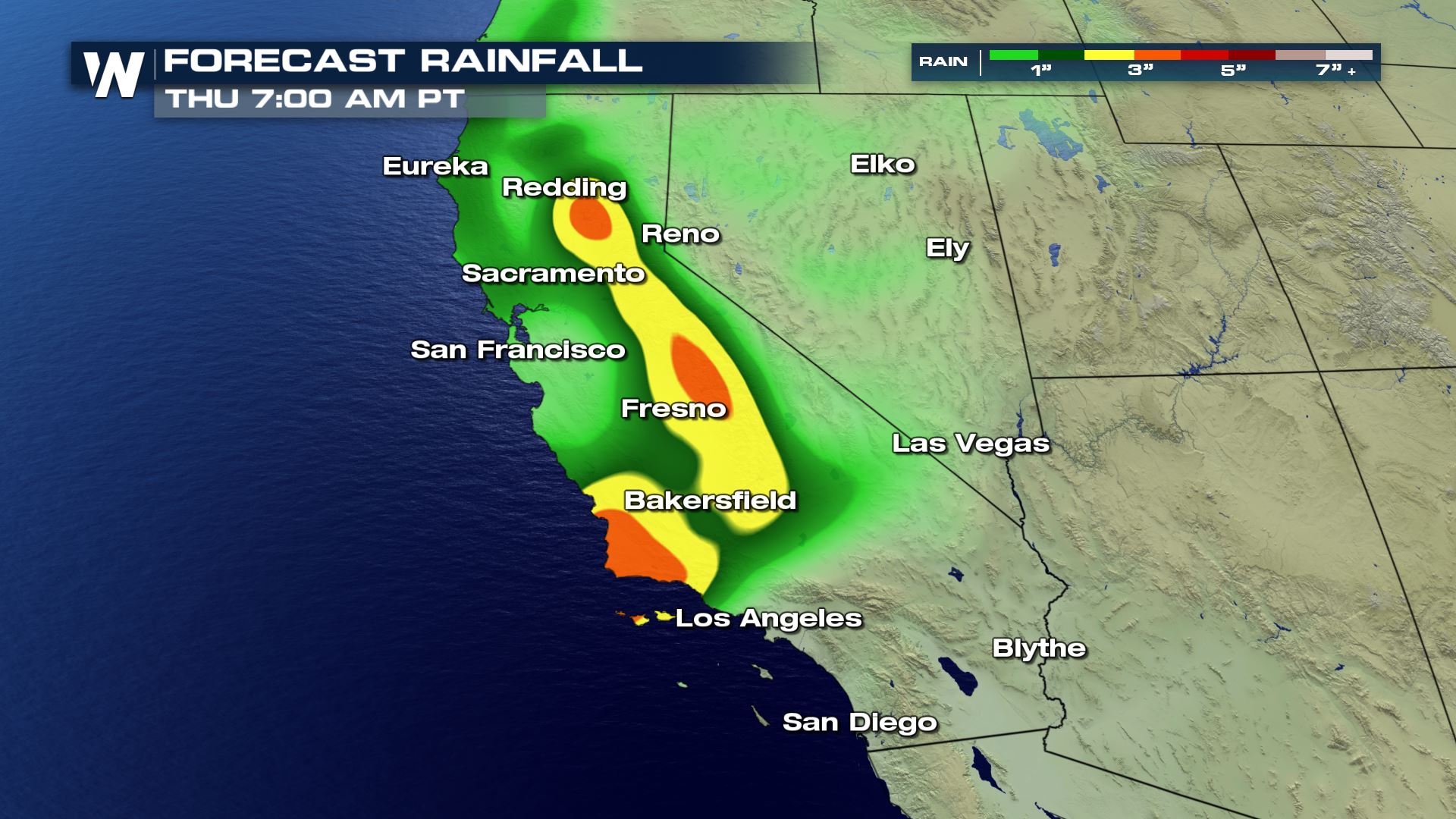 Take a look at the latest rainfall forecast through Thursday morning. The potential for 1-3 inches of rainfall for areas like Bakersfield, Fresno and Redding will be possible the rest of Wednesday.
Meteorologist Patrick Crawford
Take a look at the latest rainfall forecast through Thursday morning. The potential for 1-3 inches of rainfall for areas like Bakersfield, Fresno and Redding will be possible the rest of Wednesday.
Meteorologist Patrick Crawford
Forecast
A cold front pushing into California will have plenty of Pacific Moisture to work with and this will help generate heavy precipitation for parts of California and Nevada. Heavy rainfall in addition to snow melt will create excess runoff and bring a threat of flash flooding, mudslides, rock slides and debris flows, particularly in the vicinity of the Detwiler and Pier fire burn scars.
Flood Alerts
Several inches of rainfall will be possible today and tomorrow and this means some flash flood alerts for parts of California. Some roads may become impassable or become completely washed out. Anyone in these areas should be on alert for rising waters on area streams.
Rainfall Forecast
Take a look at the latest rainfall forecast through Thursday morning. The potential for 1-3 inches of rainfall for areas like Bakersfield, Fresno and Redding will be possible the rest of Wednesday.
Meteorologist Patrick Crawford
All Weather News
More
Wildfire Outbreak in the Pacific Northwest
SPOKANE, WA - On Saturday, August 1st, the Ol
3 Aug 2026 1:55 AM

More Storms for the East Through Monday
A low-pressure system that moved through the
3 Aug 2026 1:50 AM


After Reaching Category 5, Genevieve Weakens in the Pacific
PacificGenevieve formed last Friday south of
3 Aug 2026 12:30 AM

Flooding, Severe Storms Target the Midwest Again
After an active week of storms across the nor
1 Aug 2026 1:40 AM

Flooding Risk Increases as Heavy Rain Targets the Tri-State Area
Tuesday, heavy rainfall moved across the Nort
30 Jul 2026 12:25 AM

Severe Weather: Energy From the Midwest Now in the Southeast
UPPER MIDWEST - Through Monday, dangerous tor
29 Jul 2026 10:30 PM