Potential for Flooding Rains in the Middle Atlantic States
Special Stories
24 Jul 2018 9:27 AM
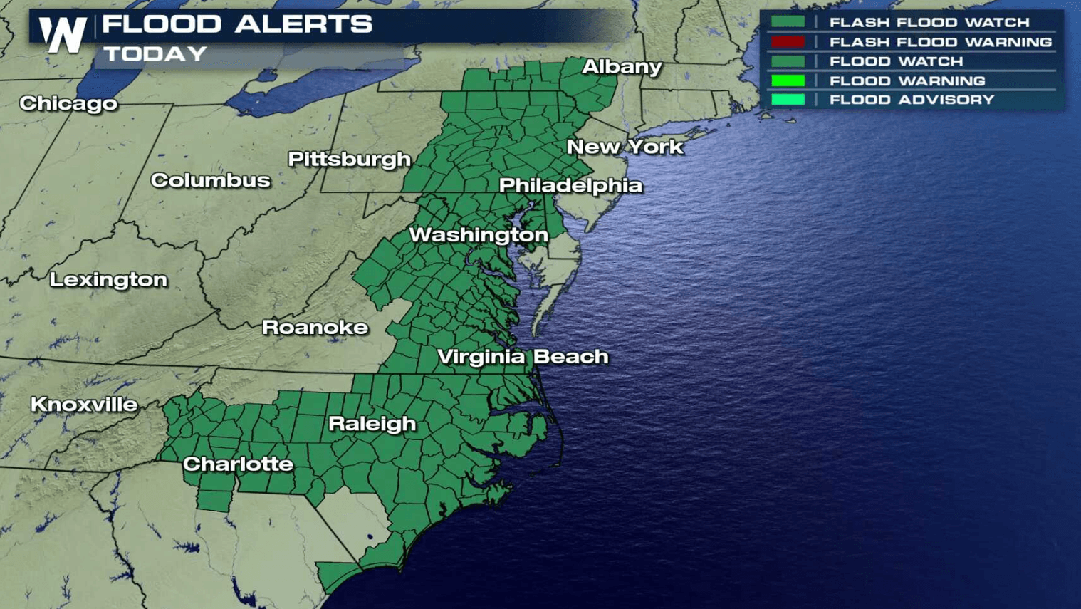
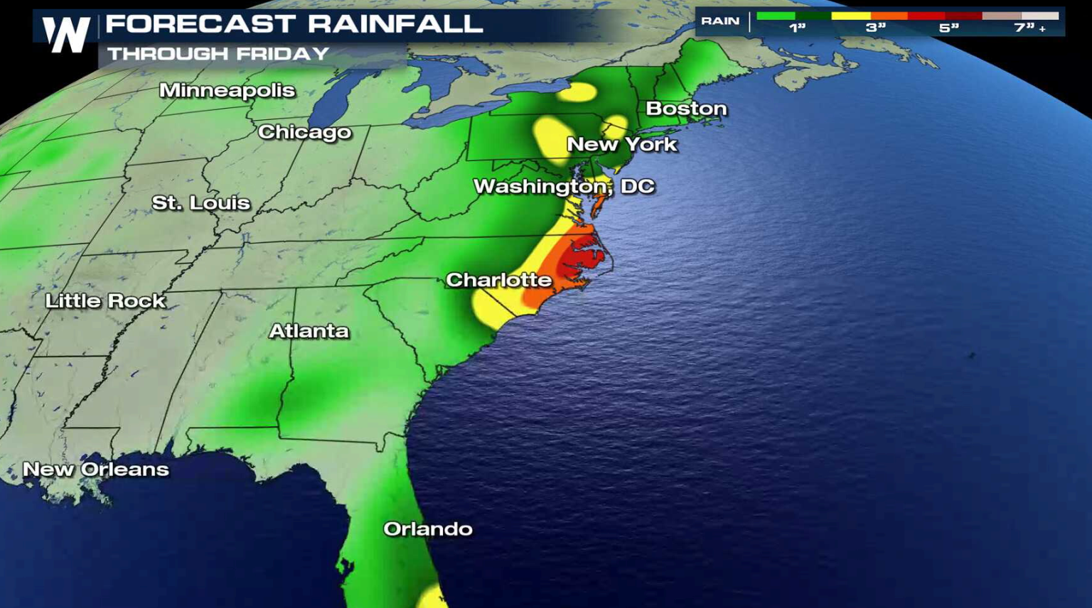
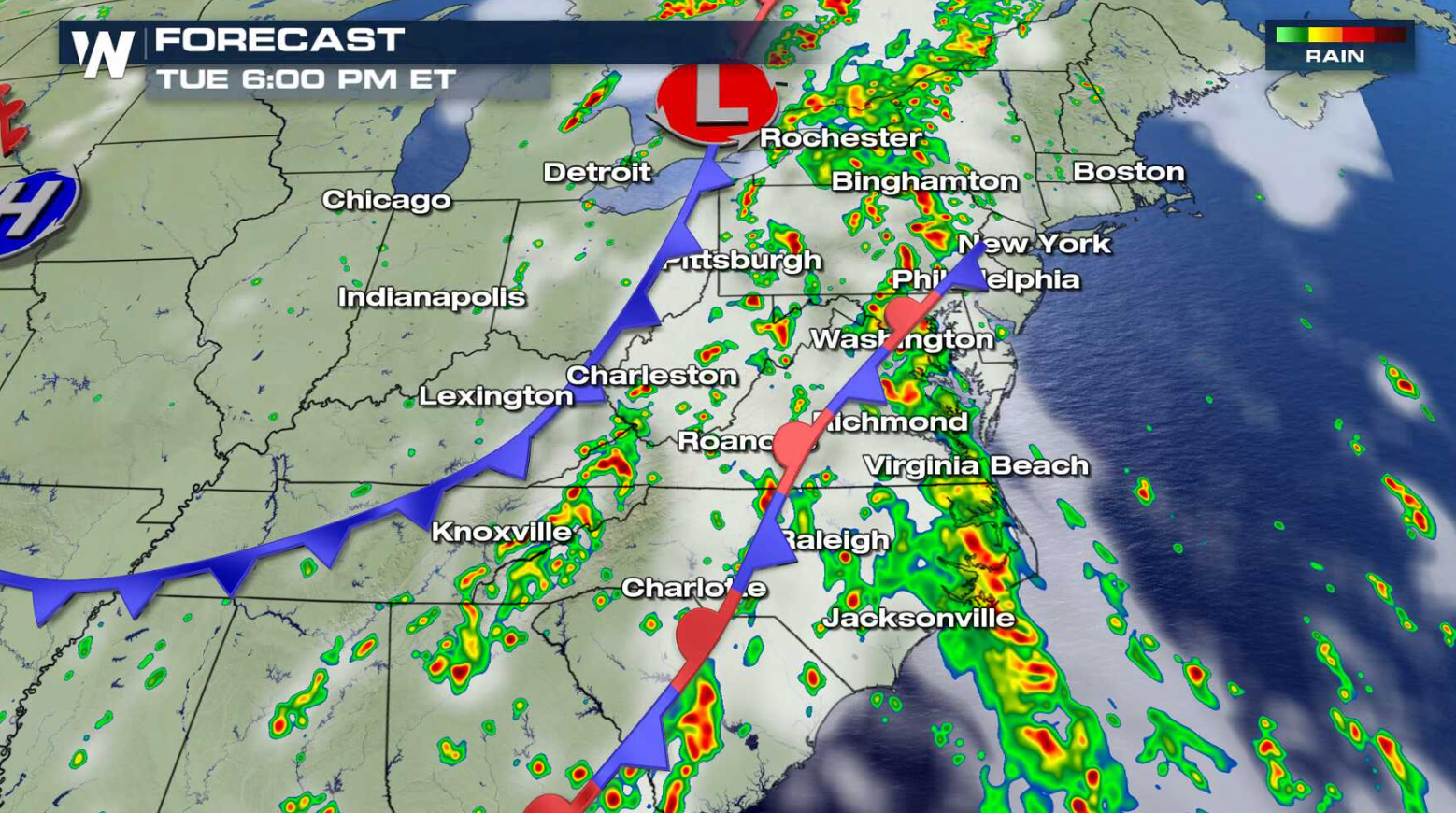
Flooding is possible in parts of the Eastern Seaboard as a slow moving storm system will produce rounds of heavy rain throughout the week. Flash Flood Watches continue from New York to South Carolina through Wednesday. Several inches of rain are possible through the week, especially in the Middle Atlantic states.
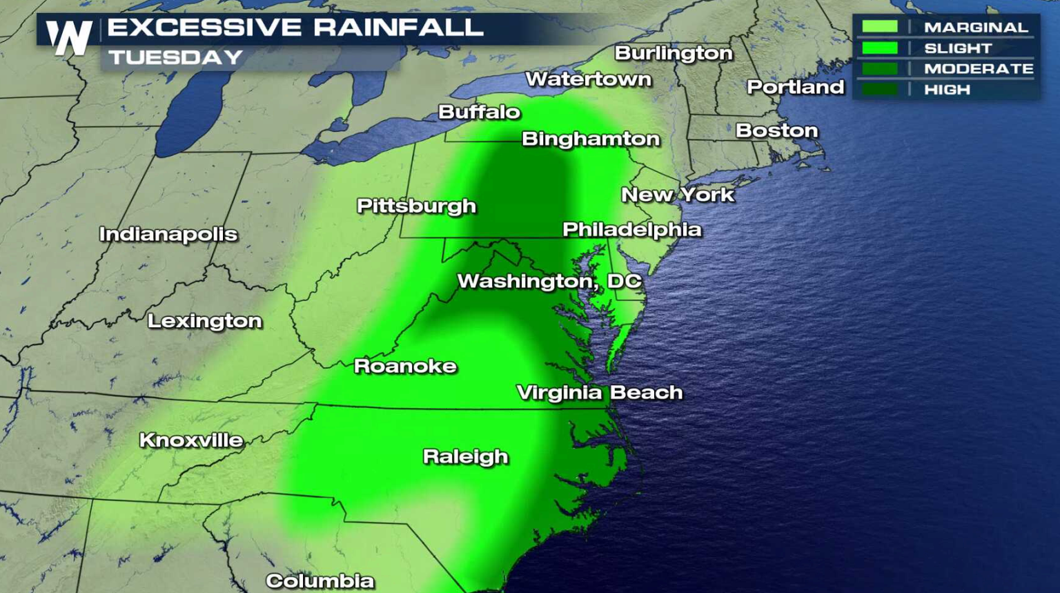
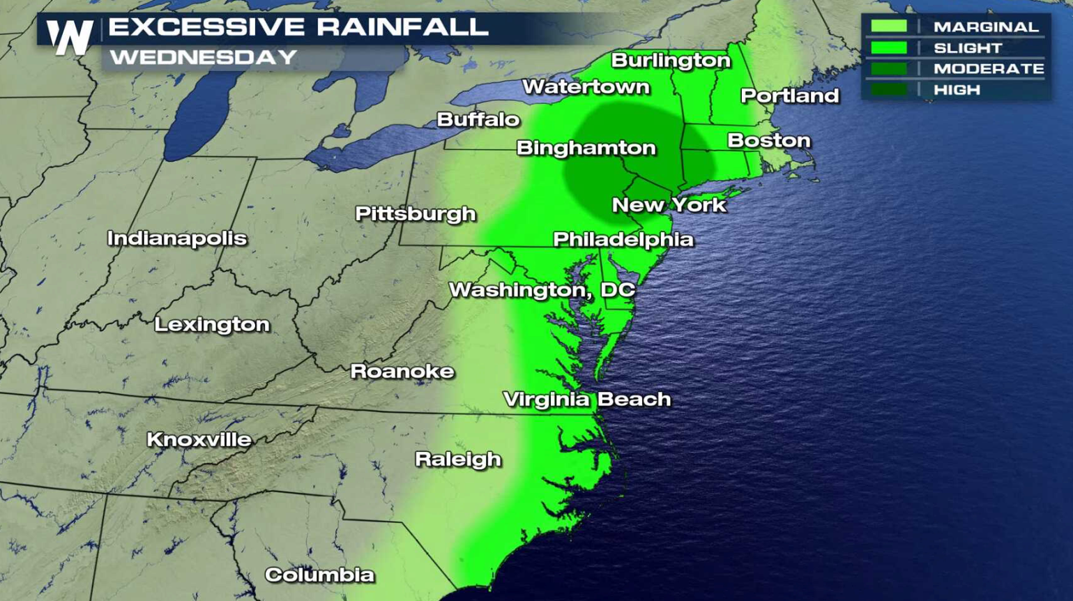
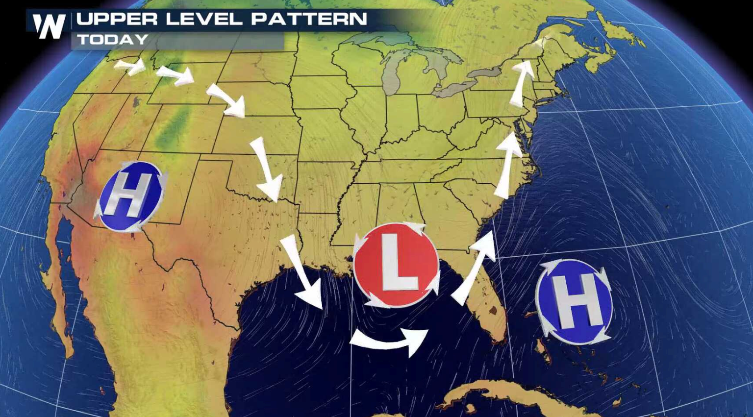
 A stalled front will stream high humidity northward from the Gulf of Mexico and Atlantic Ocean. As a second cold front approaches the area from the west, showers and thunderstorms will form. Slow moving storms may pass over similar areas, increasing the chance for flooding.
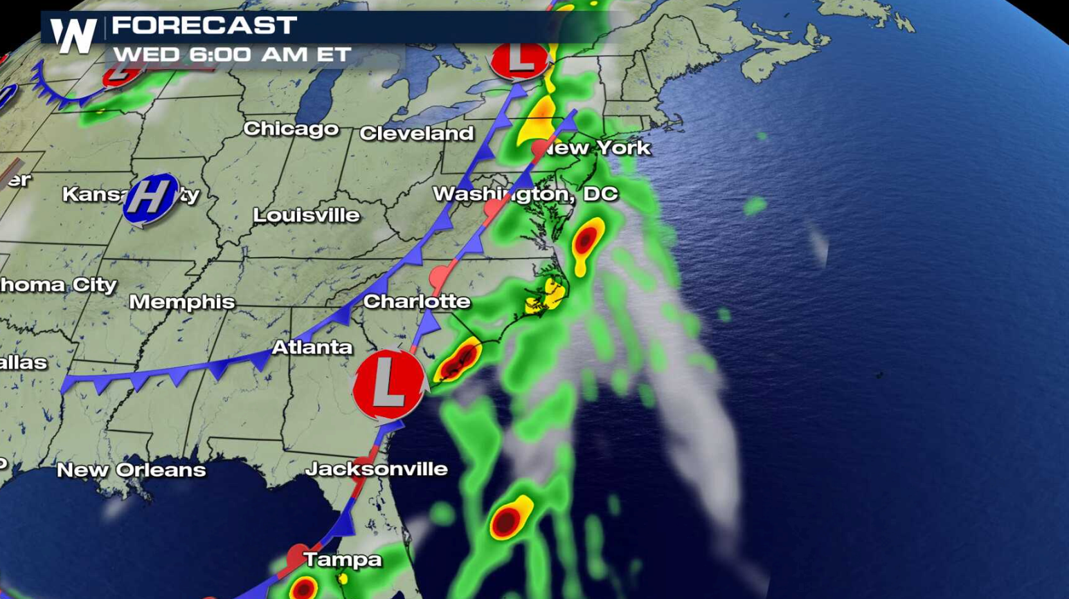
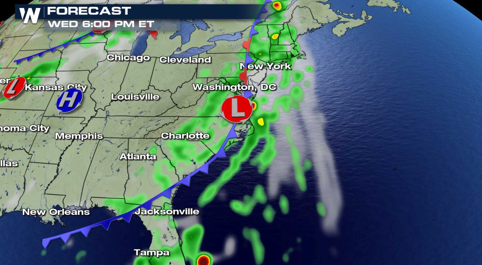 With a deep trough digging in the atmosphere across the East, the wet pattern will extend throughout the week and may continue into next week. More than 5" of rain may fall in some areas.
https://twitter.com/NWSCPC/status/1021545641481252864
With a deep trough digging in the atmosphere across the East, the wet pattern will extend throughout the week and may continue into next week. More than 5" of rain may fall in some areas.
https://twitter.com/NWSCPC/status/1021545641481252864
 For WeatherNation: Meteorologist Mace Michaels
A stalled front will stream high humidity northward from the Gulf of Mexico and Atlantic Ocean. As a second cold front approaches the area from the west, showers and thunderstorms will form. Slow moving storms may pass over similar areas, increasing the chance for flooding.
With a deep trough digging in the atmosphere across the East, the wet pattern will extend throughout the week and may continue into next week. More than 5" of rain may fall in some areas.
https://twitter.com/NWSCPC/status/1021545641481252864
For WeatherNation: Meteorologist Mace MichaelsAll Weather News
More
Tropical Storm Bertha Makes Landfall Along Gulf Coast
Wednesday afternoon: Bertha made landfall wit
23 Jul 2026 3:20 AM

Flash Flooding for the Carolinas This Week
Another stalled front in the Carolinas is for
23 Jul 2026 1:20 AM

Another Round of Storms Targets the Northeast
Tuesday brought severe weather again across p
23 Jul 2026 1:15 AM

Pacific Northwest Fires Bringing Down the Air Quality
Conditions have been really dry out west. We'
23 Jul 2026 1:00 AM

Another Round of Severe Weather for the Upper Midwest and Great Lakes
The upper-level low train continues to keep t
21 Jul 2026 1:45 AM

Air Quality Improvements in the Forecast
Wildfires burning in Northwestern Ontario, Ca
20 Jul 2026 7:20 PM

Monsoon Moisture Brings Weekend Flood Threat
The monsoon has returned to the southwestern
19 Jul 2026 1:30 AM