Flooding Risk from the Ohio Valley to the Northeast
Special Stories
1 Nov 2018 10:01 AM
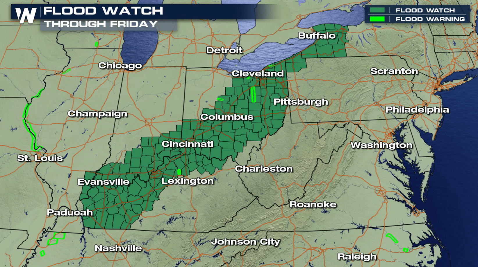
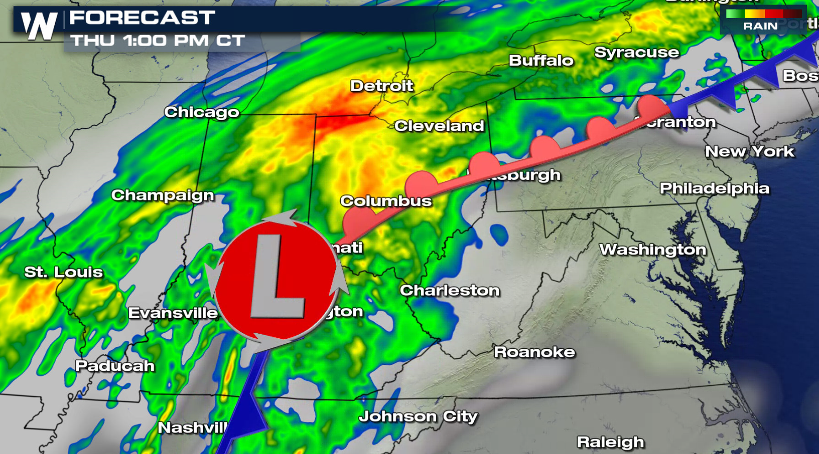
A cold front and low pressure center moving from the Ohio Valley into the Northeast will produce heavy rainfall through Friday. Flood-prone and low-lying areas will likely experience flooding issues. Rises on area creeks, streams, and rivers are expected. Urban street flooding may also occur. Rainfall totals will reach up to 3" in some areas.
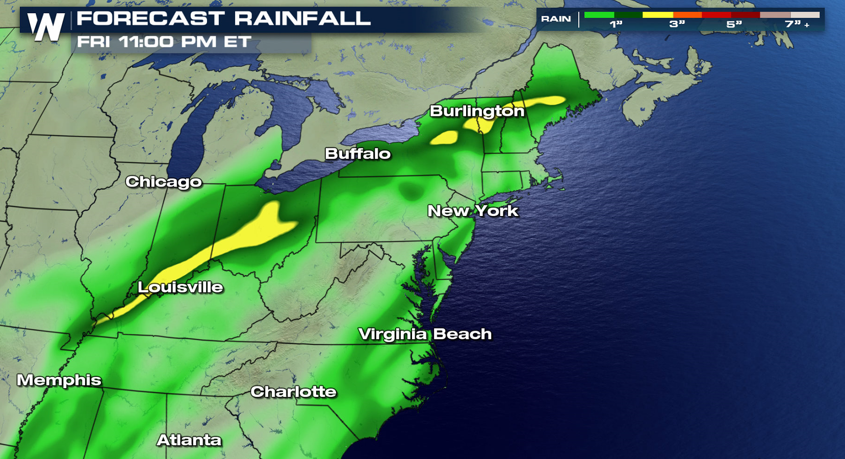
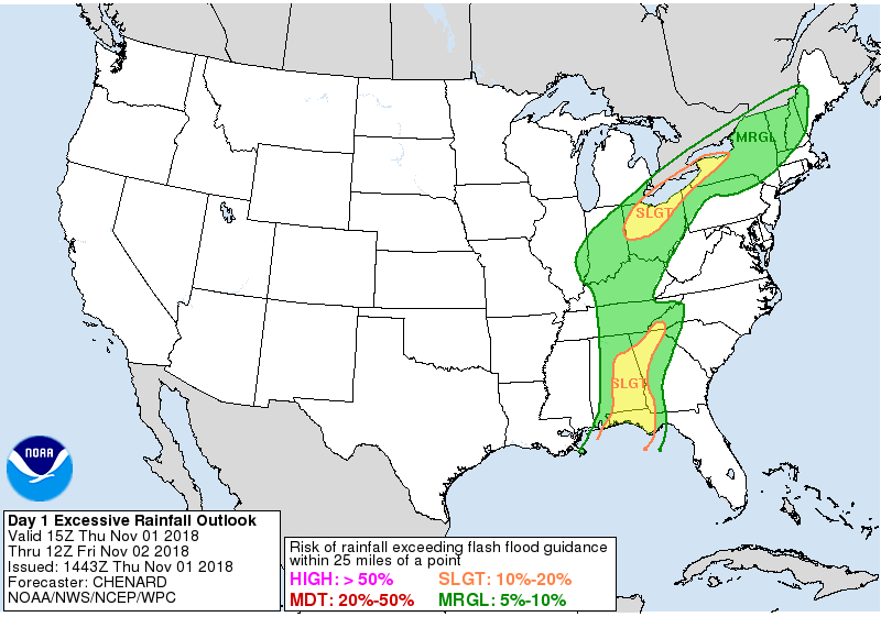
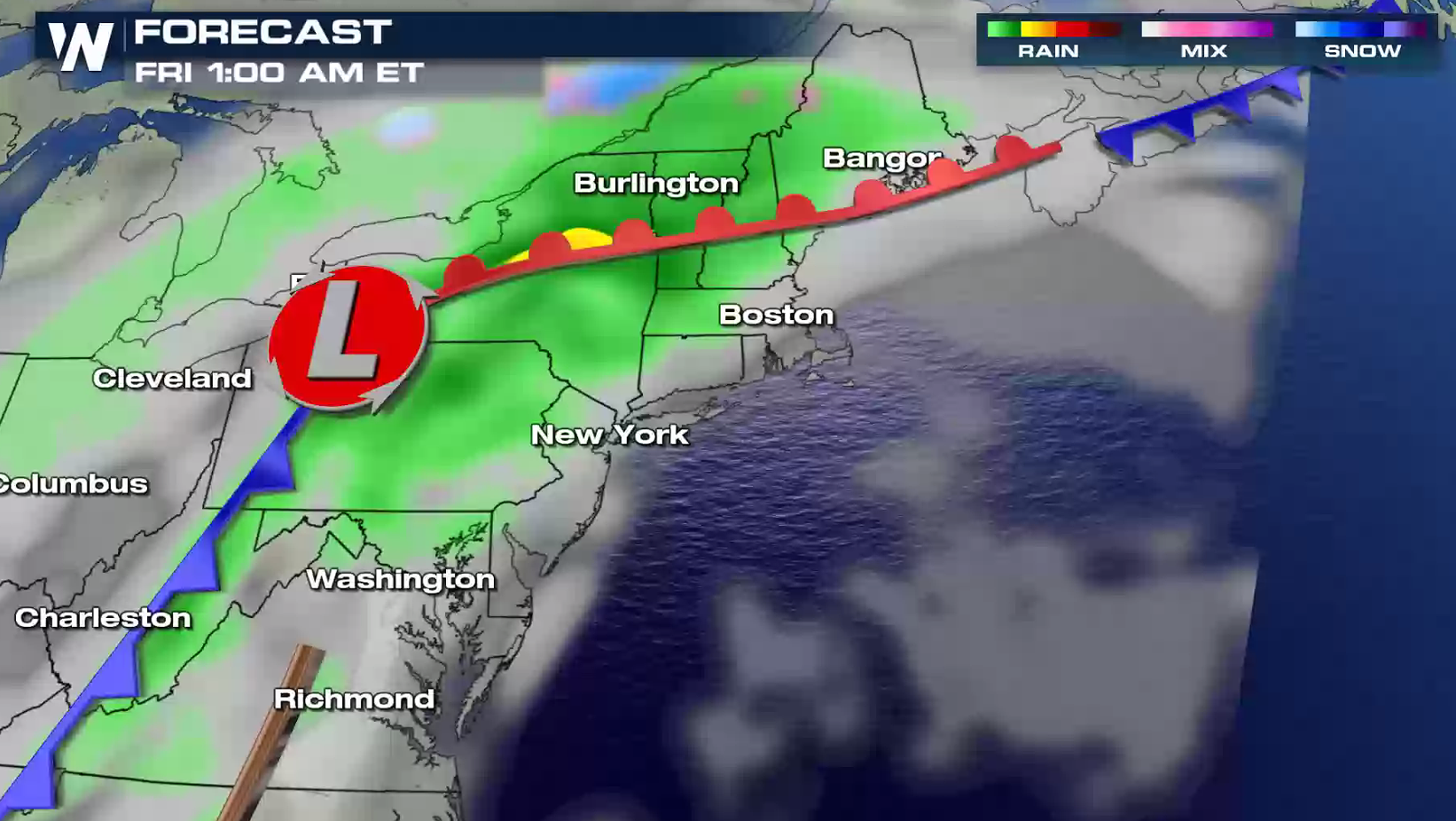
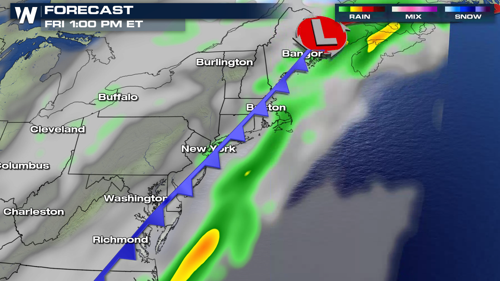
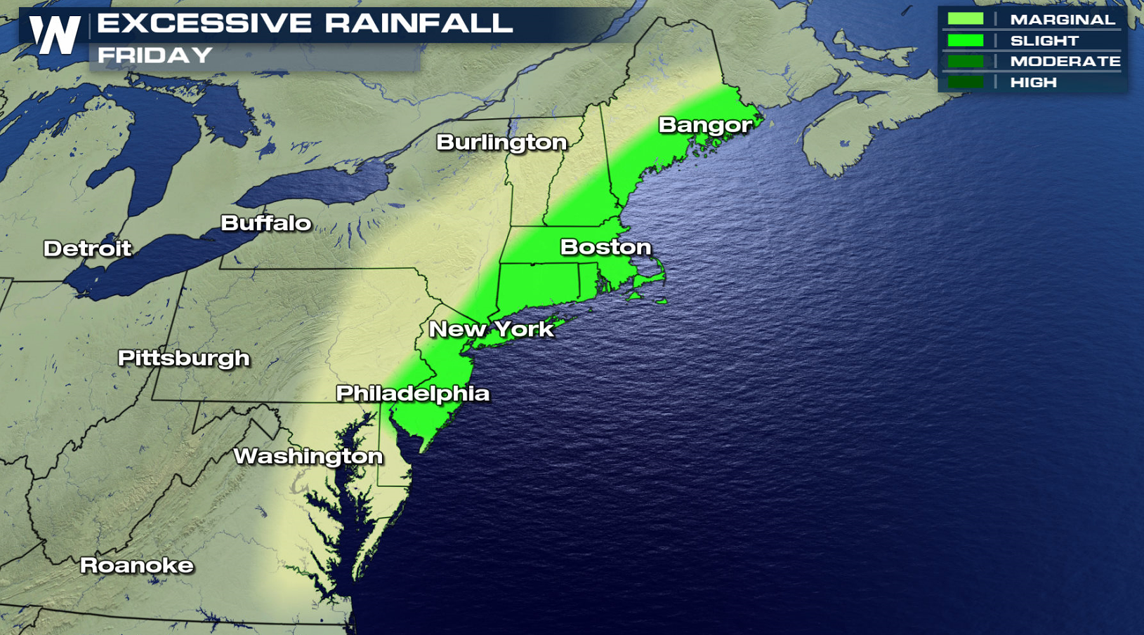 Heavy rain will continue across the Ohio Valley into this evening (Thursday) as the storm system slowly pushes to the north and east. The low pressure center will move into the Northeast on Friday, bringing a threat for excessive rainfall. The system will move into the Atlantic Ocean by Saturday, ending the risk for flooding.
 For WeatherNation: Meteorologist Mace Michaels
Heavy rain will continue across the Ohio Valley into this evening (Thursday) as the storm system slowly pushes to the north and east. The low pressure center will move into the Northeast on Friday, bringing a threat for excessive rainfall. The system will move into the Atlantic Ocean by Saturday, ending the risk for flooding.
For WeatherNation: Meteorologist Mace MichaelsAll Weather News
More

Flooding, Severe Storms Target the Midwest Again
After an active week of storms across the nor
1 Aug 2026 1:40 AM


After Reaching Category 5, Genevieve Weakens in the Pacific
PacificFausto is now a post-tropical cyclone.
31 Jul 2026 1:30 AM

Flooding Risk Increases as Heavy Rain Targets the Tri-State Area
Tuesday, heavy rainfall moved across the Nort
30 Jul 2026 12:25 AM

Severe Weather: Energy From the Midwest Now in the Southeast
UPPER MIDWEST - Through Monday, dangerous tor
29 Jul 2026 10:30 PM