Flooding Risk in the Southeast into Early Wednesday
Special Stories
24 Mar 2020 9:15 AM
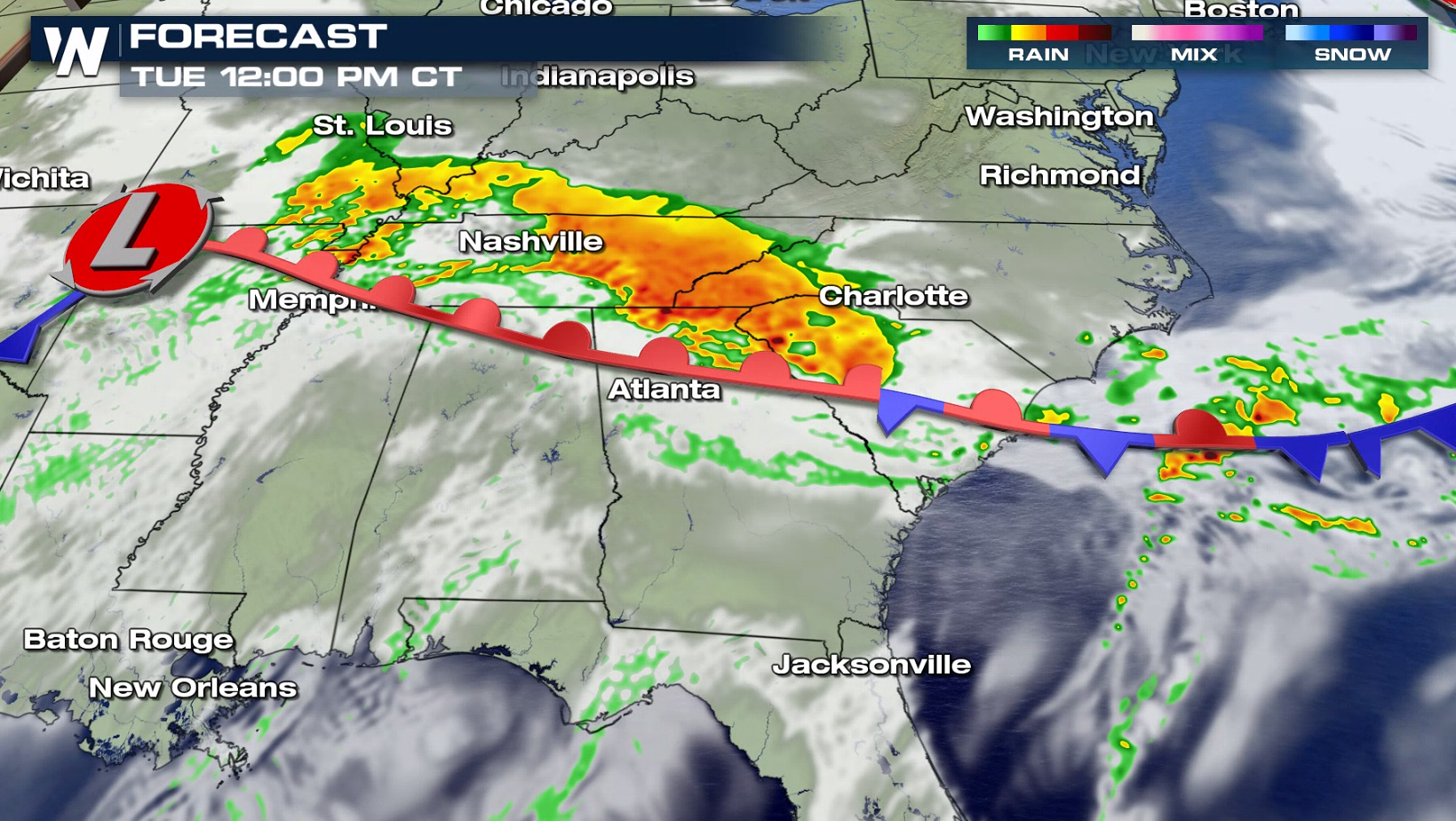
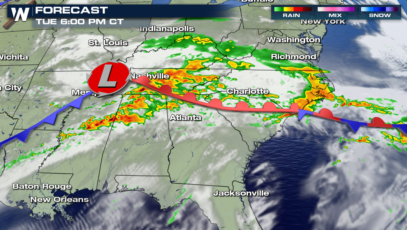
A potent storm system will bring several rounds of thunderstorms to the Southeast over the next 24 hours. With ongoing high rivers and stream and already saturated soils, runoff from additional rain will lead to a greater threat of flooding. Flash Flood Watches include portions of Tennessee, Alabama, Georgia, North and South Carolina.
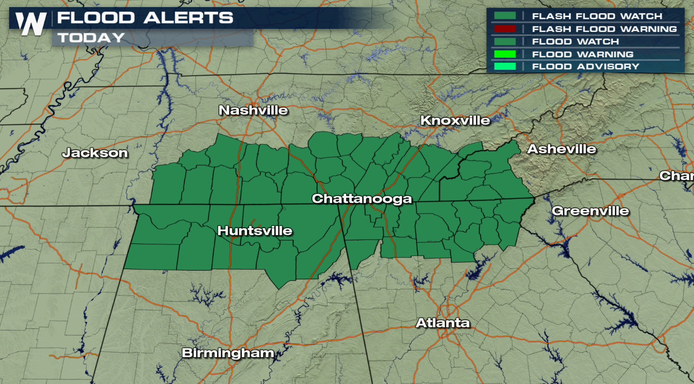
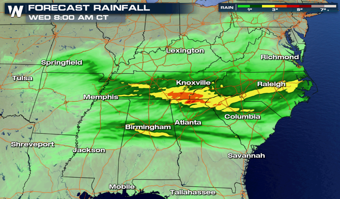
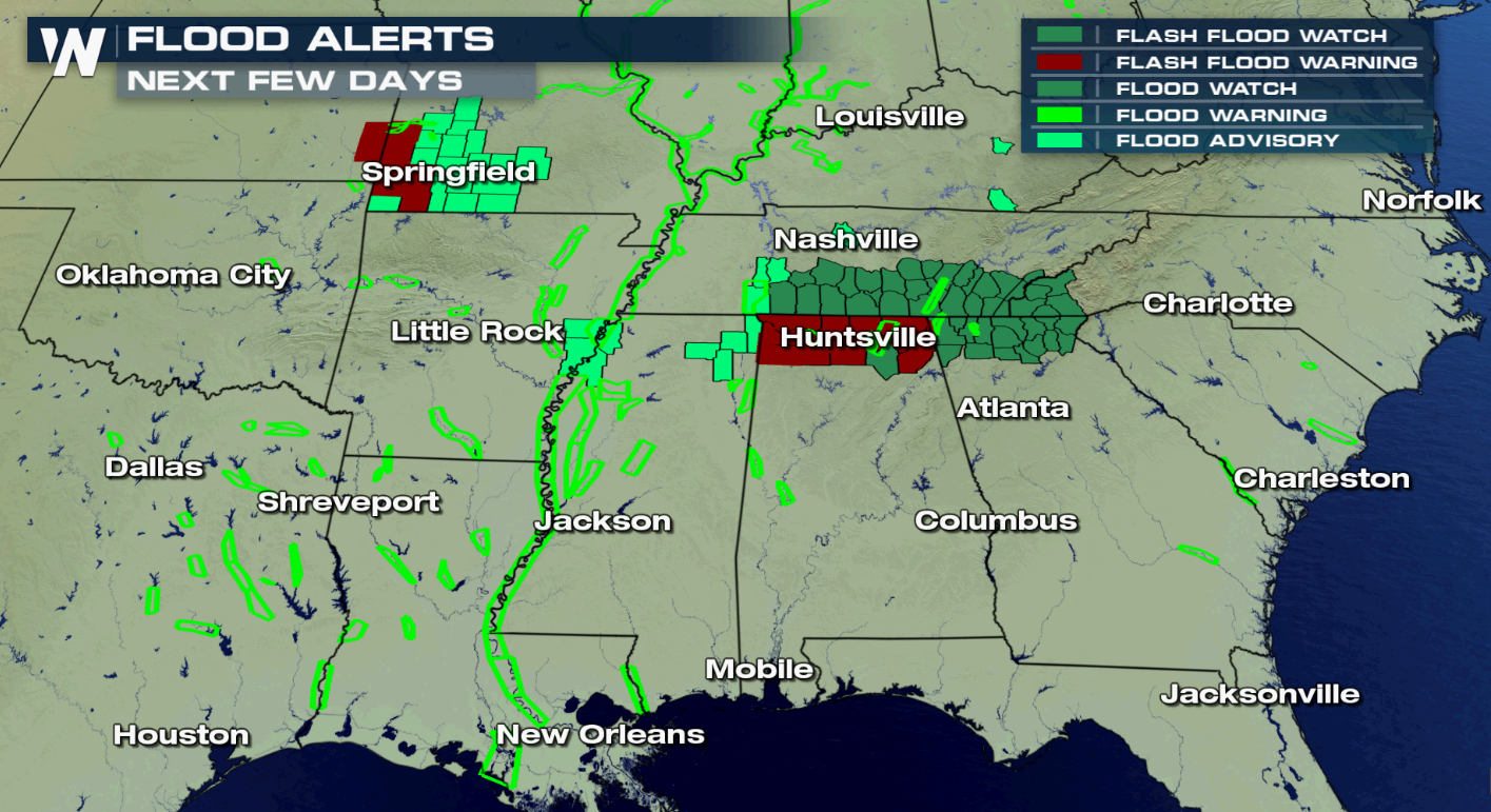 There is the potential for more than 3" of rain, especially in the Lookout Mountain Region. 1" to 3" will be common throughout the Tennessee Valley to the Outer Banks of North Carolina.
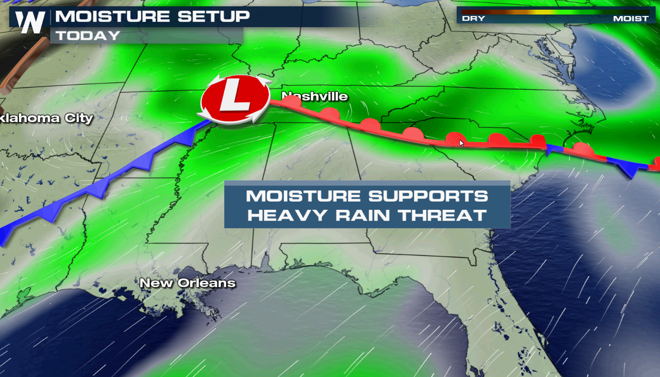 A low pressure center will push from the Central Plains today (Tuesday) into the Appalachians by Wednesday. Waves of showers and thunderstorms will track across the region, bringing heavy rain and the potential for flooding, especially in areas that see multiple storms.
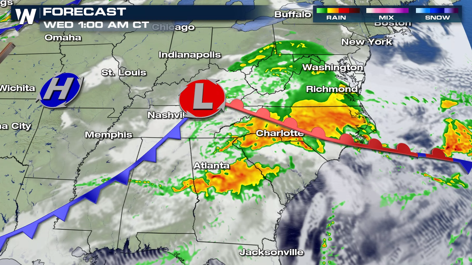 The heavy rainfall will come to an end Wednesday morning. WeatherNation will keep you up-to-date on the latest flooding risk on-air and online.

 There is the potential for more than 3" of rain, especially in the Lookout Mountain Region. 1" to 3" will be common throughout the Tennessee Valley to the Outer Banks of North Carolina.

 A low pressure center will push from the Central Plains today (Tuesday) into the Appalachians by Wednesday. Waves of showers and thunderstorms will track across the region, bringing heavy rain and the potential for flooding, especially in areas that see multiple storms.


 The heavy rainfall will come to an end Wednesday morning. WeatherNation will keep you up-to-date on the latest flooding risk on-air and online.
All Weather News
More