Flooding Risk Increases as Heavy Rain Targets the Tri-State Area

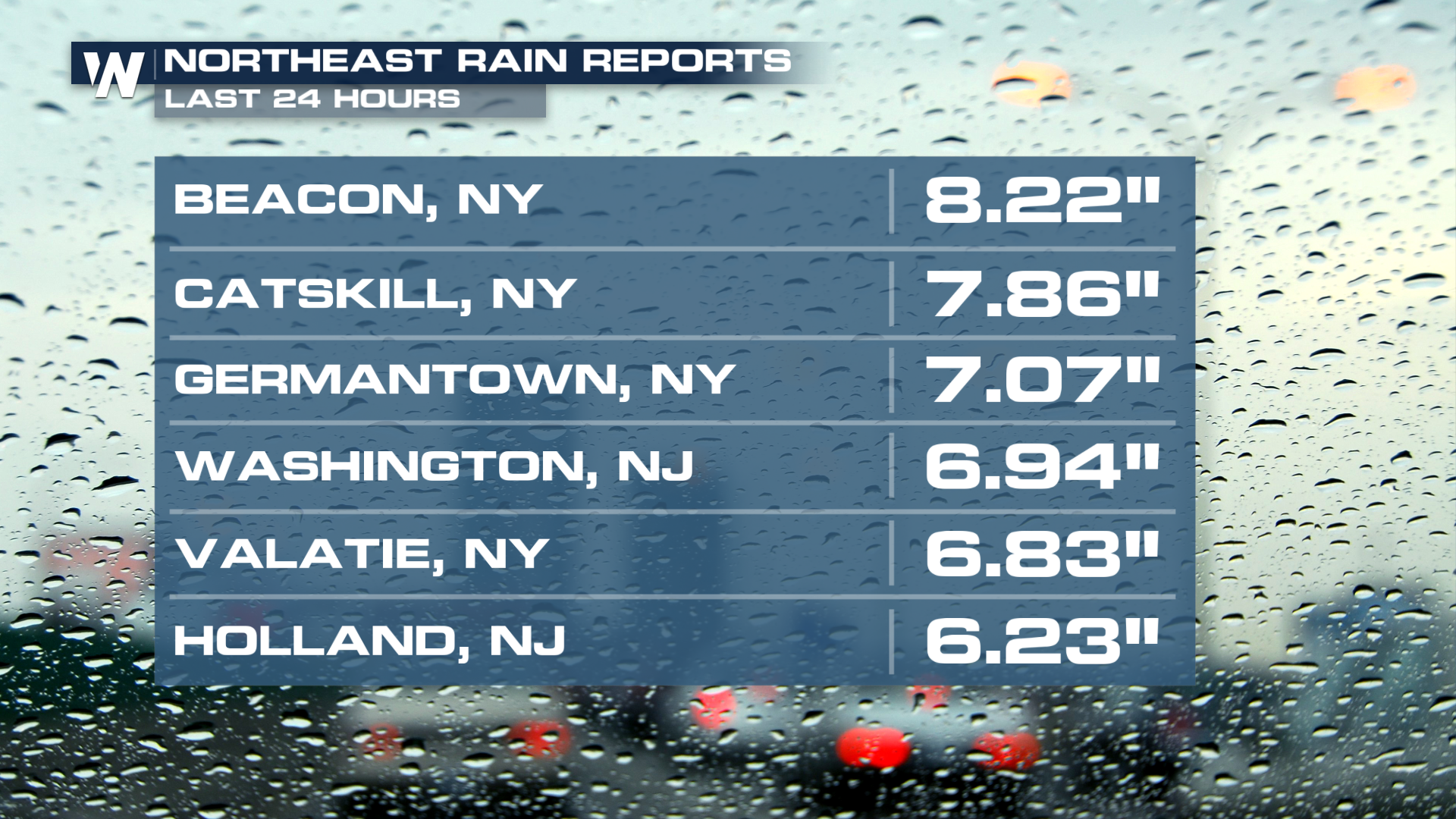
Tuesday, heavy rainfall moved across the Northeast in association with an upper-level low. Totals exceeded 6-7 inches for portions of New York and New Jersey.
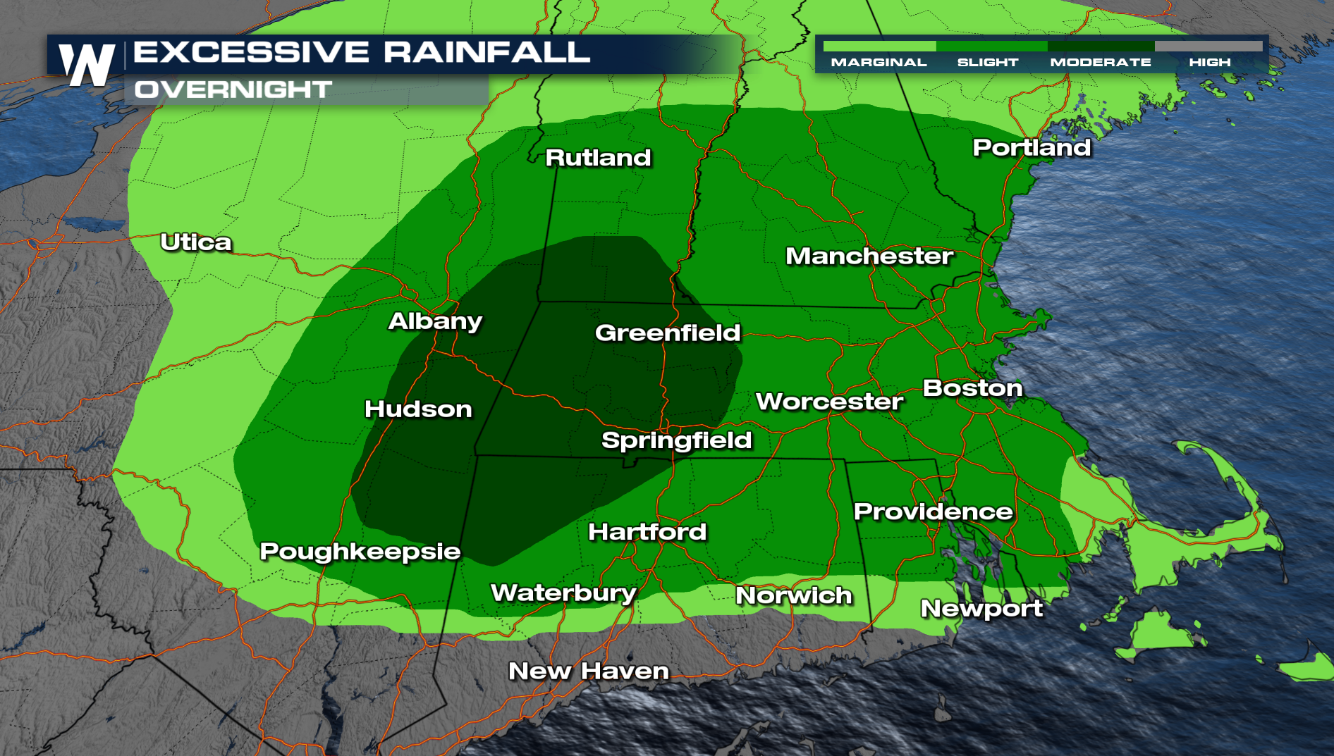
 An Excessive Rainfall Outlook remains through today as more storms are expected throughout this region. The Weather Prediction Center has placed portions of the New England area, under a MODERATE (level 3 out of 4) risk for flash flooding.
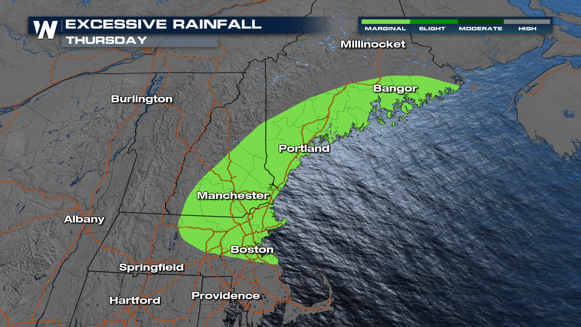
 Rainfall rates could reach 1 to 2 inches per hour, allowing several inches of rain to fall in a short amount of time. This could quickly overwhelm drainage systems and lead to dangerous flash flooding. Come Thursday, the flash flooding threat is expected to fall off. A MARGINAL (level 1 out of 4) risk remains in place, however. Cities like Boston will be under that threat for flash flooding for two days in a row.
Rainfall totals through Thursday morning could exceed an additional 5 inches across parts of western Massachusetts.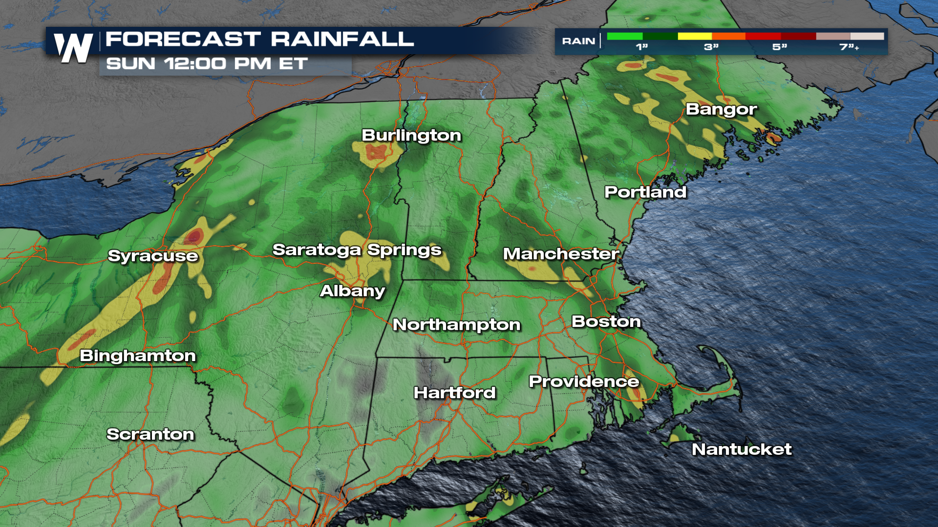 For the latest forecast and updates, be sure to join us on WeatherNation.


