Flooding Threat Continues Along the Gulf Coast
Special Stories
28 Nov 2020 10:31 AM
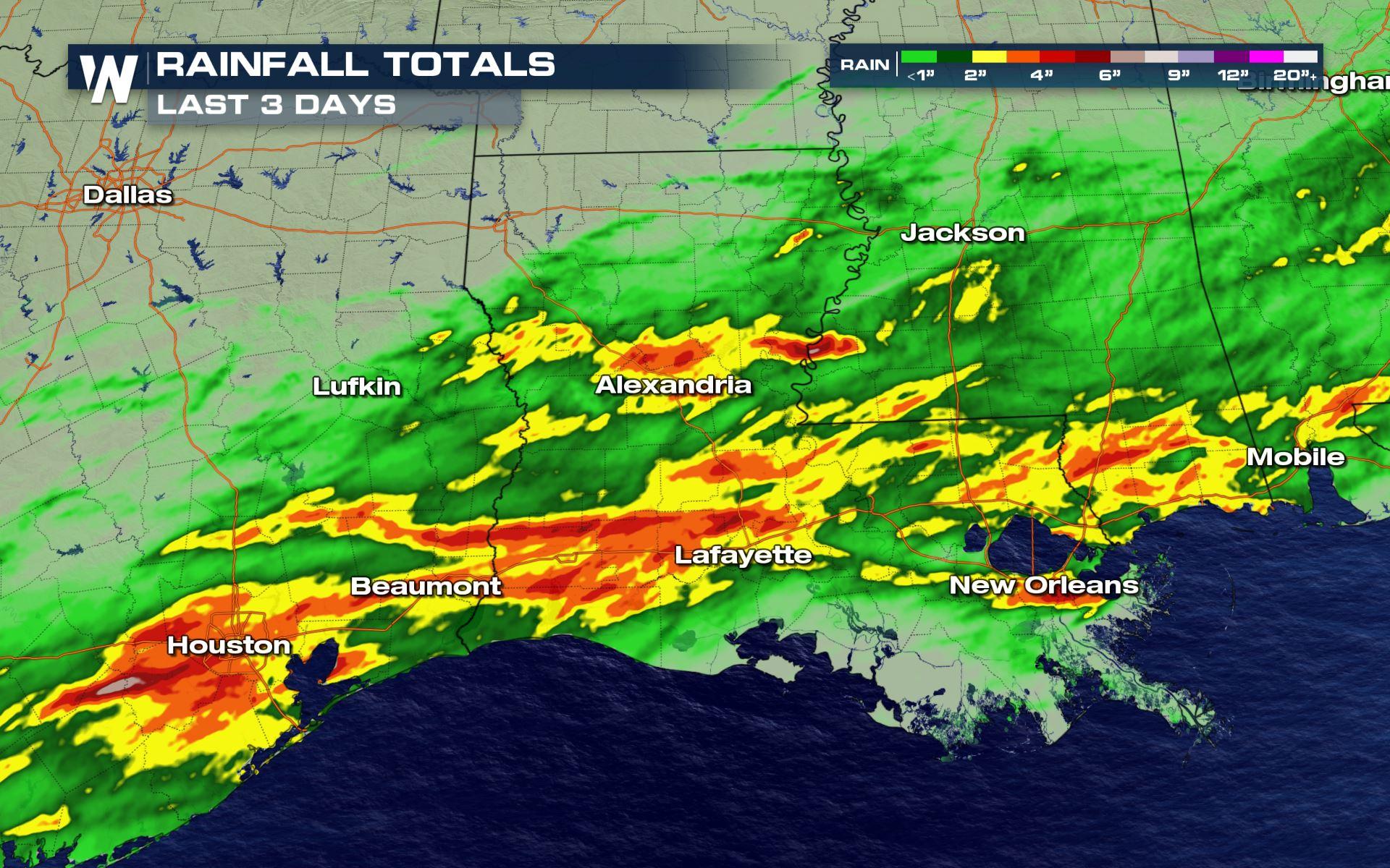
Heavy rain has saturated soils along portions of the Central Gulf Coast, with between 3-7 inches over the last 3 days in some locations. There is potential for additional heavy showers to continue through Saturday and the first half of Sunday, keeping the risk in place for flooding and flash flooding.
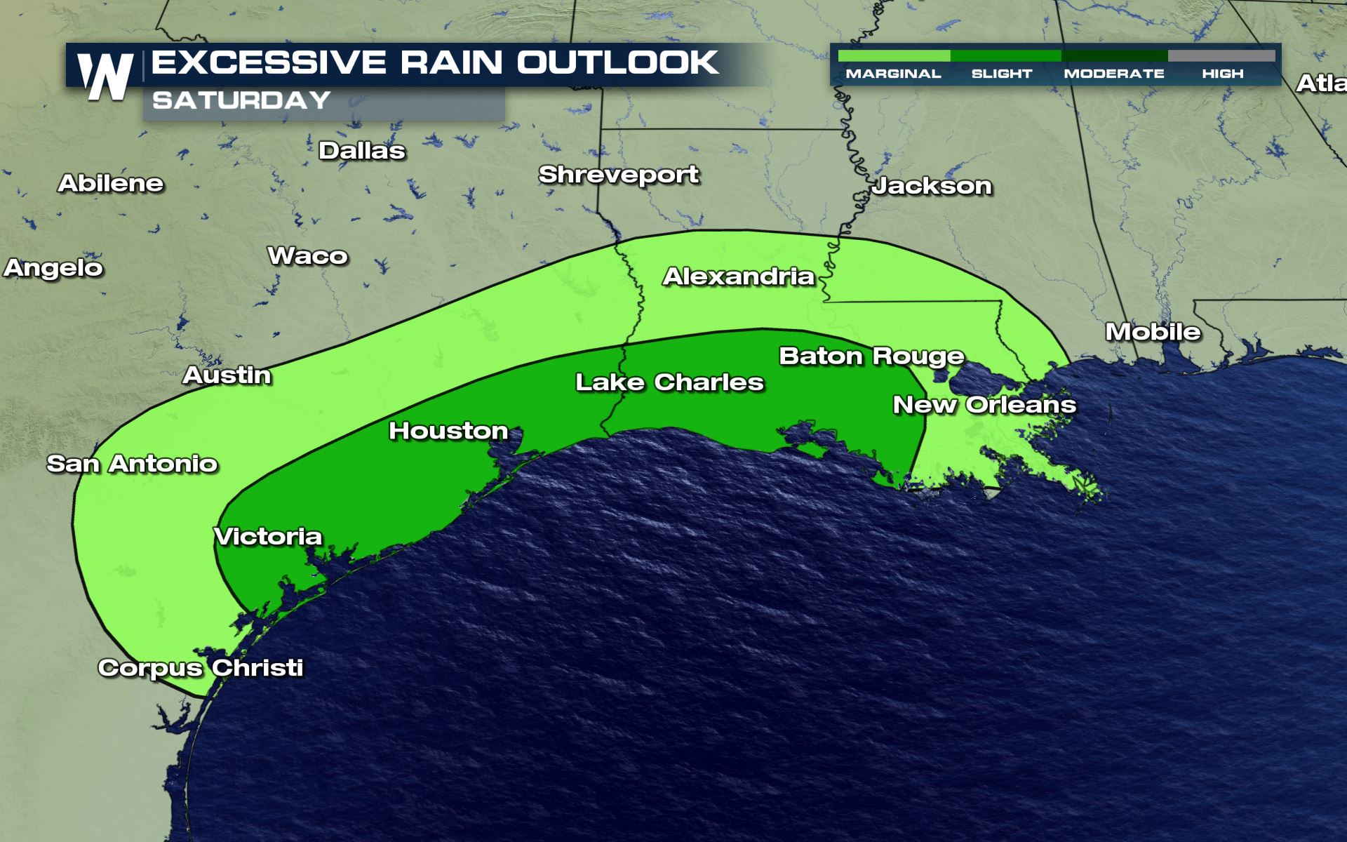 Above, the excessive outlook highlights to I-10 corridor between Baton Rouge and Houston for the best chance for flash flooding through Sunday morning, with more of an isolated risk for areas like New Orleans and San Antonio.
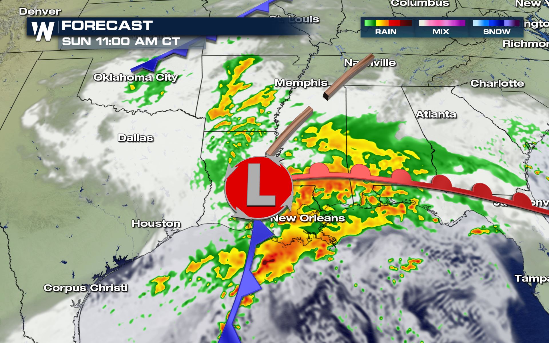
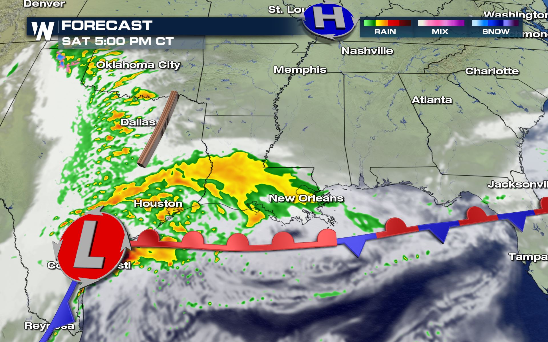 By early Sunday, the heaviest showers are expected to be mostly east of the Lone Star State, but the flooding risk will continue across Louisiana and Mississippi.
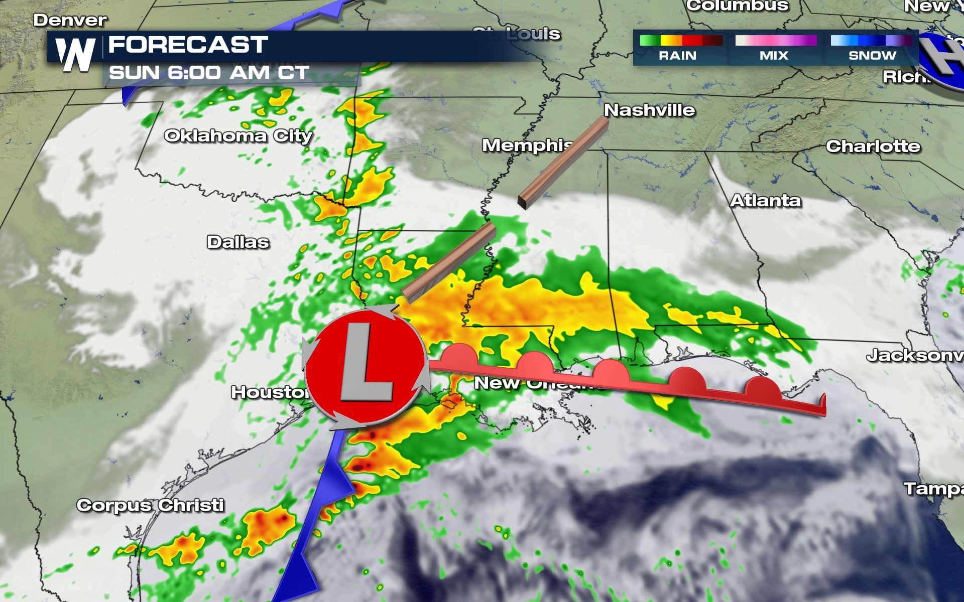 By late Sunday morning, the cluster of showers and storms moves into Eastern Louisiana and across Southern Mississippi. Southern Mississippi may still have some pockets of heavy rain lingering just past sunset Sunday.
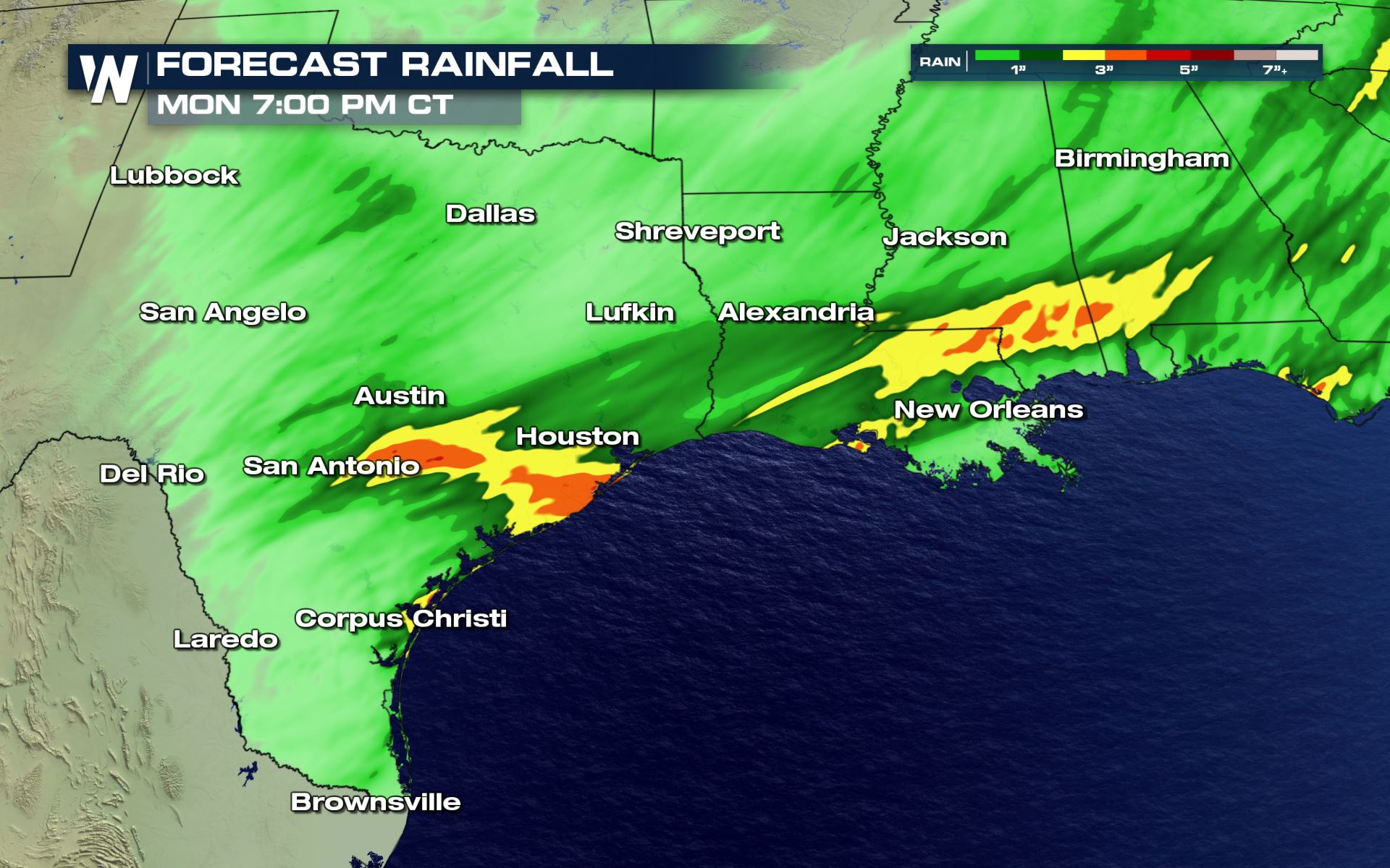
 Additional showers could accumulate to more than 3-5 inches in some areas, this is on top of what fell earlier in the week. Expect potentially widespread nuisance flooding to continue, with flash flooding possible in heavier downpours and thunderstorms.
 If you encounter a flooded roadway, do not try to cross it or drive around barriers. The road surface could wash out without warning.
Above, the excessive outlook highlights to I-10 corridor between Baton Rouge and Houston for the best chance for flash flooding through Sunday morning, with more of an isolated risk for areas like New Orleans and San Antonio.
Forecast
The heavy rain is expected to continue as a potent low develops in the Gulf and slowly moves to the northeast. As a warm front develops, the moisture will lift to the north spreading moderate to heavy showers from Texas through Western Mississippi through Saturday.
By early Sunday, the heaviest showers are expected to be mostly east of the Lone Star State, but the flooding risk will continue across Louisiana and Mississippi.
By late Sunday morning, the cluster of showers and storms moves into Eastern Louisiana and across Southern Mississippi. Southern Mississippi may still have some pockets of heavy rain lingering just past sunset Sunday.
Additional showers could accumulate to more than 3-5 inches in some areas, this is on top of what fell earlier in the week. Expect potentially widespread nuisance flooding to continue, with flash flooding possible in heavier downpours and thunderstorms.
If you encounter a flooded roadway, do not try to cross it or drive around barriers. The road surface could wash out without warning.
All Weather News
More
More Storms for the East Through Monday
A low-pressure system that moved through the
2 Aug 2026 7:05 PM

Wildfire Outbreak in the Pacific Northwest
Conditions have been incredibly dry out west.
2 Aug 2026 1:30 PM

After Reaching Category 5, Genevieve Weakens in the Pacific
PacificGenevieve formed on last Friday south
2 Aug 2026 1:25 PM


Flooding, Severe Storms Target the Midwest Again
After an active week of storms across the nor
1 Aug 2026 1:40 AM

Flooding Risk Increases as Heavy Rain Targets the Tri-State Area
Tuesday, heavy rainfall moved across the Nort
30 Jul 2026 12:25 AM

Severe Weather: Energy From the Midwest Now in the Southeast
UPPER MIDWEST - Through Monday, dangerous tor
29 Jul 2026 10:30 PM