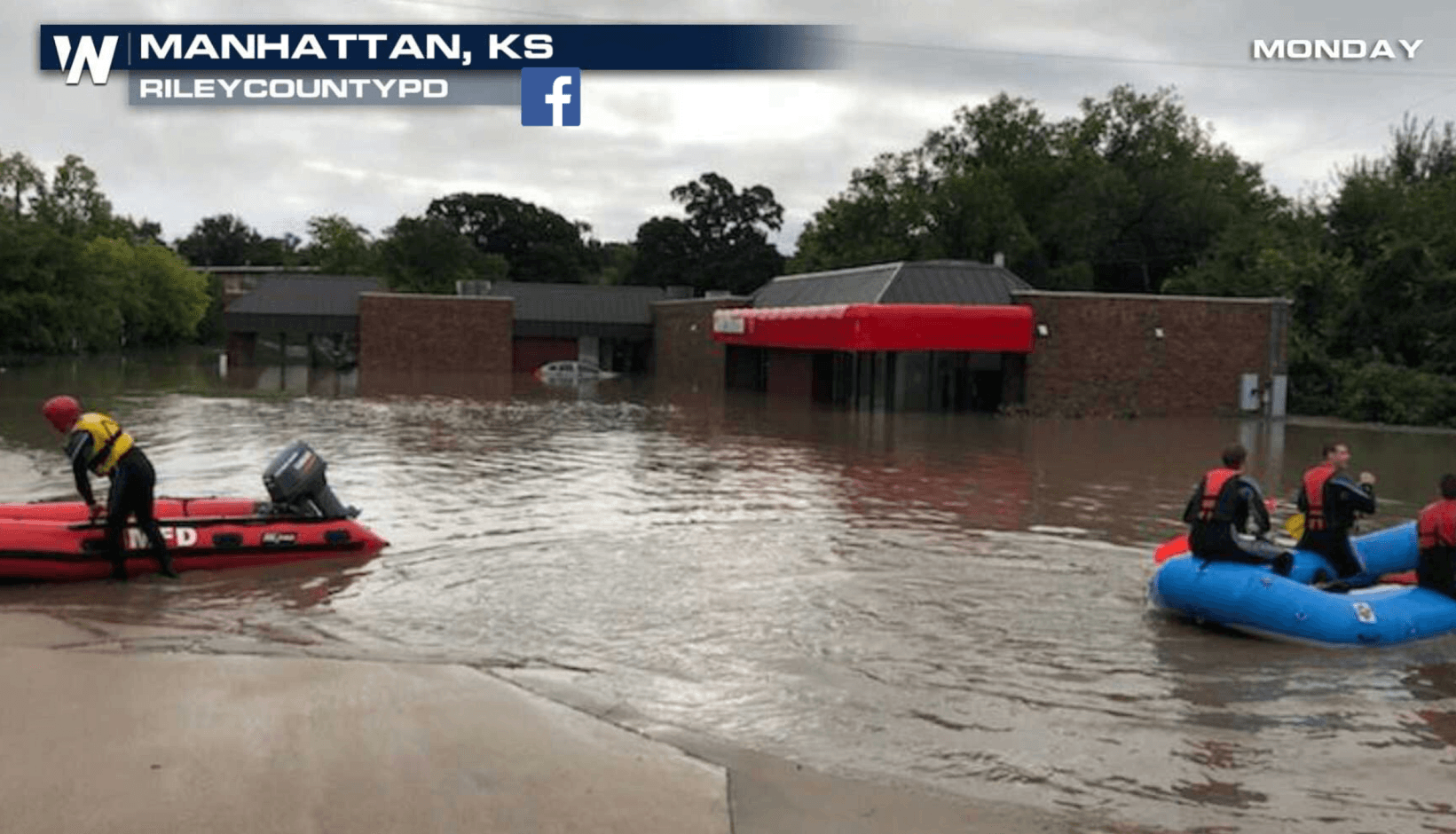
Flooding Threat Continues from the Plains to Great Lakes
Special Stories
4 Sep 2018 12:58 PM
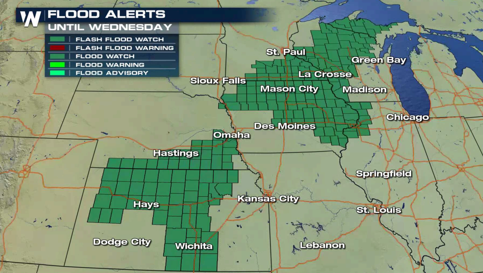
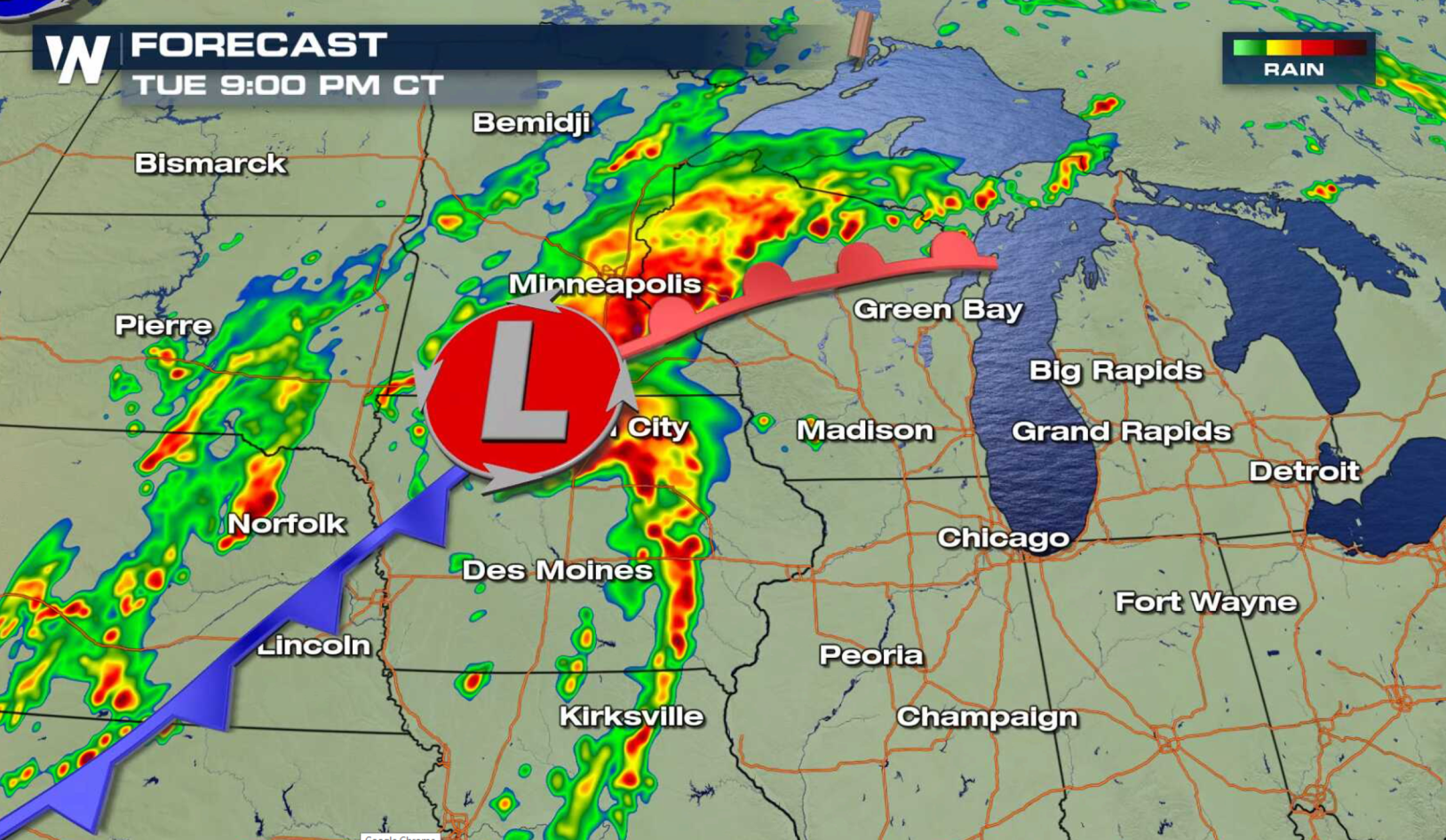
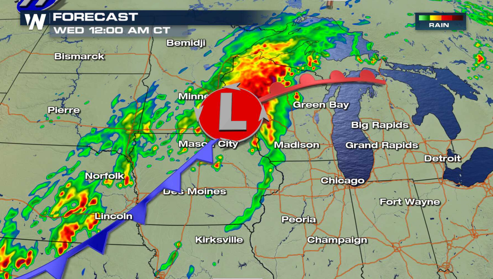
The threat for heavy rain continues from the Plains to the western Great Lakes this week. With soils over-saturated and rivers running high, flooding is possible in areas that see showers and thunderstorms again. Flash Flood Watches extend from Kansas to Upper Peninsula of Michigan.
 https://twitter.com/NWSWPC/status/1037040749005680640
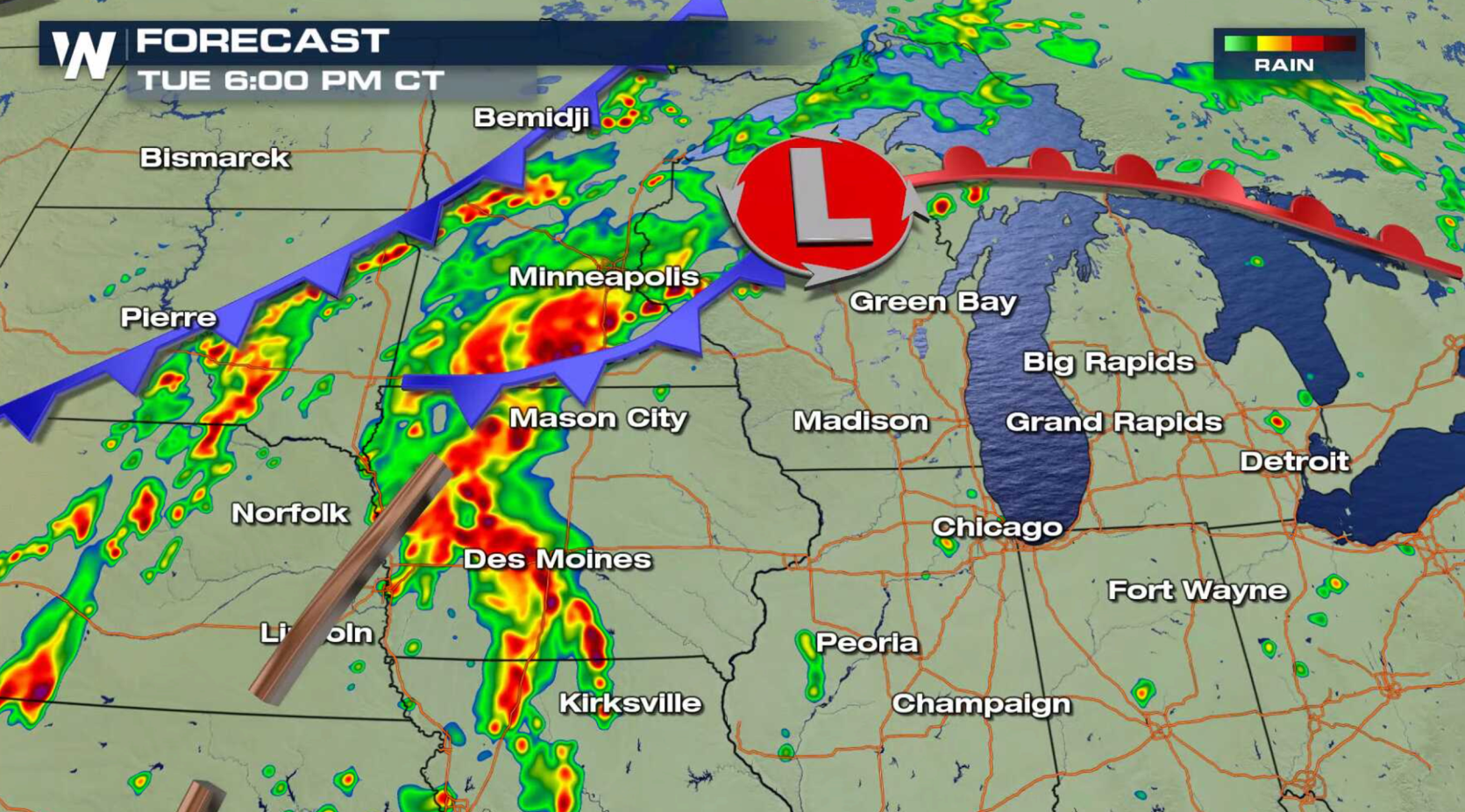
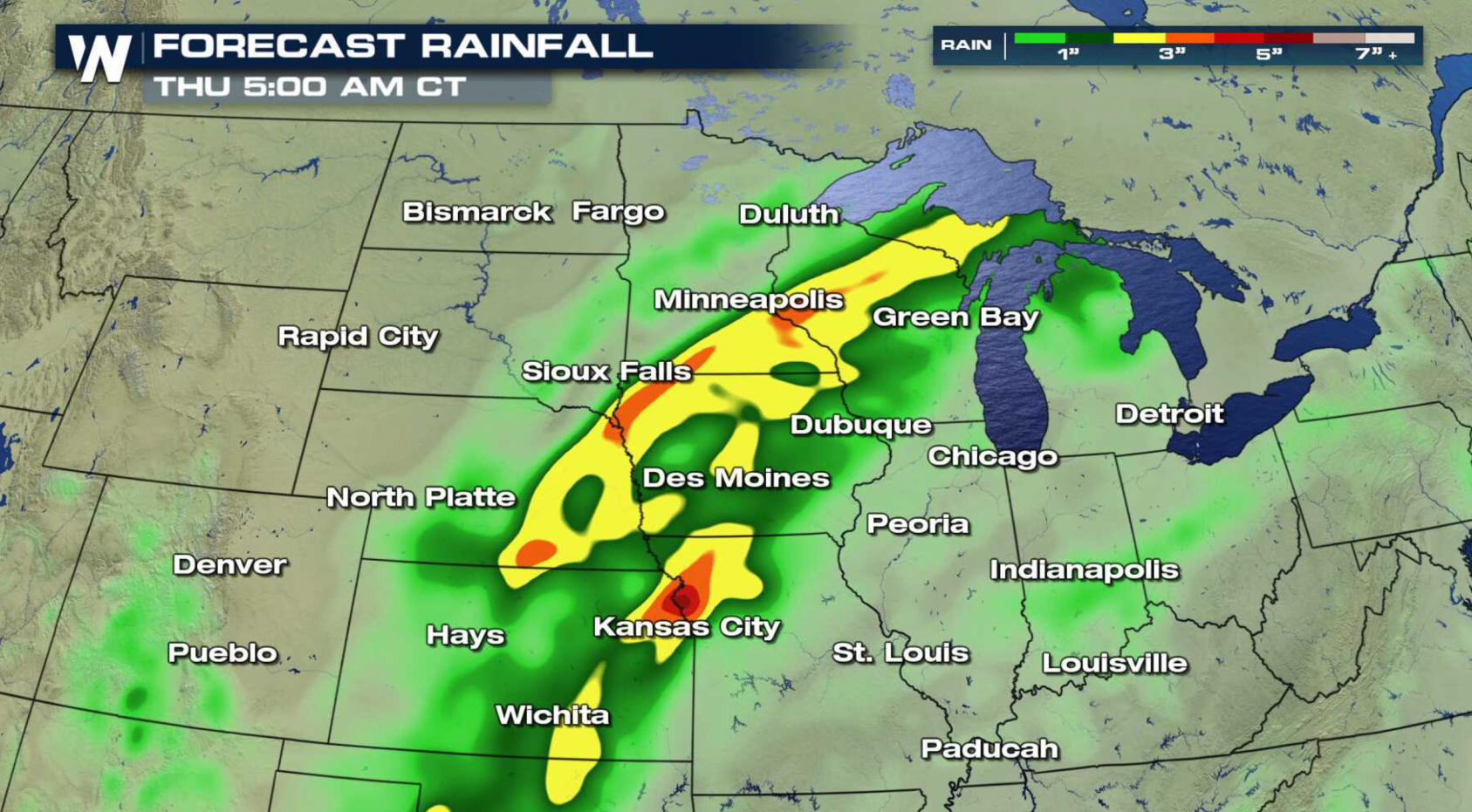 3" to 6" of rain may fall in some areas into early Thursday. A slow moving storm system will keep rain in the forecast over the next 24 hours. With high humidity, thunderstorms will dump heavy rainfall once again.
 For WeatherNation: Meteorologist Mace Michaels
https://twitter.com/NWSWPC/status/1037040749005680640
3" to 6" of rain may fall in some areas into early Thursday. A slow moving storm system will keep rain in the forecast over the next 24 hours. With high humidity, thunderstorms will dump heavy rainfall once again.
For WeatherNation: Meteorologist Mace MichaelsAll Weather News
More

Flooding, Severe Storms Target the Midwest Again
After an active week of storms across the nor
31 Jul 2026 11:15 PM


After Reaching Category 5, Genevieve Weakens in the Pacific
PacificFausto is now a post-tropical cyclone.
31 Jul 2026 1:30 AM

Flooding Risk Increases as Heavy Rain Targets the Tri-State Area
Tuesday, heavy rainfall moved across the Nort
30 Jul 2026 12:25 AM

Severe Weather: Energy From the Midwest Now in the Southeast
UPPER MIDWEST - Through Monday, dangerous tor
29 Jul 2026 10:30 PM