Flooding Threat from the Ohio Valley to the Plains
Special Stories
7 Sep 2018 10:03 AM
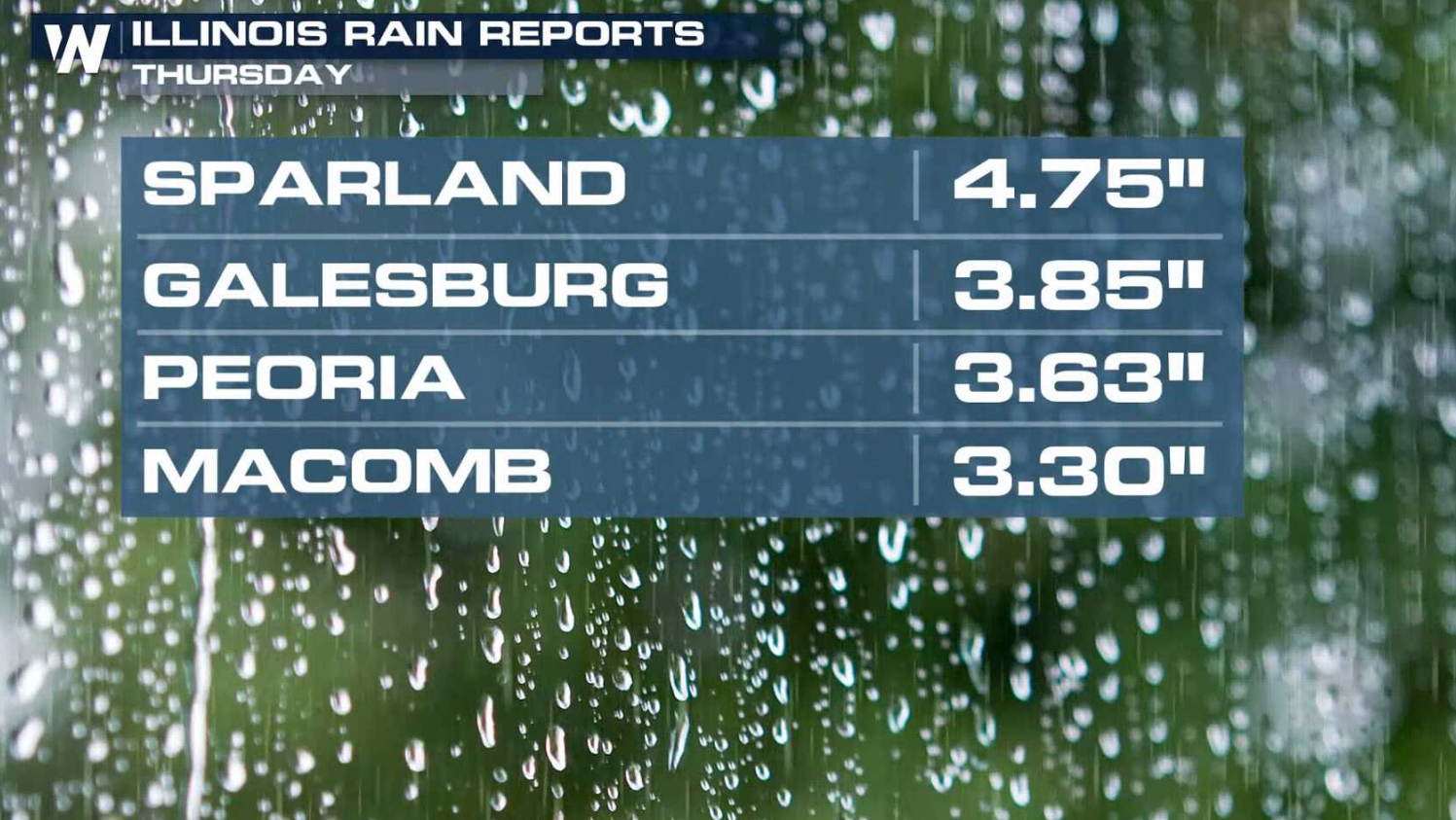
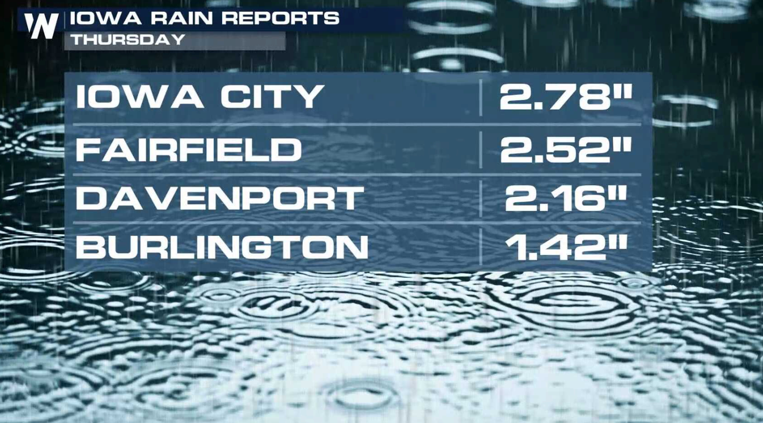
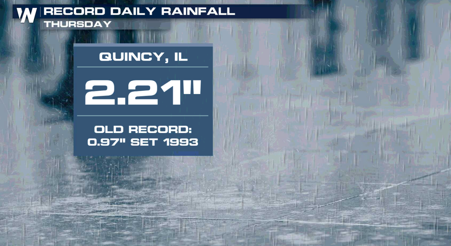
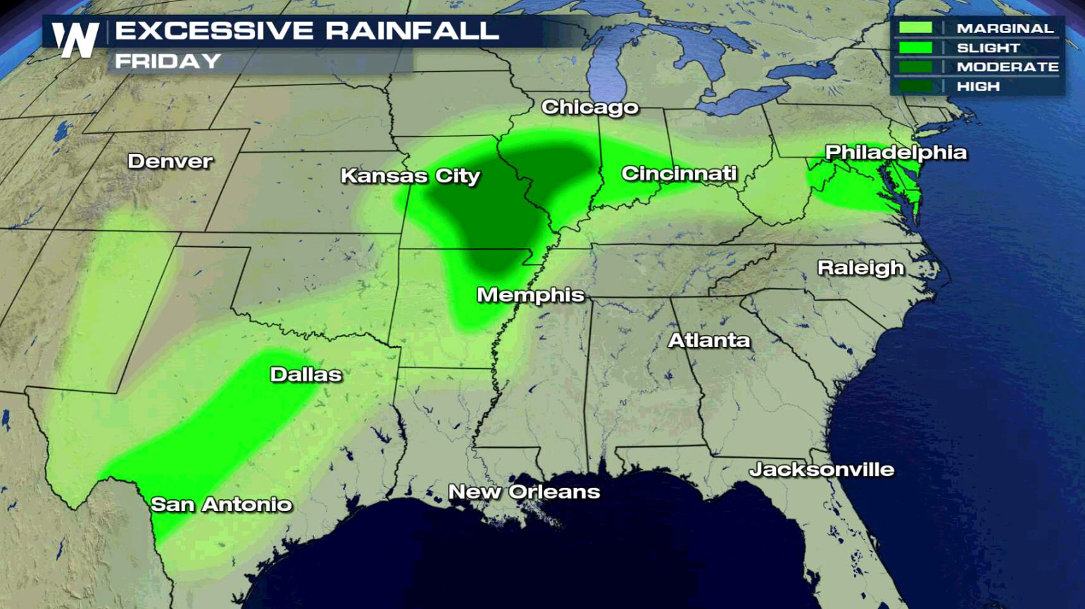
Another day of heavy rain fell through portions of the Ohio Valley into the Plains and more is ahead for today (Friday). Some areas saw more than 4" of rainfall, creating some flooding.
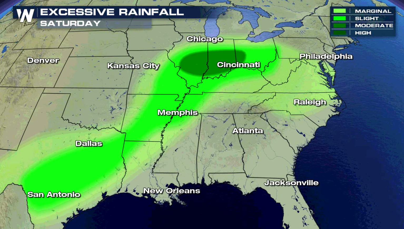
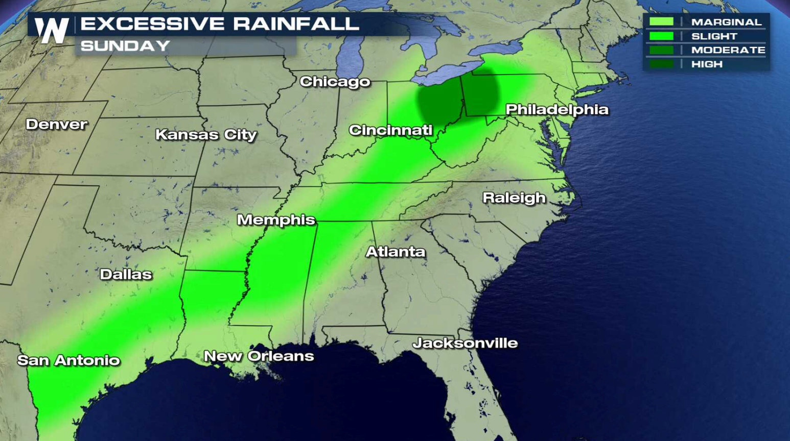
 Through this weekend, Flash Flood Watches remain in effect from northern Virginia through the Ohio Valley and into the southern Plains. More than 6" of rain may fall in some areas by Monday.
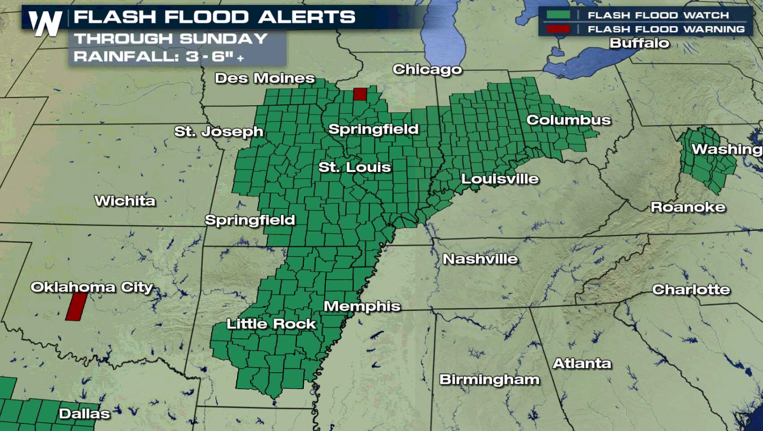
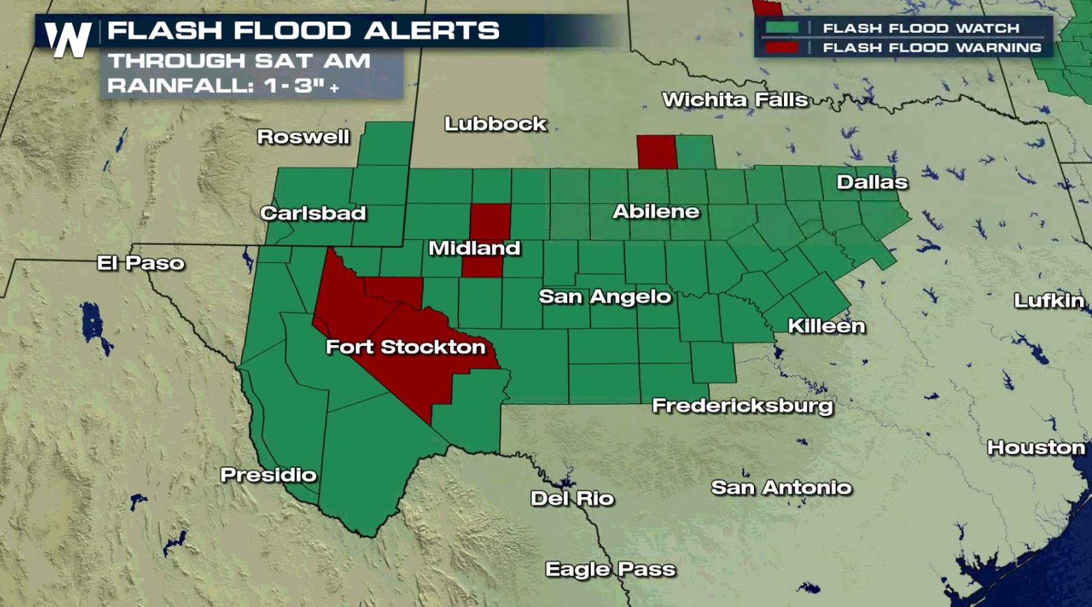
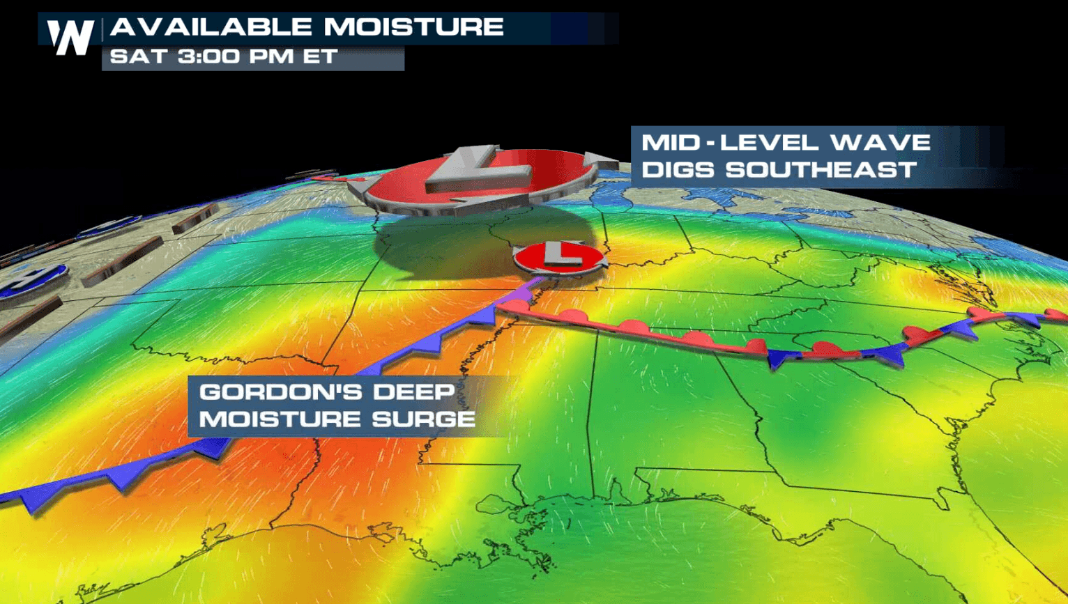
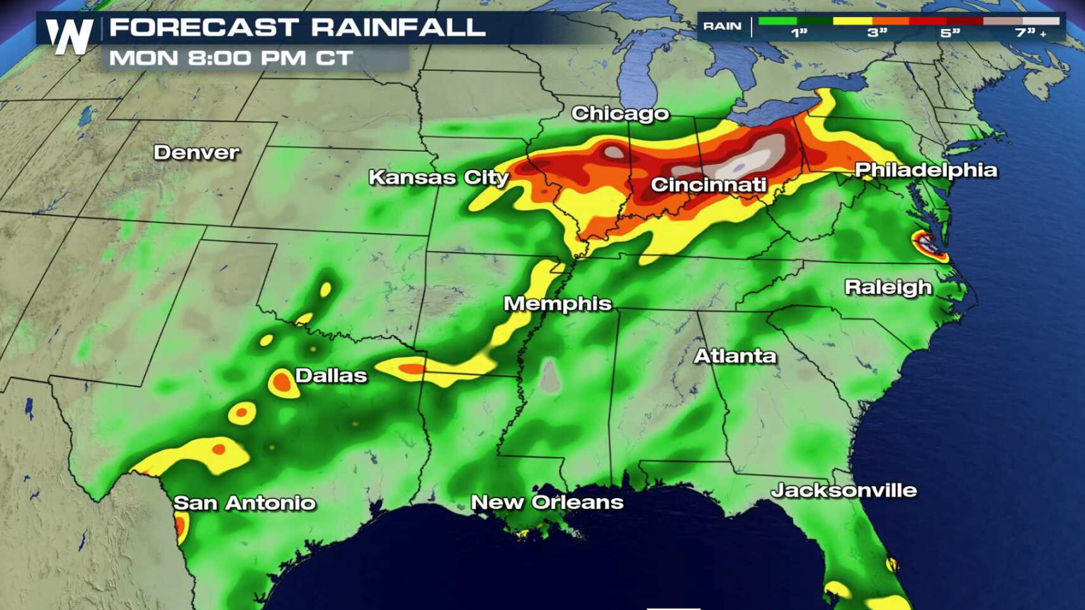 A slow moving cold front coupled with Tropical Depression Gordon are the culprits for bringing the flooding threat. High humidity and strong Jet Stream energy will fuel showers and thunderstorms with the potential for heavy rain.
 For WeatherNation: Meteorologist Mace Michaels
Through this weekend, Flash Flood Watches remain in effect from northern Virginia through the Ohio Valley and into the southern Plains. More than 6" of rain may fall in some areas by Monday.
A slow moving cold front coupled with Tropical Depression Gordon are the culprits for bringing the flooding threat. High humidity and strong Jet Stream energy will fuel showers and thunderstorms with the potential for heavy rain.
For WeatherNation: Meteorologist Mace MichaelsAll Weather News
More


More Storms for the East Sunday and Monday
A low-pressure system crashing through the Mi
2 Aug 2026 2:20 AM

After Reaching Category 5, Genevieve Weakens in the Pacific
PacificGenevieve formed on last Friday south
2 Aug 2026 1:30 AM

Flooding, Severe Storms Target the Midwest Again
After an active week of storms across the nor
1 Aug 2026 1:40 AM

Flooding Risk Increases as Heavy Rain Targets the Tri-State Area
Tuesday, heavy rainfall moved across the Nort
30 Jul 2026 12:25 AM

Severe Weather: Energy From the Midwest Now in the Southeast
UPPER MIDWEST - Through Monday, dangerous tor
29 Jul 2026 10:30 PM