Florence Becomes the First Major Hurricane in the Atlantic This Season
Special Stories
5 Sep 2018 10:56 AM
Unexpectedly, Hurricane Florence has become the first major hurricane in the Atlantic Basin this season. According to the National Hurricane Center, "Florence has been rapidly intensifying since yesterday, an event that was not foreseen by any intensity models, nor forecasters." Upper level wind shear was expected to keep the storm at category one strength, but the hurricane moved along "a small pocket of relatively low shear, and with waters becoming progressively warmer, the hurricane has strengthened significantly more than anticipated", NHC states.
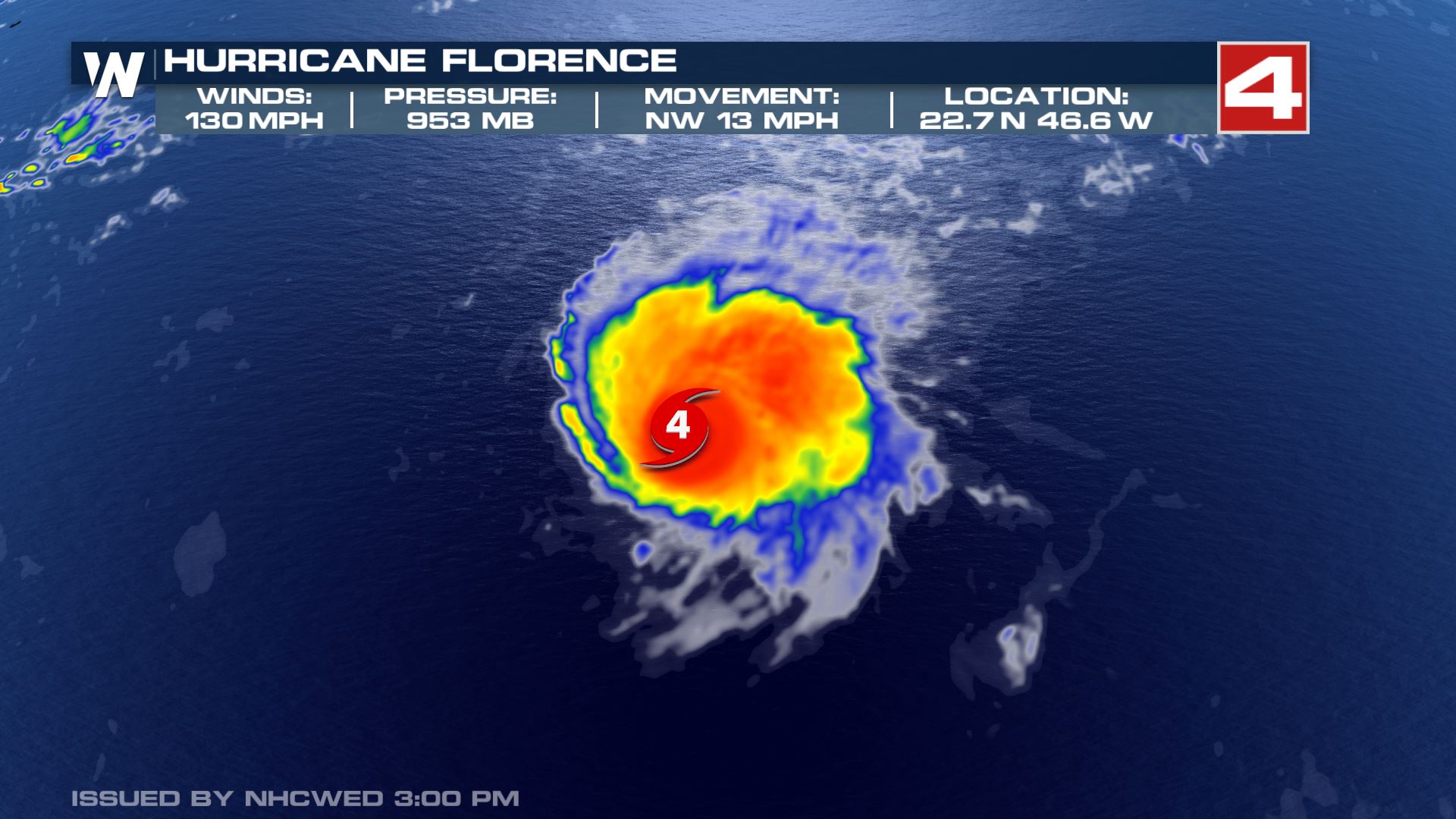
 The cyclone now has sustained winds of 130 mph, making it a category four storm. Some weakening is expected as Florence moves over slightly cooler central Atlantic Ocean waters and encounters the previously mentioned wind shear.
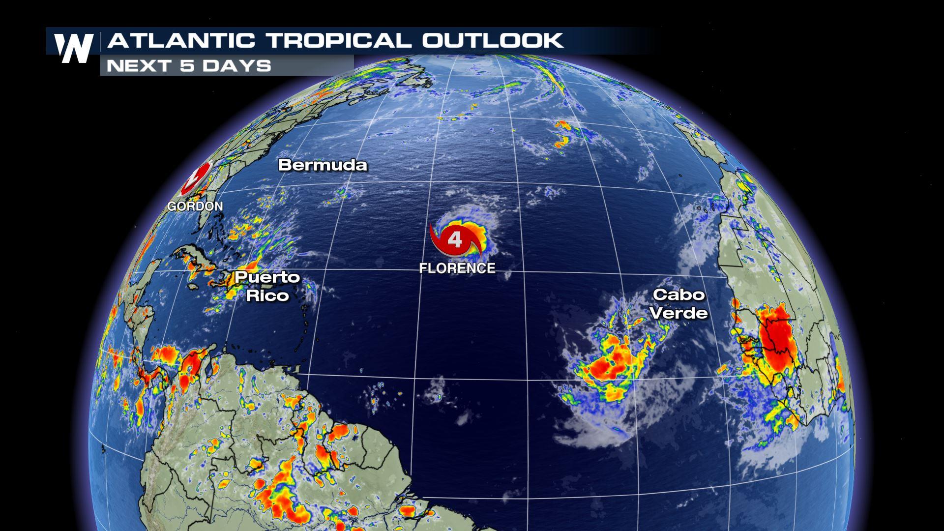
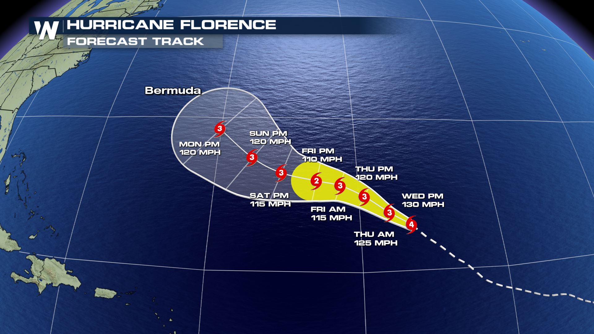
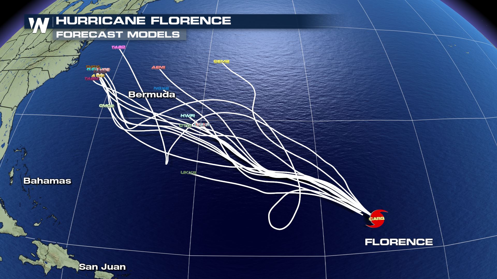
Florence is located about 1160 miles east-northeast of the northern Leeward Islands and 1370 miles east-southeast of Bermuda. The forecast track takes Florence around an upper level high pressure ridge, steering the storm to the west and northwest.
The cyclone now has sustained winds of 130 mph, making it a category four storm. Some weakening is expected as Florence moves over slightly cooler central Atlantic Ocean waters and encounters the previously mentioned wind shear.
Florence is located about 1160 miles east-northeast of the northern Leeward Islands and 1370 miles east-southeast of Bermuda. The forecast track takes Florence around an upper level high pressure ridge, steering the storm to the west and northwest.
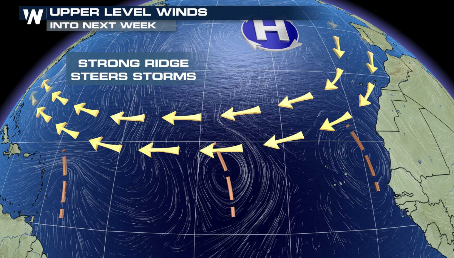
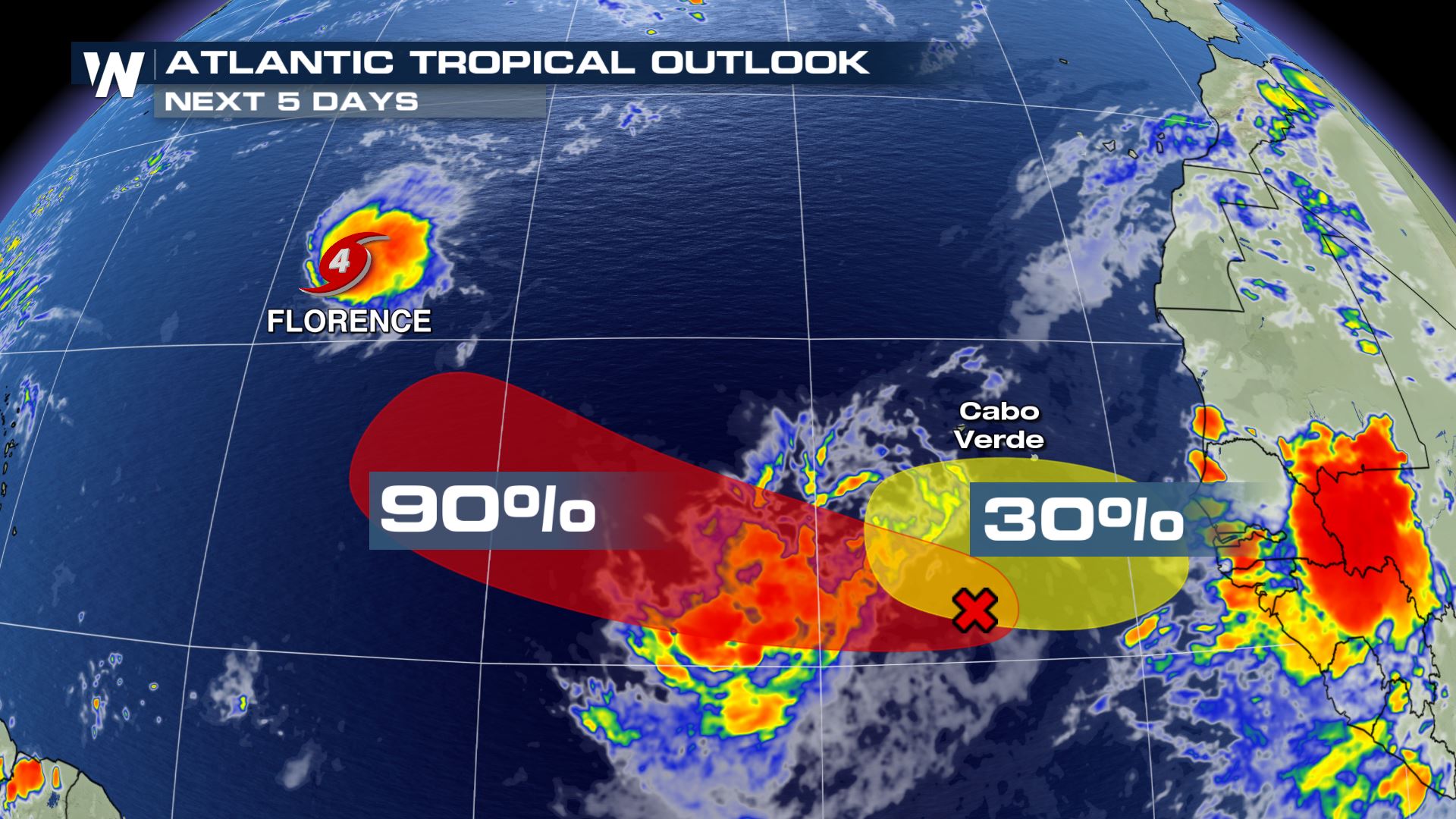 A broad area of low pressure, located a couple hundred miles southwest of the Cape Verde Islands has become better organized. With conditions favorable for development ahead of the storm, intensification is likely and a tropical depression is likely to form later this week.
For WeatherNation: Meteorologist Mace Michaels
A broad area of low pressure, located a couple hundred miles southwest of the Cape Verde Islands has become better organized. With conditions favorable for development ahead of the storm, intensification is likely and a tropical depression is likely to form later this week.
For WeatherNation: Meteorologist Mace Michaels
The cyclone now has sustained winds of 130 mph, making it a category four storm. Some weakening is expected as Florence moves over slightly cooler central Atlantic Ocean waters and encounters the previously mentioned wind shear.
Florence is located about 1160 miles east-northeast of the northern Leeward Islands and 1370 miles east-southeast of Bermuda. The forecast track takes Florence around an upper level high pressure ridge, steering the storm to the west and northwest.
A broad area of low pressure, located a couple hundred miles southwest of the Cape Verde Islands has become better organized. With conditions favorable for development ahead of the storm, intensification is likely and a tropical depression is likely to form later this week.
For WeatherNation: Meteorologist Mace MichaelsAll Weather News
More
Wildfire Outbreak in the Pacific Northwest
SPOKANE, WA - On Saturday, August 1st, the Ol
2 Aug 2026 7:20 PM

More Storms for the East Through Monday
A low-pressure system that moved through the
2 Aug 2026 7:20 PM


After Reaching Category 5, Genevieve Weakens in the Pacific
PacificGenevieve formed on last Friday south
2 Aug 2026 6:25 PM

Flooding, Severe Storms Target the Midwest Again
After an active week of storms across the nor
1 Aug 2026 1:40 AM

Flooding Risk Increases as Heavy Rain Targets the Tri-State Area
Tuesday, heavy rainfall moved across the Nort
30 Jul 2026 12:25 AM

Severe Weather: Energy From the Midwest Now in the Southeast
UPPER MIDWEST - Through Monday, dangerous tor
29 Jul 2026 10:30 PM