Florence Nearly Stalled, Dropping Tremendous Rain

Top Stories
14 Sep 2018 4:15 PM
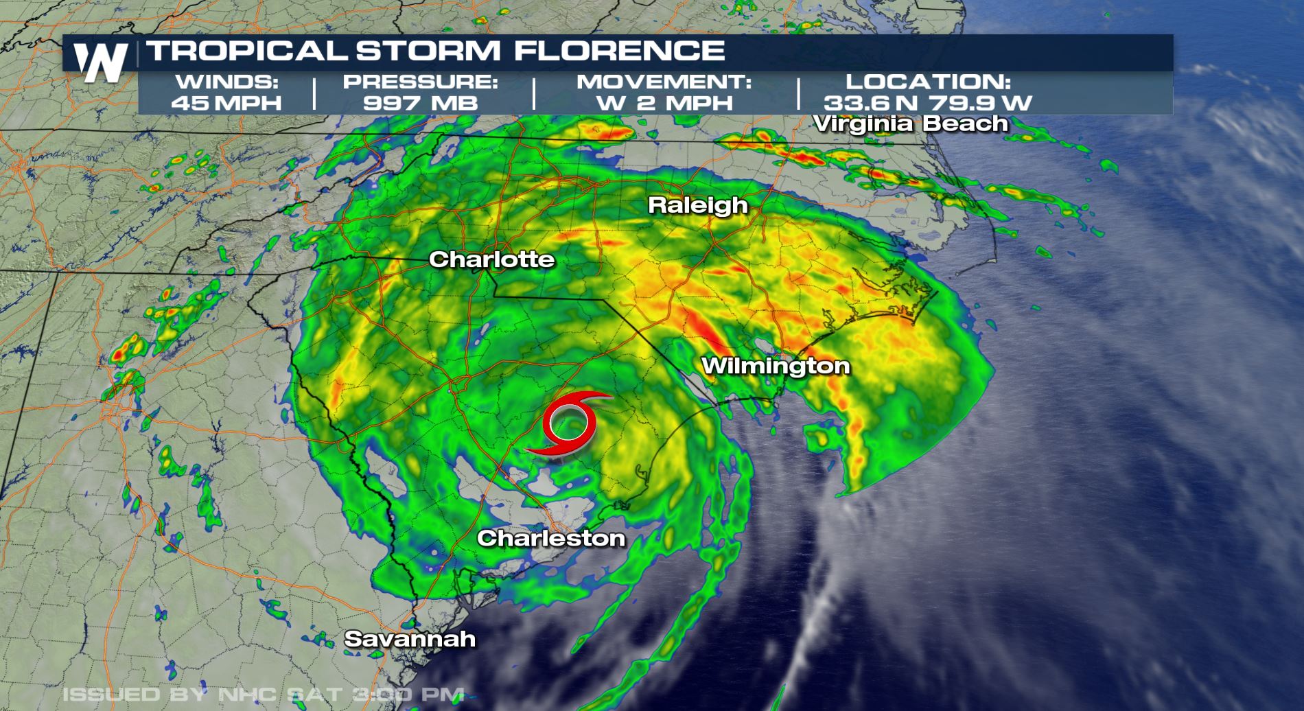
As of Saturday evening, Florence continued to maintain tropical storm strength, while dumping tremendous rainfall.
Florence made landfall as a Category 1 hurricane Friday morning in North Carolina, before transitioning into a tropical storm. Despite winds around 45 mph only a small distance from the center of the storm, Florence continues to bring other damaging impacts, including flooding rain, storm surge, and power outages as ongoing threats.
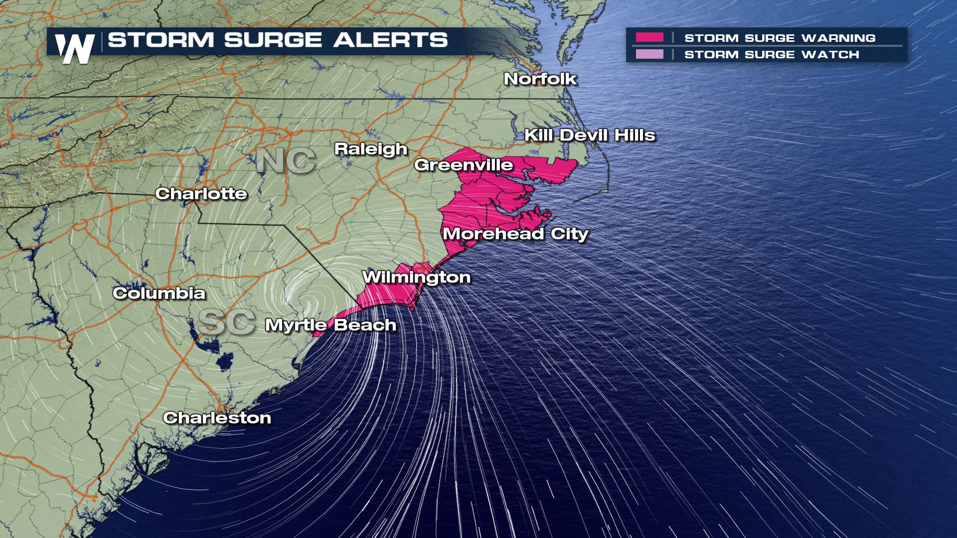 Storm surge warnings are in effect (pink) until further notice
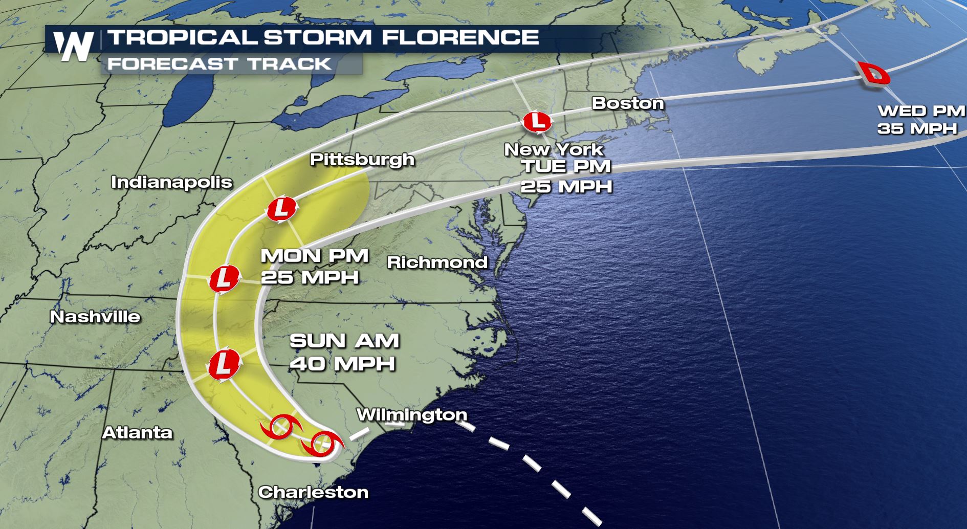
Florence is forecast to stay quite strong through Friday night as the storm feeds off of the warm Atlantic Ocean. Quicker weakening is expected this weekend as it encounters higher terrain.
Storm surge warnings are in effect (pink) until further notice
Florence is forecast to stay quite strong through Friday night as the storm feeds off of the warm Atlantic Ocean. Quicker weakening is expected this weekend as it encounters higher terrain.
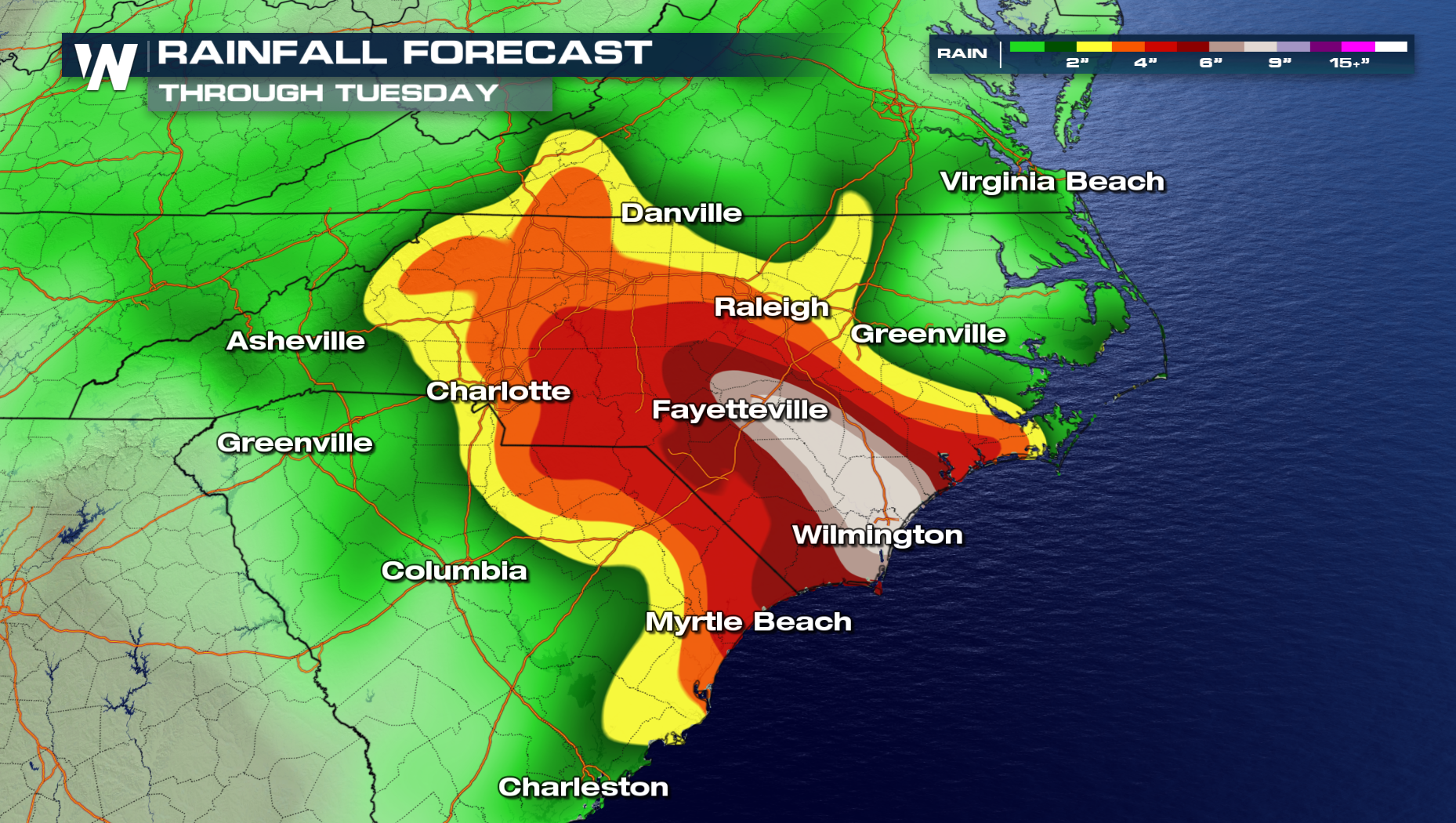
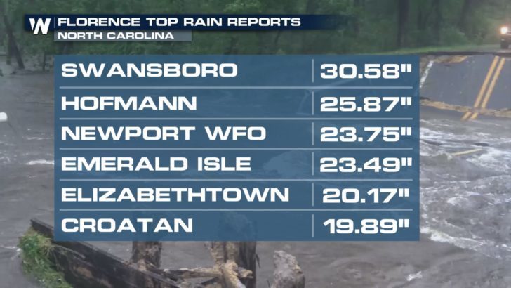
 It cannot be emphasized enough that extremely heavy rainfall will be a serious hazard. Nearly 24 inches of rain has already fallen in areas of southeastern North Carolina and more rain is still to come.
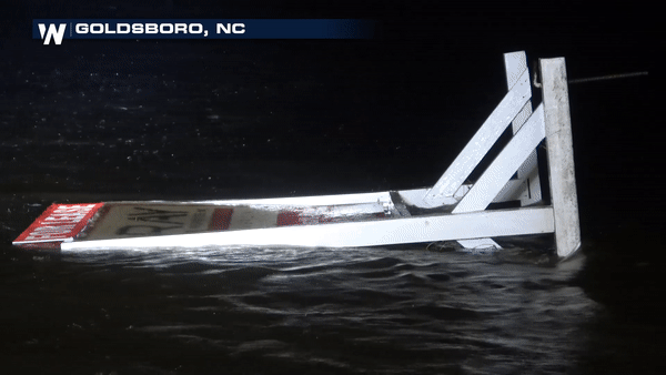
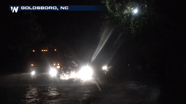
 Extreme flooding took place late Friday night and continues Saturday for many parts of North and South Carolina.
 Tropical-storm-force winds and isolated tornadoes will continue to be possible through Saturday as the storm spins inland, slowly. Alerts are in effect until further notice for each hazard.
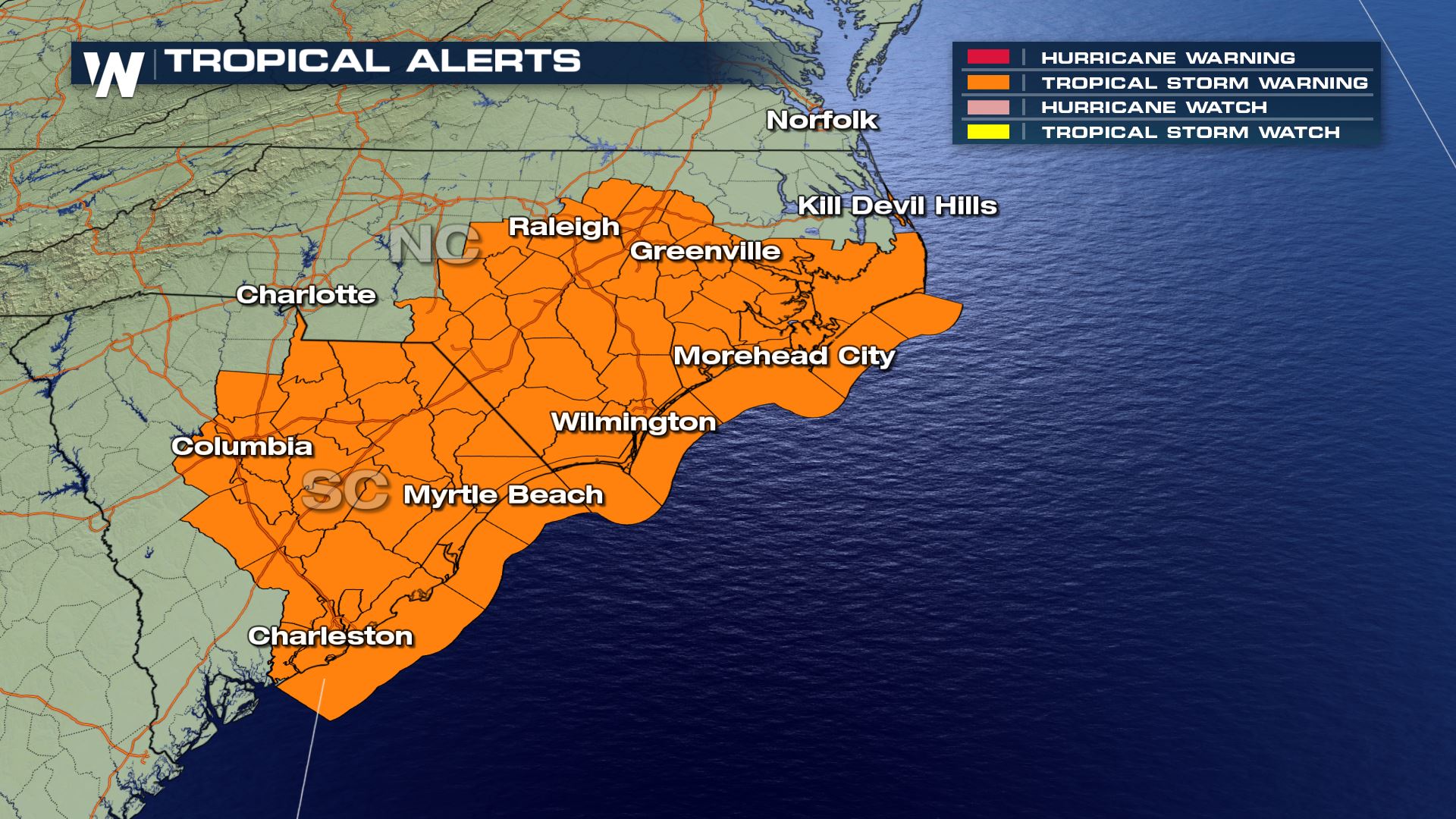 A tropical storm warning remains in effect until further notice
Continue to stay with WeatherNation for all of the latest updates on Florence and all other weather-related hazards.
For WeatherNation, Meteorologist Steve Glazier
A tropical storm warning remains in effect until further notice
Continue to stay with WeatherNation for all of the latest updates on Florence and all other weather-related hazards.
For WeatherNation, Meteorologist Steve Glazier
Storm surge warnings are in effect (pink) until further notice
Florence is forecast to stay quite strong through Friday night as the storm feeds off of the warm Atlantic Ocean. Quicker weakening is expected this weekend as it encounters higher terrain.
It cannot be emphasized enough that extremely heavy rainfall will be a serious hazard. Nearly 24 inches of rain has already fallen in areas of southeastern North Carolina and more rain is still to come.
Extreme flooding took place late Friday night and continues Saturday for many parts of North and South Carolina.
Tropical-storm-force winds and isolated tornadoes will continue to be possible through Saturday as the storm spins inland, slowly. Alerts are in effect until further notice for each hazard.
A tropical storm warning remains in effect until further notice
Continue to stay with WeatherNation for all of the latest updates on Florence and all other weather-related hazards.
For WeatherNation, Meteorologist Steve GlazierAll Weather News
More
Heat Wave Grips Central, Western U.S.
Are you over the summer heat yet? SouthwestEx
25 Jul 2026 11:10 AM

Tropics: Fausto Heads to Hawaii; Genevieve Has Formed and Could Become a Major Hurricane
Atlantic BasinBertha has dissipated after mov
25 Jul 2026 11:00 AM

Severe Storms Target the Midwest This Weekend
Extreme heat will be a big story this week ac
25 Jul 2026 11:00 AM

Southeast Flood Risk Lingers Near Stalled Front
A stalled boundary over the Southeast will ke
25 Jul 2026 10:55 AM

Fire Weather Continues This Weekend
Conditions have been really dry out west. We'
25 Jul 2026 10:50 AM

Another Round of Storms Targets the Northeast
Tuesday brought severe weather again across p
23 Jul 2026 1:15 AM

Another Round of Severe Weather for the Upper Midwest and Great Lakes
The upper-level low train continues to keep t
21 Jul 2026 1:45 AM