Florida’s Rainy Season Starting Ahead of Schedule

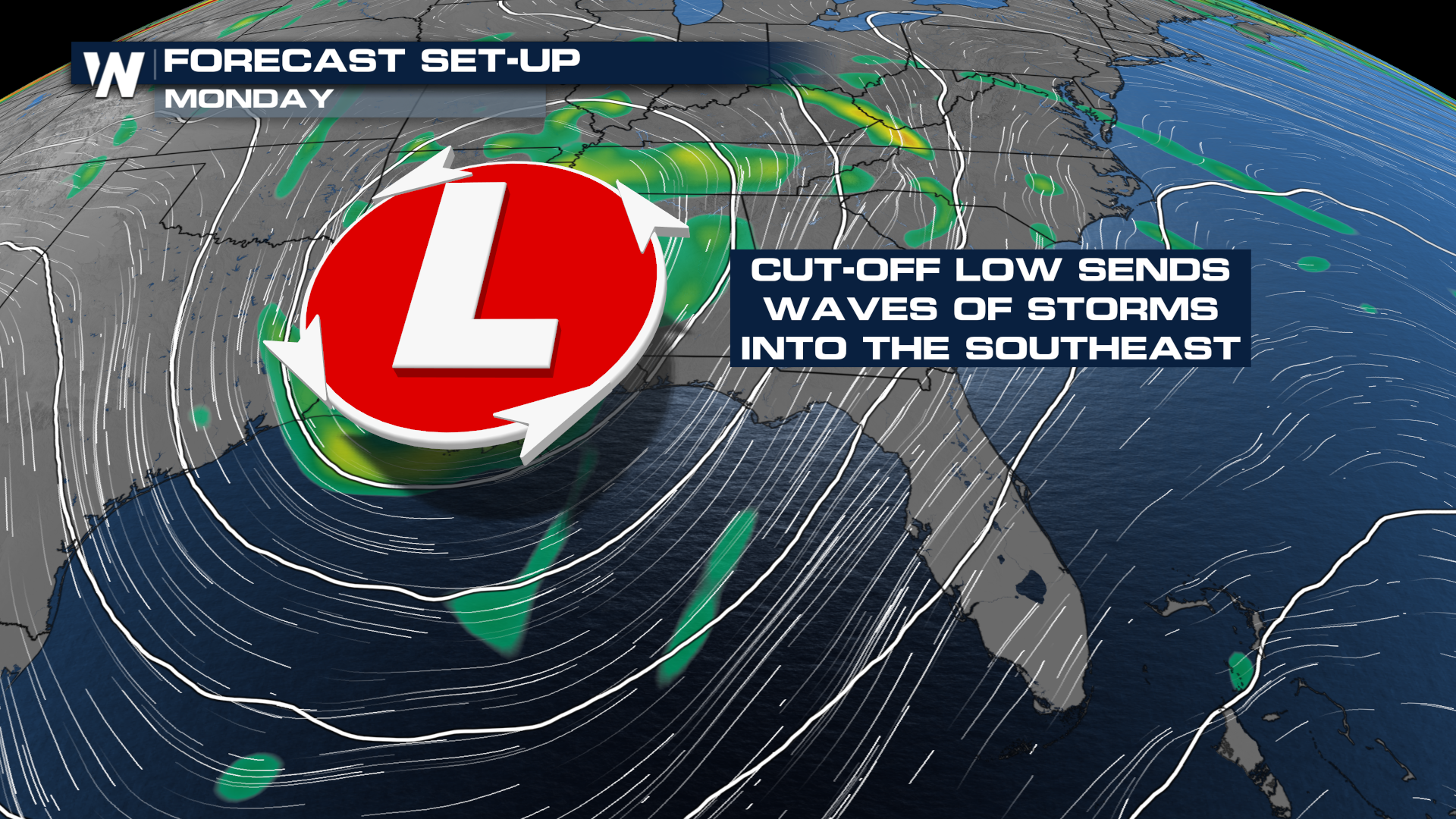
An upper-level low will meander around the Gulf this weekend, sending rounds of showers and thunderstorms into the Southeast with increasing flood potential.
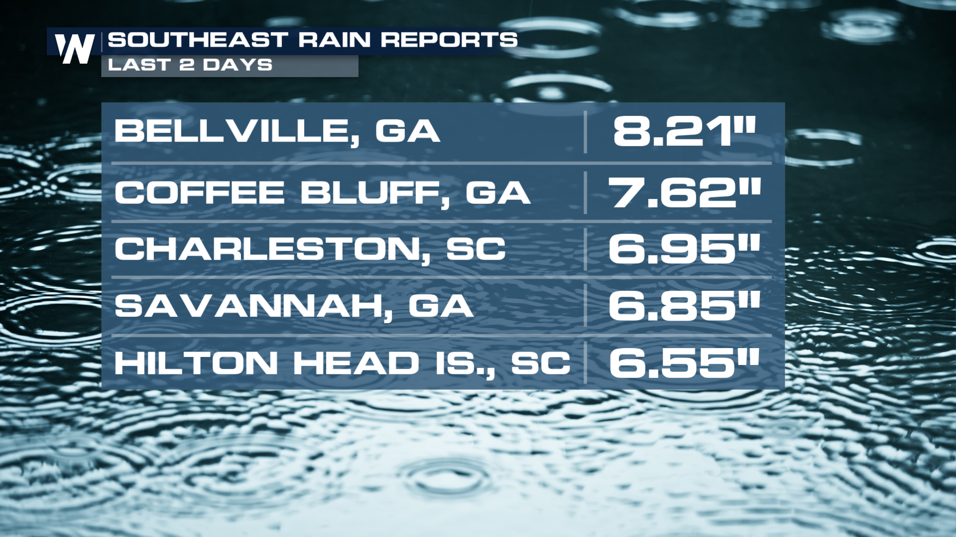
 Amounts
 As we head into the work week, as this large upper low over the Lower Mississippi Valley lingers, heavy rainfall could measure up to 3-6" with isolated totals even higher than that.
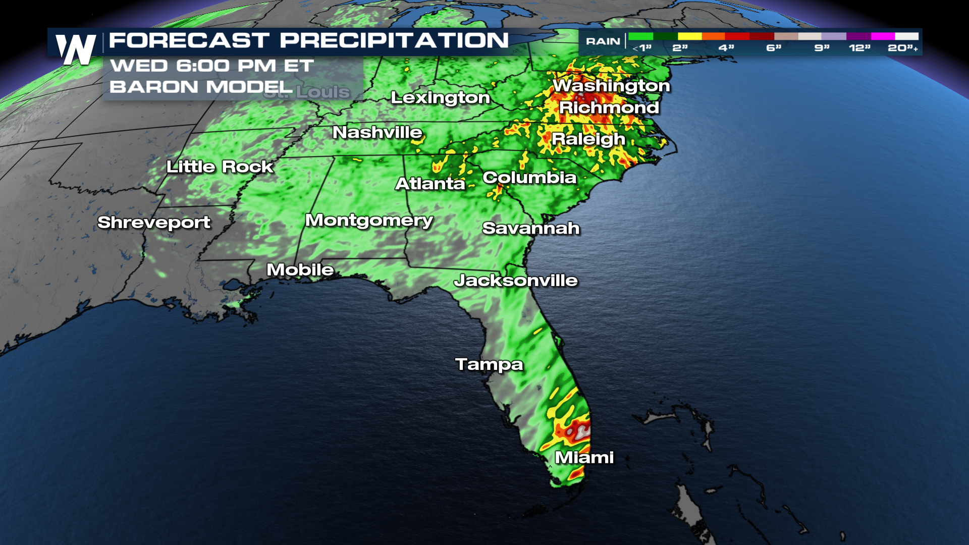 In fact, the Weather Prediction Center has upgraded areas in South Florida to a MODERATE risk for seeing excessive rainfall today (above).
Timing
This low is still lingering, and the flood threat will continue over the next few days.
So, When Is Florida’s Rainy Season Usually?
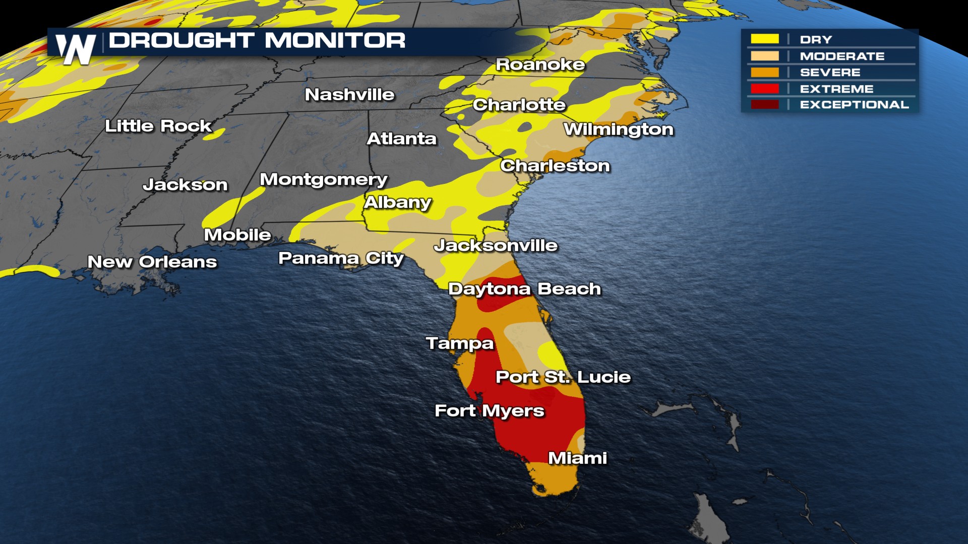
Florida’s rainy season typically runs from late May through mid-October, aligning closely with the Atlantic hurricane season. During this time, the state receives nearly 70% of its annual rainfall (Goodbye drought), with frequent storms developing in the early afternoon and clearing by evening.
What to Expect Daily During the Rainy Season
Afternoon thunderstorms are the hallmark of Florida summers. These storms are usually short-lived but intense, capable of producing heavy rainfall, lightning, and gusty winds. It is common to see sunshine in the morning, followed by a dramatic downpour after 2 PM.
Despite the daily rain, most of Florida’s rainy season does not consist of day-long washouts. Instead, brief but powerful storms roll through, often leaving behind cooler temperatures and stunning sunsets.
Safety Tips During the Rainy Season
Check the forecast daily: Download the WeatherNation app for frequent updates.
Be cautious on roads: Rain can make roads slick (Google 'Florida Black Ice') and cause flash flooding in low-lying areas.
Avoid open water and outdoor activities during storms: Lightning is a serious threat in Florida, often referred to as the lightning capital of the U.S.
Have a hurricane plan: June through November is also hurricane season, and some rainstorms can be part of larger systems.
Stay with WeatherNation for the latest.


