Friday Florida Severe Storm Threat
Top Stories
7 May 2021 11:40 AM
A lingering cold front will prompt another round of strong and potentially severe storms for Florida on Friday, mostly for the Miami area and the Keys. We have a marginal risk (level 1 out of 5) for severe storms today.
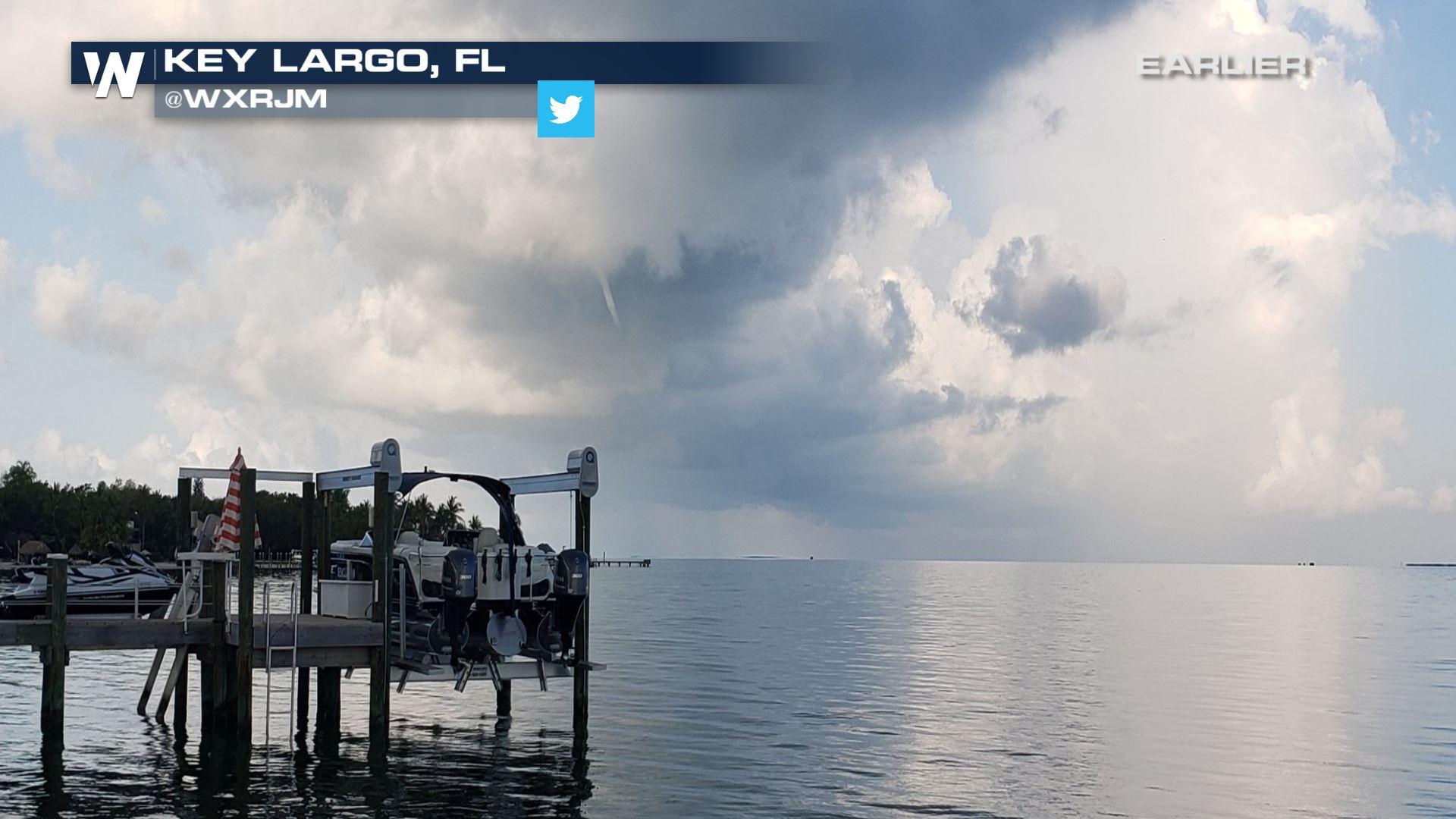
 Earlier on Friday, there were even waterspouts off the coast of the Florida Keys! The tornado threat will be low today, but watch for waterspouts as we head through the afternoon and evening.
 The primary concerns for today's storms will be hail and gusty winds, from West Palm Beach down to the Keys.
 Storm coverage will favor the southern I-95 corridor and the western Bahamas through the afternoon and evening. By sundown, the strongest storms will be across the Atlantic Ocean.


 WeatherNation is streaming online 24/7 with all of your top weather headlines and regional forecasts. Stay with us for the latest updates!
Earlier on Friday, there were even waterspouts off the coast of the Florida Keys! The tornado threat will be low today, but watch for waterspouts as we head through the afternoon and evening.
The primary concerns for today's storms will be hail and gusty winds, from West Palm Beach down to the Keys.
Storm coverage will favor the southern I-95 corridor and the western Bahamas through the afternoon and evening. By sundown, the strongest storms will be across the Atlantic Ocean.
WeatherNation is streaming online 24/7 with all of your top weather headlines and regional forecasts. Stay with us for the latest updates!All Weather News
More
Wildfire Outbreak in the Pacific Northwest
SPOKANE, WA - On Saturday, August 1st, the Ol
3 Aug 2026 1:55 AM

More Storms for the East Through Monday
A low-pressure system that moved through the
3 Aug 2026 1:50 AM


After Reaching Category 5, Genevieve Weakens in the Pacific
PacificGenevieve formed last Friday south of
3 Aug 2026 12:30 AM

Flooding, Severe Storms Target the Midwest Again
After an active week of storms across the nor
1 Aug 2026 1:40 AM

Flooding Risk Increases as Heavy Rain Targets the Tri-State Area
Tuesday, heavy rainfall moved across the Nort
30 Jul 2026 12:25 AM

Severe Weather: Energy From the Midwest Now in the Southeast
UPPER MIDWEST - Through Monday, dangerous tor
29 Jul 2026 10:30 PM