Friday Morning Soaking for the Northeast
Top Stories
27 Sep 2018 9:08 PM
Heads up! Before you grab the coffee and keys and race out the door on Friday morning, check the weather and radar. Many cities in the Northeast are going to be getting rained on throughout the morning commute.
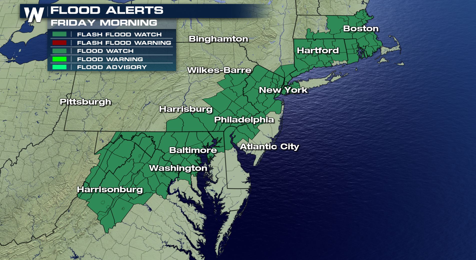 Flood alerts are in effect through midday Friday for the potential of heavy rain causing flooding.
Flood watches are in effect due to the heavy rainfall. This means that there is a heightened potential for areas of flooding. You'll want to check the traffic conditions and give yourself extra time when driving on these soaked roads. The Friday morning rush hour will be going a little slower, leaving you a little late!
Below you will find three images of how the morning is expected to pan out. These are forecast images from Thursday night so they *could* be slightly off by Friday morning. However they paint a good picture of how the morning will unfold. Take a look:
Flood alerts are in effect through midday Friday for the potential of heavy rain causing flooding.
Flood watches are in effect due to the heavy rainfall. This means that there is a heightened potential for areas of flooding. You'll want to check the traffic conditions and give yourself extra time when driving on these soaked roads. The Friday morning rush hour will be going a little slower, leaving you a little late!
Below you will find three images of how the morning is expected to pan out. These are forecast images from Thursday night so they *could* be slightly off by Friday morning. However they paint a good picture of how the morning will unfold. Take a look:
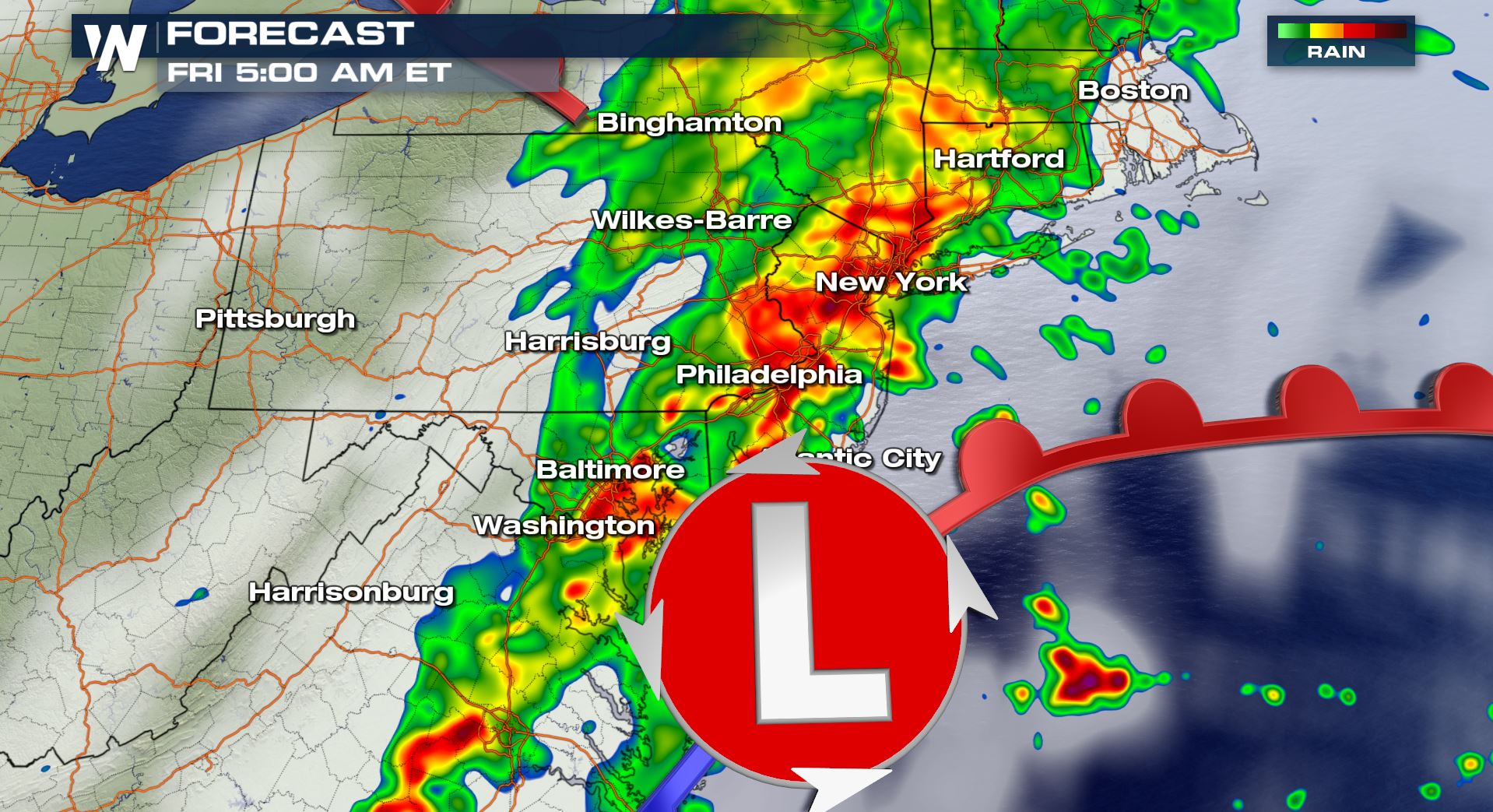 The forecast radar at 5 a.m. Eastern Time Friday, September 28 where yellow, orange, and red show the heaviest rain.
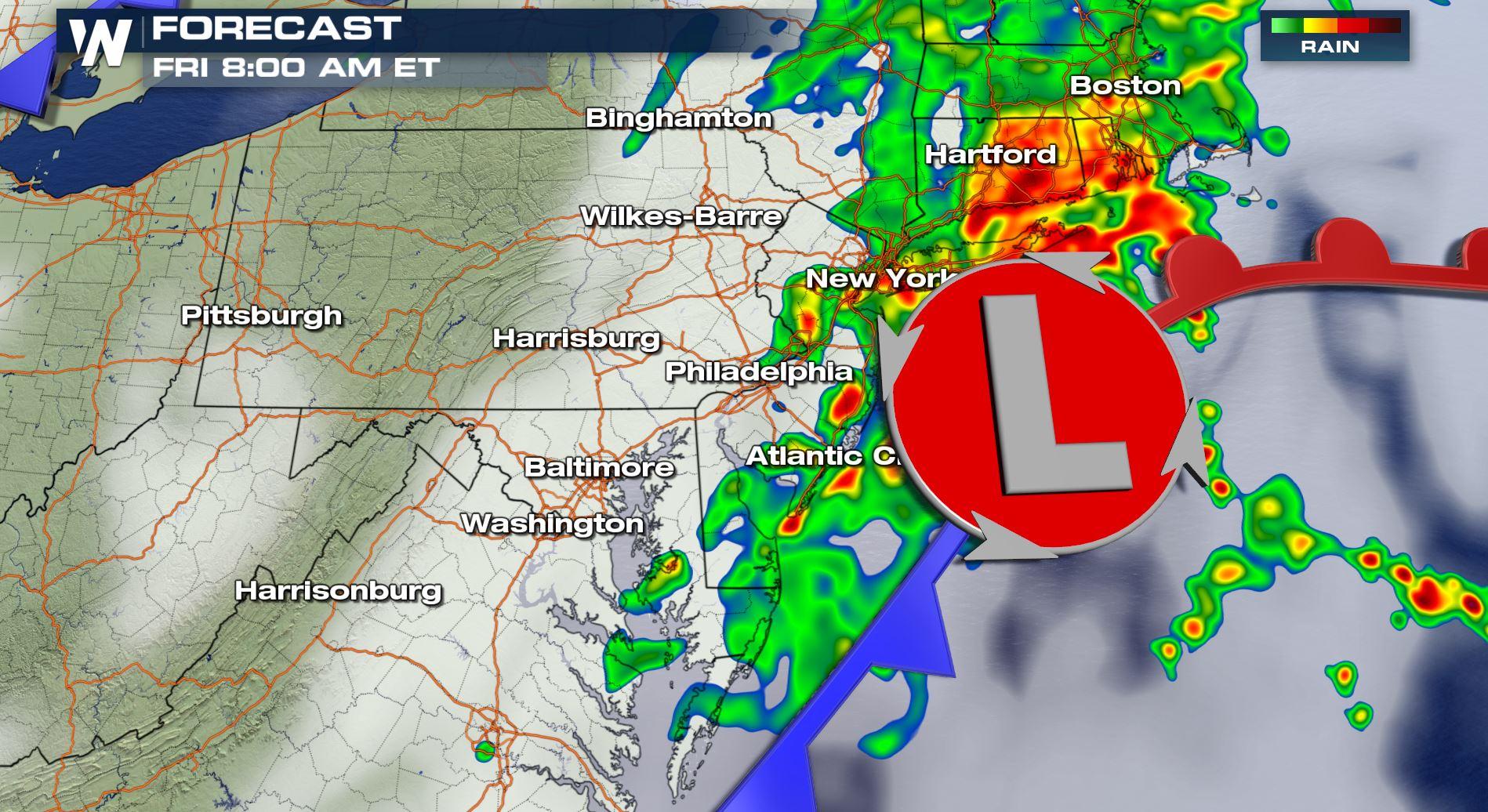
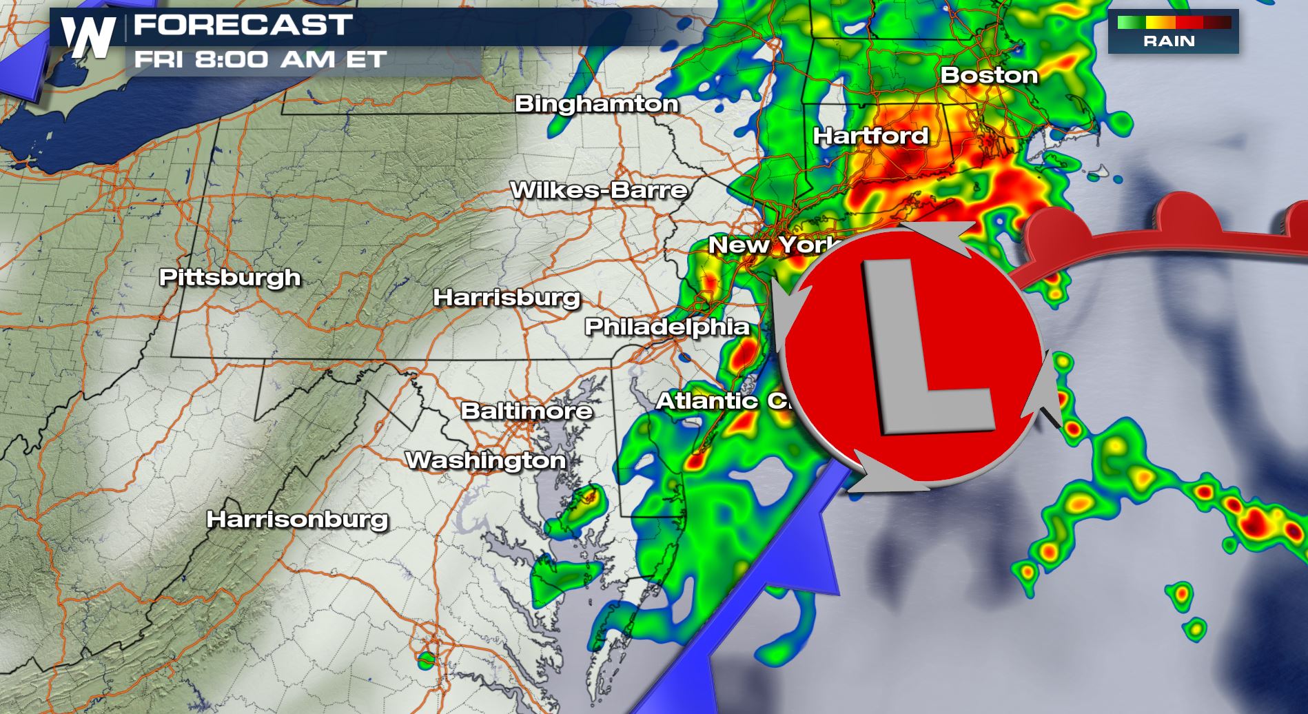 The forecast radar at 8 a.m. Eastern Time Friday, September 28 where yellow, orange, and red show the heaviest rain.
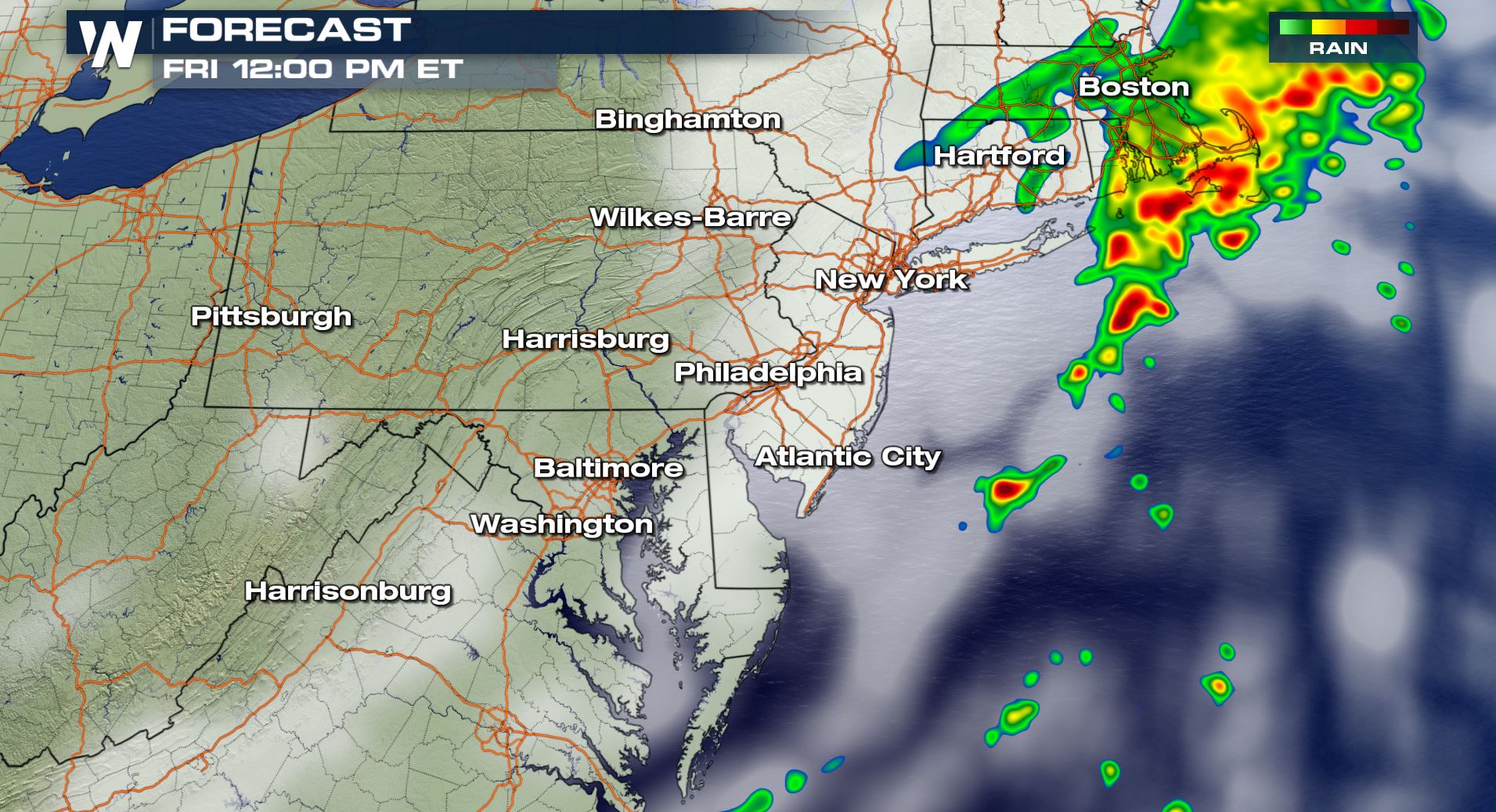 The forecast radar at 12 p.m. Eastern Time Friday, September 28 where yellow, orange, and red show the heaviest rain.
Most of this rain will leave the Northeast by late-morning Friday. In parts of Southern New England the rain may last as late as early afternoon. Locally heavy rain will be possible with amounts up to three inches!
The forecast radar at 12 p.m. Eastern Time Friday, September 28 where yellow, orange, and red show the heaviest rain.
Most of this rain will leave the Northeast by late-morning Friday. In parts of Southern New England the rain may last as late as early afternoon. Locally heavy rain will be possible with amounts up to three inches!
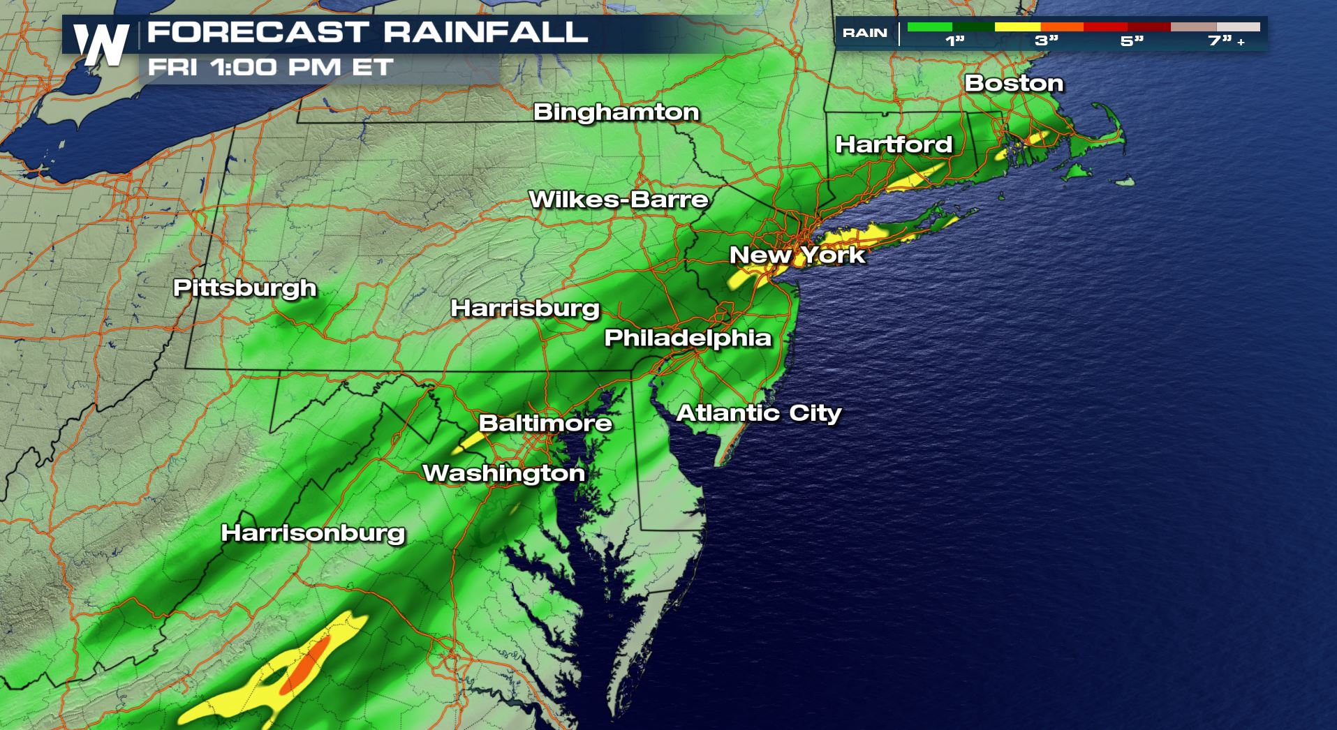 Forecast total rainfall through 1 p.m. Eastern Friday, September 28
We advise you to get out the door a little earlier than usual in these soaked cities on Friday morning! By Friday afternoon's commute it will be far drier.
For WeatherNation, Meteorologist Steve Glazier
Forecast total rainfall through 1 p.m. Eastern Friday, September 28
We advise you to get out the door a little earlier than usual in these soaked cities on Friday morning! By Friday afternoon's commute it will be far drier.
For WeatherNation, Meteorologist Steve Glazier
Flood alerts are in effect through midday Friday for the potential of heavy rain causing flooding.
Flood watches are in effect due to the heavy rainfall. This means that there is a heightened potential for areas of flooding. You'll want to check the traffic conditions and give yourself extra time when driving on these soaked roads. The Friday morning rush hour will be going a little slower, leaving you a little late!
Below you will find three images of how the morning is expected to pan out. These are forecast images from Thursday night so they *could* be slightly off by Friday morning. However they paint a good picture of how the morning will unfold. Take a look:
The forecast radar at 5 a.m. Eastern Time Friday, September 28 where yellow, orange, and red show the heaviest rain.
The forecast radar at 8 a.m. Eastern Time Friday, September 28 where yellow, orange, and red show the heaviest rain.
The forecast radar at 12 p.m. Eastern Time Friday, September 28 where yellow, orange, and red show the heaviest rain.
Most of this rain will leave the Northeast by late-morning Friday. In parts of Southern New England the rain may last as late as early afternoon. Locally heavy rain will be possible with amounts up to three inches!
Forecast total rainfall through 1 p.m. Eastern Friday, September 28
We advise you to get out the door a little earlier than usual in these soaked cities on Friday morning! By Friday afternoon's commute it will be far drier.
For WeatherNation, Meteorologist Steve GlazierAll Weather News
More
East Gears Up for Stormy, Wet Weekend
A low pressure system crashing through the Mi
1 Aug 2026 11:35 AM


Flooding, Severe Storms Target the Midwest Again
After an active week of storms across the nor
1 Aug 2026 1:40 AM

After Reaching Category 5, Genevieve Weakens in the Pacific
PacificFausto is now a post-tropical cyclone.
31 Jul 2026 1:30 AM

Flooding Risk Increases as Heavy Rain Targets the Tri-State Area
Tuesday, heavy rainfall moved across the Nort
30 Jul 2026 12:25 AM

Severe Weather: Energy From the Midwest Now in the Southeast
UPPER MIDWEST - Through Monday, dangerous tor
29 Jul 2026 10:30 PM