Friday Severe Weather Outlook
Special Stories
28 Jun 2019 8:56 AM
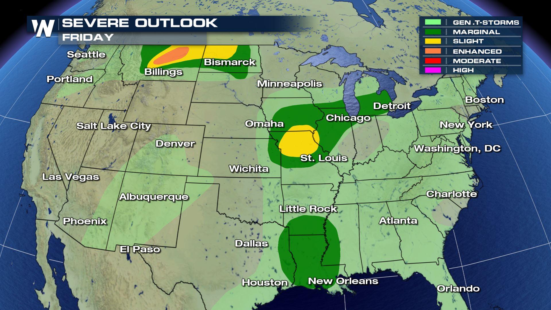
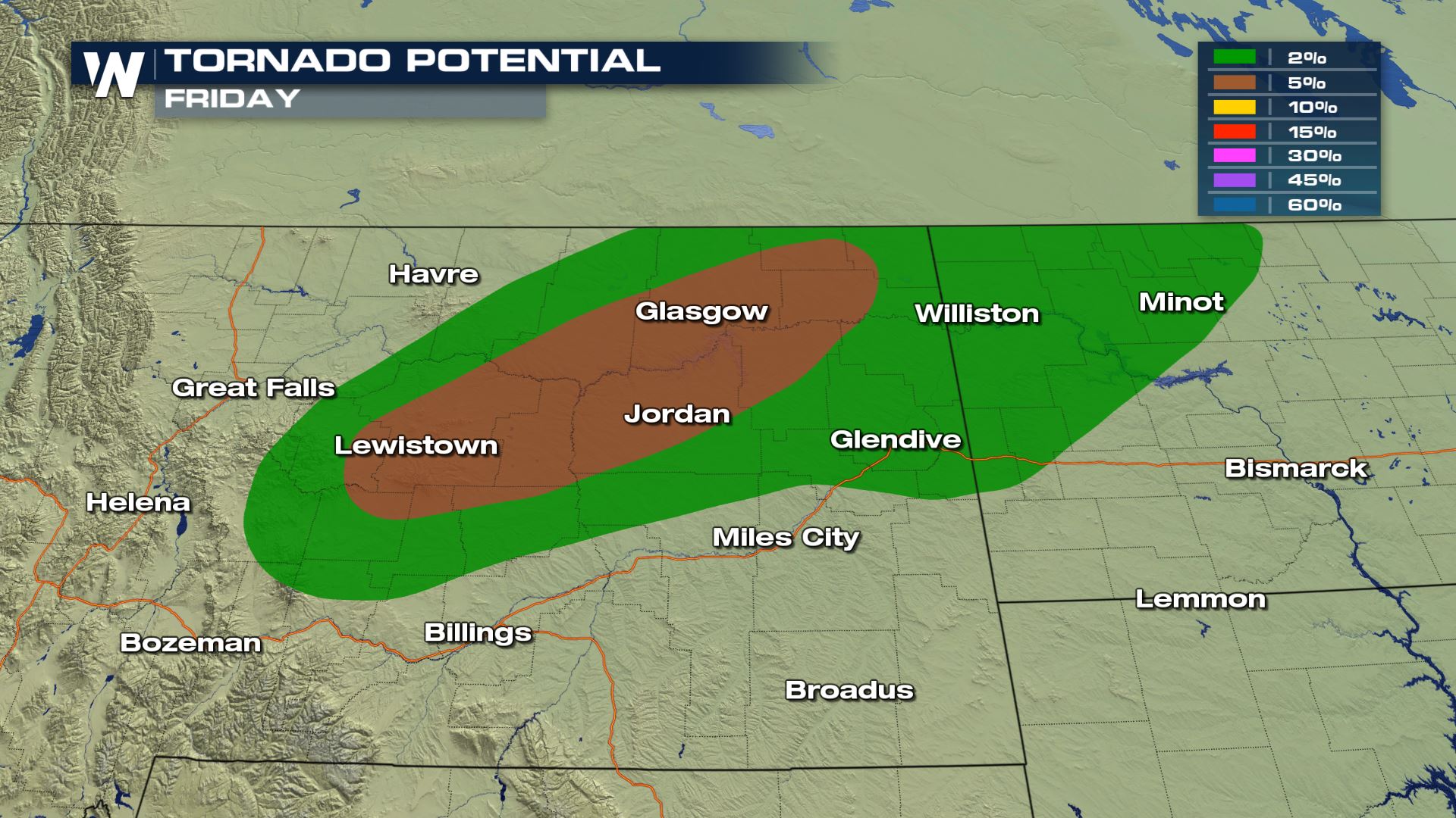
As we head into the weekend, portions of the Plains and Deep South have the potential to see severe thunderstorms for Friday, June 28. There is an enhanced risk for severe weather in North Dakota and Montana, with slight and marginal risks in parts of the Great Lakes, Central Plains and Mississippi Delta.

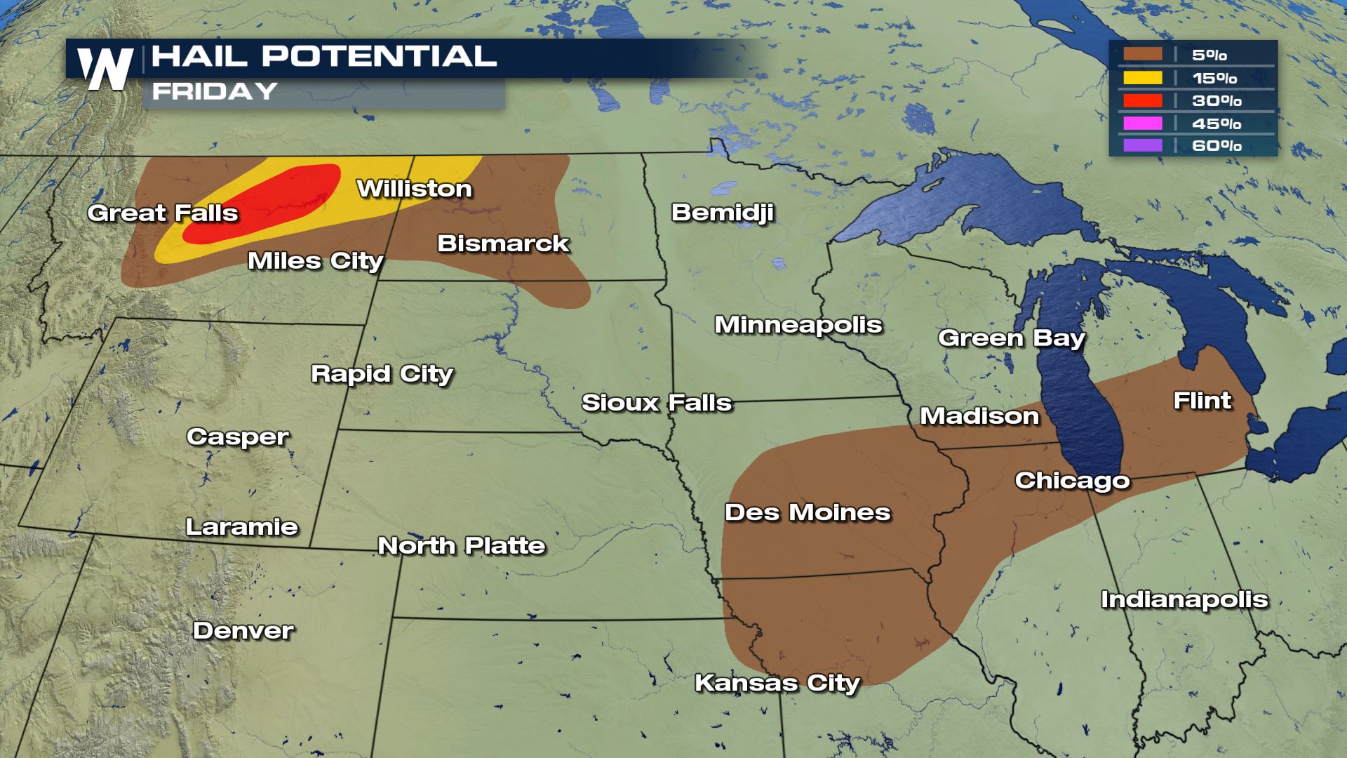
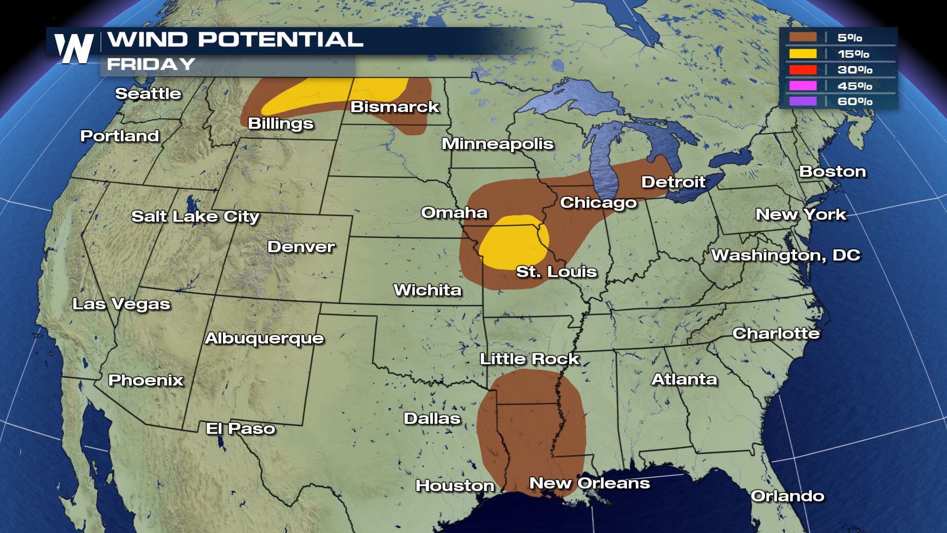
 Damaging wind gusts and large hail are the biggest concerns, with a slightly higher potential in Montana and North Dakota. There is a some risk for tornadoes as well.
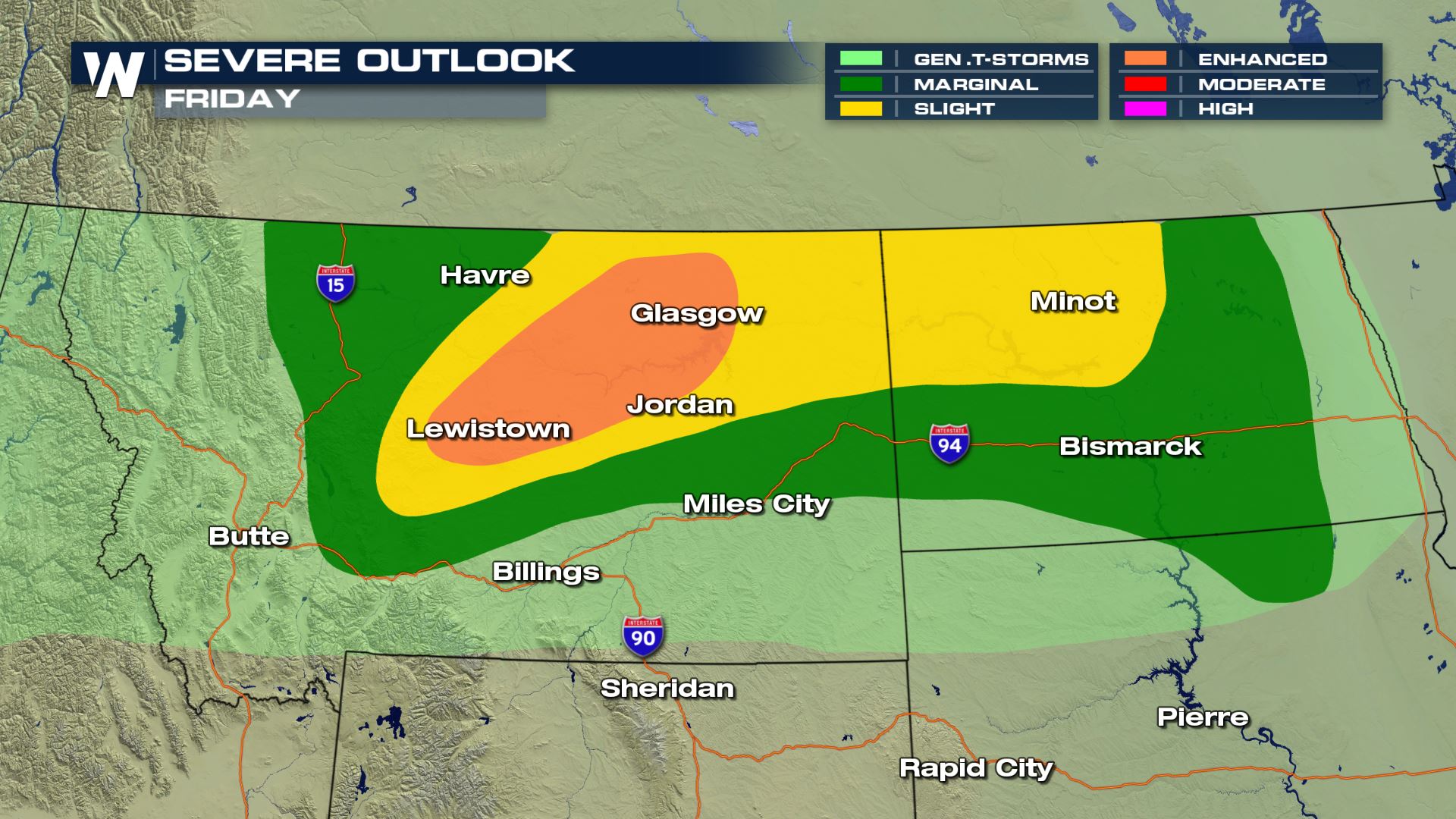
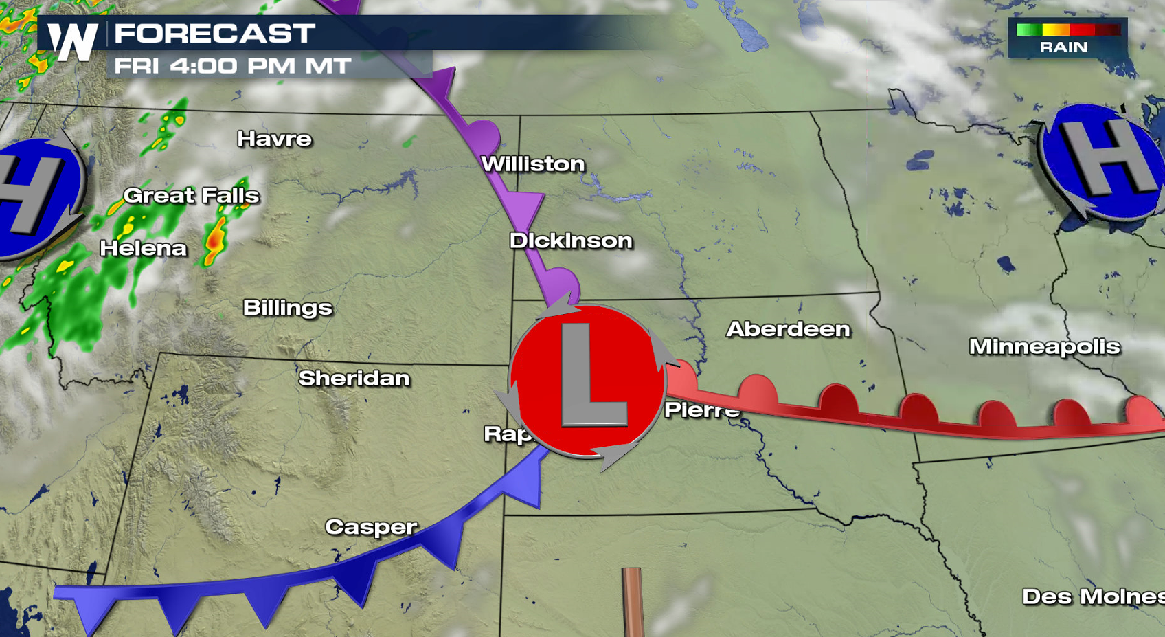
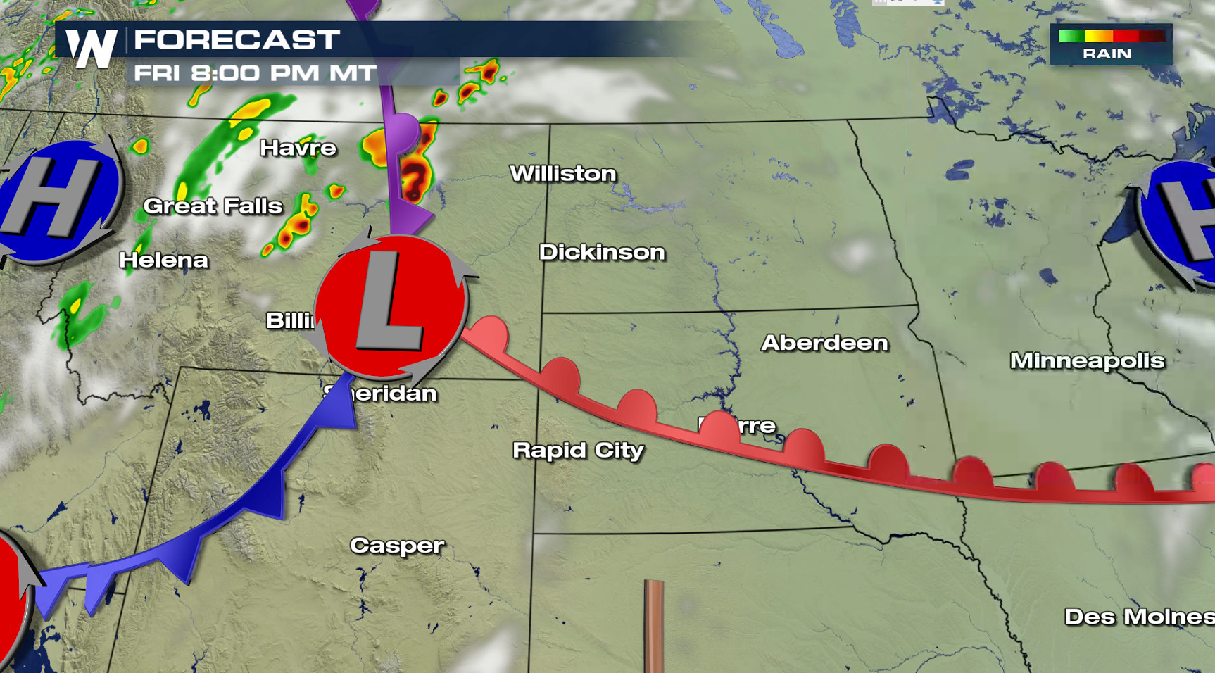
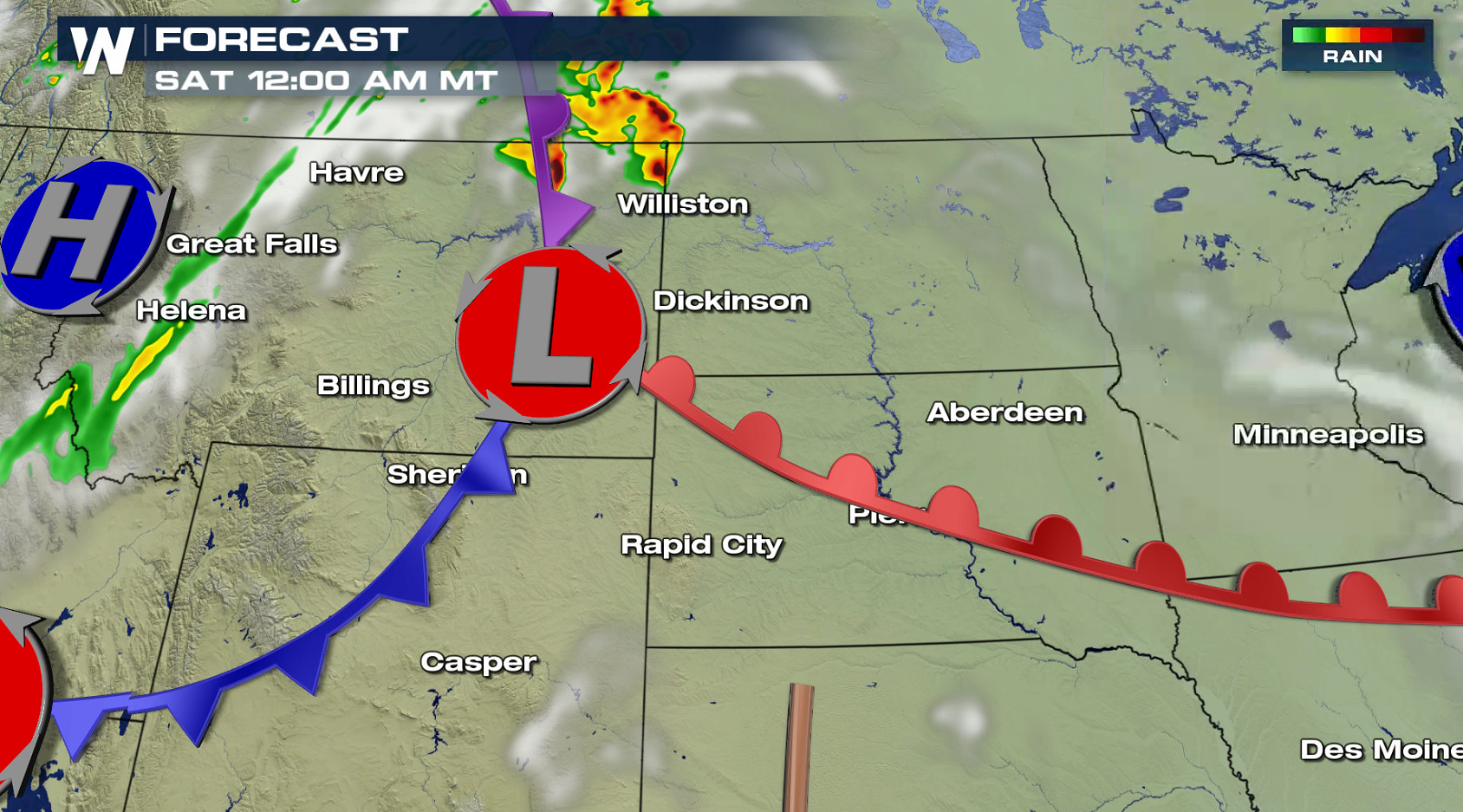
 A slow moving low pressure center will be the main focus for producing thunderstorms. With warm temperatures and increasing humidity, storms will be able to grow in coverage and intensity due to the building instability. Some supercells may form in the late afternoon and early evening.
Here's the hour by hour forecast in the area of greatest risk for the High Plains, including Montana.
A slow moving low pressure center will be the main focus for producing thunderstorms. With warm temperatures and increasing humidity, storms will be able to grow in coverage and intensity due to the building instability. Some supercells may form in the late afternoon and early evening.
Here's the hour by hour forecast in the area of greatest risk for the High Plains, including Montana.
 WeatherNation will keep you updated on-air and online with the latest watches and warnings throughout the weekend.
For WeatherNation: Meteorologist Mace Michaels
WeatherNation will keep you updated on-air and online with the latest watches and warnings throughout the weekend.
For WeatherNation: Meteorologist Mace Michaels
Damaging wind gusts and large hail are the biggest concerns, with a slightly higher potential in Montana and North Dakota. There is a some risk for tornadoes as well.
A slow moving low pressure center will be the main focus for producing thunderstorms. With warm temperatures and increasing humidity, storms will be able to grow in coverage and intensity due to the building instability. Some supercells may form in the late afternoon and early evening.
Here's the hour by hour forecast in the area of greatest risk for the High Plains, including Montana.
WeatherNation will keep you updated on-air and online with the latest watches and warnings throughout the weekend.
For WeatherNation: Meteorologist Mace MichaelsAll Weather News
More
More Storms for the East Through Monday
A low-pressure system that moved through the
2 Aug 2026 10:40 PM

Wildfire Outbreak in the Pacific Northwest
SPOKANE, WA - On Saturday, August 1st, the Ol
2 Aug 2026 10:35 PM


After Reaching Category 5, Genevieve Weakens in the Pacific
PacificGenevieve formed on last Friday south
2 Aug 2026 6:25 PM

Flooding, Severe Storms Target the Midwest Again
After an active week of storms across the nor
1 Aug 2026 1:40 AM

Flooding Risk Increases as Heavy Rain Targets the Tri-State Area
Tuesday, heavy rainfall moved across the Nort
30 Jul 2026 12:25 AM

Severe Weather: Energy From the Midwest Now in the Southeast
UPPER MIDWEST - Through Monday, dangerous tor
29 Jul 2026 10:30 PM