Friday Severe Weather Risks - Plains and Middle Atlantic
Special Stories
23 Aug 2019 5:29 AM
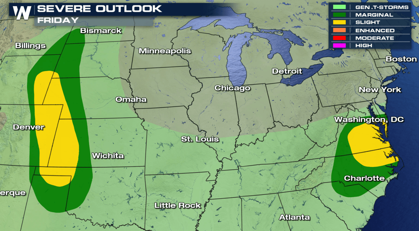
The work week will end with a risk for severe thunderstorms in the Plains, Front Range, and Middle Atlantic. Those are the two areas of focus, according to NOAA's Storm Prediction Center.
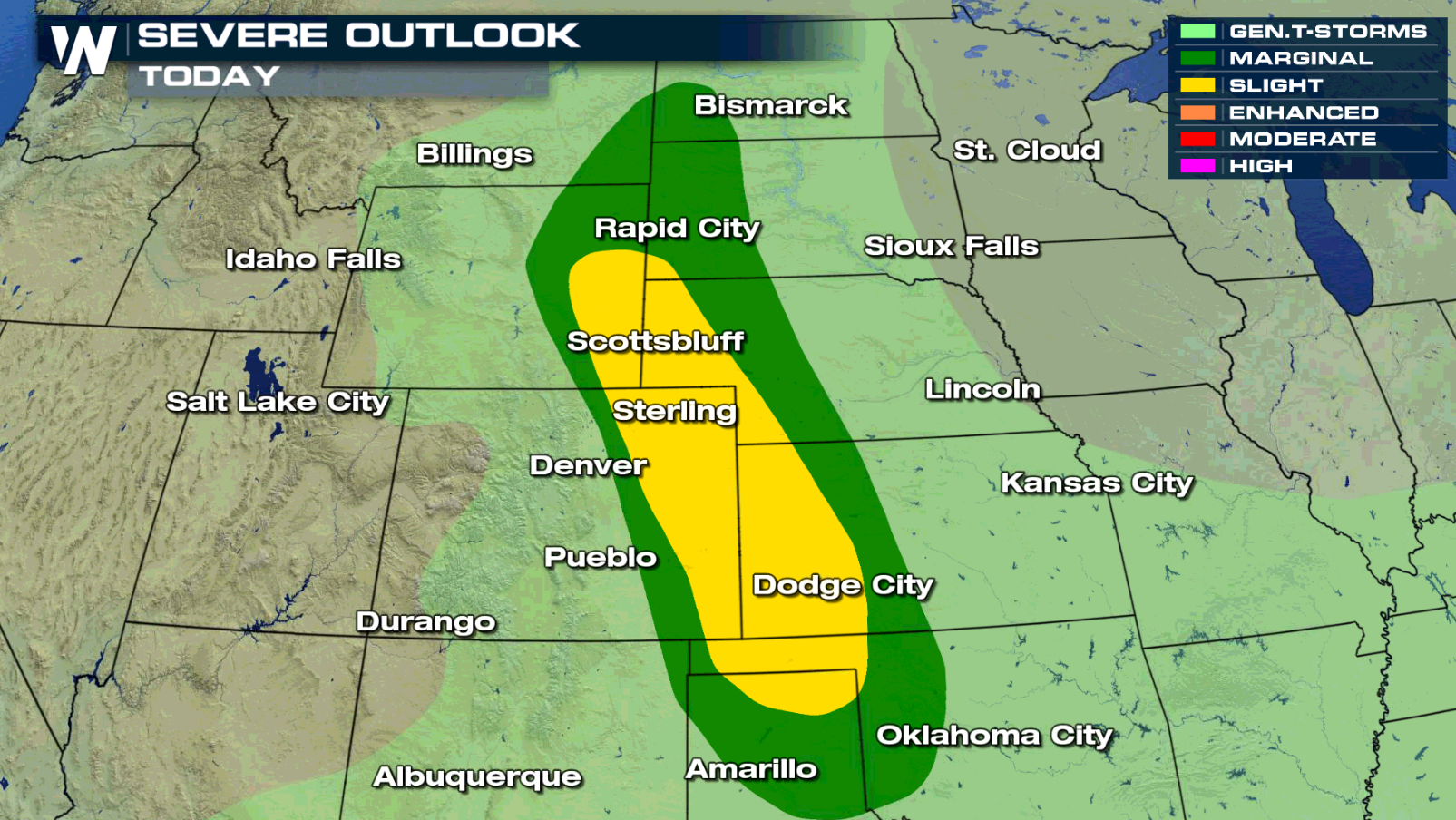
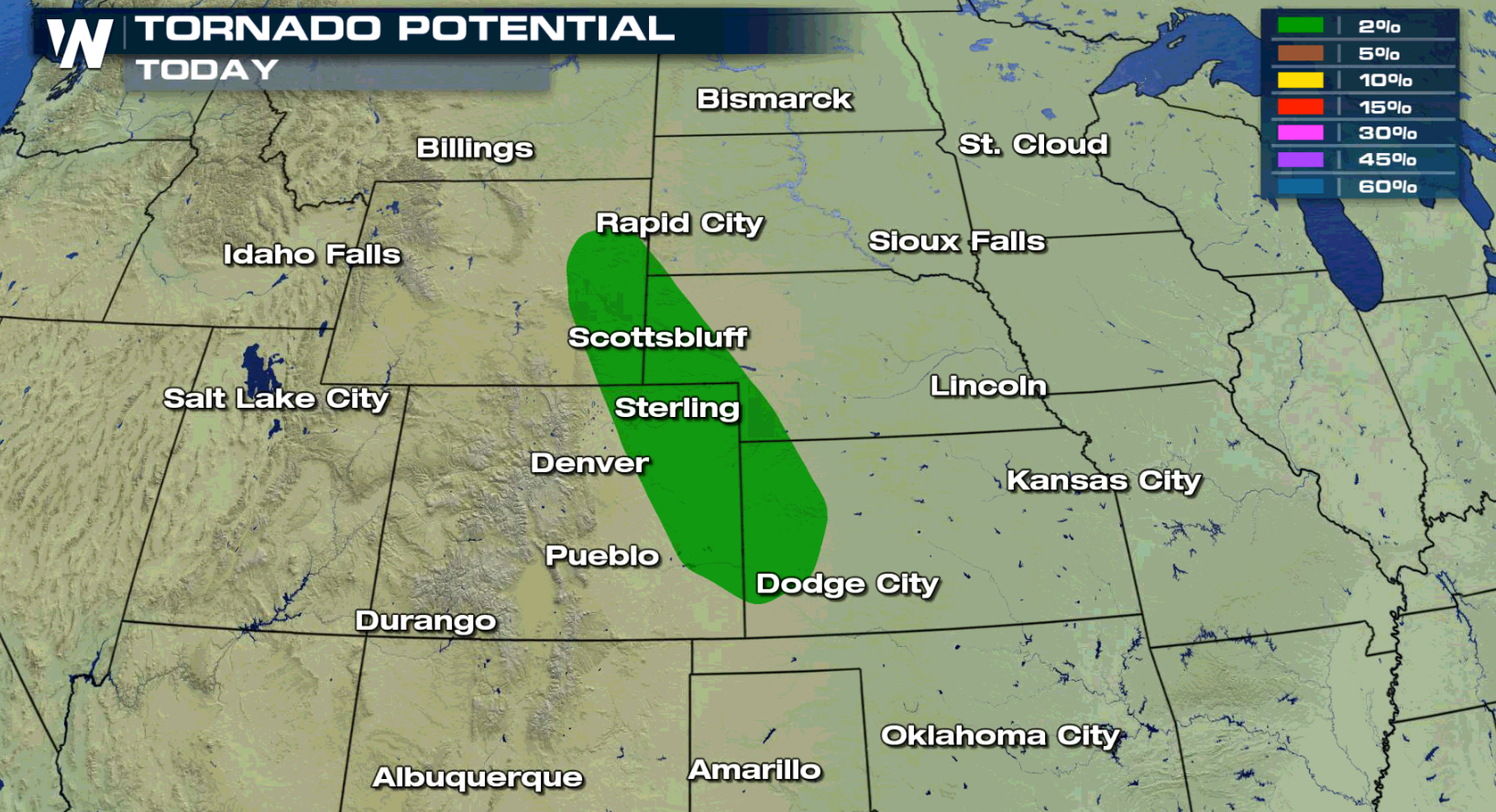
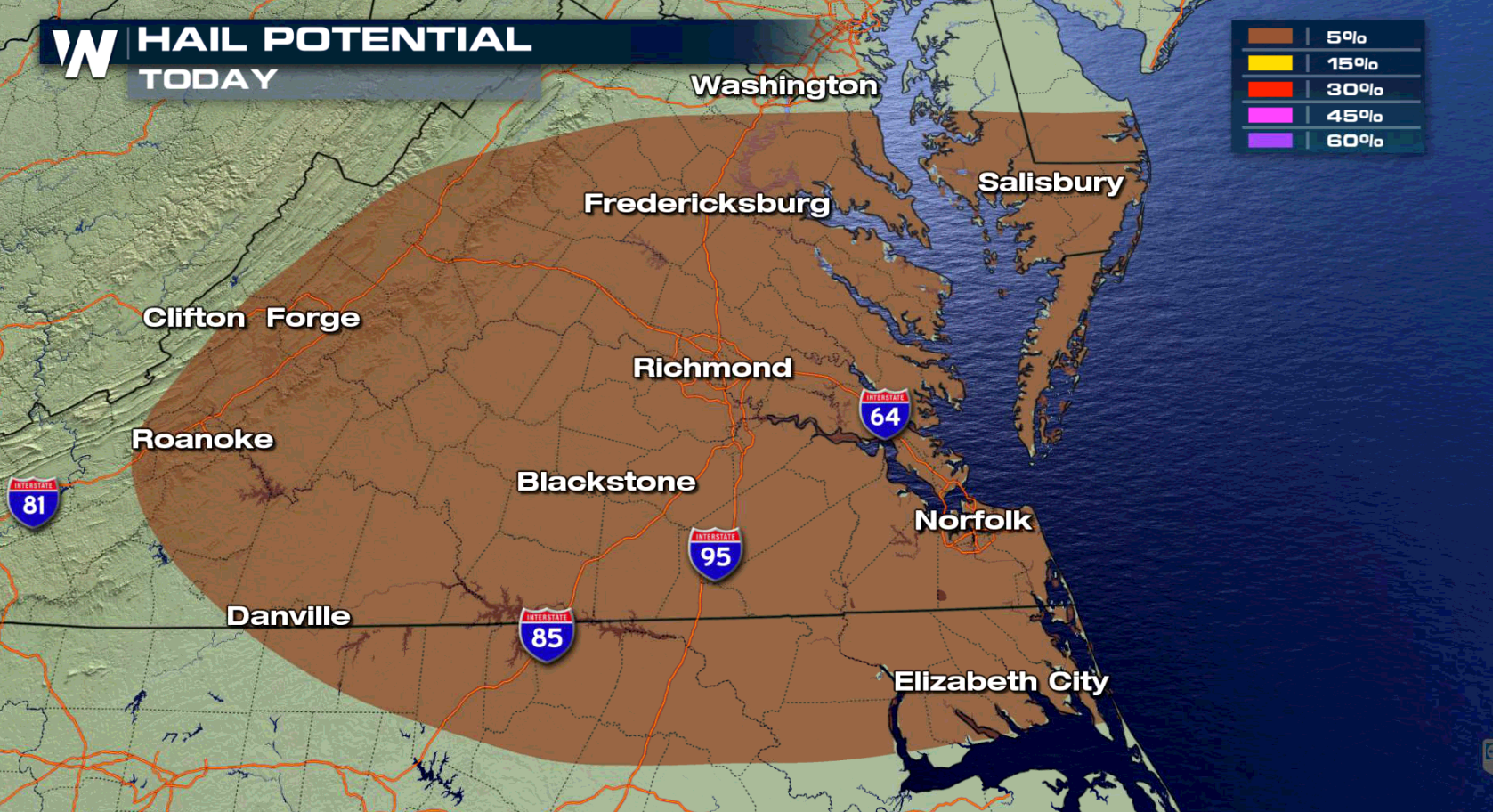
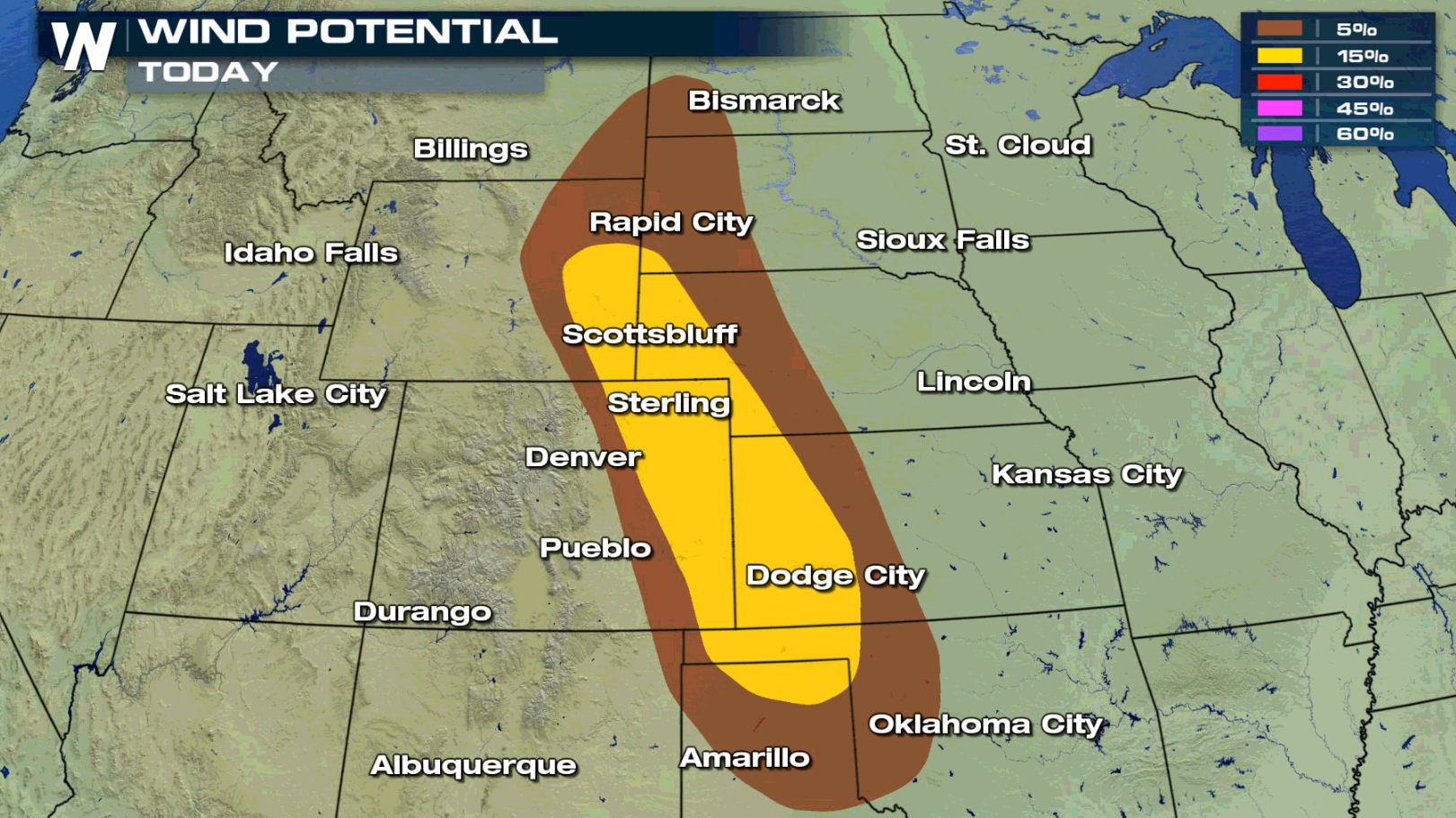 Damaging wind gusts, higher than 58 mph, and large hail, greater than an inch in diameter, are the biggest concerns. There is a threat for tornadoes in the late afternoon and earlier evening, mainly in the Front Range.
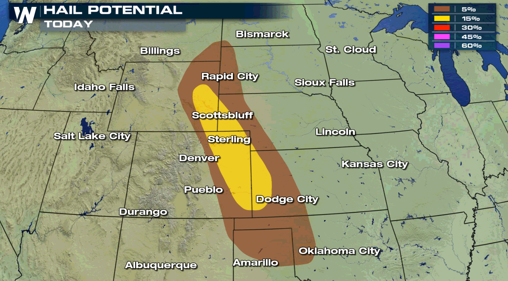
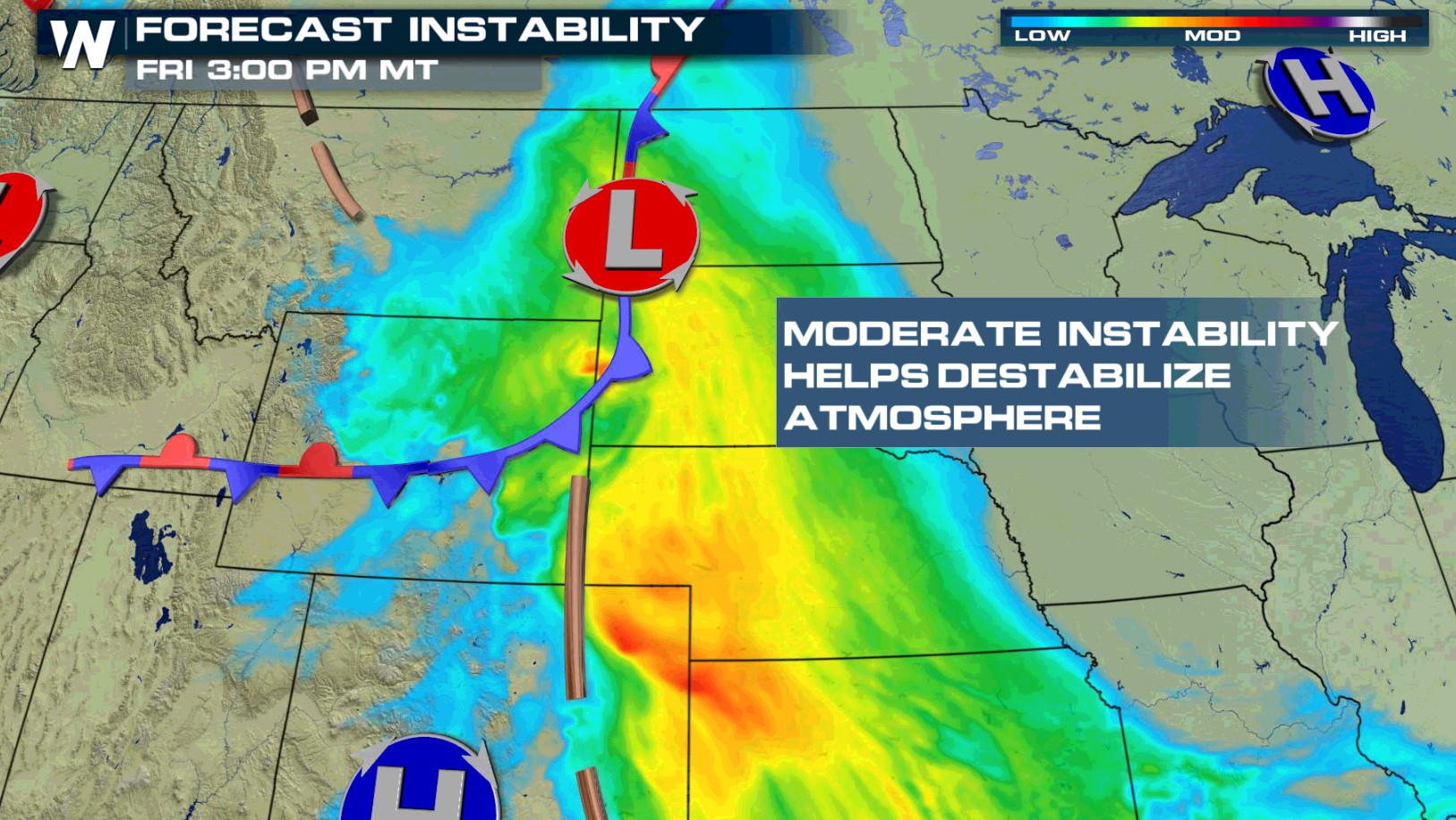
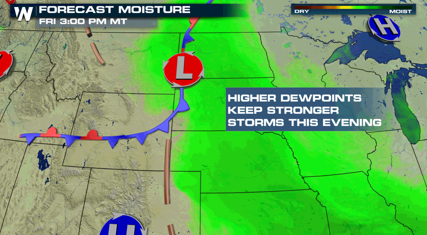
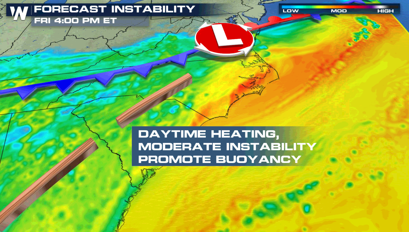
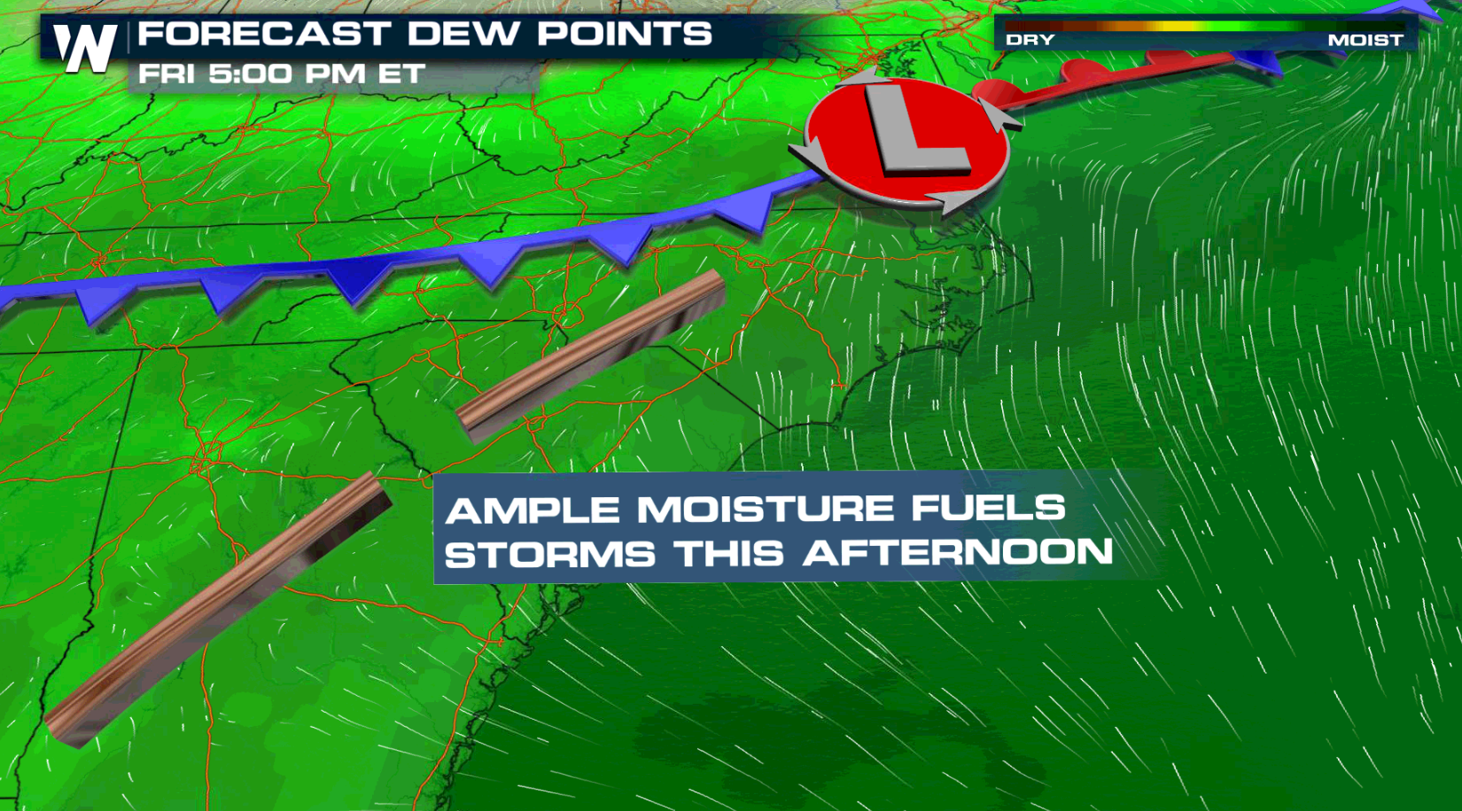
 Instability will be building throughout the day and dew points will be climbing. That will help storms form and sustain strength. Storms will likely remain strong throughout the night.
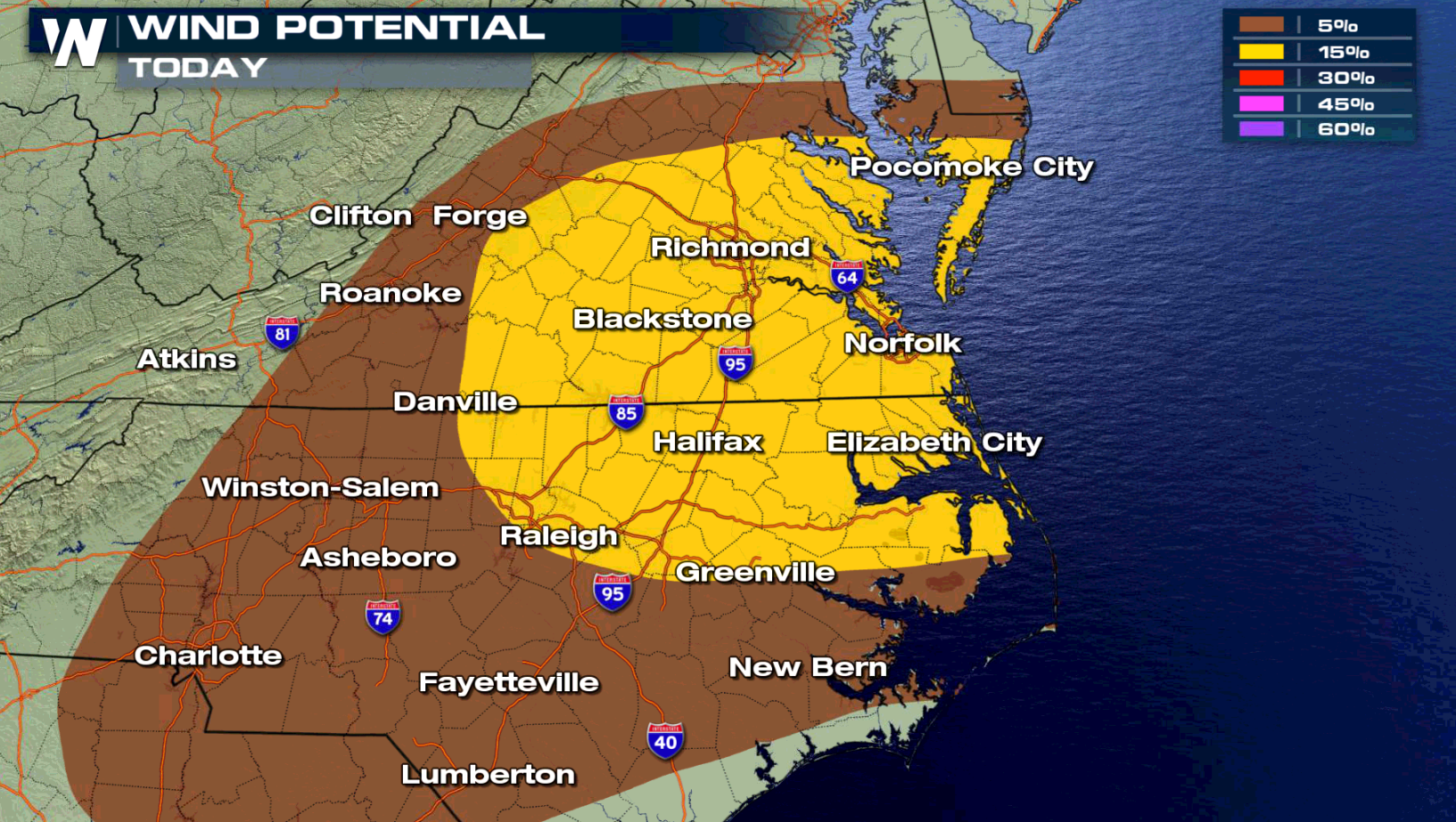
 Along the Atlantic, The Hampton Roads and Outer Banks of North Carolina also have a risk for severe weather. A cold front and low pressure center will produce damaging wind gusts in the afternoon and evening.
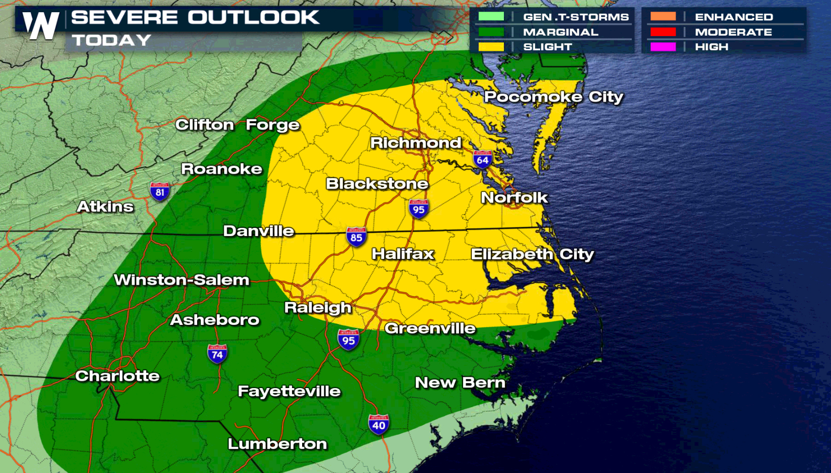
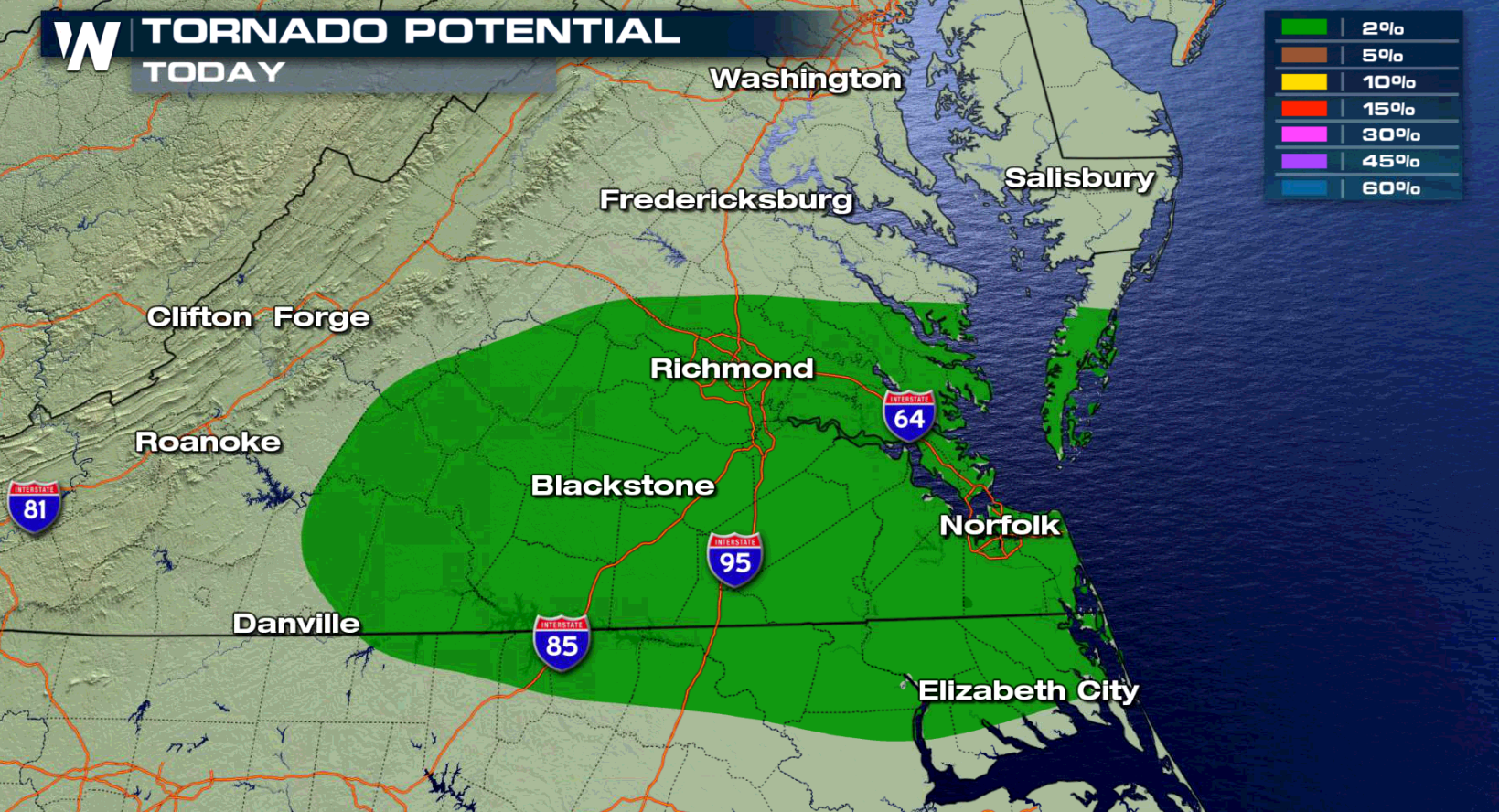
 There is also a low risk for tornadoes, mainly centered in near the mouth of Chesapeake Bay and in the Hampton Roads.
 As the low pressure center approaching the Atlantic Ocean, it will drag a cold front across the region. Moderate instability and high humidity will produce severe thunderstorms in the afternoon and evening.
 For WeatherNation: Meteorologist Mace Michaels
Damaging wind gusts, higher than 58 mph, and large hail, greater than an inch in diameter, are the biggest concerns. There is a threat for tornadoes in the late afternoon and earlier evening, mainly in the Front Range.
Instability will be building throughout the day and dew points will be climbing. That will help storms form and sustain strength. Storms will likely remain strong throughout the night.
Along the Atlantic, The Hampton Roads and Outer Banks of North Carolina also have a risk for severe weather. A cold front and low pressure center will produce damaging wind gusts in the afternoon and evening.
There is also a low risk for tornadoes, mainly centered in near the mouth of Chesapeake Bay and in the Hampton Roads.
As the low pressure center approaching the Atlantic Ocean, it will drag a cold front across the region. Moderate instability and high humidity will produce severe thunderstorms in the afternoon and evening.
For WeatherNation: Meteorologist Mace MichaelsAll Weather News
More

Tropics: Fausto Heads towards Hawaii; Genevieve Cat 4 Hurricane
PacificTropical Storm Fausto continues to tra
28 Jul 2026 10:30 AM

Severe Storms Target the Midwest to the Northeast
UPPER MIDWEST - Through Monday, dangerous tor
28 Jul 2026 10:25 AM

Southeast Flood Risk Lingers Near Stalled Front
A stalled boundary over the Southeast will ke
25 Jul 2026 10:55 AM

Another Round of Storms Targets the Northeast
Tuesday brought severe weather again across p
23 Jul 2026 1:15 AM

Another Round of Severe Weather for the Upper Midwest and Great Lakes
The upper-level low train continues to keep t
21 Jul 2026 1:45 AM

Air Quality Improvements in the Forecast
Wildfires burning in Northwestern Ontario, Ca
20 Jul 2026 7:20 PM