Frigid air moves in; Wind Chill Alerts for the Northeast
Special Stories
28 Jan 2021 10:46 AM
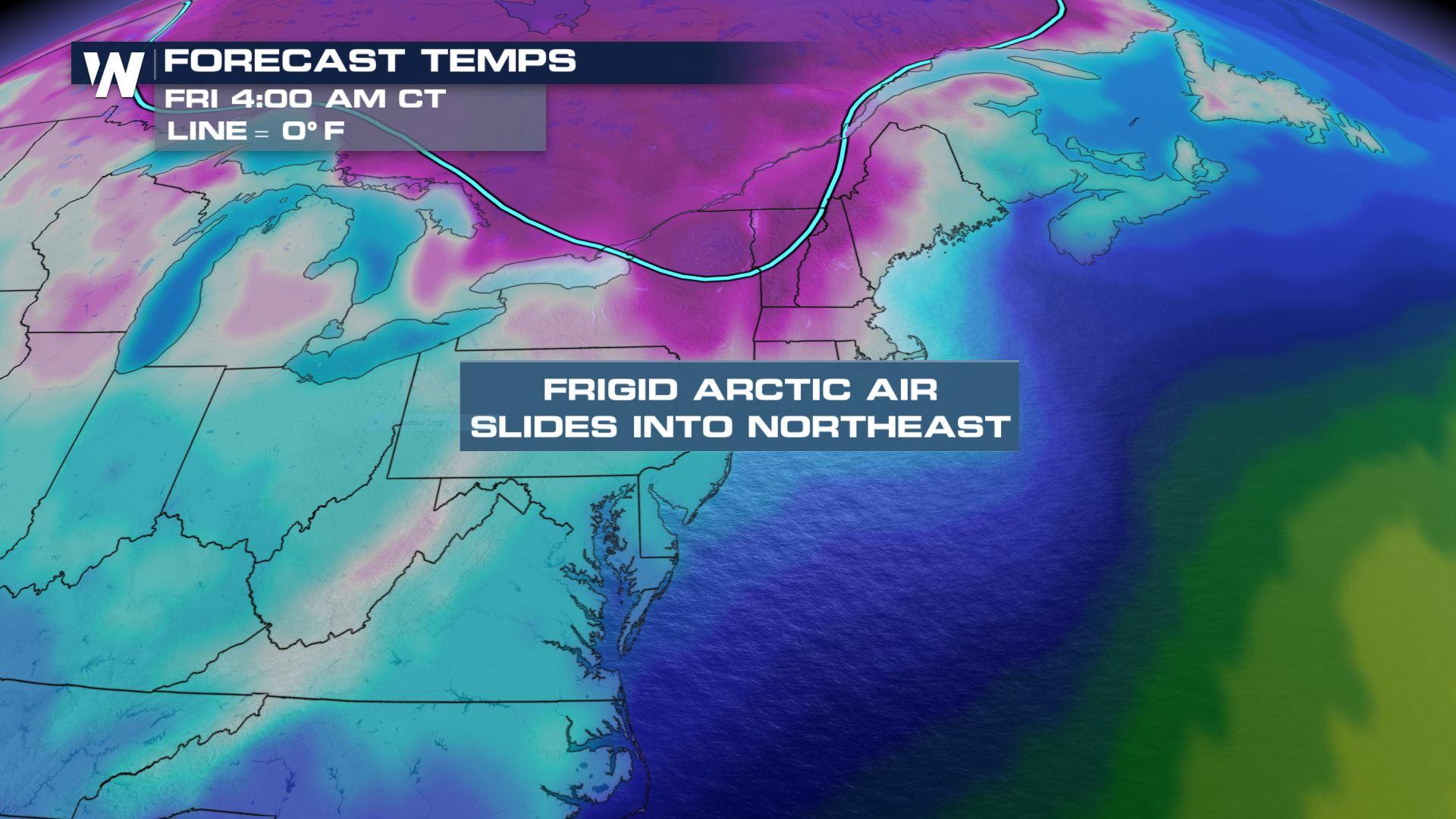
Frigid Canadian air is headed into the Northeast Thursday night into Friday with wind chills expected to be as low as -25° to -30° F. This cold blast lingers into the weekend with very cold mornings expected.
 This Arctic air will spill into the northeast on the back side of a cold front. Not only will it be incredibly cold but it will also be very windy behind the front. As temperatures plummet overnight this will lead to dangerous wind chills.
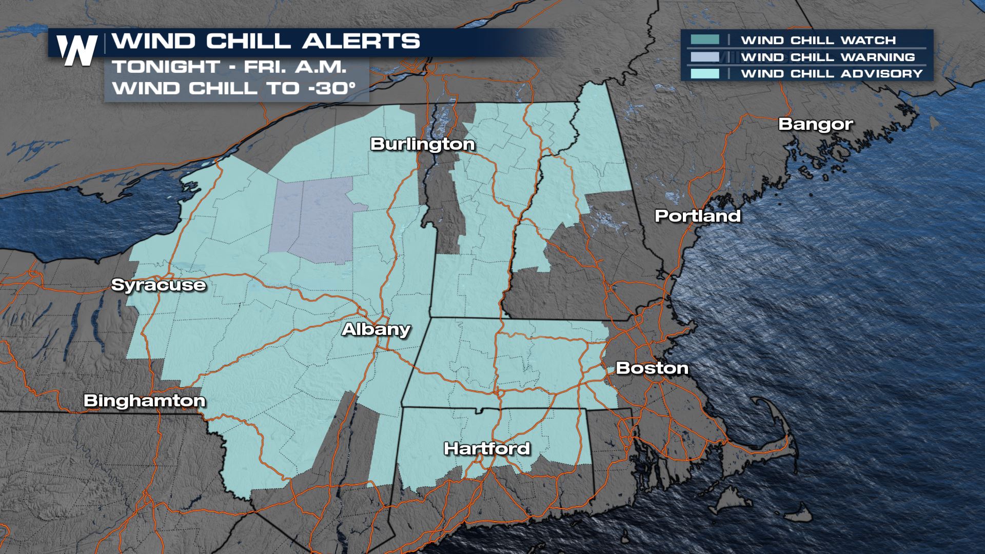 Wind chills could be as low as -25° in the light blue shaded areas in the Wind Chill Advisory across central and eastern New York, Massachusetts, northern Connecticut, Vermont and New Hampshire. Wind chills in the Tug Hill Plateau may be even colder, down to -30° where there is a Wind Chill Warning.
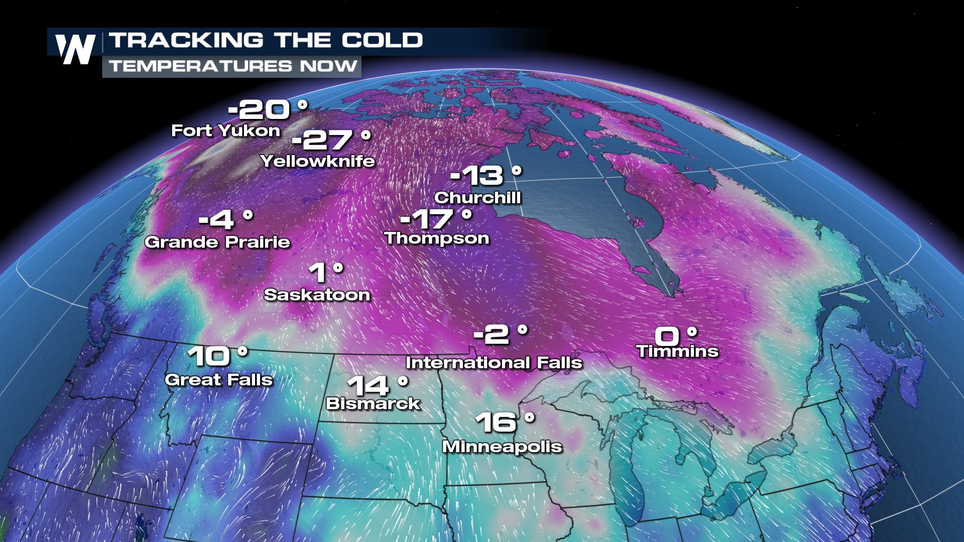
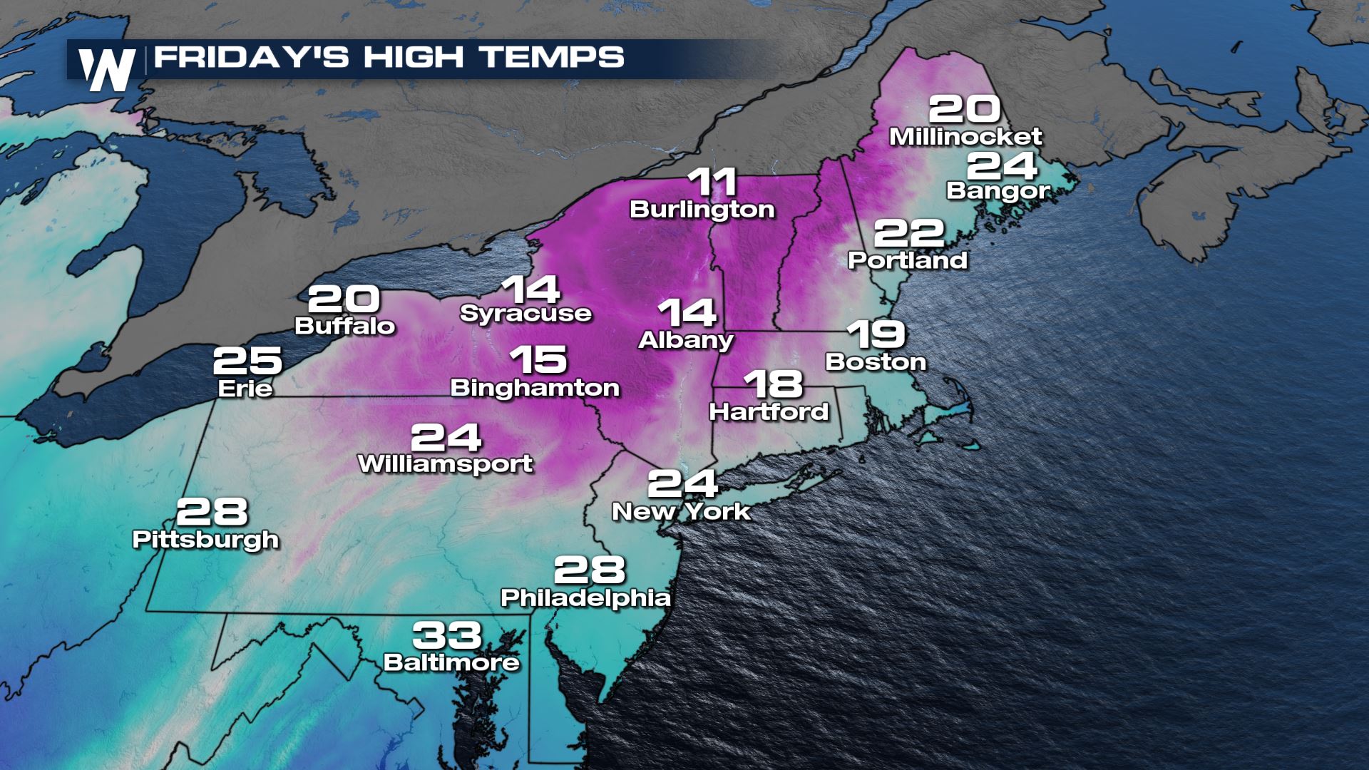
 As the Canadian air flows in behind the cold front, temperatures will fall into the single digits overnight with some spots dropping below 0.
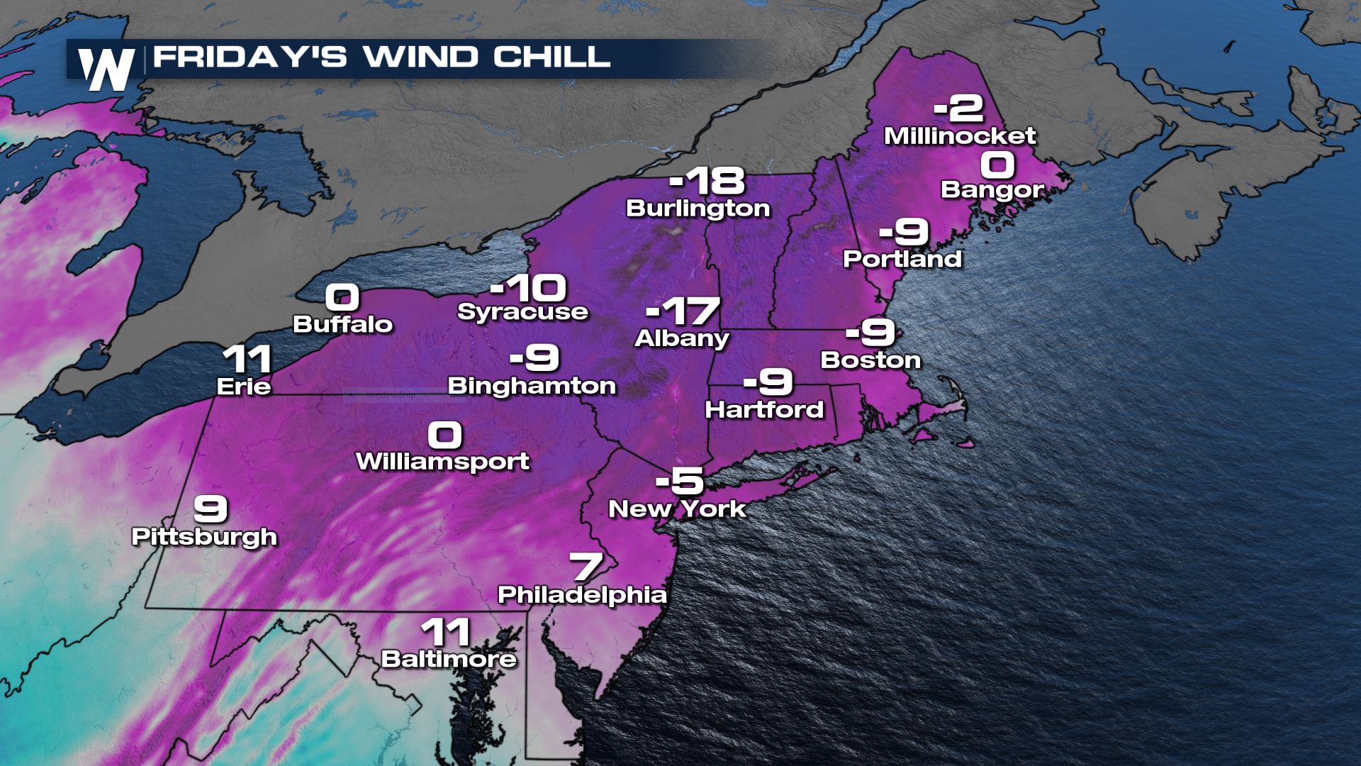 Wind chills will be even colder in the dark purple and white shaded areas. This is dangerous cold, so take care to stay warm if you must be outside for any length of time or stay inside if at all possible. Make sure to bring all pets inside as well.
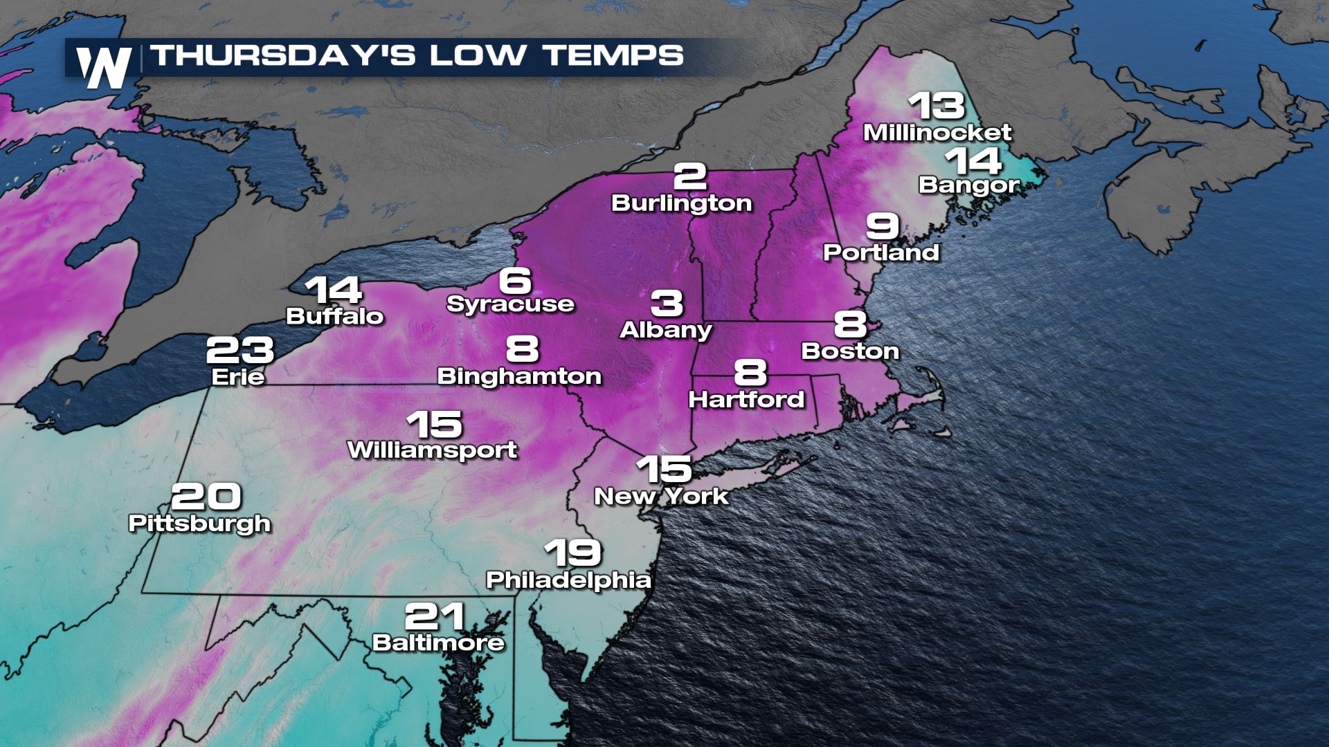
Temperatures will not warm up much Friday or Saturday with the frigid air still in place. Many areas toward the Canadian border will stay in the teens for highs.
Wind chills will be even colder in the dark purple and white shaded areas. This is dangerous cold, so take care to stay warm if you must be outside for any length of time or stay inside if at all possible. Make sure to bring all pets inside as well.
Temperatures will not warm up much Friday or Saturday with the frigid air still in place. Many areas toward the Canadian border will stay in the teens for highs.
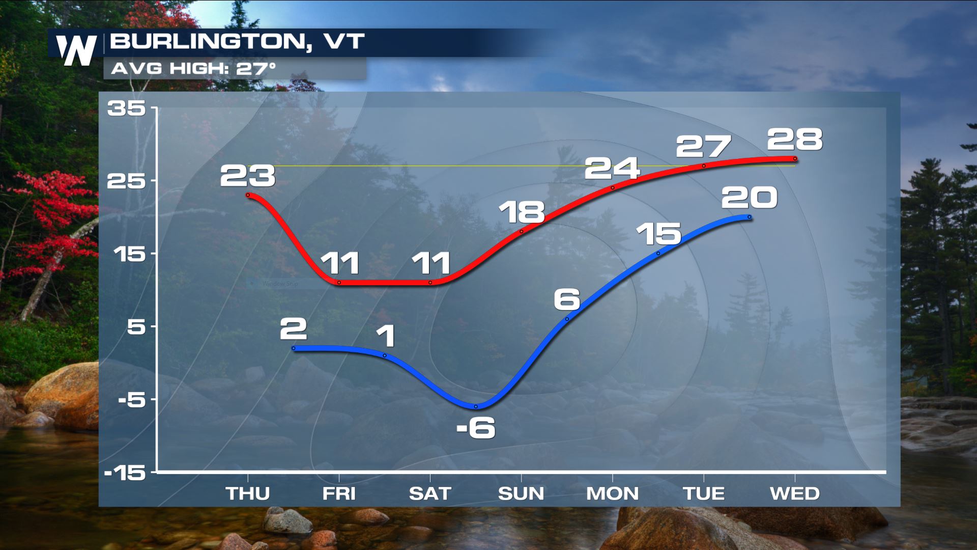
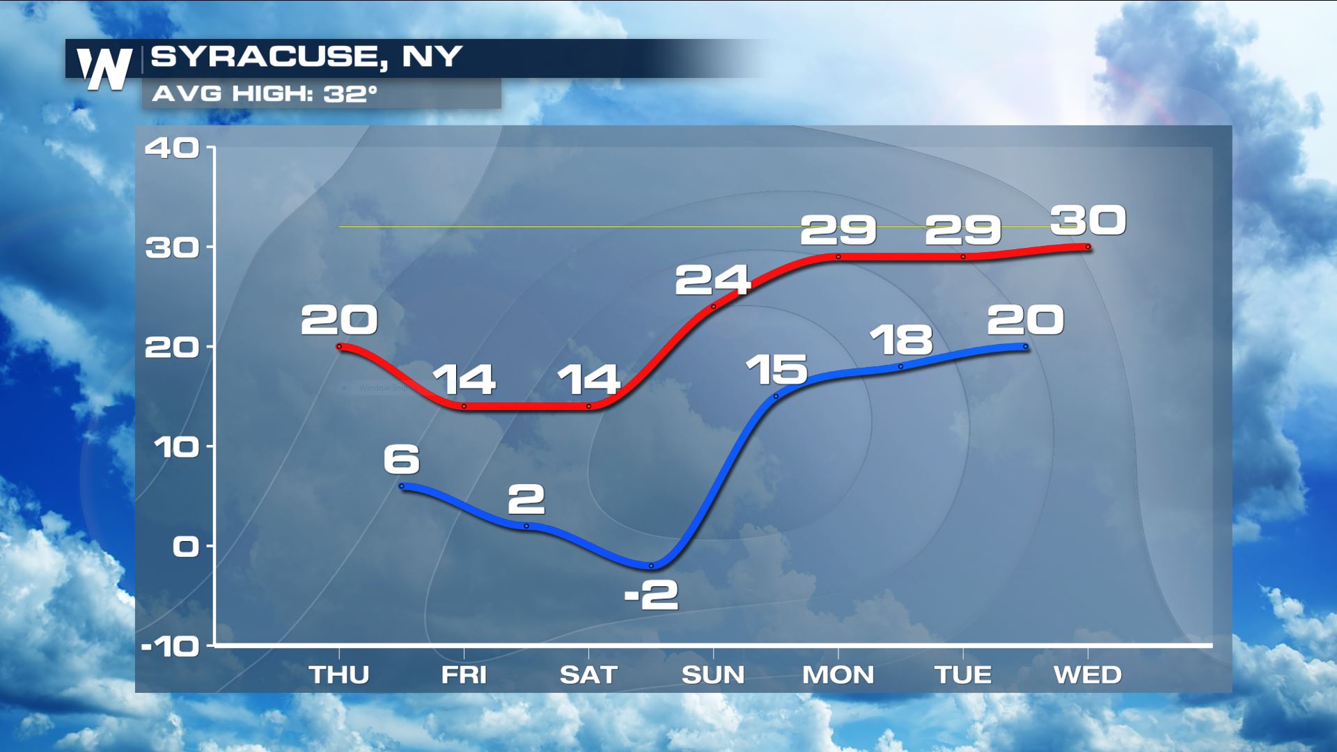
 Temperatures for places like Burlington and Syracuse will be in the low single digits for the next several nights. Saturday night will be the coldest with lows falling below zero, but the wind will be calm.
 This is one of our top weather headlines. Stay with WeatherNation for all the details on this bitter cold blast and other national weather headlines.
This Arctic air will spill into the northeast on the back side of a cold front. Not only will it be incredibly cold but it will also be very windy behind the front. As temperatures plummet overnight this will lead to dangerous wind chills.
Wind chills could be as low as -25° in the light blue shaded areas in the Wind Chill Advisory across central and eastern New York, Massachusetts, northern Connecticut, Vermont and New Hampshire. Wind chills in the Tug Hill Plateau may be even colder, down to -30° where there is a Wind Chill Warning.
As the Canadian air flows in behind the cold front, temperatures will fall into the single digits overnight with some spots dropping below 0.
Wind chills will be even colder in the dark purple and white shaded areas. This is dangerous cold, so take care to stay warm if you must be outside for any length of time or stay inside if at all possible. Make sure to bring all pets inside as well.
Temperatures will not warm up much Friday or Saturday with the frigid air still in place. Many areas toward the Canadian border will stay in the teens for highs.
Temperatures for places like Burlington and Syracuse will be in the low single digits for the next several nights. Saturday night will be the coldest with lows falling below zero, but the wind will be calm.
This is one of our top weather headlines. Stay with WeatherNation for all the details on this bitter cold blast and other national weather headlines.
All Weather News
More
Fronts Continue To Spark Severe Weather Across the Plains
A cold front that brought record lows to the
18 Jul 2025 10:40 PM

Extreme Heat Impacts for the East Coast & South
Extreme heat continues to impact several area
18 Jul 2025 10:05 PM

Flooding Threat Remains Elevated in the East
A cold front pushing through the Eastern Seab
18 Jul 2025 9:10 PM

EF-2 Firenado from the Deer Creek Fire in Utah
A fire tornado was spotted near La Sal, Utah
18 Jul 2025 7:30 AM

Tropical System Brings Flood Risk to the Central Gulf
Time has run out for notable tropical develop
18 Jul 2025 3:05 AM

Heavy Rain, Flooding Threat Returns to Florida
Keep the rain boots handy in Florida - heavy
13 Jul 2025 12:50 PM

Severe Storm Risk Pushes into the Great Lakes, Ohio Valley
Friday was another busy day with severe weath
12 Jul 2025 8:00 PM