Getaway Forecast

Special Stories
26 Mar 2019 11:37 AM
FORECAST
 The getaway forecast is looking a little wet over the next couple of days. Isolated showers will start to pop up as we head into the evening hours.
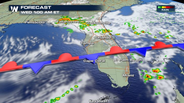
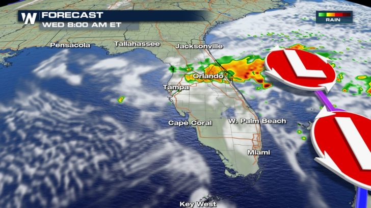
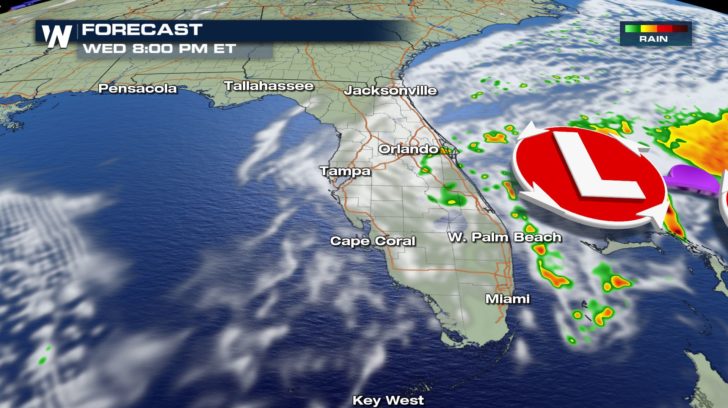
By Wednesday morning, a band of heavy rain accompanied by thunderstorms will move into the panhandle of Florida and slowly track towards the south. Expect these showers to linger all throughout the day.
By Thursday, it looks to be a lot better with rain and clouds clearing up.
TEMPERATURE FORECAST
The getaway forecast is looking a little wet over the next couple of days. Isolated showers will start to pop up as we head into the evening hours.
By Wednesday morning, a band of heavy rain accompanied by thunderstorms will move into the panhandle of Florida and slowly track towards the south. Expect these showers to linger all throughout the day.
By Thursday, it looks to be a lot better with rain and clouds clearing up.
TEMPERATURE FORECAST
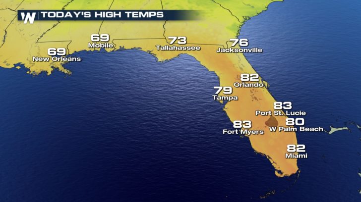
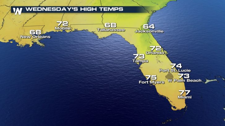
 Temperatures today will be quite pleasant, but once the front passes, temperatures will cool off into the 60s and 70s for the middle of the work week.
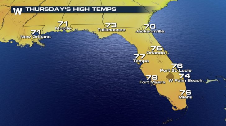
By Friday, we should see temperatures start to warm back up.
Temperatures today will be quite pleasant, but once the front passes, temperatures will cool off into the 60s and 70s for the middle of the work week.
By Friday, we should see temperatures start to warm back up.
The getaway forecast is looking a little wet over the next couple of days. Isolated showers will start to pop up as we head into the evening hours.
By Wednesday morning, a band of heavy rain accompanied by thunderstorms will move into the panhandle of Florida and slowly track towards the south. Expect these showers to linger all throughout the day.
By Thursday, it looks to be a lot better with rain and clouds clearing up.
TEMPERATURE FORECAST
Temperatures today will be quite pleasant, but once the front passes, temperatures will cool off into the 60s and 70s for the middle of the work week.
By Friday, we should see temperatures start to warm back up.All Weather News
More
Fronts Continue To Spark Severe Weather Across the Plains
A cold front that brought record lows to the
18 Jul 2025 10:40 PM

Extreme Heat Impacts for the East Coast & South
Extreme heat continues to impact several area
18 Jul 2025 10:05 PM

Flooding Threat Remains Elevated in the East
A cold front pushing through the Eastern Seab
18 Jul 2025 9:10 PM

EF-2 Firenado from the Deer Creek Fire in Utah
A fire tornado was spotted near La Sal, Utah
18 Jul 2025 7:30 AM

Tropical System Brings Flood Risk to the Central Gulf
Time has run out for notable tropical develop
18 Jul 2025 3:05 AM

Heavy Rain, Flooding Threat Returns to Florida
Keep the rain boots handy in Florida - heavy
13 Jul 2025 12:50 PM

Severe Storm Risk Pushes into the Great Lakes, Ohio Valley
Friday was another busy day with severe weath
12 Jul 2025 8:00 PM