It was a successful launch for the NOAA GOES-S Satellite launch! Watch the launch here:
https://www.facebook.com/WeatherNation/videos/10156296250339874/
https://twitter.com/JVPStorm/status/969335459682930688
The Day of the Launch
https://youtu.be/ORA9BaCcjls
We’re quickly approaching another milestone in Earth Observation satellite deployment, as we get ready for the launch of GOES-S, the next major addition to the NOAA satellite fleet. Once it’s operational, this bird will become GOES-17, the new GOES-West satellite and will overlap it’s view of Earth with GOES-East to cover the Western Hemisphere.
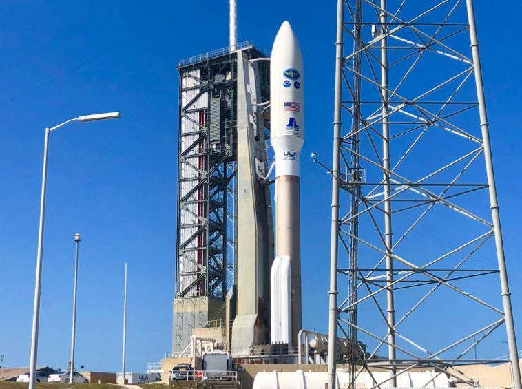
On November 19th, 2016, the night sky over Cape Canaveral was ripped open by a United Launch Alliance Atlas V rocket, carrying the first of the next generation of NOAA weather satellite, GOES-R into space. Just a little more than a year later, after calibrations, testing, and a move to its permanent location, the newly designated GOES-16 became our new GOES-East satellite, on December 18th last year.
The entire GOES-R series of four identical satellites, GOES-R, S, T and U. Are equipped with Advanced Baseline Imagers, designed to scan the western hemisphere five times faster, with four times the image resolution and three times the color channels of our older legacy systems. That means much faster, extremely more accurate observations of severe storms, tropical systems, smoke and volcanic ash.
As a matter of fact, last year, months before officially operational, the ABI on GOES-16 helped National Weather Service offices detect wildfires in Kansas and Oklahoma, well before the first 911 calls came in!
During severe weather, another incredible GOES instrument, the Geostationary Lightning Mapper, can shoot 500 images per second, as it tracks cloud to ground strikes, and lightning activity in the the clouds that charge the atmosphere. New research indicates that increased lightning activity may be a predictor for tornado formation, so with the GLM, forecasters have another powerful tool to help warn us earlier than ever before.
Once operational as GOES-WEST, GOES-S will be followed to orbit next year by GOES-T and in 2024 by GOES-U, keeping this lifesaving satellite series operational through 2036.
https://www.youtube.com/watch?v=siSypEEhk8A
The GOES-S Journey
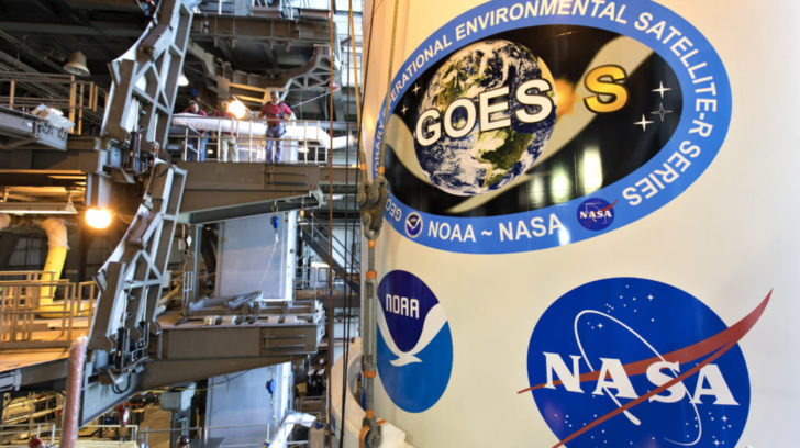
It was in December of 2015 that NOAA’s next generation weather satellite, GOES-S, started being assembled.
“This is an operational satellite,” said Tim Gasparrini, GOES-R Series Program Director at Lockheed Martin. “There’s millions of people that depend on the data coming off of this satellite. And it’s got to work, and it’s got to work every minute of every day.”
https://twitter.com/WeatherNation/status/967157935062228992
The satellite underwent two years of calibrations and vigorous testing to prepare for a life in outer space.
“We had to build them to survive that environment and meet all the requirements not only at launch, carrying on for operations, but for ten years afterwards,” said Dr. Frank Eparvier, who worked on the GOES-R Series EXIS Instrument at the Laboratory for Atmospheric & Space Physics.
In July of 2017, WeatherNation was able to get a first look at the completed satellite, then an exclusive opportunity to travel with GOES-S from Colorado to Florida, where it’s awaits liftoff on March 1.
This weather satellite will join its predecessor, GOES-East, to watch over the entire western hemisphere.
The payload fairing containing NOAA’s Geostationary Operational Environmental Satellite-S (GOES-S) was lifted up by crane and moved into the United Launch Alliance (ULA) Vertical Integration Facility at Space Launch Complex 41 at Cape Canaveral Air Force Station in Florida. The fairing will be mated to the ULA Atlas V rocket. GOES-S is the second in a series of four advanced geostationary weather satellites. The satellite is slated to launch aboard the ULA Atlas V on March 1.
“GOES-17 will provide coverage of the Western US, Alaska, Hawaii, the Pacific Ocean, Mexico, and Central America,” said Ajay Mehta, acting deputy assistant administrator for systems at NOAA’s National Environmental Satellite, Data and Information Service (NESDIS).
https://twitter.com/WeatherNation/status/966694210089955329
GOES-S will be working with GOES-East to continue to send back images and data that will assist meteorologists with forecasts and aid in decision making by community and national leaders.
“We’re now able to cover the entire domain space of what we’re responsible for in terms of public safety and this data will have a fundamental role in improving our situational awareness and our forecast capabilities,” said Dr. Louis Uccellini, director of the National Weather Service.
United Launch Alliance NASA LSP & Delta II Program Manager Scott Messer talks about the upcoming mission
“This means more lives are saved and better environmental intelligence for state and local officials who, for example, may need to make decisions about when to call for evacuations ahead of life threatening wildfires,” Mehta said.
WeatherNation’s correspondent John Van Pelt and I will be there for you in Florida for the GOES-S launch, to talk about the science and give you a front row seat to this historic event.
Join John Van Pelt and Meredith Garofalo as we cover the exciting GOES-S launch live from Cape Canaveral, Florida.
https://media.weathernationtv.com/news/five-reasons-goes-s-will-game-changer-weather-forecasts-western-u-s/