GPM Satellite Observes Arkansas and Tennessee Flooding Downpours
Special Stories
1 Mar 2018 3:58 PM
[GPM data was used to create 3-D views that showed intense storms extending from Oklahoma into Arkansas. Credits: NASA / JAXA, Hal Pierce]
From NASA
The Global Precipitation Measurement mission or GPM core satellite provided forecasters with a look at the rainfall rates in storms drenching Arkansas and Tennessee.
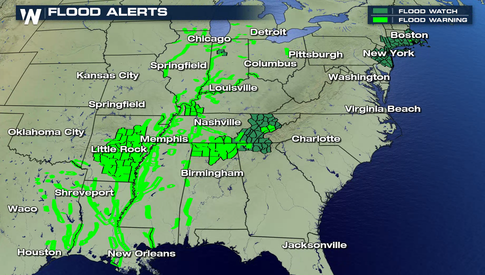
NOAA's National Weather Service has issued flood advisories and flood warnings for large areas of Arkansas and Tennessee on March 1. Large parts of the Ohio Valley and Mississippi valley have received flooding rainfall during the past week. Arkansas has seen more rain than any other state. Life threatening flood conditions have resulted from over 10 inches of rain falling in extensive areas of central Arkansas.
 https://www.youtube.com/watch?v=Z8a-0ZFD-Go
[On Wenesday at 11:15 p.m. CST, GPM data was used to create 3-D views that showed intense storms extending from Oklahoma into southwestern Arkansas. Storm tops in the area were shown by GPM to reach heights above 5.6 miles and some of storms were dropping rain at greater than 5.1 inches per hour (red and purple). Credit: NASA / JAXA, Hal Pierce]
Early today the National Weather Service in Little Rock, Arkansas noted "Much of central and southern Arkansas has seen between one and three inches, with isolated higher amounts, of rainfall over the last 24 hours. This has only aggravated the flooding situation across the area. Excessive runoff will continue today, even well after the rain ends." For more information about GPM, visit: www.nasa.gov/gpm
https://twitter.com/Kidrocks4me/status/969255201046712320
[Credit: Rhonda Russell-Hood via Storyful/Twitter]
Edited for WeatherNation by Meteorologist Mace Michaels
https://www.youtube.com/watch?v=Z8a-0ZFD-Go
[On Wenesday at 11:15 p.m. CST, GPM data was used to create 3-D views that showed intense storms extending from Oklahoma into southwestern Arkansas. Storm tops in the area were shown by GPM to reach heights above 5.6 miles and some of storms were dropping rain at greater than 5.1 inches per hour (red and purple). Credit: NASA / JAXA, Hal Pierce]
Early today the National Weather Service in Little Rock, Arkansas noted "Much of central and southern Arkansas has seen between one and three inches, with isolated higher amounts, of rainfall over the last 24 hours. This has only aggravated the flooding situation across the area. Excessive runoff will continue today, even well after the rain ends." For more information about GPM, visit: www.nasa.gov/gpm
https://twitter.com/Kidrocks4me/status/969255201046712320
[Credit: Rhonda Russell-Hood via Storyful/Twitter]
Edited for WeatherNation by Meteorologist Mace MichaelsAll Weather News
More