Heat Advisory Issued Because of Hurricane Michael
Special Stories
25 May 2019 9:04 PM
Seven months after Hurricane Michael devastated parts of the Florida Panhandle, the National Weather Service office in Tallahassee issued a heat advisory specifically for the hardest hit areas.
Meteorologist David Neal interviewed NWS Tallahassee Meteorologist Donal Harrigan about the alert.
https://youtu.be/AGphTNmjGl4
After Hurricane Michael there was widespread tree damage, lots of structural damage and even displaced residents. The flattened area is now absorbing more heat according to the National Weather Service office. Usually the heat advisory is issued for this location when the feels-like temperature approaches about 108 degrees and above. However, NWS Tallahassee will keep these alerts in effect with feels-like temperatures near 100-105° due to the circumstances.
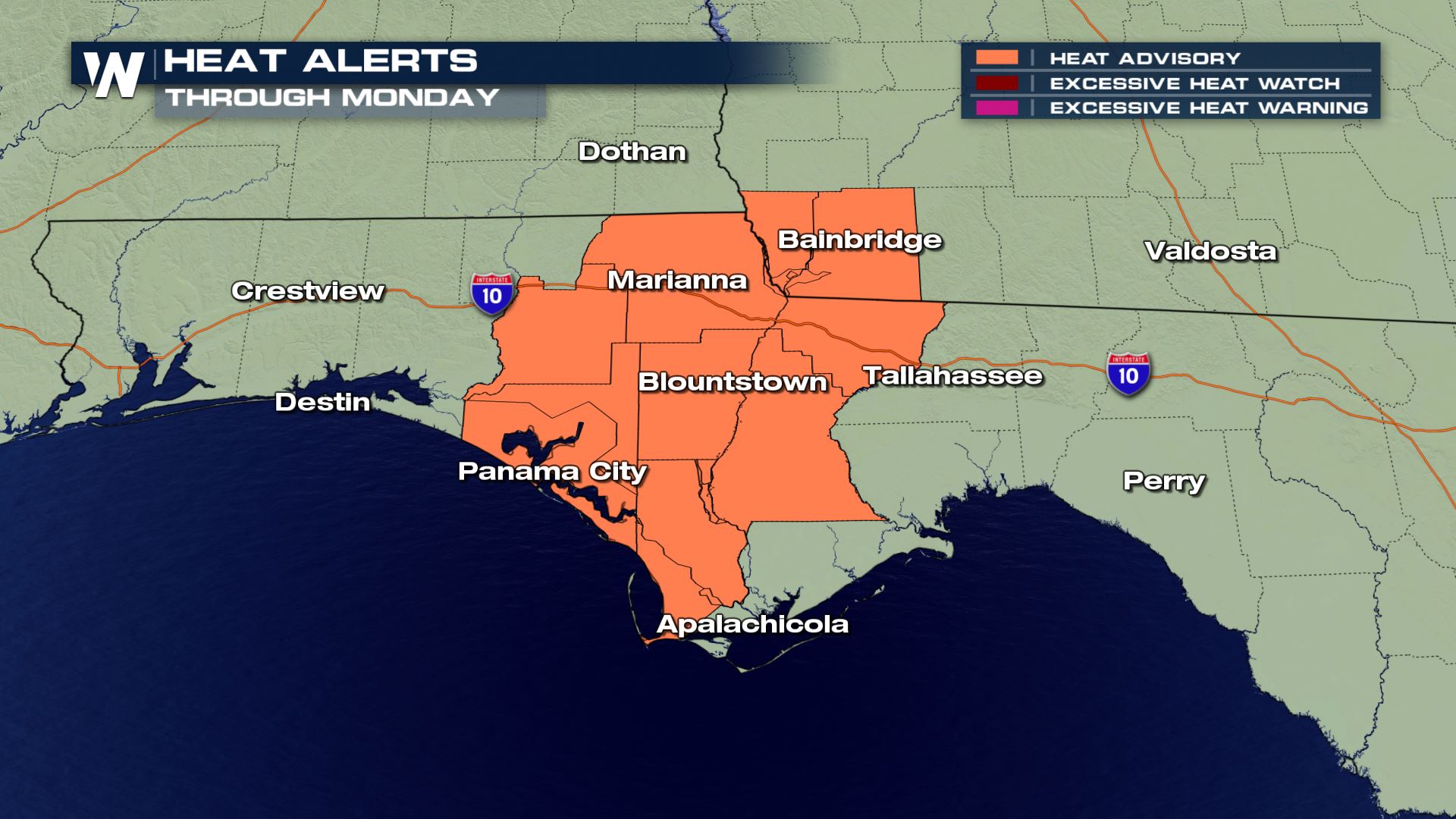 On Saturday, the heat index in Tallahassee approached 100-101 degrees for about 3 to 4 straight hours. On Sunday and Monday it will be a couple of degrees hotter.
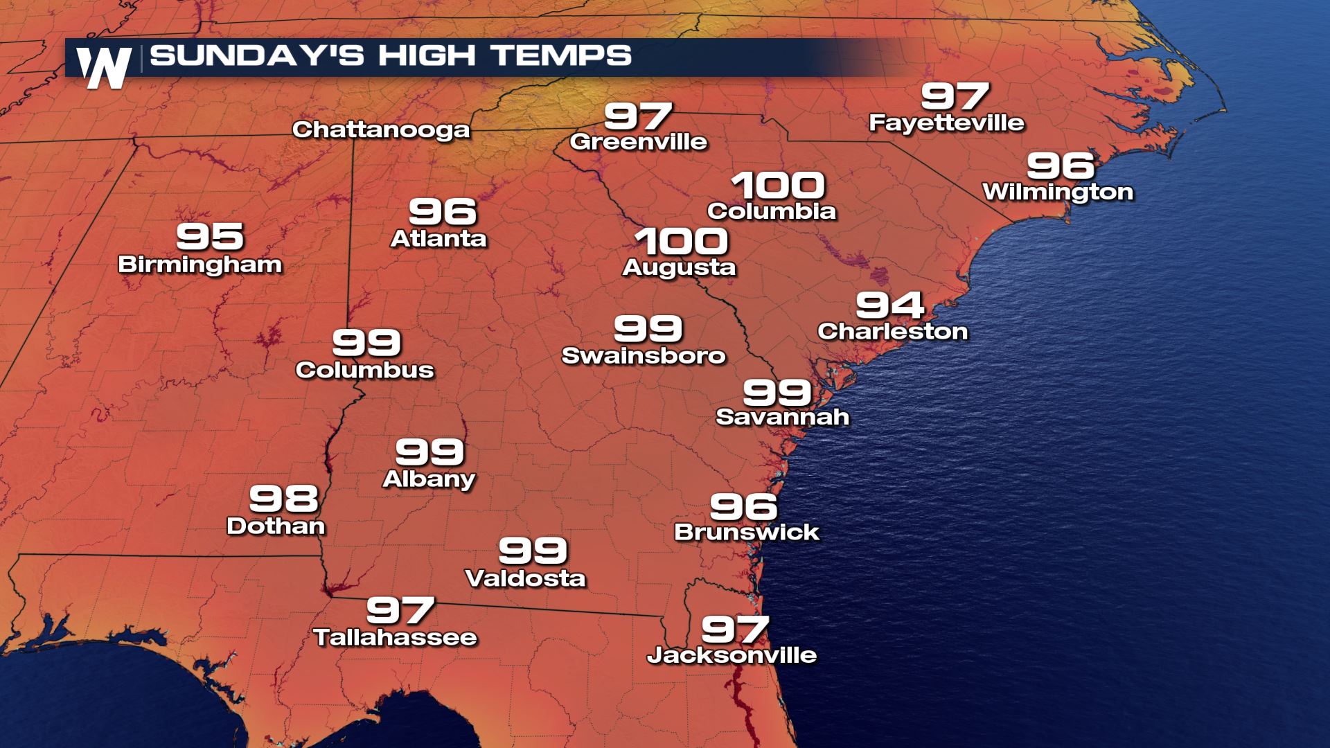
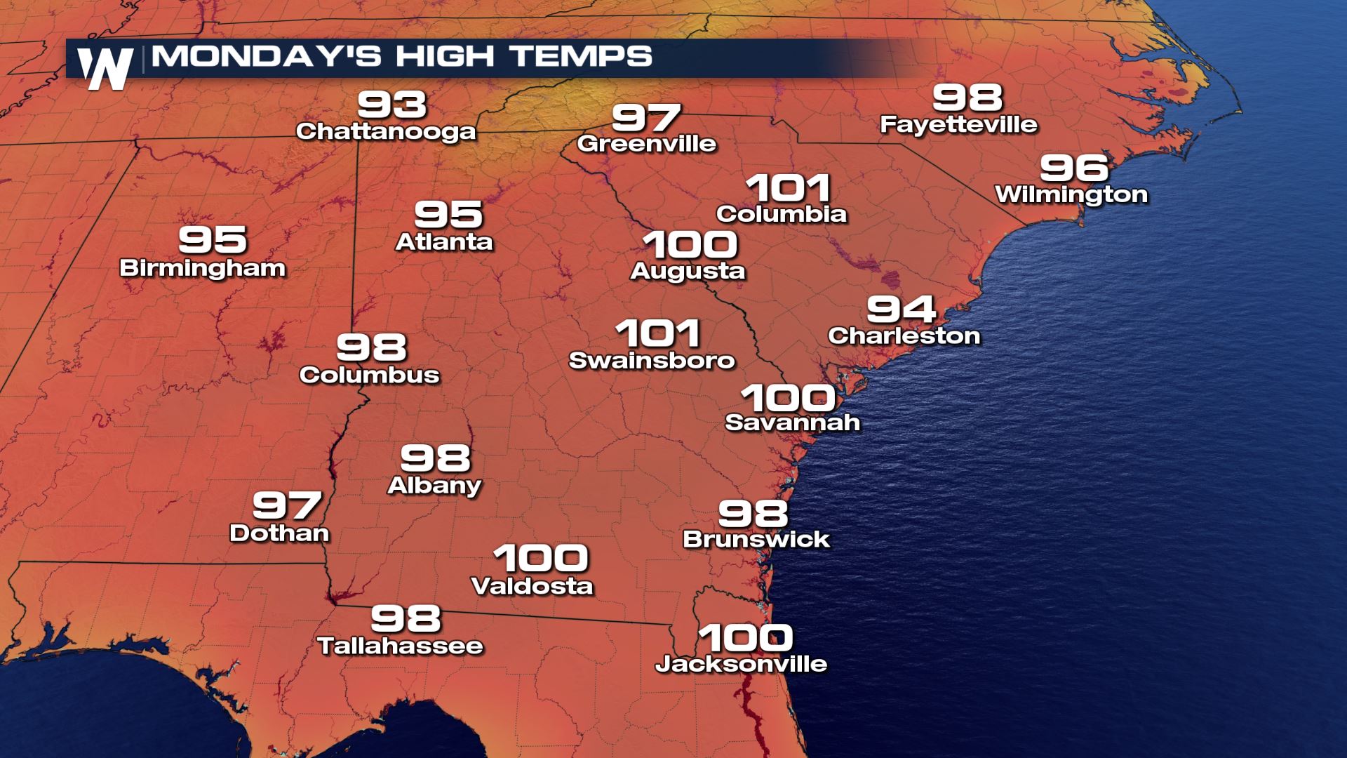 Temperatures are forecast to cool slightly and gradually on Wednesday, Thursday and Friday. However, it'll take a while to do so and it will only dip into the low 90's instead of near 100 degrees!
For WeatherNation, Meteorologist Steve Glazier
 On Saturday, the heat index in Tallahassee approached 100-101 degrees for about 3 to 4 straight hours. On Sunday and Monday it will be a couple of degrees hotter.

 Temperatures are forecast to cool slightly and gradually on Wednesday, Thursday and Friday. However, it'll take a while to do so and it will only dip into the low 90's instead of near 100 degrees!
For WeatherNation, Meteorologist Steve Glazier
Temperatures are forecast to cool slightly and gradually on Wednesday, Thursday and Friday. However, it'll take a while to do so and it will only dip into the low 90's instead of near 100 degrees!
For WeatherNation, Meteorologist Steve GlazierAll Weather News
More